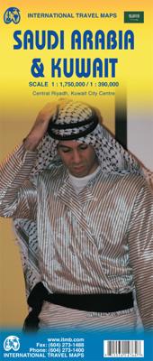
Wegenkaart - landkaart Saudi Arabia & Kuwait - Saudi Arabië en Koeweit | ITMB

0
Een degelijke kaart met aanduidingen van o.a. nationale parken, vliegveld, benzinepomp, dirt-roads en kleine plattegrond van hoofdstad. Als overzichtskaart goed te gebruiken. 1:390,000 / 1:1750000 Saudi Arabia remains a unique entity in today's world, steadfastly governing itself in splendid isolation and fighting hard to keep 'modern' influences ...

Verkopers met dit product

Verkoper
Bezorging
Prijs
DeZwerver.nl logo
DeZwerver.nl
2,95
13,95

Anderen bekeken ook

Wegenkaart - landkaart Philadelphia & Pennsylvania | ITMB
This map began as a result of a map conference held in Philadelphia a few years ago. Maps of the city at that time tended to concentrate on the entire spread-out urban area, resulting in the historic core, which was of interest mostly to visitors, crowded into a small portion of the map. Our map covers from the zoo and art gallery in the north to West Oregon St in South Phillie, so takes on much more than the historic area and the downtown, but does so at an excellent scale, so everything from the Liberty Bell to the University of Pennsylvania campus shows up clearly and easy to read. The other side of the map is also a brand new map for ITMB.     Legend Includes: Roads by classification, Airports, Aerodromes and small aircrafts, Ferrie routes, Bus terminals, Metro Stations, Railway stations, Gas stations, Car Parks, Border crossing, State parks with or without campsites, Hospitals, Shopping centres, Postoffices, Police stations, FireStations, Museums, Tourist information centers, Poi…
13,95
Wegenkaart - landkaart Bahrain & Qatar | ITMB
Een degelijke kaart met aanduidingen van o.a. nationale parken, vliegveld, benzinepomp, dirt-roads en kleine plattegrond van hoofdstad. Als overzichtskaart goed te gebruiken.  Schaal: - Bahrein 1:115.000 - Qatar 1:300.000 The northern portion of the United Arab Emirates consists of a small peninsula (Qatar) and an island (Bahrain). Although these countries are not geographically significant in relation to their neighbours, they are enormously wealthy, thanks to oil, and have aspirations of grandeur. Qatar hosted the FIFA World Cup of soccer in November 2022. This is significant. Qatar, as a destination country, is now 'on the map'. Its capital, Doha, is quite well developed, with three Metro subway lines, motorways, and a sophisticated city centre dominated by superb high-rise architecture. Just to the west, the island of Bahrain is just as wealthy, and just as likely to have ornate architecture, luxurious shopping arcades, and an extravagant lifestyle. Its capital, Manama, is growing…
13,95
Wegenkaart - landkaart Bangladesh & India oost | ITMB
Een degelijke kaart met aanduidingen van o.a. nationale parken, vliegveld, benzinepomp, dirt-roads en kleine plattegrond van hoofdstad. Als overzichtskaart goed te gebruiken. I like Bangladesh. Sure, the government is too corrupt and the country gets schmucked every time there's a hurricane, but the people are friendly and hard-working and gradually improving their country. As a travel destination, Bangladesh has to be considered as part of a trip to India for most people, so in addition to updating and modernizing our artwork, we have added a map of the easternmost portion of India, showing access routes and sites of interest in both countries. One of the great treats of Bangladesh is to take a ferry from Dhaka to Khulna, a two-day trip. The map also includes an inset of Dhaka, the capital, although we had to show only a few of the thousands of mosques in the city.    Legend Includes: Roads by classification, Airports, Ferrie routes, Bus stations, Car parks, State boudaries, border c…
13,95
Wegenkaart - landkaart Sydney & Australia Southeast | ITMB
Plattegrond van Sydney, schaal 1:7.500, met aan de andere zijde een overzichtskaart van zuidoost Australië, schaal 1:2.000.000   Sydney is probably the best-known city in Australia and this map benefits from trips we have taken to ground-truth the information. It is attractive, pertinent, and easy to use as a map. As with many of our international city maps, we have re-worked this title into a double-sided map with the souteastern half of Australia on the reverse side. As with many of ITMB's map this edition is freshly printed on waterproof paper, more for its durability in the case of Australia than humidity.   Legend Includes: Roads by classification, International Airports, Airports, Ferry lines, Boat-Ferry docks, Railways, Railway stations, Bus terminals, Bicycle Trails, Foreshore trail systems, Pedestrian streets, Staircases, Small Nature reservesm Zoos, Fishing, Caves, Camps sites, Accomodation, Tourism information centers, Museums, Live Theatres, Cinemas, Post offices, Police S…
13,95
Wegenkaart - landkaart Sikkim & India Northeast | ITMB
Een degelijke kaart met aanduidingen van o.a. nationale parken, vliegveld, benzinepomp, dirt-roads en kleine plattegrond van Calcutta. Beschrijft de punt van India tussen Nepal en Buthan. De ene zijde van de kaart omvat Sikkim, schaal 1:135.000. De andere zijde van de kaart omvat Noordoost India, ten dele Nepal, Myanmar en China, schaal 1: 1.500.000. Kaart van Calcutta en Calcutta met omgeving.   Sikkim is an autonomous state between India and Chinese-controlled Tibet, much as Bhutan. It is a wonderful, mountainous country to visit, with reasonably good goads going far to the north, well into the Himalayas, and interesting temples/pagodas to see, as well as the fabulous Fam Rong Lho Wildlife Sanctuary. As anyone visiting this remote state needs to pass through the northeastern area of India to reach Sikkim, we have include a complete, detailed map of Bengal, Bihar, Meghalaya, and the Assam states as well as of the portion of Nepal abutting Sikkim, and an inset map of Kolkata. The map …
13,95
Wegenkaart - landkaart Mali | ITMB
Een degelijke kaart met aanduidingen van o.a. nationale parken, vliegveld, benzinepomp, dirt-roads en kleine plattegrond van hoofdstad. Als overzichtskaart goed te gebruiken.   Folded road and travel map in color. Scale 1:2,400,000. Distinguishes roads ranging from primary paved roads to other roads or tracks. Legend includes international airport/national airports, air fields, gasoline/petrol stations, post office, hospital/medical facilities, hotels, motels/lodging, resthouse or hostel, campsites or huts, museums, border crossings, no border crossings, points of interest, crafts/pottery, archaelogical sites, historic ruins or sites, mines, bus station, forts, mosques, churches/missions, oasis, caves, fishing ports, beaches, hiking/trekking. Includes inset map of Bamako and Timbuktu, road distance chart and extensive index.
13,95
Wegenkaart - landkaart Guyana Suriname & French Guiana | ITMB
Een degelijke wegenkaart met aanduidingen van o.a. nationale parken, vliegveld, benzinepomp, dirt-roads en kleine plattegrond van hoofdstad. Als overzichtskaart goed te gebruiken.   The focus of this map is on Guyana, reflecting the changes coming about as a result of the growing assertiveness of Brasil, which has repaved the highway north from Manaus on the Amazon to the border with Guyana (at Bomfin). The Guyanese are improving the road to Georgetown, shortening travel times for goods in both directions by weeks. This new bridge also enables travelers to pass north and south much more easily. We have also re-done the inset map of Georgetown to bring it up to date. We have also changed the regional map on the reverse side, which used to cover all three Guianas countries, and replaced it by one concentrating on the other two countries. The most significant change we've made is to re-name Surinam to the country's preferred name of Suriname. As we made relatively few changes to the artw…
13,95
Wegenkaart - landkaart 3203 Adventure Map Morocco - Marokko | National Geographic
Wegenkaart van Marokko met vermelding van veel bezienswaardigheden, nationale parken en attrakties. Watervast en scheurvast. Juist door deze vermeldingen onderscheidt de kaart zich van andere wegenkaarten. National Geographic's Morocco Adventure Map is designed to meet the unique needs of adventure travelers—detailed, durable, and accurate. Morocco includes the locations of thousands of cities and towns with an index for easily locating them, plus a clearly marked road network complete with distances and designations for motorways, dual carriageways, major roadways, and more. Transportation within and beyond the country is made easier with the location of airports, airfields, railroads, ferry routes, river crossings, lighthouses, harbors, border crossings, and petrol stations. What sets National Geographic Adventure Maps apart from traditional road maps are the hundreds of points of interest that highlight the diverse, unique, and exotic destinations within Morocco. In addition to typ…
17,50
Wegenkaart - landkaart Egypt & Cairo | ITMB
Following the so-called Arab spring of a few years ago, northern Africa experienced much turbulence. Egypt experienced the overthrow of the government, the installation of a radical religious-oriented replacement, and the installation of military governance. Tourism plummeted. Most map publishers discontinued their maps of the country. Five years later, Egypt has stabilized and tourism is growing. We feel that the time is right to re-introduce our ITMB map of Egypt. This version focuses on the portions of the country that have been re-opened for tourism, which means from the Mediterranean coastline south to the Aswan Dam. The portion further south remains closed for the moment, as is the border crossing with Sudan. We have also been forced to leave off the Great Sand Sea and the Western Desert portions for the same reason of unrest, as the border areas with Libya remain very unstable. However, we have provided a large inset map of Egypt, covering everything, in the area of desert. We …
13,95
Wegenkaart - landkaart Ghana | ITMB
Een degelijke kaart met aanduidingen van o.a. nationale parken, vliegveld, benzinepomp, dirt-roads en kleine plattegrond van hoofdstad. Als overzichtskaart goed te gebruiken. Folded road and travel map in color. Scale 1:500,000. Distinguishes roads ranging from motorways to other roads. Legend includes tracks, railroads, ferry routes, international airports, national airports, aerodromes/small aircrafts, gasoline/petrol stations, bus stations, hospitals/medical facilities, castles/forts, points of interest, ruins or archaeological sites, campsites and huts, museums, lodges, churches, mosques. Includes inset map of Cape Coast, Accra and Kumasi. Extensive index.
13,95

Klanten-reviews van Wegenkaart - landkaart Saudi Arabia & Kuwait - Saudi Arabië en Koeweit | ITMB

Er zijn nog geen beoordelingen voor dit productBen jij de eerste die een review plaatst?

Meer over Wegenkaart - landkaart Saudi Arabia & Kuwait - Saudi Arabië en Koeweit | ITMB

Productomschrijving

Een degelijke kaart met aanduidingen van o.a. nationale parken, vliegveld, benzinepomp, dirt-roads en kleine plattegrond van hoofdstad. Als overzichtskaart goed te gebruiken. 1:390,000 / 1:1750000

Saudi Arabia remains a unique entity in today's world, steadfastly governing itself in splendid isolation and fighting hard to keep 'modern' influences at bay. However, it has modern trappings such as an excellent road system, even though women aren't allowed to drive, and modern cities, even though women won't be allowed to vote in local elections until 2015. The cities of Medina and Mecca are closed to infidels. Kuwait, its immediate neighbour to the north is an open society and is included on this map as a very large inset, with a separate inset of Kuwait City. Central Riyadh is also included as an inset map, showing mosques, hotels, banks, and shopping areas.   Legend Includes: Roads by classification, Railways, Capitals, International Airports, Domestic Airports, Border crossings, Railway stations, Pedestrian overpasses, Bus terminals, Heli-pads, Hotels, Notable buildings, Police stations, Banks, Post offices, Embassies, Shopping centers, Hospitals, Libraries, Schools, Universities, Car parks, Car rental agencies, Gas station, Sea Ports, Lighthouses, Forts, Caves, Historical sites, Museums, Mosques, Lighthouses, Oil terminals, Oil fields, Coral, Sand, Swamp, Volcanoes, Points of interest, World Heritage Sites, Stadiums, Golf courses, Zoos, Live theatres and cinemas, Souks, Playing fields, Statues and much more...

Productinformatie

    Verken gerelateerde categorieën

    Webshop.nl maakt gebruik van cookies. Ga je verder op onze website, ga dan akkoord met het plaatsen van cookies en de verwerking van deze data door ons en vermelde partners.