Wegenkaart - landkaart Santa Cruz - Tierra del Fuego - Sur de Chile (Zuid Chili - Vuurland) | Zagier & Urruty

0
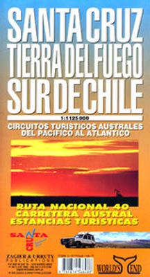
Mooie overzichtskaart / wegenkaart voor het zuiden van Chili en Vuurland. Inclusief een overzicht van de voor fietsers aantrekkelijke Carretera Austral, de eindeloze weg die Vuurland met het echte Chili verbindt. The southern tip of America from Coihaique and Copahue to Cape Horn. Estancias, National Road 40 and Carretera Austral. Patagonian Chann...

Verkopers met dit product

Webshop
Bezorging
Prijs
DeZwerver.nl logo
DeZwerver.nl
niet bekend
17,95

Anderen bekeken ook

Wegenkaart - landkaart Parque Nacional los Glaciares | Zagier & Urruty
LOS GLACIARES NATIONAL PARK ECOMAP The most incredible Park of Patagonia, including Perito Moreno Glacier and Mount Fitz Roy. Satellite relief, roads, navigation, camping, inns and estancias, etc. El Parque mas espectacular de la Patagonia, donde sobresalen el Glaciar Perito Moreno y el Monte Fitz Roy. Rutas, navegaciones, estancias turisticas, paradores, camping, etc. Spanish / English edition. Southern Patagonia’s main National Park, Los Glaciares, with the world's only advancing glacier. The map uses satellite imagery, enhanced with colours and hill-shading to give a vivid representation of the relief. Many local peaks, glaciers and other geographical features are marked and named. Road network includes unpaved roads and dirt tracks, with locations of petrol stations and intermediate driving distances. Ferry connections on the region’s numerous lakes are also indicated. Symbols highlight accommodation and restaurant facilites. Latitude and longitude lines are drawn at 15' intervals…
17,95
Wegenkaart - landkaart - Wandelkaart trekkingmap Tierra del Fuego & Isla Navarino | Zagier & Urruty
Kaart gebaseerd op satellietfoto's met ingetekende hoogtelijnen, campsites, routes en hutten. Bedenk dat het allemaal wel heel globaal is, het is niet de meest ideale schaal om op te lopen. The Argentine and Chilean sectors of Tierra del Fuego. Satellital relief, winter resorts, secondary roads, tracks, distances. Special maps of Staten Land, Navarino Island and beagle Channel. The most updated available. Isla Navarino 1:200.000 rest 1:500.000
17,95
Wegenkaart - landkaart Lagos del Sur - Araucania - Puerto Montt - Bariloche | Zagier & Urruty
Overzichtskaart van dit met name door Zuidamerikanen zelf veel bezocht gebied. The most popular Parks of northern Patagonia: Nahuel Huapi, Lanin, Los Arrayanes, Villarrica, Puyehue, Alerce Andino, Vicente Perez Rosales, Hornopiren. Relief, roads, trails, distances, camping, fishing, etc. Roads to Bariloche, Puerto Montt, San Mart�n de los Andes, Alumine, El Bolson, La Angostura, Osorno, Temuco, Valdivia. afmeting 70 x 95 cm
17,95
Nieuw
Wegenkaart - landkaart 3203 Adventure Map Morocco - Marokko | National Geographic
Wegenkaart van Marokko met vermelding van veel bezienswaardigheden, nationale parken en attrakties. Watervast en scheurvast. Juist door deze vermeldingen onderscheidt de kaart zich van andere wegenkaarten. National Geographic's Morocco Adventure Map is designed to meet the unique needs of adventure travelers—detailed, durable, and accurate. Morocco includes the locations of thousands of cities and towns with an index for easily locating them, plus a clearly marked road network complete with distances and designations for motorways, dual carriageways, major roadways, and more. Transportation within and beyond the country is made easier with the location of airports, airfields, railroads, ferry routes, river crossings, lighthouses, harbors, border crossings, and petrol stations. What sets National Geographic Adventure Maps apart from traditional road maps are the hundreds of points of interest that highlight the diverse, unique, and exotic destinations within Morocco. In addition to typ…
17,50
Wegenkaart - landkaart D9 Sachsen | Marco Polo
Goede wegenkaart van een deel van Duitsland,met schaal 1:200.000: meer details dan de Michelin wegenkaarten van Duitsland. Deze kaarten hebben een register, een tabel met afstanden tussen steden, enkele centrumkaarten van de meest belangrijke steden, vermelding van o.a. campings aan de hand van symbolen alsmede de bezienswaardigheden. Ook benzinepompen worden bijvoorbeeld vermeld! The maps retain the publisher’s traditional cartography of this series, boldly stressing main roads and motorways in strong colours and selected towns in large letters, but also showing minor roads and villages in considerable detail. Road information includes toll roads, traffic restrictions and seasonal closures, gradient marking for steep roads, scenic routes, etc. Motorway services clearly indicate types of facilities available there. Railway network includes narrow gauge and tourist lines, cable car lines, and chair lifts. The series is particularly good for identifying geographical features: mountain a…
13,95
Wegenkaart - landkaart D6 Hessen | Marco Polo
Goede wegenkaart van een deel van Duitsland,met schaal 1:200.000: meer details dan de Michelin wegenkaarten van Duitsland. Deze kaarten hebben een register, een tabel met afstanden tussen steden, enkele centrumkaarten van de meest belangrijke steden, vermelding van o.a. campings aan de hand van symbolen alsmede de bezienswaardigheden. Ook benzinepompen worden bijvoorbeeld vermeld! The maps retain the publisher’s traditional cartography of this series, boldly stressing main roads and motorways in strong colours and selected towns in large letters, but also showing minor roads and villages in considerable detail. Road information includes toll roads, traffic restrictions and seasonal closures, gradient marking for steep roads, scenic routes, etc. Motorway services clearly indicate types of facilities available there. Railway network includes narrow gauge and tourist lines, cable car lines, and chair lifts. The series is particularly good for identifying geographical features: mountain a…
13,95
Wegenkaart - landkaart Map of Etosha | Honeyguide
Wegenkaart van Etosha NP in Namibie: met campings etc. A4 formaat. This reliable, very informative and cheap guide should be on board if Etosha Natonal Park is your destiny. It holds all information you need there: Telephon- and Fax numbers of the Central Reservation Offices and the Wildlife Ressort, the timetables for gates, shops and restaurants, the easy-to-read map to the tracks of the park(overall 4 pages), distances of legs, the name of waterholes and resort facilities. Excellent colour illustrations of the 47 mammals and 211 birds species of Etosha, overall seven pages. Names in German and English. - Colour map of the National Park (overall 4 pages) - 7 pages colour illustrations of mammals and birds - Detailed Information on the camps Namutoni, Halali and Okaukuejo - Easy-to-read map with names of waterholes, outlooks and rest points
17,50
Wegenkaart - landkaart D5 Nordrhein Westfalen | Marco Polo
Goede wegenkaart van een deel van Duitsland,met schaal 1:200.000: meer details dan de Michelin wegenkaarten van Duitsland. Deze kaarten hebben een register, een tabel met afstanden tussen steden, enkele centrumkaarten van de meest belangrijke steden, vermelding van o.a. campings aan de hand van symbolen alsmede de bezienswaardigheden. Ook benzinepompen worden bijvoorbeeld vermeld! The maps retain the publisher’s traditional cartography of this series, boldly stressing main roads and motorways in strong colours and selected towns in large letters, but also showing minor roads and villages in considerable detail. Road information includes toll roads, traffic restrictions and seasonal closures, gradient marking for steep roads, scenic routes, etc. Motorway services clearly indicate types of facilities available there. Railway network includes narrow gauge and tourist lines, cable car lines, and chair lifts. The series is particularly good for identifying geographical features: mountain a…
13,95

Klanten-reviews van Wegenkaart - landkaart Santa Cruz - Tierra del Fuego - Sur de Chile (Zuid Chili - Vuurland) | Zagier & Urruty

Er zijn nog geen beoordelingen voor dit productBen jij de eerste die een review plaatst?

Meer over Wegenkaart - landkaart Santa Cruz - Tierra del Fuego - Sur de Chile (Zuid Chili - Vuurland) | Zagier & Urruty

Productomschrijving

Mooie overzichtskaart / wegenkaart voor het zuiden van Chili en Vuurland. Inclusief een overzicht van de voor fietsers aantrekkelijke Carretera Austral, de eindeloze weg die Vuurland met het echte Chili verbindt.

The southern tip of America from Coihaique and Copahue to Cape Horn. Estancias, National Road 40 and Carretera Austral. Patagonian Channels. National Parks and inns. Service charts and distances.

Verken gerelateerde categorieën

Webshop.nl maakt gebruik van cookies. Ga je verder op onze website, ga dan akkoord met het plaatsen van cookies en de verwerking van deze data door ons en vermelde partners.