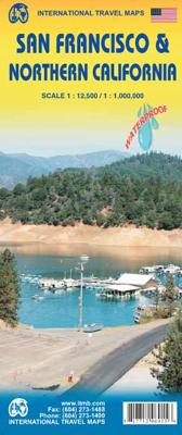
Wegenkaart - landkaart San Francisco - Northern California (Californië) | ITMB

0
San Francisco met schaal 1: 12.500   San Fran is one of my favourite cities; almost as nice as Vancouver. Names such as Chinatown, Nob Hill, the Tenderloin, and Cow Hollow evoke memories of a city that has long moved past its early reputation as a port feeding the goldfields around Sutter's Run, but it is still a clean and sophisticated city to vi...

Verkopers met dit product

Verkoper
Bezorging
Prijs
DeZwerver.nl logo
DeZwerver.nl
2,95
13,95

Anderen bekeken ook

Wegenkaart - landkaart San Francisco - Northern California (Californië) | ITMB
San Francisco met schaal 1: 12.500   San Fran is one of my favourite cities; almost as nice as Vancouver. Names such as Chinatown, Nob Hill, the Tenderloin, and Cow Hollow evoke memories of a city that has long moved past its early reputation as a port feeding the goldfields around Sutter's Run, but it is still a clean and sophisticated city to visit. I personally like the old restored trolleys trundling down Market Street, and the restaurants in the Sunset district. This edition adds great value to our map in two ways: first, we have added an extremely detailed and attractive map of all of northern California to the reverse, to help visitors enjoy the Napa Valley, Sacramento, and the Redwood Sequoia trees, and secondly, the map has been printed on plastic paper for durability and attractiveness.   Legend Includes:   Roads by classification, Provincial Boundaries,State Highways, Main Roads, Secondary and other Roads, Capital, Cities, Nature sights, Airports, Point of Interests, Museum…
13,95
Wegenkaart - landkaart Californië - California | ITMB
  Waterproof wegenkaart van Californië op schaal 1:1m met inzetjes van Hollywood, LA, Santa Monica en San Francisco. Natuurkundige overzichtskaart met veel plaatsen en wegen, spoorlijnen en rivieren, hoogten, lengte- en breedtegraden   The map includes inset maps of Hollywood, Los Angeles, Santa Monica, and San Francisco.   Legend Includes: Roads by classification, Provincial Boundaries,State Highways, Main Roads, Secondary and other Roads, State Capital, Cities, Nature sights, Airports, Point of Interests, Museums, Hot Springs, Gas Stations, National Reserves, Hotels, Lodges,Golf courses and much more
13,95
Wegenkaart - landkaart Nevada & Northern California | ITMB
Een degelijke kaart met aanduidingen van o.a. nationale parken, vliegveld, benzinepompen.   The USA is one of the most challenging countries to map due to its strong identification with state boundaries. Last month, we introduced two new maps of Idaho and Montana; this month, we wish to introduce Nevada. As a state, Nevada is mostly desert-like and is lightly populated. Its two major urban areas, Las Vegas and Reno, are extremely popular travel destinations. In addition, Nevada offers the Hoover Dam, one of the seven wonders of the modern world, a national park with 5,000-year-old pine trees, America’s second deepest lake (Tahoe), the eighth highest mountain peak in the USA, and the biggest air force bombing range in the world (Nellis). The map is double-sided, and covers northern California on the other side. This includes such treasures as Death Valley, part of the Mojave Desert, Yosemite National Park, the beautiful sequoia trees in the far northeast corner, and man-made wonders s…
13,95
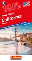
Wegenkaart - landkaart 5 Californië, California - Nevada | Hallwag
Uitstekende wegenkaart waarbij de Europese kleurstelling de kaart zeer prettig leesbaar maken i.v.m. met Amerikaanse kaartenmakers. Deze kaart is eenzijdig bedrukt. Op de kaart is informatie te vinden waar allerlei voorzieningen te vinden zijn (d.m.v. symbolen), zoals campings, picknickplaatsen, informatiecentra, luchthavens enz. Bij de kaart zit een apart boekje met een aantal kleine stadsplattegronden, informatie over Nationale Parken en overige informatie voor toeristen.   Met Californie, Nevada, Far West USA.   These new, region by region "USA Road Guides", on a scale of 1 : 1 mio, provide up-to-date, detailed road maps with lots of tourist information. Transit and city maps, as well as detailed maps of national parks, are included in the map layout. The map package also includes a mileage chart with travelling times between major cities, and a brochure with an index of places, travel information from A to Z, top attractions and travel tips.   Plaatsen op de kaart: Los Angeles S…
14,50
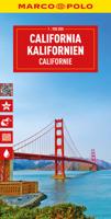
Wegenkaart - landkaart California - Californië | Marco Polo
Duidelijke wegenkaart van Marco Polo: alle wegen, zowel de verharde als belangrijke onverharde wegen zijn weergegeven.  Mooie toeristisch interessante wegen die de moeite waard zijn, zijn groen gearceerd. Veel toeristische informatie is toegevoegd zoals de nationale parken, campings, kastelen en vliegvelden. Afstanden tussen belangrijke steden en benzinestations staan ook op de kaart. Een plaatsnamenregister ontbreekt niet.   ---   This Marco Polo map features really easy to read cartography. Topography is highlighted with relief shading and loads of spot heights and the road network is clearly shown with roads ranging from motorways all the way through to minor secondary roads. The map also clearly indicates airports, places of interest, scenic/tourist routes, view points etc.   The map includes a booklet attached to the cover that contains some useful information and a very extensive index that covers locations, places of interest and geographical features. Also included are a dista…
14,95
Wegenkaart - landkaart Californië - California | Borch
Mooie geplasticieerde kaart van Californië. Deze kaart biedt een goed overzicht van dit deel van de Verenigde Staten met detailkaarten.   Our soft-laminated folded map of California shows: California North 1:1 200 000, California South 1:1 200 000, Yosemite National Park 1:675 000, USA administrative and time zones. Borch Maps are easy to fold, durable and water-repellent with a wipeable surface. Borch Maps show hotels, museums, monuments, markets, public transport, top sights and points of interest, useful statistics, conversion charts for temperatures, weights and measurements, climate charts showing temperatures, sunshine hours, precipitation and humidity, overview maps, time zones, and much more...   Mountains, ocean, forest, desert - California has everything to offer the visitor. And in Los Angeles, anything is possible: lying on Venice Beach in the morning, skiing in the nearby San Gabriel Mountains in the afternoon, a visit to Disneyland, an exciting tour through Universal Stu…
11,50
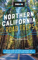
Reisgids Northern California - Noord Californië | Moon Travel Guides
De Amerikaanse uitgever Moon is een vergelijkbare gids met uitgever Lonely Planet > veel praktische informatie met veel diepgang! Het feit dat het een Amerikaanse uitgever is, maken deze gidsen zeer aantrekkelijk voor de staten en nabije landen afzonderlijk. De Lonely Planet haalt dat nivo niet! Explore iconic San Francisco, stroll along foggy coastal cliffs, or climb the peaks of the Sierra Nevada: Answer the call of the open road with Moon Northern California Road Trips. -Pick Your Road Trip: Find flexible getaways throughout NorCal, like three-day routes through Wine Country, Lake Tahoe, Monterey and Big Sur, and more, or combine them for an epic 21-day driving tour- Eat, Sleep, Stop and Explore: With lists of the best places for hikes, wine-tasting, water sports, and more, you can take on the steep streets of San Francisco, sample wine at its source in Sonoma, and pitch a tent in the pines of Yosemite. Spot whales in Bodega Bay, hike through towering redwoods or up to the peak of …
28,95
Wegenkaart - landkaart Baja California - Mexico | ITMB
Een degelijke kaart met aanduidingen van o.a. nationale parken, vliegveld, benzinepomp, dirt-roads. Als overzichtskaart goed te gebruiken. The long peninsula on the north-western edge of Mexico (the ‘lost’ province of Alta California being the temporary possession of that country to the north) is a favourite travel destination for visitors from all over the world, whether they be day-trippers crossing into Tijuana, RVers headed for the Gulf, 4x4ers wanting to explore the dreaded Viscaino Desert, or intrepid explorers wanting to experience a part of Mexico that has always prided itself as being a little ‘different’. I remember the first time Kevin Healey and I visited the peninsula in 1988. He couldn’t handle the spicy food, and we had to beat a retreat to the north after three days, but he produced the definitive Baja map two months later. This digitized, double-sided map is based on his efforts, but has been updated several times since his death, and Lan and I love going to Baja to r…
13,95
Wegenkaart - landkaart - Stadsplattegrond San Diego - California south | ITMB
Wegenkaart en stadsplattegrond in een kaart: aan de ene zijde San Diego stadsplattegrond en op de andere kant een kaart van het zuiden van Californië. San Diego on a clear, well presented street plan from ITMB, with a transit system diagram, a road map of the city and its environs, and a street plan of central Tijuana, plus on the reverse a road map of the US/Mexico border region extending east beyond El Paso and within USA north to Las Vegas.   On one side is an indexed street plan of San Diego, covering the city’s central districts (as indicated in our coverage image), including the downtown area, the Old Town for which an enlargement is provided, Balboa Park, University Heights, the Mission Bay Park with the SeaWorld, and the city’s international airport. The plan clearly shows the MTS and other public transit stations, highlights main traffic arteries and indicates one way streets. Also marked are recommended cycle routes. Streets are annotated with selected block numbers for easi…
13,95
Wegenkaart - landkaart 3119 California - Nevada | National Geographic
Mooie kaart van de bekende kaartenmaker National Geographic. Veel details door kleurgebruik. De wegen zijn met kleuren verdeeld in drukke en minder drukke, de wegnummers zijn goed terug te vinden. De kaart onderscheidt zich van andere series door de hoeveelheid topografische details als counties, plaatsnamen en waterwegen en het bevat een register waarin het eenvoudig zoeken is. Daarnaast is de kaart gedrukt op scheur- en watervast papier. The United States California and Nevada Adventure Map will guide you through two of the most spectacular and diverse states in the country. California and Nevada contain Yosemite and Sequoia & Kings Canyon National Parks, Death Valley and the Mohave Desert, the Sierra Nevada Mountains, Lake Tahoe, and dozens of magnificent National Monuments, Forests, and Wilderness Areas. The map includes the cities of Los Angeles, San Francisco, San Diego, and Las Vegas as well as the breathtaking Pacific coast of California. It covers western Utah and Arizona, in…
17,50

Klanten-reviews van Wegenkaart - landkaart San Francisco - Northern California (Californië) | ITMB

Er zijn nog geen beoordelingen voor dit productBen jij de eerste die een review plaatst?

Meer over Wegenkaart - landkaart San Francisco - Northern California (Californië) | ITMB

Productomschrijving

San Francisco met schaal 1: 12.500   San Fran is one of my favourite cities; almost as nice as Vancouver. Names such as Chinatown, Nob Hill, the Tenderloin, and Cow Hollow evoke memories of a city that has long moved past its early reputation as a port feeding the goldfields around Sutter's Run, but it is still a clean and sophisticated city to visit. I personally like the old restored trolleys trundling down Market Street, and the restaurants in the Sunset district. This edition adds great value to our map in two ways: first, we have added an extremely detailed and attractive map of all of northern California to the reverse, to help visitors enjoy the Napa Valley, Sacramento, and the Redwood Sequoia trees, and secondly, the map has been printed on plastic paper for durability and attractiveness.   Legend Includes:   Roads by classification, Provincial Boundaries,State Highways, Main Roads, Secondary and other Roads, Capital, Cities, Nature sights, Airports, Point of Interests, Museums, Hot Springs, Gas Stations, Medical Facility, National Reserve, Hotels, Border Crossing,Hospitals,Lodges,Golf courses and much more

Productinformatie

    Verken gerelateerde categorieën

    Webshop.nl maakt gebruik van cookies. Ga je verder op onze website, ga dan akkoord met het plaatsen van cookies en de verwerking van deze data door ons en vermelde partners.