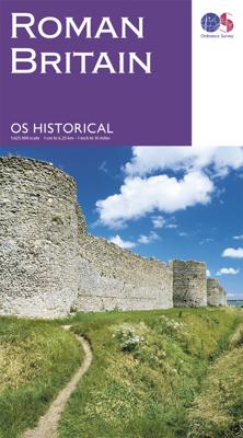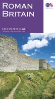
Wegenkaart - landkaart Roman Britain | Ordnance Survey

0
An informative map showing the location of the most important ancient monuments of Roman Britain. The map has been produced by Ordnance Survey in collaboration with the Ancient Monument Trusts of England, Scotland and Wales, so as to provide an authoritative map of the historical sights of Great Britain. It also contains valuable background detail...

Verkopers met dit product

Verkoper
Bezorging
Prijs
DeZwerver.nl logo
DeZwerver.nl
2,95
12,95

Anderen bekeken ook

Wegenkaart - landkaart Ancient Britain | Ordnance Survey
The Ordnance Survey Ancient Britain map is a comprehensive guide to the most important archaeological sites of early English, Welsh and Scottish history. Ordnance Survey's Ancient Britain map shows Neolithic, Bronze Age, Iron Age, Roman and early Medieval sites – against a backdrop of modern mapping. This extract shows some of the ancient sites of Wiltshire marked on the map. The secrets of Ancient Britain are to be revealed in a revised Historical map and guide from Ordnance Survey. Aimed at anyone with an interest in the early history of Britain – from schoolchildren through to archaeologists and tourists – the map helps bring the past to life. Information on the map includes ancient roads and place names – as well as comprehensive features and illustrations on many aspects of life in the period, including land use and settlement sites. Photographs, showing how many of the sites look today, are also used to give context. The map is created in conjunction with The National Monuments …
13,50
Wandelgids 029 Pathfinder Guides Wye Valley and Forest of Dean | Ordnance Survey
Wandelgids Wye Valley en Forest of Dean. Deze gids bevat 28 dagwandelingen, variërend van korte tochten tot pittige dagtochten. De bijbehorende kaarten zijn uitstekend: men heeft de topografische kaarten van Ordnance Survey gebruikt waarop de route is ingetekend. Daarnaast praktische informatie over de wandeling en wat beschrijvingen van het gebied. The Wye Valley and Forest of Dean Pathfinder guidebook contains 28 circular walks for all abilities. Walks are from 4km to 17km long, and each route includes a difficulty rating, route directions, an extract of the Ordnance Survey map and notes and photos of key features to look for. All of them have been created and tested by experienced walkers to help you make the most of the area.   This guide focuses on the middle and lower sections of the Wye Valley, roughly where the river leaves its upper reaches in mid-Wales to enter Herefordshire. Hay-on-Wye, Hereford and the walled town of Chepstow are also covered, as is the classic view over t…
18,50
Wandelgids 019 Pathfinder Guides Dumfries & Galloway | Ordnance Survey
Wandelgids van het zuidwestenl van Schotland. Deze gids bevat 28 dagwandelingen, variërend van korte tochten tot pittige dagtochten. De bijbehorende kaarten zijn uitstekend: men heeft de topografische kaarten van Ordnance Survey gebruikt waarop de route is ingetekend. Daarnaast praktische informatie over de wandeling en wat beschrijvingen van het gebied. With 28 circular walks all created by experienced walkers, this Pathfinder walking guidebook for Dumfries and Galloway is ideal for both visitors and locals. The routes range from extended strolls to exhilarating hikes, so there is something for everyone. Each route includes a detailed description, a difficulty rating, the Ordnance Survey map for the route, GPS waypoints and key historical and landscape features to look out for.   Dumfries and Galloway form the south-west of Scotland; a broad wedge of land jutting out into the Irish Sea between the Solway Firth and the Firth of Clyde. The area is also part of Scotland's border country…
18,50
Wegenkaart - landkaart 08 Discoverer Ballymoney | Ordnance Survey
Zeer gedetailleerde topografische kaart met een aantal toegevoegde toeristische symbolen voor bijv. Bezienswaardigheden en campings. Met hoogtelijnen, mooi kleurgebruik en ingetekende lange-afstands-wandelroutes.   OSNI has replaced the One-Inch maps with a completely new series at 1:50 000 scale. The series is numbered on an all-Ireland basis and Ordnance Survey of Northern Ireland is responsible for the design and publication of the sheets that cover Northern Ireland and adjoining parts of the Republic of Ireland. The layout incorporates a number of overlaps. This map is derived from the latest large scale material, supplemented by new aerial photographs and ground surveys. It is the country's most detailed small-scale map and as well as showing all the features that were on the One-Inch map.
19,50
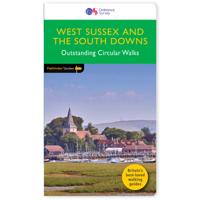
Wandelgids 066 Pathfinder Guides West Sussex and the South Downs National Park | Ordnance Survey
Wandelgids van een deel van Engeland. Deze gids bevat 28 dagwandelingen, variërend van korte tochten tot pittige dagtochten. De bijbehorende kaarten zijn uitstekend: men heeft de topografische kaarten van Ordnance Survey gebruikt waarop de route is ingetekend. Daarnaast praktische informatie over de wandeling en wat beschrijvingen van het gebied. Containing 28 circular, graded walks that have all been created and tested by experienced walkers, this walking guidebook is ideal for both visitors and locals. The routes range from extended strolls to exhilarating hikes, so there is something for everyone. Each route includes a detailed description, the Ordnance Survey map for the route, GPS waypoints and key historical and landscape features to look for.   The South Downs has some great opportunities for scenic, but not too challenging routes, including the South Downs Way. Walks in this book include one around Ardingly Reservoir, Devil's Dyke and the Arun Canal. Routes range from 5.6km (3…
18,50
Wandelkaart The Mournes | Ordnance Survey Ireland
From the rugged granite peaks of the mountains to the picturesque coastline below, the Mournes region is an Area of Outstanding Natural Beauty. This guide map has information about climbing, rambling or relaxing in the area.   The 1:25,000 scale paper map is for outdoor enthusiasts and provides a detailed guide for many outdoor activities and highlights local amenities and services such as filling stations and bus stops. The map includes Slieve Croob, the Murlough Nature Reserve and Castlewellan Forest Park.   A map for everyone, from the experienced hill walker or rock climber to the casual rambler, from the bird watcher or fisherman to the family out for a picnic.   The Mournes in detail - tracks, cliffs, climbs, the Wall, etc. Contouring at 10 -metre intervals showing clearly the impressive relief of the uplands...sweeping down to the sea via the scenic drives and forests to boating and fishing.   OSNI activity maps are double sided and printed on water resistant paper.   Features:…
14,95
Reisgids Outer Hebrides Guide Book | Charles Tait
The Outer Hebrides Guide Book provides a thoroughly informative insight into unique life on the Scottish islands. Learn in fine photographic and written detail about the active traditional crafts, ancient archeology, geology and undisturbed nature and wildlife across these stunning islets.   This wonderfully written guide by experienced travel writer and photographer Charles Tait takes you around the main magical islands of the Outer Hebrides off the west coast of Scotland. Take a step back in time and explore the rich cultural, historical and natural delights of Lewis, Harris, The Uists, and Barra.   All the information provided in this guide is complimented by 12 hand-picked itineraries across the main islands of the Outer Hebrides. Each itinerary lists recommended sites, monuments and activities across a designated region or theme and are all accompanyed with Ordnance Survey maps for clarity.   How this guide is laid out   The Charles Tait guides for Scotland are brimming with info…
24,95
Wandelgids Aviemore and the Cairngorms | Ordnance Survey
Get outside in the Cairngorms, Britain’s largest national park, with ten tried-and-tested accessible walks along the Spey Valley. Discover ancient Caledonian woodland, beautiful lochs and sparkling rivers against a backdrop of snow-capped mountains, waiting for the whole family to enjoy.   Aviemore and the Cairngorms Short Walks Made Easy include:   - Explore Loch Garten and Loch Mallachie, an RSPB Reserve and a haven for ospreys, and pine woodland filled with rare wildlife - Follow the line of the Strathspey Railway and see steam trains chugging past from Aviemore to the ‘osprey village’ of Boat of Garten - Go for a woodland ramble through Glenmore Forest Park to glacial Loch Morlich, where you can stroll the red sands of the highest beach in Britain - Wander the enchanted shores of Loch an Eileen, where a ruined castle stands on the loch’s one island - Stroll through wildflower-rich meadows on the banks of the Calder and the Spey as you circle Newtonmore - See the iconic Old Packhor…
10,-
Wandelgids 060 Pathfinder Guides Lake District | Ordnance Survey
Wandelgids van het Lake District, dit prachtige deel van Engeland. Deze gids bevat 28 dagwandelingen, variërend van korte tochten tot pittige dagtochten. De bijbehorende kaarten zijn uitstekend: men heeft de topografische kaarten van Ordnance Survey gebruikt waarop de route is ingetekend. Daarnaast praktische informatie over de wandeling en wat beschrijvingen van het gebied. Are you planning a visit to the Lake District? Do you enjoy a walk in the country or a leisurely afternoon stroll? Britain's best loved walking guides brings you a brand new Pathfinder Guide to More Lake District Walks containing 28 fabulous walks exploring the wide range of landscapes offered by the UK's most popular walking region. Offering something for walkers of all abilities, Pathfinder Guide to Lake District Walks contains: * 28 easy to follow walks ranging in length from 2-15 miles - all clearly graded * Large-scale Ordnance Survey route maps for each walk * GPS waypoints for easy navigation * Colour photo…
18,50
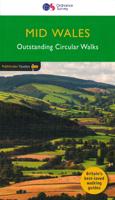
Wandelgids 041 Pathfinder Guides Mid Wales | Ordnance Survey
Wandelgids van midden Wales. Deze gids bevat 28 dagwandelingen, variërend van korte tochten tot pittige dagtochten. De bijbehorende kaarten zijn uitstekend: men heeft de topografische kaarten van Ordnance Survey gebruikt waarop de route is ingetekend. Daarnaast praktische informatie over de wandeling en wat beschrijvingen van het gebied. Explore Mid Wales over 28 walks with this walking guidebook from the Pathfinder series. Each walk is listed by distance and difficulty, and range from a family-friendly 4km (2.5 miles) to a challenging 20km (12 miles)   Often ignored in favour of the more popular Snowdonia and Brecon Beacons National Parks to the north and south, mid Wales still offers some stunning views and beautiful walks. Both coastal routes and upland walks are featured, and include Catti's Cave, Devil's Bridge and the Mynach Valley, The Claerwen Valley and the source of the river Severn   Each of the 28 circular walks has been created by experienced walkers, and includes a route…
18,50

Klanten-reviews van Wegenkaart - landkaart Roman Britain | Ordnance Survey

Er zijn nog geen beoordelingen voor dit productBen jij de eerste die een review plaatst?

Meer over Wegenkaart - landkaart Roman Britain | Ordnance Survey

Productomschrijving

An informative map showing the location of the most important ancient monuments of Roman Britain. The map has been produced by Ordnance Survey in collaboration with the Ancient Monument Trusts of England, Scotland and Wales, so as to provide an authoritative map of the historical sights of Great Britain. It also contains valuable background details on life in Britain during this formative period. This Ordnance Survey Historical map and guide is a fascinating possession for the interested and enthusiastic historians of today.

Verken gerelateerde categorieën

Webshop.nl maakt gebruik van cookies. Ga je verder op onze website, ga dan akkoord met het plaatsen van cookies en de verwerking van deze data door ons en vermelde partners.