webshop.nl
Categorieën
  Sluiten

Meer Collins
Meer Collins in Literatuur boeken

Wegenkaart - landkaart Road Map of Britain 2025 | Collins

Full-colour, double-sided road map of Great Britain at a scale of 8.7 miles to 1 inch. Northern England, Scotland and the Isle of Man are on one side with Southern England and Wales on the other.   With its easily identifiable counties and unitary authorities,this map is ideal for business users but it is also perfect for tourists for route plannin...
11,50

Webshops met dit product

Webshop
Bezorging
Prijs

Anderen bekeken ook

Wegenkaart - landkaart Road Map of Britain 2025 | Collins
Full-colour, double-sided road map of Great Britain at a scale of 8.7 miles to 1 inch. Northern England, Scotland and the Isle of Man are on one side with Southern England and Wales on the other.   With its easily identifiable counties and unitary authorities,this map is ideal for business users but it is also perfect for tourists for route planning.   Main features:   Fully updated Counties and local council areas shown in colour Clear, detailed road network Town and city names, rivers, railway lines and canals are clearly shown 16 city/town centre street plans Index to place names Mileage chart Car ferry routes Key in English, French and German
11,50
Wegenkaart - landkaart Ireland - Ierland road map 2025 | Collins
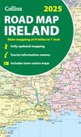
Explore Ireland with easy-to-read mapping from Collins. Full-color map of Ireland at 9 miles to 1 inch (1:570,240), with clear, detailed road network and counties and new administrative areas shown in color. This double-sided map covers the whole of Ireland, and is ideal for reference or route planning.   This map of Ireland shows the road network in detail. It is ideal for business users, with coloring of local council areas, but it is also perfect for tourists as a route planning map.   Main features include:   Fully updated New administrative areas shown in color Clear, detailed road network Town and city names, rivers, lakes, spot heights, railway lines and canals are clearly shown City/town centre street plans of Belfast, Cork, Dublin, Dún Laoghaire, Galway, Limerick, Londonderry/Derry and Waterford showing places of interest Full index to place names Mileage chart Car ferry routes Key in English, French and German Area of coverage Covers the whole of the Republic of Ireland and N…
11,50
Wegenkaart - landkaart Scotland - Schotland road map 2025 | Collins
Explore Scotland with easy-to-read mapping from Collins. Full-color map of Scotland at 8.7 miles to 1 inch (1:550.000), with clear road network and administrative areas shown in color. The map covers the whole of Scotland and part of Northern England conveniently on one side, and is ideal for reference or route planning.   The map shows the road network in detail for easy route planning and has easily identifiable local council areas and boundaries.   The main features of this road map are:   Fully updated Administrative areas shown in color Clear, detailed road network and road distances Town and city names, rivers, railway lines and canals are clearly shown 7 city/town center street plans showing places of interest Index to place names Mileage chart Car ferry routes Key in English, French and German
11,50
Wegenkaart - landkaart Scotland - Schotland road map 2025 | Collins
Explore Scotland with easy-to-read mapping from Collins. Full-color map of Scotland at 8.7 miles to 1 inch (1:550.000), with clear road network and administrative areas shown in color. The map covers the whole of Scotland and part of Northern England conveniently on one side, and is ideal for reference or route planning.   The map shows the road network in detail for easy route planning and has easily identifiable local council areas and boundaries.   The main features of this road map are:   Fully updated Administrative areas shown in color Clear, detailed road network and road distances Town and city names, rivers, railway lines and canals are clearly shown 7 city/town center street plans showing places of interest Index to place names Mileage chart Car ferry routes Key in English, French and German
11,50
Wegenkaart - landkaart 10 Road Map Britain Britain - Groot Brittannië
Goede dubbelzijdige overzichtskaart met plaatsnamenregister  van heel Engeland met Schotland erbij. Britain’s clearest mapping from the experts at the AA, in a handy foldable map. Fully updated, this map of Britain combines clear design and an easy-to-read scale with more road detail to ensure that you never lose your way. The map includes information on toll points, service areas, road numbers, motorways, dual carriageways and wide and narrow local roads. National Parks, and places of interest are also highlighted. Caravan and camping sites pinpointed on the mapping. City and town plans Easy-to-read place index name. Part of a range of 9 regional sheet maps plus 1 map covering the whole of Britain. Map Series - 1 West Country & Wales. 2 Central Southern England. 3 South East England. 4 East Anglia. 5 Midlands & Central England. 6 Wales. 7 Northern England. 8 North England & Scottish Borders. 9 Scotland. 10 Britain.
9,95
Wegenkaart - landkaart Touring Map of Scotland - Schotland | Collins
Best-selling map of Scotland. More than 1,000 places of tourist interest plotted and named on the map. The features have been plotted onto an up-to-date and attractive Collins map of Scotland.   A clear, easy to follow road map with colour classified roads. Ideal for tourists with hundreds of distinctive tourist symbols and tourist information centres all shown.   This map includes: • The whole of Scotland on a double sided sheet at 5 miles to 1 inch • Over 25 categories of tourist information shown on the map including youth hostels, picnic sites and ferries as well as the more obvious tourist sites such as castles, wildlife parks and museums • Detailed town centre maps of Edinburgh, Glasgow, Aberdeen, Dundee, Inverness and Perth • New places of interest including Japanese Garden (near Dollar), Macallan Distillery Centre, Moat Brae (Dumfries) and Scottish Submarine Centre (Helensburgh) • Road updates include the new Dalry bypass, Maybole bypass under construction, A9 dualling sections…
9,95
Wegenkaart - landkaart 8 Road Map Britain North of England & Scottish
Goede dubbelzijdige wegenkaart met plaatsnamenindex van het noorden van Engeland en het zuiden van Schotland. Grof geschetst is het een rechthoek tussen Motherwell, Berwick-upon-Tweed, Middlesbrough en Kendal. Inclusief Isle of Man. Britain’s clearest mapping from the experts at the AA, in a handy foldable map. Fully updated, this map of North England & Scottish Borders combines clear design and an easy-to-read scale with more road detail to ensure that you never lose your way. The map includes information on toll points, service areas, road numbers, motorways, dual carriageways and wide and narrow local roads. National Parks, and places of interest are also highlighted. Caravan and camping sites pinpointed on the mapping. City and town plans Easy-to-read place index name. Part of a range of 9 regional sheet maps plus 1 map covering the whole of Britain. Map Series - 1 West Country & Wales. 2 Central Southern England. 3 South East England. 4 East Anglia. 5 Midlands & Central England. 6…
9,95
Wegenkaart - landkaart Wales & south of England - Zuid Engeland | ITMB
Een degelijke kaart met aanduidingen van o.a. nationale parken, vliegveld, benzinepompen. We are gradually increasing the scales for our data of Great Britain and this is our latest effort. Most visitors to the UK fly into one of London's four airports and combine a visit to the city with an opportunity to travel to various destinations within striking distance of London. England is so incredibly rich in heritage and scenic attractions that it is extremely difficult to portray the country as a map of the entire entity. As a result, England lends itself nicely to be divided into a central/northern portion and a southern portion. To fit areas as diverse as Cornwall and Norwich on one sheet, one needs to have a vertical frame, with Devon/Cornwall up to the top of Wales on one side and Wiltshire to Kent up to York (admittedly, not normally considered to be part of 'southern', but vertically, that's what happens. At this scale, all of southern England and all of Wales can be shown in good d…
13,95

Klanten-reviews van Wegenkaart - landkaart Road Map of Britain 2025 | Collins

Er zijn nog geen beoordelingen voor dit productBen jij de eerste die een review plaatst?

Meer over Wegenkaart - landkaart Road Map of Britain 2025 | Collins

Productomschrijving

Full-colour, double-sided road map of Great Britain at a scale of 8.7 miles to 1 inch. Northern England, Scotland and the Isle of Man are on one side with Southern England and Wales on the other.   With its easily identifiable counties and unitary authorities,this map is ideal for business users but it is also perfect for tourists for route planning.   Main features:   Fully updated Counties and local council areas shown in colour Clear, detailed road network Town and city names, rivers, railway lines and canals are clearly shown 16 city/town centre street plans Index to place names Mileage chart Car ferry routes Key in English, French and German

Productspecificaties

Artikelnummer(s)
Brand
Collins

Verken gerelateerde categorieën

Webshop.nl maakt gebruik van cookies. Ga je verder op onze website, ga dan akkoord met het plaatsen van cookies en de verwerking van deze data door ons en vermelde partners.