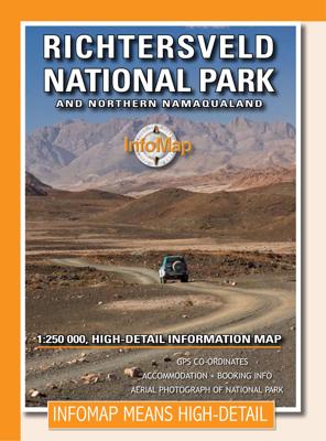
Wegenkaart - landkaart Richtersveld National Park and Northern Namaqualand | Infomap

0
Wegenkaart met toeristische informatie en geschikt voor gebruik met GPS   The original InfoMap! Now in its 8th edition this map remains as popular as ever. For those who don’t know, the Richtersveld National Park is a 160 000 hectare national park found on the banks of the Orange River in South Africa’s Northern Cape. It is the only mountain dese...

Verkopers met dit product

Verkoper
Bezorging
Prijs
DeZwerver.nl logo
DeZwerver.nl
2,95
15,95

Anderen bekeken ook

Wegenkaart - landkaart Kgalagadi - Tourist Map of Kgalagadi Transfrontier Park Botswana | Shell
Zeer bijzondere landkaart van het grensgebied van Botswana en Zuid Afrika. Uitermate handig zijn de GPS coordinaten van de meest belangrijke punten als campings of uitzichtpunten. De kaart is gebaseerd op een luchtfoto, waarbij alle details zijn ingetekend. The map: The map consists of a large map of the entire Park on the front of the map. On the back is enlargements of six maps - the South African side, Mabuasehube, Swart Pan area, Gemsbok Wilderness Trail, Mabuasehube Wilderness Trail and of the Kaa Kalahari Concession. Satellite images were used and the roads were tracked by GPS. There are 168 GPS coordinates on this map. Establishment of a Transfrontier Park: On the 7 th of April 1999 Botswana and South Africa signed a bilateral agreement in which they agreed to manage their adjacent national parks, Gemsbok National Park in Botswana and Kalahari Gemsbok National Park in South Africa, as a single ecological unit – the Kgalagadi Transfrontier Park. It is the first formally declared…
17,50
Wegenkaart - landkaart National Park Pocket Map South Downs | Collins
Handige kleine kaart van dit Nationaal Park. De kaart geeft een goed en helder overzicht van het gebied met alle plaatsen, doorgaande wandelpaden (alhoewel grof van schaal), bezienswaardigheden etc. Met een register en aanvullende tekst onder de kaart is het een mooi overzicht wat je waar kunt gaan doen. Handy little full colour map of South Downs National Park.Detailed mapping and visitor information to the National Park along with a selection of photographs. Map at a scale of 1:125 000 (1cm to 1.25km, 2.0 miles to 1 inch).This small map gives a great overview of the South Downs National Park, and is the perfect companion for exploring this beautiful area of South East England.• Clear, detailed mapping• Key park, tourist and travel information• Ideal for planning visits to the National Park• Index to help locate and plan your trip· Information on the South Downs Way, Miles Without Stiles routes, the Seven Sisters and other places of interest
7,95
Nieuw
Wegenkaart - landkaart 3117 Adventure Map Alaska | National Geographic
Wegenkaart van Alaska met vermelding van veel bezienswaardigheden, nationale parken en attrakties. Watervast en scheurvast. Alaska is a land so vast that is boggles the imagination. It is so large that it could easily contain the next three largest states: Texas, California, and Montana and still have room left over. Despite its large size Alaska has very few inhabitants making it the state with the lowest population density. Alaska is known for its dramatic, diverse terrain of wide-open spaces, mountains and forests, with abundant wildlife and many small towns.   A majority of Alaska, sixty percent, is owned and managed by the Federal Government. These lands are open to the public and offer a wide range of activities from sightseeing in Denali National Park to river-running and fishing on one of many wild rivers. Many vistors to Alaska choose to arrive via cruise ship through the famous Inside Passage. The Alaska Adventure Map shows all of these features and more from the temperate r…
17,50
Wegenkaart - landkaart Jasper National Park (Alberta) | Gem Trek Maps
Waterproof and tear-resistant map for Jasper National Park in the Canadian Rockies.   Whether you are a first-time visitor or a long-time local, you’ll find Gem Trek’s Jasper National Park Map to be an invaluable tool. Researched and designed by locals, and printed in Canada, this map features accurate cartography and subtly colored relief that puts the mountainous region in perspective. The map is printed on high-quality synthetic waterproof paper that can be folded and refolded hundreds of times.   The 1:250,000 scale is ideal for discovering the very best of Jasper National Park. Highlights and our recommended hiking trails are marked by numbered stars, then cross-referenced on the reverse side with descriptions. Also included are all mountains and their elevations, along with natural features such as waterfalls, hot springs, and glaciers.   In addition to descriptions for the top highlights and most popular hiking trails, the reverse side has inset maps for the town of Jasp…
16,95
Wegenkaart - landkaart Chobe | Shell
Zeer bijzondere goede landkaart van Chobe National Park in Botswana. Uitermate handig zijn de GPS coordinaten van de meest belangrijke punten als campings of uitzichtpunten. De kaart is gebaseerd op een luchtfoto, waarbij alle details zijn ingetekend. The map: The Chobe map consists of a complete map of Chobe on the front of the map and there are 5 individual maps of the major tourist areas on the back of the map. These are Chobe river front east, Chobe river front west, Nogatsaa, Savute and a small orientation map. The map was compiled by using satellite images, giving one a birds eye-view of the area. The roads were tracked by means of a GPS and then super-imposed on the photographs. Detailed GPS co-ordinates are supplied for game-drive areas. The Chobe map contains 126 GPS co-ordinates. The four main tourist areas: The Chobe National Park consists of a variety of vegetation types and geological features, offering extreme contrasts and a wide range of wildlife experiences within the…
17,50
Wegenkaart - landkaart National Park Pocket Map Dartmoor | Collins
Handige kleine kaart van dit Nationaal Park. De kaart geeft een goed en helder overzicht van het gebied met alle plaatsen, doorgaande wandelpaden (alhoewel grof van schaal), bezienswaardigheden etc. Met een register en aanvullende tekst onder de kaart is het een mooi overzicht wat je waar kunt gaan doen. Handy little full colour map of Dartmoor National Park. Detailed mapping and visitor information to the National Park along with a selection of photographs.The perfect way to explore this beautiful area in the South of England. This small map gives a great overview of the Dartmoor National Park.• Clear, detailed mapping• Key park, tourist and travel information• Ideal for planning visits to the National Park• Index to help locate and plan your trip
7,95
Nieuw
Wegenkaart - landkaart - Stadsplattegrond Toronto & Southern Ontario - Ontario zuid | ITMB
Overzichtskaart van het zuiden van Ontario - schaal 1:600.000 - met op de andere kant een grote plattegrond van Toronto op schaal 1:12.000 Legend Includes: Roads by classification, Accomodations, Museum, Churches, Buildings, Points of tourist, Public Interests, Post Offices, Police Stations, Schools, Live Theatres, Cinemas, Ruins, Bus Terminals, Ferry Terminals, Service Areas, Hospitals, Ports, Mines, RCMP, Major Airports, Secondary Airports, Camp Grounds, National Park and Equivalent Reserves, Ski, Picnic Sites, and much more.   Toronto is the largest city in Canada by far. Touristically, its attraction rests with its central core, from High Park in the west to the Don River in the east, and from the park-like islands in Lake Ontario to Bloor Street in the north. In this area, one finds remnants of the oldest portion of ‘muddy York’, the original fort built to deter American raiders (close to the exhibition grounds), Campbell House (at Queen & University), and the first public schoo…
13,95
Wandelkaart - Topografische kaart 201 Trails Illustrated Yellowstone National Park | National Geographic
Prachtige geplastificeerde kaart van het bekende nationaal park. Met alle recreatieve voorzieningen als campsites, maar ook met topografische details en wandelroutes ed. Door uitgekiend kleurgebruik zeer prettig in gebruik. Scheur en watervast! National Geographic's Trails Illustrated map of Yellowstone National Park is designed to meet the needs of outdoor enthusiasts by combining valuable information with unmatched detail of America's first national park. Expertly researched and created in partnership with local land management agencies, this map features key points of interest including Mammoth Hot Springs, Canyon Village, Yellowstone Lake, Yellowstone Falls, Grant Village, and Old Faithful geyser area.   With over 1,000 miles of mapped trails, the Yellowstone National Park map can guide you off the beaten path and back again. The clearly marked trails include mileages between intersections. Trail summaries provide elevation, duration, and difficulty for a variety of suggested hike…
16,95
Nieuw
Wegenkaart - landkaart Planning Map Australia - Australië | Lonely Planet
Durable and waterproof, with a handy slipcase and an easy-fold format, Lonely Planet Australia Planning Map is your conveniently-sized passport to traveling with ease. Get more from your map and your trip with images and information about top country attractions, itinerary suggestions, a transport guide, planning information, themed lists and practical travel tips. With this easy-to-use, full colour navigation tool in your back pocket, you can truly get to the heart of Australia, so begin your journey now! Durable and waterproof Easy-fold format and convenient size Handy slipcase Full colour and easy-to-use Before-you-go info Beautiful imagery Tailored itineraries Can't-miss regional highlights Detailed town index Transport planner Themed lists Covers Sydney, Byron Bay, Blue Mountains, Canberra, Melbourne, Goldfields, Great Ocean Road, Murray River, Brisbane, Great Barrier Reef, Whitsundays, The Daintree, Darwin, Kakadu National Park, Uluru-Kata Tjuta National Park, Hob…
10,95
Wegenkaart - landkaart National Park Pocket Map Exmoor | Collins
Handige kleine kaart van dit Nationaal Park. De kaart geeft een goed en helder overzicht van het gebied met alle plaatsen, doorgaande wandelpaden (alhoewel grof van schaal), bezienswaardigheden etc. Met een register en aanvullende tekst onder de kaart is het een mooi overzicht wat je waar kunt gaan doen. Handy little full colour map and guide of Exmoor National Park. Detailed mapping and visitor information to the National Park along with a selection of photographs.   This small map with additional text and photographs gives a great overview of the Exmoor National Park, and is the perfect companion for exploring this beautiful area of southwest England.   Clear, detailed mapping Key park, tourist and travel information Ideal for planning visits to the National Park Index to help locate and plan your trip
7,95

Klanten-reviews van Wegenkaart - landkaart Richtersveld National Park and Northern Namaqualand | Infomap

Er zijn nog geen beoordelingen voor dit productBen jij de eerste die een review plaatst?

Meer over Wegenkaart - landkaart Richtersveld National Park and Northern Namaqualand | Infomap

Productomschrijving

Wegenkaart met toeristische informatie en geschikt voor gebruik met GPS   The original InfoMap! Now in its 8th edition this map remains as popular as ever. For those who don’t know, the Richtersveld National Park is a 160 000 hectare national park found on the banks of the Orange River in South Africa’s Northern Cape. It is the only mountain desert park in Southern Africa and is one of the few national parks in which you are not confined to your car. Dry, arid with a feeling of isolation, life in the park is influenced by the mist created by the cold Atlantic Ocean. Known to the local Nama people as ‘malmokkie’ it brings moisture to an otherwise parched land. Despite its lack of rainfall the area is rich in flora containing many species, like the Halfmens, which exist nowhere else on earth.   The area has long been a favorite for botanists, photographers, lovers of remote places and 4×4 enthusiasts who flock to this corner of South Africa for its unique character, isolation and feeling of wilderness. If visiting the park why not spend a few nights under the trees along the Orange River – South Africa’s biggest river – relaxing while monkeys and mongeese run along its rocky banks; or shout into Echo Canyon from beside the impressive Tatasberg; or cross into Namibia via the Sendelingsdrif ferry.   This map also includes the Richtersveld World Heritage Site, an area equal in size to that of the National Park – equally impressive, remote and alluring. Visit the villages of Eksteenfontein and Lekkersing and sample traditional Nama food. Drive to Alexander Bay or spend time in the seaside town of Port Nolloth.   The map includes detailed route and travel information for the National Park, the World Heritage Site and surrounding areas. It also includes an inset with the popular Eco 4×4 route – South Africa’s longest 4×4 route. Details on this edition include GPS points, distances, useful contacts numbers, accommodation and booking information PLUS a large-scale detailed aerial photograph of the National Park on the back of the map with road overlay.  

Verken gerelateerde categorieën

Webshop.nl maakt gebruik van cookies. Ga je verder op onze website, ga dan akkoord met het plaatsen van cookies en de verwerking van deze data door ons en vermelde partners.