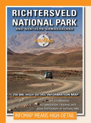
Wegenkaart - landkaart Richtersveld National Park and Northern Namaqualand | Infomap

0
Wegenkaart met toeristische informatie en geschikt voor gebruik met GPS   The original InfoMap! Now in its 8th edition this map remains as popular as ever. For those who don’t know, the Richtersveld National Park is a 160 000 hectare national park found on the banks of the Orange River in South Africa’s Northern Cape. It is the only mountain dese...

Verkopers met dit product

Verkoper
Bezorging
Prijs
DeZwerver.nl logo
DeZwerver.nl
2,95
15,95

Anderen bekeken ook

Wegenkaart - landkaart Richtersveld National Park and Northern Namaqualand | Infomap
Wegenkaart met toeristische informatie en geschikt voor gebruik met GPS   The original InfoMap! Now in its 8th edition this map remains as popular as ever. For those who don’t know, the Richtersveld National Park is a 160 000 hectare national park found on the banks of the Orange River in South Africa’s Northern Cape. It is the only mountain desert park in Southern Africa and is one of the few national parks in which you are not confined to your car. Dry, arid with a feeling of isolation, life in the park is influenced by the mist created by the cold Atlantic Ocean. Known to the local Nama people as ‘malmokkie’ it brings moisture to an otherwise parched land. Despite its lack of rainfall the area is rich in flora containing many species, like the Halfmens, which exist nowhere else on earth.   The area has long been a favorite for botanists, photographers, lovers of remote places and 4×4 enthusiasts who flock to this corner of South Africa for its unique character, isolation and fee…
15,95
Wegenkaart - landkaart Kaokoland and northern Damaraland - Namibië | Infomap
Goede betrouwbare kaart van het noordwesten van Namibië: Damaraland en Kaokoland. Met GPS coordinaten. Engels Colour folding Map, 52x73 cm, scale 1:620.000. The first scale road map of this area to be produced with GPS co-ordinates. 100 GPS Co-ordinates of major intersections, refuelling points and accommodation information. Map range 11°45’ to 15°00’ East and 17° to 20°00’ South. Detailed road map Kaokoland / Kaokoveld (Namibia) includes GPS co-ordinates of major intersections, refuelling points and accomodation information.   This map covers North-Western Namibia on the one side and BUSHMANLAND and CAPRIVI in North-Eastern Namibia on the reverse side. This map is very much recommended for travelers to these regions as an addition to our bigger scaled Namibia map. Here you get a nice amplified look at the regions with loads of GPS coordinates, accommodation and petrol points. Furthermore we included extensive route and travel ideas and general information on Kaokoland. Sold in a plas…
15,95
Wegenkaart - landkaart Kgalagadi Transfrontier Park | Infomap
Kgalagadi Transfrontier Park in Zuid Afrika, wegenkaart 1:500.000. Met toeristische informatie en geschikt voor gebruik met GPS   The reverse side of the map shows the main tourist areas in the large scale of 1: 270 000.   The traveller can make use of the well established and well maintained infrastructure and roads on the South African side of the Park including rest camps that offer all luxuries or rough it on the Botswana side with deep sandy tracks and unfenced camping spots. Apart from the park itself our map covers also the immediate surrounding of the park with emphasis on the area north of the park in Western Botswana between Hukuntsi and Ukhwi known as the Western Woodlands, a remote and wild paradise for the 4x4 enthusiast.Easy to read in a vehicle   Practical, user-friendly scale Accommodation listed with booking details Waterholes Distances between points through the park Viewpoints and picnic sites GPS co-ordinates Botswana section with camps listed Gate times Border pos…
15,95
Wegenkaart - landkaart 3122 Northern Plains | National Geographic
Mooie kaart van de bekende kaartenmaker National Geographic. Veel details door kleurgebruik. De wegen zijn met kleuren verdeeld in drukke en minder drukke, de wegnummers zijn goed terug te vinden. De kaart onderscheidt zich van andere series door de hoeveelheid topografische details als counties, plaatsnamen en waterwegen en het bevat een register waarin het eenvoudig zoeken is. Daarnaast is de kaart gedrukt op scheur- en watervast papier. The United States Northern Plains Adventure Map will guide though a varied landscape, from the high dry plains of the western Dakota's, Nebraska and Kansas through the glacially carved lakes of northern Minnesota to edge of the Mississippi River in Iowa. South Dakota contains the dramatic Black Hills with Mt. Rushmore, North Dakota has Badlands and Theodore Roosevelt National Parks. Nebraska, Kansas, and Iowa are known for their huge skies, rolling farmlands, and sweeping vistas. Minnesota offers endless forests and lakes including those of Voyageur…
17,50
Wegenkaart - landkaart Jasper National Park & Northern Alberta | ITMB
  Jasper National Park kaart, zeer gedetailleerd (schaal 1:250.000) plus op de anderekant van de kaart staat Noord Alberta, schaal 1:1.000.000. Natuurkundige overzichtskaart met veel plaatsen en wegen, spoorlijnen en rivieren, hoogten, lengte- en breedtegraden.   Two words immediately come to my mind if I were to describe Northern Alberta: Oil and Cold. Oil sands could be found relatively easily within the Northern Alberta region. This pushes the Canadian economy forward as gasoline and other petroleum products are becoming higher in demand. Northern Alberta is also about the subzero temperature. The region of Northern Alberta mostly contains very cold, long winters and warm, short summers. Fort McMurray, for example, one of the famous urban communities located in the Wood buffalo municipality, has only a yearly mean temperature of 0.7 degrees Celsius. Nonetheless, Northern Alberta is also a land of recreation activities and wild adventures. On the other side of the Northern Alberta …
13,95
Wegenkaart - landkaart 3300 Adventure Map Finland & Northern Scandinavia - Finland en noord Scandinavië | National Geographic
Wegenkaart van Finland en noord Scandinavië met vermelding van veel bezienswaardigheden, nationale parken en attrakties. Watervast en scheurvast. Juist door deze vermeldingen onderscheidt de kaart zich van andere wegenkaarten. National Geographic's Finland and Northern Scandinavia Adventure Map is designed to meet the unique needs of adventure travelers with its detail, durability, and accuracy. Scandinavia North includes the locations of thousands of cities and towns with an index for easily locating them, plus a clearly marked road network complete with distances and designations for expressways, motorways, and more. What sets National Geographic Adventure Maps apart from traditional road maps are the hundreds of points of interest that highlight the diverse and unique destinations within northern Scandinavia. World Heritage sites, museums, amusement parks, zoos, castles, archeological sites, churches, and more are included, making it invaluable to travelers hoping to experience all…
17,50
Wegenkaart - landkaart Yellowstone National Park and Wyoming | ITMB
The USA is a vast and wonderful land to explore. ITMB is steadily increasing our coverage of this important travel destination and this month concentrates on the State of Wyoming, with a detailed travel map on one side, including small portions of adjacent states of Utah, Colorado, Nebraska, South Dakota, Montana, and Idaho. The state is lightly populated, with Cheyanne as its capital and main city. Interstates 80 and 90 both traverse the state, with Interstate 25 being the only north-south motorway. Yellowstone National Park occupies the northwest corner of the state and also occupies the second side of the sheet with an extremely detailed map. Yellowstone is the first area in the world to be proclaimed as a national protected area (Banff was second), and Yellowstone remains the paramount preserved wilderness environment in the world. There are several small urban areas within the park for accommodations and servicing, such as West Thumb, Canyon City, and Mammoth Hot Springs. The mai…
13,95
Wegenkaart - landkaart 3306 Adventure Map Spain Northern - Noord Spanje | National Geographic
Wegenkaart van Noord Spanje met vermelding van veel bezienswaardigheden, nationale parken en attrakties. Watervast en scheurvast. Juist door deze vermeldingen onderscheidt de kaart zich van andere wegenkaarten. National Geographic's Northern Spain Adventure Map is designed to meet the unique needs of adventure travelers—detailed, durable, and accurate. Northern Spain includes the locations of thousands of major cities and towns with an index for easily locating them, plus a clearly marked road network complete with distances and designations for expressways, motorways, and more. St. James Way, one of the most important Christian pilgrimages during medieval times, is noted for travelers seeking to retrace to route to the Cathedral of Santiago de Compostela in Galicia where the remains of the apostle Saint James are believed to be buried.   What sets National Geographic Adventure Maps apart from traditional road maps are the hundreds of points of interest that highlight the diverse and …
17,50
Wegenkaart - landkaart Nevada & Northern California | ITMB
Een degelijke kaart met aanduidingen van o.a. nationale parken, vliegveld, benzinepompen.   The USA is one of the most challenging countries to map due to its strong identification with state boundaries. Last month, we introduced two new maps of Idaho and Montana; this month, we wish to introduce Nevada. As a state, Nevada is mostly desert-like and is lightly populated. Its two major urban areas, Las Vegas and Reno, are extremely popular travel destinations. In addition, Nevada offers the Hoover Dam, one of the seven wonders of the modern world, a national park with 5,000-year-old pine trees, America’s second deepest lake (Tahoe), the eighth highest mountain peak in the USA, and the biggest air force bombing range in the world (Nellis). The map is double-sided, and covers northern California on the other side. This includes such treasures as Death Valley, part of the Mojave Desert, Yosemite National Park, the beautiful sequoia trees in the far northeast corner, and man-made wonders s…
13,95
Wegenkaart - landkaart 04 Southwest British Columbia & Northern Washington | Gem Trek Maps
Goede wegenkaart van British Columbia met Nationale Parken, Overnachtingsmogelijkheden, Ski gebieden en bezienswaardigheden. Gem Trek’s Southwest British Columbia & Northern Washington map meets the needs of visitors looking to explore the lower mainland of British Columbia and the northern section of Washington state.   All the major highways are shown, as well as national, provincial, and state parks and wilderness areas. The map also shows lesser-known back roads, and pinpoints the location of lodges, campgrounds and hot springs. Mileage charts on the front and back provide distances between major towns and cities.   The Southwest British Columbia & Northern Washington map covers all of Vancouver Island and extends west through the city of Vancouver and the Okanagan Valley to the Kootenays. South of the border, Washington state is covered from the Gulf Islands in the west to Spokane in the east, with coverage as far south as Mount Rainer National Park.   The Southwest British Colu…
9,95

Klanten-reviews van Wegenkaart - landkaart Richtersveld National Park and Northern Namaqualand | Infomap

Er zijn nog geen beoordelingen voor dit productBen jij de eerste die een review plaatst?

Meer over Wegenkaart - landkaart Richtersveld National Park and Northern Namaqualand | Infomap

Productomschrijving

Wegenkaart met toeristische informatie en geschikt voor gebruik met GPS   The original InfoMap! Now in its 8th edition this map remains as popular as ever. For those who don’t know, the Richtersveld National Park is a 160 000 hectare national park found on the banks of the Orange River in South Africa’s Northern Cape. It is the only mountain desert park in Southern Africa and is one of the few national parks in which you are not confined to your car. Dry, arid with a feeling of isolation, life in the park is influenced by the mist created by the cold Atlantic Ocean. Known to the local Nama people as ‘malmokkie’ it brings moisture to an otherwise parched land. Despite its lack of rainfall the area is rich in flora containing many species, like the Halfmens, which exist nowhere else on earth.   The area has long been a favorite for botanists, photographers, lovers of remote places and 4×4 enthusiasts who flock to this corner of South Africa for its unique character, isolation and feeling of wilderness. If visiting the park why not spend a few nights under the trees along the Orange River – South Africa’s biggest river – relaxing while monkeys and mongeese run along its rocky banks; or shout into Echo Canyon from beside the impressive Tatasberg; or cross into Namibia via the Sendelingsdrif ferry.   This map also includes the Richtersveld World Heritage Site, an area equal in size to that of the National Park – equally impressive, remote and alluring. Visit the villages of Eksteenfontein and Lekkersing and sample traditional Nama food. Drive to Alexander Bay or spend time in the seaside town of Port Nolloth.   The map includes detailed route and travel information for the National Park, the World Heritage Site and surrounding areas. It also includes an inset with the popular Eco 4×4 route – South Africa’s longest 4×4 route. Details on this edition include GPS points, distances, useful contacts numbers, accommodation and booking information PLUS a large-scale detailed aerial photograph of the National Park on the back of the map with road overlay.  

Productinformatie

    Verken gerelateerde categorieën

    Webshop.nl maakt gebruik van cookies. Ga je verder op onze website, ga dan akkoord met het plaatsen van cookies en de verwerking van deze data door ons en vermelde partners.