webshop.nl
Categorieën
  Sluiten

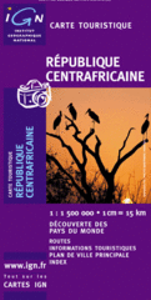
Wegenkaart - landkaart Republique Centrafricane - Centraal Afrikaanse Republiek | IGN - Institut Géographique National

Goede overzichtskaart van het Franse Cartografisch Instituut. Met autoroutes en stadsplattegronden van de belangrijkste steden.Indexed map with a plan of Bangui and an administrative map of the country. Topography and terrain are indicated by relief shading and spot heights, with forests, savanna, deserts, areas of seasonal inundation, and boundari...
11,75

Webshops met dit product

Webshop
Bezorging
Prijs

Anderen bekeken ook

Wegenkaart - landkaart Burkina Faso | IGN - Institut Géographique National
Goede overzichtskaart van het Franse Cartografisch Instituut. Met autoroutes en stadsplattegronden van de belangrijkste steden. General map of the country with relief shading, showing a large number of small villages and settlements. Roads are classified according to their usability in wet conditions. Towns with accommodation are marked, as are fuelling stations. Nature reserves and rivers, both permanent and intermittent, are also shown. Latitude and logitude at intervals of 1 degree are marked in the margins and indicated by ticks on the map itself. Four insets show simple street plans of Ouagadougou and Bobo-Dioulasso, administrative divisions of the country, and the distribution of its ethnic groups. The legend is in French only.  
11,75
Wegenkaart - landkaart 3100 Adventure Map Costa Rica | National Geographic
Zeer gedetailleerde kaart van Costa Rica met stadsplattegrond van de hoofdstad van Costa Rica. Misschien wel de beste kaart! Gedrukt op scheur- en watervast papier. Double-sided, waterproof, tear-resistant and with a street plan of central San José, the NGS Costa Rica Adventure Map was produced in cooperation with the Instituto Geográfico Nacional, Costa Rica’s national survey organization. The country is divided east/west, with a generous overlap between the two sides. Topography is shown by contours at 100m intervals, enhanced by relief shading and spot heights. Along the coast reefs, rocks and shallow water areas are marked. The map indicates various types of vegetation: forests, palm forest, mangrove, and fresh or salt water swamps. Road network includes gravel tracks and indicates roads passable only in summer. Railways and local airstrips are marked, as well as the country’s internal administrative boundaries together with names of the provinces. The map highlights seven differen…
17,50
Wegenkaart - landkaart Kyrgyzstan - Kirgizië | Gizi Map
Met name door het kleurgebruik een mooie kaart: heel duidelijk wordt het landschap weergegeven. Daarnaast veel topografische details.   Kyrgyzstan at 1:750,000 from Gizi Map with excellent presentation of the country’s mountainous terrain through bold altitude colouring and plenty of names of mountain ranges, etc, road network indicating routes of the old Silk Road, plus a street plan of Bishkek and an administrative map of the country. All place names are in the Latin alphabet.   Topography is vividly shown by bold elevation colouring, with spot heights and graphics for swamps, salt flats and deserts, plus plenty of names of mountain ranges, peaks, valleys, etc. National parks are highlighted. The map shows internal provincial boundaries and also clearly indicates the country’s Uzbek and Tadjik enclaves. Road network includes selected local tracks and highlights routes which used to the part of the old Silk Road. Railway lines are included and local airports are marked. Symbols indica…
15,95
Wegenkaart - landkaart IGN Mini Map Corse - Corsica | IGN - Institut Géographique National
Goed leesbare wegenkaart van Corsica. Anders dan de gewone kaart is deze in klein formaat gevouwen, past makkelijk in je jaszak. Regionale kaart 1:200.000 van Frankrijk, IGN: Wegenkaart met afstandsaanduiding, toeristische informatie en spoorwegen met stations, nationale en regionale parken zijn duidelijk aangegeven. De kaart bevat ook kaartjes van het centrum van de grote steden in de regio, met straatnaamregister. De legenda is ook in Engels.   Corsica is part of IGN's 1:200 000 Regional Road & Tourist series. The map features super clear road detail, showing everything from major motorways to small secondary roads. Toll sections are marked along with the location of the toll gates, the location of the fixed speed cameras is given, service areas and rest areas are shown and junction numbers are clearly marked. All of the bigger roads indicate intermediate road distances.   The map is aimed at the tourist and, as such, shows the location of many places of interest including towns of i…
6,95
Wegenkaart - landkaart Mauritius - île Maurice | IGN - Institut Géographique National
Duidelijke wegenkaart van Mauritius met een gedetailleerde schaal van 1:85.000 waardoor veel detail zichtbaar is. Alle gehuchten en bewoningen staan vermeld, maar ook met symbolen aangegeven bezienswaardigheden en bijvoorbeeld mooie stranden en nationale parken.  With this range IGN produces all purpose maps for many overseas countries, many of which have been under French rule in the past. Maps in this range are printed at scales which vary according to coverage area. These are ideal for touring and are suitable as a reference for those driving hire-cars. The up-to-date mapping provides a wealth of coloured road and track information plus place names, railway line routes etc. Many map symbols are used to locate and quickly identify points of interest, and the multilingual legend has English, French, German and Italian translations.Laminated:This laminated weatherproof map is the last word in durability and will outlast many other apparently similar products. The map is covered in toug…
10,75
Wegenkaart - landkaart 3 China centraal | Nelles Verlag
Goede wegenkaart van een deel van China. Aan beide kanten bedrukt. Met veel toeristische aanduidingen als nationale parken en culturele bezienswaardigheden. Prima leesbare kaart. Cental China at 1:1,750,000 from Nelles in a convenient format for use when travelling, with street plans of central Beijing and Shanghai. The map is double-sided, with an overlap between the sides, and provides coverage from just north of the capital, to include the local sections of the Great Wall, to Wenzhou and westwards to include Xian. All place names are in the Latin alphabet only with, where useful, their historical pre-Pinyin names (Peking, Tsingtao, etc).   Maps in the Nelles series for China present road and rail networks on a base with topography indicated by relief shading, with names of mountain ranges and peaks plus additional spot heights. Local airports are marked and the maps also show internal administrative boundaries with names of the provinces. Places of interest, including historical sig…
11,95
Wegenkaart - landkaart Cordillera Cantabrica - Asturias y provincias limitrofes | Adrados Ediciones
Gedetailleerde wegenkaart an de Cordillera Cantabrica met hoogtelijnen, hoogte verschillen in kleur en schaduw en UTM coördinaten. Met plaatsnamen index! Cordillera Cantabrica on a detailed road map from the Oviedo based Adrados Ediciones, presenting this mountainous region with contours at 100m intervals, altitude coluring, relief shading and UTM coordinates. Since the publishers specialize in detailed hiking maps, including the best coverage of the Picos de Europa, the map includes an exceptionally large number of names of peaks, passes, etc. Symbols highlight best rock and ice climbing areas, huts and refuges, campsites, mountain rescue posts and information centres. Along the coast numerous beaches are named. Road network includes small country roads and tracks. Local railway lines are shown, although not very easy to see on the base map filled with so much information. The map has a 10km UTM grid. Map legend is in Spanish only. On the reverse is a panorama drawing of the area, loo…
14,95
Wegenkaart - landkaart Litouwen & Letland | ITMB
ITMB is very pleased to release its first-ever map of the Baltic country of Lithuania, which occupies Side 1 of this double-sided map. It is bordered by Latvia on its north, the Russian enclave of Kalingrad on its southeast, and Poland and Belarus on its south and east. It is now on the front lines of tension between Russia and its neighbours, as are all the Baltic states. It is also a valued member of both NATO and the EU, and as such is easy to access from either Poland or Latvia. Lithuania fronts on to the Baltic Sea with a major port at Klaipeda (formerly Memel), with its capital being Vilnius. Historically, the country has suffered German and Russian invasions during the 20th century, the last of which resulted in the country losing its independence completely by being absorbed into the Russian Empire in the latter stages of WW2. It regained its independence in 1991, with the collapse of the USSR and shortly thereafter applied to join both the European Union and NATO. Touristicall…
14,95
Wegenkaart - landkaart Panama | ITMB
Een degelijke kaart met aanduidingen van o.a. nationale parken, vliegveld, benzinepomp, dirt-roads en kleine plattegrond van hoofdstad. Als overzichtskaart goed te gebruiken. Panama on an indexed, double-sided map from ITMB, printed on waterproof and tear-resistant plastic paper, with large, clear street plan of central Panama City highlighting various places of interest and tourist facilities, including 18 selected hotels. The map divides the country east/west, with some overlap between the two sides. Topography is shown by altitude colouring with spot heights and names of mountain ranges. Swaps, mangrove and salt marshes are marked, and national parks or protected areas and Indian Reserves highlighted. The map shows the country’s road network with locations of petrol stations and border crossings, plus railways and local airports or landing grounds. Internal administrative boundaries are shown with names of the provinces. Symbols highlight various places of interest, archaeological s…
13,95
Wegenkaart - landkaart Ontario | ITMB
Een degelijke kaart voor Ontario met aanduidingen van o.a. nationale parken, vliegveld, benzinepomp, dirt-roads en kleine plattegrond van Toronto, Sault Ste. Marie. Als overzichtskaart goed te gebruiken. Ontario and Quebec form the portion of Canada known as Central Canada. Ontario is the industrial heartland of the country, and the southern portion is the most densely-populated and urbanized part of Canada. Toronto is a city of 2.8M people and the heartland of an economic region serving 100,000,000 people in two countries. Southern Ontario is also home for six million residents, some of the most historic sites in the country, and major recreational land masses (Algonquin Park, Bruce Trail, Muskoka/Haliburton). Northern Ontario, on the other side of the map, occupies the bulk of the land area of the province, and is dominated by the Canadian Shield (a pre-Cambrian rock formation that is the oldest land on earth, rich in mineral wealth). The North is dominated by recreational activities…
13,95

Klanten-reviews van Wegenkaart - landkaart Republique Centrafricane - Centraal Afrikaanse Republiek | IGN - Institut Géographique National

Er zijn nog geen beoordelingen voor dit productBen jij de eerste die een review plaatst?

Meer over Wegenkaart - landkaart Republique Centrafricane - Centraal Afrikaanse Republiek | IGN - Institut Géographique National

Productomschrijving

Goede overzichtskaart van het Franse Cartografisch Instituut. Met autoroutes en stadsplattegronden van de belangrijkste steden.Indexed map with a plan of Bangui and an administrative map of the country. Topography and terrain are indicated by relief shading and spot heights, with forests, savanna, deserts, areas of seasonal inundation, and boundaries of national parks and forest reserves. Road network includes minor roads and tracks and shows location of petrol stations. The map also indicates hospitals and medical centres, post offices, missions and other religions establishments, selected accommodation, places of interest, etc. Latitude and longitude are marked in the margins at 2º intervals and by cross ticks on the map itself. Map legend is in French only.The map has an index of place names, and insets showing Bangui and the surrounding area at 1:50,000 with main streets and districts within the city, and an administrative map of the country.
Webshop.nl maakt gebruik van cookies. Ga je verder op onze website, ga dan akkoord met het plaatsen van cookies en de verwerking van deze data door ons en vermelde partners.