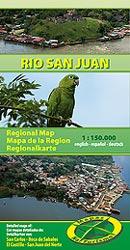
Wegenkaart - landkaart Regionalmap Río San Juan with Cityplans San Carlos | Mapas Naturismo

0
Goede uitgebreide landkaart van het grensgebied Nicaragua en Costa Rica met informatie over musea, natuurgebieden, pompstations, hotels etc. en met stadsplattegronden Managua tot Rivas op schaal 1:150.000, stadsplattegronden van San Carlos, El Castillo , San Juan de Nicaragua, plattegrond Boca de Sabalos...

Verkopers met dit product

Verkoper
Bezorging
Prijs
DeZwerver.nl logo
DeZwerver.nl
2,95
11,75

Anderen bekeken ook

Nieuw
Wegenkaart - landkaart Masaya - Granada ( Zuidwest Nicaragua ) | Mapas Naturismo
South-Western Nicaragua map at 1:120,000 from Mapas NaTurismo, covering the area west of Lago Nicaragua between Managua and Rivas with, on the reverse, street plans of Masaya and Granada, plus enlargements for Volcán Mombacho, Isletas de Granada and Isla Zapatera. On one side is an indexed road map at 1:120,000 covering the area west of Lago Nicaragua between Managua and Rivas. Isla de Ometepe is included as an inset. Relief shading and altitude colouring provides very clear presentation of the terrain. Road network includes local tracks and shows locations of fuel supplies. Symbols mark locations with tourist accommodation, beaches and surfing sites, protected area including turtle reserves, etc. The map has a UTM grid and its legend includes English. On the reverse are street plans of Masaya and Granada at 1:12,500, both highlighting tourist accommodation and various facilities and places of interest, plus enlargements for Volcán Mombacho and the surrounding area, Isletas de Granada…
11,75
Wegenkaart - landkaart 3100 Adventure Map Costa Rica | National Geographic
Zeer gedetailleerde kaart van Costa Rica met stadsplattegrond van de hoofdstad van Costa Rica. Misschien wel de beste kaart! Gedrukt op scheur- en watervast papier. Double-sided, waterproof, tear-resistant and with a street plan of central San José, the NGS Costa Rica Adventure Map was produced in cooperation with the Instituto Geográfico Nacional, Costa Rica’s national survey organization. The country is divided east/west, with a generous overlap between the two sides. Topography is shown by contours at 100m intervals, enhanced by relief shading and spot heights. Along the coast reefs, rocks and shallow water areas are marked. The map indicates various types of vegetation: forests, palm forest, mangrove, and fresh or salt water swamps. Road network includes gravel tracks and indicates roads passable only in summer. Railways and local airstrips are marked, as well as the country’s internal administrative boundaries together with names of the provinces. The map highlights seven differe…
17,50
Nieuw
Wegenkaart - landkaart Nicaragua | Mapas Naturismo
Uitstekende wegenkaart van Nicaragua. Zo niet de beste op de markt van de kleine uitgeverij Mapas Naturismo! Met gedetailleerde kaarten van: - Rio San Juan 1:200.000 - Island Ometepe 1:200.000 - Delta Río San Juan 1:10.000 - Big and Little Corn Island, elk 1:75.000 Met ook nog: - belangrijke historische plaatsen - alle nationale parken - afstanden in kilometers, benzine stations en touristische routes - de meest belangrijke volksfeesten De kaart heeft een GPS-Grid!
11,75
Wegenkaart - landkaart Midden Amerika - Central America | ITMB
Een degelijke kaart met aanduidingen van o.a. nationale parken, vliegveld, benzinepomp, dirt-roads. Als overzichtskaart goed te gebruiken. Met Belize, Guatemala, Honduras, El Salvador, Nicaragua, Costa Rica en Panama. Folded color road and travel map. Scale 1:1,100,000. Distinguishes roads ranging from highways (paved/unpaved) to seasonal tracks. Legend includes swamps, glaciers, reefs, active volcanoes, railways, ferry routes, protected areas/national parks, international airports, domestic airports with scheduled services, landing grounds, points of interest, ruins, lighthouses, mines, beaches, gas stations, border crossing points. Includes inset map of Panama Canal Area, Isla del Coco. Extensive index, general information on the listed countries.  
13,95
Nieuw
Wegenkaart - landkaart Egypte | Freytag & Berndt
De kaart is dubbelzijdig, heeft enkele stadsplattegronden van de meest bekende steden en er is een register bij. Goede duidelijke wegenkaart aan twee kanten bedrukt. Wel een grote lap kaart, maar daardoor bestrijkt het een groot gebied. Alle toeristische details staan er op, ook campings worden vermeld. Gedetailleerde, tweezijdige landkaart, prima geschikt voor planning en rondtrekken. De berijdbare wegen zijn goed weergeven, zowel de hoofdwegen als provinciale en lokale wegen; wegnummers worden vermeld. Afstanden tussen plaatsen zijn in kilometers op de kaart ingetekend, daarnaast worden ook op belangrijke plekken benzinepompen gemarkeerd. In het kaartbeeld wordt door middel van schaduw het reliëf weergegeven en soms enkele punten in het landschap met de daadwerkelijke hoogte. Provinciegrenzen zijn goed terug te vinden, nationale parken en reservaten ook. Met allerhande symbolen worden toeristische bezienswaardigheden weergegeven als monumenten, historisch belangrijke plekken en uitz…
14,95
Nieuw
Wegenkaart - landkaart - Stadsplattegrond San Diego - California south | ITMB
Wegenkaart en stadsplattegrond in een kaart: aan de ene zijde San Diego stadsplattegrond en op de andere kant een kaart van het zuiden van Californië. San Diego on a clear, well presented street plan from ITMB, with a transit system diagram, a road map of the city and its environs, and a street plan of central Tijuana, plus on the reverse a road map of the US/Mexico border region extending east beyond El Paso and within USA north to Las Vegas.   On one side is an indexed street plan of San Diego, covering the city’s central districts (as indicated in our coverage image), including the downtown area, the Old Town for which an enlargement is provided, Balboa Park, University Heights, the Mission Bay Park with the SeaWorld, and the city’s international airport. The plan clearly shows the MTS and other public transit stations, highlights main traffic arteries and indicates one way streets. Also marked are recommended cycle routes. Streets are annotated with selected block numbers for easi…
13,95
Nieuw
Wegenkaart - landkaart - Wandelkaart 84971 Guadeloupe, Saint-Martin - Sint Maarten, Saint-Barthélémy | IGN - Institut Géographique National
Landkaart van deze voormalige Franse kolonie. Vanzelfsprekend gemaakt door de Franse topografische dienst. Gedetailleerde topografische wegenkaart Guadeloupe, Sint Maarten en St Barts schaal 1:80.000 met opdruk van bezienswaardigheden, stranden en wandelpaden en stadsplattegronden van Basse-Terre en Pointe a Pitre Les cartes routières et touristiques des départements et territoires d’Outre-mer vous permettent de découvrir ces destinations exotiques que sont la Guyane, la Réunion, les Comores, la Martinique, la Guadeloupe, la Nouvelle Calédonie et la Polynésie. Une gamme de 22 titres, tous riches de renseignements touristiques (marchés locaux, artisanat, sites intéressants) et d’informations sur les activités de plein-air (surf, plongée sous-marine, vol libre, équitation) sont à votre disposition pour vous faire connaitre et apprécier ces destinations lointaines.
12,95

Klanten-reviews van Wegenkaart - landkaart Regionalmap Río San Juan with Cityplans San Carlos | Mapas Naturismo

Er zijn nog geen beoordelingen voor dit productBen jij de eerste die een review plaatst?

Meer over Wegenkaart - landkaart Regionalmap Río San Juan with Cityplans San Carlos | Mapas Naturismo

Productomschrijving

Goede uitgebreide landkaart van het grensgebied Nicaragua en Costa Rica met informatie over musea, natuurgebieden, pompstations, hotels etc. en met stadsplattegronden

Managua tot Rivas op schaal 1:150.000, stadsplattegronden van San Carlos, El Castillo , San Juan de Nicaragua, plattegrond Boca de Sabalos

Verken gerelateerde categorieën

Webshop.nl maakt gebruik van cookies. Ga je verder op onze website, ga dan akkoord met het plaatsen van cookies en de verwerking van deze data door ons en vermelde partners.