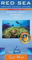
Wegenkaart - landkaart Red Sea Rode Zee (Sharm el Sheikh, Hurghada, Sinai ) | Gizi Map

0
Red Sea at 1:2,000,000 from Gizi Map with lists of diving sites and wrecks along its shores, an enlargement of southern Sinai and its coastal waters, plus street plans of Sharm el Sheikh and Hurghada with tourist information. Coverage extends from Port Said and the Suez Canal beyond the Bab-el-Mandeb Straights to Djibouti City and Aden (Adan). On ...

Verkopers met dit product

Verkoper
Bezorging
Prijs
DeZwerver.nl logo
DeZwerver.nl
2,95
15,95

Anderen bekeken ook

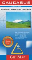
Wegenkaart - landkaart Kaukasus - Caucasus | Gizi Map
  The Caucasus at 1:1,000,000 from Gizi Map, presenting the region in a road edition with relief shading to show its topography and make the road network stand out better against the background. Coverage includes the southern republics of Russia. International boundaries are clearly marked.    Within Georgia the map indicates the boundaries of South Ossetia, Abkhazia and Adjara; in Azerbaijan the border of Nagorno Karabach and the ceasefire line are marked. Coverage within Russia extends north of Krasnodar and Stavropol, with boundaries of individual republics including Chechnya, North Ossetia and Dagestan. Place names are shown in Latin alphabet, but within Georgia, Armenia and Russia larger towns are also named in local script.   Relief shading with plenty of names of geographical features such as individual mountain ranges, peaks, swamps, salt flats, etc, presents the topography. Road network is graded in six types, with driving distances on main and selected connecting routes. Rai…
15,95
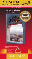
Wegenkaart - landkaart Yemen - Jemen | Gizi Map
Yemen, including the Gulf of Aden, at 1:1,250,000 on an excellent and informative map from Gizi Maps, with a street plan of central Sana’a and enlargements of the environs of the capital and Aden, plus the Aden Peninsula.   The map has the publisher’s characteristic bold altitude colouring and plenty of names of various mountain chains, peaks, deserts, etc. Graphics indicate swamps, salt flats, wadis, deserts, lava flows, water wells, oasis, etc, to provide a vivid picture of the country’s topography. Names of the larger towns, provinces and many geographical features are given in both Latin and Arabic alphabets; all other place names are shown only transliterated.   Coverage extends southward to the northern coastline of the Horn of Africa, including the whole of Djibouti and most of Eritrea. Within the Gulf of Aden the Internationally Recommended Transit Corridor (IRTC) is marked, as well as other ferry and shipping routes including those leading to the Socotra Archipelago and in th…
15,95
Wegenkaart - landkaart Südtirol Alto Adige - Dolomiti - Zuid Tirol - Dolomieten | Tabacco Editrice
Heel duidelijke wegenkaart van Zuid Tirol. De kaart is goed leesbaar met mooie kleurstellin waardoor goed duidelijk wordt hoe en waar de bergbieden en nationale parken liggen.  The South Tyrol region of north-eastern Italy on a durable, waterproof and tear-resistant road map at 1:150,000 from Tabacco with excellent presentation of the topography derived from the publishers’ highly regarded and popular hiking maps, plus on the reverse a panorama drawing of the mountains. Coverage extends from the Austrian border to just past Trento and Feltre, and west/east from Bormio to well east of Belluno.   The map provides a very clear picture of the region’s landscape through graphic relief for its exposed rocky areas, plus relief shading and contours at 100m intervals, and has plenty of names of individual groups, peaks, valleys, etc. Additional colouring indicates woodlands and boundaries of national parks and other protected areas are marked. Minor roads are drawn without generalizing their c…
12,50
Wegenkaart - landkaart 3019 Adventure Map Turkey Mediterranean Coast Turkije | National Geographic
Wegenkaart van de zuidelijke kust van Turkije met vermelding van veel bezienswaardigheden, nationale parken en attrakties. Watervast en scheurvast.   National Geographic's Turkey, Mediterranean Coast Adventure Map is designed to meet the unique needs of adventure travelers with its durability and accurate information. This folded map provides global travelers with the perfect combination of detail and perspective, highlighting hundreds of points of interest and the diverse and unique destinations within the country.   The front side of the Turkey Mediterranean Coast map details the southern coastal region of the country. This side shows the Mediterranean Sea to the south and Syria to the east. The coastline extends from Kas to Iskenderum. The reverse side of the map details Turkey’s western coastal region of the country and its border with Greece and Bulgaria. This side shows the western coast from the Sea of Marmara down to the Mediterranean Sea. The map includes the locations of cit…
17,50
Wegenkaart - landkaart 3109 Adventure Map Nicaragua, Honduras , El Salvador | National Geographic
Wegenkaart van Nicaragua, Honduras, en El Salvador met vermelding van veel bezienswaardigheden, nationale parken en attrakties. Watervast en scheurvast. Juist door deze vermeldingen onderscheidt de kaart zich van andere wegenkaarten. National Geographic's Nicaragua, Honduras, El Salvador AdventureMap is designed to meet the unique needs of adventure travelers with its durability and accurate information. This folded map provides global travelers with the perfect combination of detail and perspective, highlighting hundreds of points of interest and the diverse and unique destinations within the country.   The map includes the locations of cities and towns with a user-friendly index, plus a clearly marked road network complete with distances and designations for major highways, main roads, and tracks and trails for those seeking to explore more remote regions.   Every AdventureMap is printed on durable synthetic paper, making them waterproof, tear-resistant and tough — capable of withst…
17,50
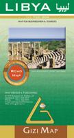
Wegenkaart - landkaart Lybië - Libya | Gizi Map
Libya at 1:1,750,000 on an indexed road map from Gizi Map with exceptionally fine and detailed presentation of its physical geography, oil and gas wells and pipelines, water aqueducts, ancients sites and other places of interest, etc. Names of larger towns and selected smaller locations, as well as of many topographic features are also shown in Arabic.   The map provides a very fine presentation of the country’s geography through relief shading and graphics for sandy or stone deserts, swamps, salt flats, oasis, and water wells, plus numerous spot heights and plenty of names of mountain ranges, wadis, etc. Road network shows desert tracks and gives distances on main routes. Railway lines are included and domestic airports/aerodromes are marked. The map also shows oil or gas wells and pipelines, water aqueducts and boundaries of administrative provinces. Symbols indicate locations with campsites or youth hostels, various places of interest including archaeological sites and natural curi…
15,95
Wegenkaart - landkaart South Pacific Cruising & Samoa | ITMB
Een overzichtskaart van de zuidelijke Stille Oceaan met de cruise routes tussen de verschillende eilanden aangegeven. Op de achterzijde een overzichtskaart van Samoa This is a new venture for ITMB. Cruising is a rapidly-growing segment of the travel industry, experiencing double-digit growth rates annually. Obviously, this is a thriving market. In conjunction with several cruise ship lines, we have prepared a map of the South Pacific Ocean, which extends southwards from Hawai'i to the southern tip of New Zealand and eastwards from central Australia/Papua New Guinea to the Pitcairn Islands. Thus, it does not include the popular South East Asia and China coast routes. We think this has to change at a time when 25,000,000 people are travelling by cruise ships. At the same time, we must keep coverage area relevant for those end users of the artwork. Even at 1:12M, most of the area covered is water, with island countries such as Fiji, Tonga, Kiribati, Tahiti, and the Cook Islands being vis…
13,95
Wegenkaart - landkaart Dolomiti - Dolomieten - Lago di Garda - Venezia | Tabacco Editrice
Dolomites – Lake Garda - Venice region of north-eastern Italy on a road map at 1:200,000 from Tabacco with excellent presentation of the topography derived from the publishers’ highly regarded and popular hiking maps, plus on the reverse a panorama drawing of the mountains. Coverage extends from the Austrian border southwards to the A4 motorway including the whole of Lake Garda, Verona, Padua and Venice, plus east to Lienz/Pordenone.   The map provides a very clear picture of the region’s landscape through graphic relief for its exposed rocky areas, plus relief shading and contours at 100m intervals, and has plenty of names of individual groups, peaks, valleys, etc. Additional colouring indicates woodlands and boundaries of national parks and other protected areas are marked. Minor roads are drawn without generalizing their course, showing the twists and turns across the mountainous terrain. Driving distances are marked on main and many connecting routes. Railway lines are shown with …
9,95
Wegenkaart - landkaart 3018 Adventure Map Turkey Turkije | National Geographic
Wegenkaart van Turkije met vermelding van veel bezienswaardigheden, nationale parken en attrakties. Watervast en scheurvast. National Geographic's Turkey Adventure Map is designed to meet the unique needs of adventure travelers with its durability and accurate information. This folded map provides global travelers with the perfect combination of detail and perspective, highlighting hundreds of points of interest and the diverse and unique destinations within the country.   The front side of the Turkey map details the eastern region of the country, from its borders with Syria and Iraq to the south, and with Iran and Armenia to the East, extending to the Black Sea and Georgia to the north. The regions featured on this side are Southeast Anatolia and East Anatolia. The reverse side of the map details Turkey’s western portion of the country, from its border with Greece to the west, to the Mediterranean Sea to the south, extending to the Black Sea to the north. This side covers the Black S…
17,50
Wegenkaart - landkaart 3202 Adventure Map Egypt - Egypte | National Geographic
Wegenkaart van Egypte met vermelding van veel bezienswaardigheden, nationale parken en attrakties. Watervast en scheurvast. Juist door deze vermeldingen onderscheidt de kaart zich van andere wegenkaarten. National Geographic's Egypt Adventure Map is designed to meet the unique needs of adventure travelers with its detail, durability, and accuracy. The map includes the locations of thousands of cities and towns with an index for easily locating them, plus a clearly marked road network complete with distances and designations for expressways, major roadways, and more. Transportation within and beyond the country is made easier with the locations of airports, airfields, railroads, ferry routes, lighthouses, harbors, border crossings, and police control points.   What sets National Geographic Adventure Maps apart from traditional road maps are the hundreds of points of interest that highlight the diverse, unique, and exotic destinations within Egypt. In addition to typical sites of intere…
17,50

Klanten-reviews van Wegenkaart - landkaart Red Sea Rode Zee (Sharm el Sheikh, Hurghada, Sinai ) | Gizi Map

Er zijn nog geen beoordelingen voor dit productBen jij de eerste die een review plaatst?

Meer over Wegenkaart - landkaart Red Sea Rode Zee (Sharm el Sheikh, Hurghada, Sinai ) | Gizi Map

Productomschrijving

Red Sea at 1:2,000,000 from Gizi Map with lists of diving sites and wrecks along its shores, an enlargement of southern Sinai and its coastal waters, plus street plans of Sharm el Sheikh and Hurghada with tourist information.

Coverage extends from Port Said and the Suez Canal beyond the Bab-el-Mandeb Straights to Djibouti City and Aden (Adan). On land in its northern section the map extends west to include the whole of the Nile Valley from Cairo to Aswan and Abu Simbel, and east to Tel Aviv and Amman. All place names are in Latin alphabet, with names of main towns also shown in Arabic

Verken gerelateerde categorieën

Webshop.nl maakt gebruik van cookies. Ga je verder op onze website, ga dan akkoord met het plaatsen van cookies en de verwerking van deze data door ons en vermelde partners.