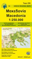
Wegenkaart - landkaart 4 Macedonia | Anavasi

0
Gedetailleerde tweetalige (Grieks/Engels) topografische wegenkaart van Griekse Macedonië met hoogtelijnen, relief, gedetailleerd wegennet met wegnummers, campings en hutten. Met ingetekende Europese en nationale lange afstandswandelpaden. Anavasi Regional Maps series (Topo250), covering half of the mainland from Konitsa to Katerini in the north an...

Verkopers met dit product

Verkoper
Bezorging
Prijs
DeZwerver.nl logo
DeZwerver.nl
2,95
11,95

Anderen bekeken ook

Wegenkaart - landkaart 4 Macedonia | Anavasi
Gedetailleerde tweetalige (Grieks/Engels) topografische wegenkaart van Griekse Macedonië met hoogtelijnen, relief, gedetailleerd wegennet met wegnummers, campings en hutten. Met ingetekende Europese en nationale lange afstandswandelpaden. Anavasi Regional Maps series (Topo250), covering half of the mainland from Konitsa to Katerini in the north and from Messolongi to Thiva in the south. The map comprises all the new highways, the protected areas and Natura sites, the european and national long distance trails and a 84 pages index of settlements, mountains and mountain refuges. Double-sided roadmap and place name index, GPS compatible regional road maps printed on waterproof and tear-resistant plastic paper
11,95
Wegenkaart - landkaart 3 Central Greece - Midden Griekenland, Thessalie en Epirus | Anavasi
Gedetailleerde tweetalige (Grieks/Engels) topografische wegenkaart van het centrale gedeelte van Griekenland - Thessalië en Epiros met hoogtelijnen, relief, gedetailleerd wegennet met wegnummers, campings en hutten. Met ingetekende Europese en nationale lange afstandswandelpaden. Anavasi Regional Maps series (Topo250), covering half of the mainland from Konitsa to Katerini in the north and from Messolongi to Thiva in the south. The map comprises all the new highways, the protected areas and Natura sites, the european and national long distance trails and a 84 pages index of settlements, mountains and mountain refuges. Double-sided roadmap and place name index, GPS compatible regional road maps printed on waterproof and tear-resistant plastic paper
11,95
Wegenkaart - landkaart Macedonië - Macedonia | Gizi Map
Goede wegenkaart van Macedonië met spoorlijnen en veel topografische details en plaatsnamen. Met index en kleine stadskaart van Skopje. Geindexeerde wegenkaart van Macedonië op 1: 250.000 van Gizi Map met een stratenplan van centraal Skopje. De kaart biedt een levendige presentatie van de bergachtige topografie van het land door middel van reliëfschaduw, hoogtekleuren, piekhoogten en veel namen van bergketens, plus markering van de nationale parken. Namen van veel steden worden ook weergegeven in het Cyrillische alfabet.   Wegennet omvat lokale wegen en sporen, toont rijafstanden op hoofd- en veel secundaire routes en geeft grensovergangen van de buurlanden aan. Spoorlijnen en lokale luchthavens zijn inbegrepen. Symbolen geven locaties aan met toeristische accommodatie, campings en andere interessante plaatsen. Breedtegraad- en lengtegraadlijnen worden getekend met intervallen van 15 '. De index staat naast de kaart. Legende van kaarten bevat Engels. Er is ook een stratenplan van het …
15,95
Wegenkaart - landkaart 52 Macedonia - Macedonië | Orama
Goede wegenkaart van een deel van Griekenland. Waar beschikbaar worden hotels en campings getoond en met symbolen worden allerhande toeristische symbolen aangeduid als historische plaatsen, kloosters, museas etc.  Tweetalig. Op elke kaart staat van de belangrijkste steden een centrumkaart en er is een behoorlijk uitgebreid register (wel kleine letters!) Kleurgebruik is duidelijk, maar een beetje flets, waardoor hoogteverschillen niet echt goed uitkomen. 
10,25
Wegenkaart - landkaart 2 Peloponnese - Peloponnesos | Anavasi
De nieuwe editie van de kaart van de Peloponnesus komt met veel verbeteringen. De grotere schaal maakt het veel leesbaarder en laat gedetailleerde informatie van de kaart zien: Uitgebreid weg- en vestigingsnetwerk. Tal van archeologische sites die voor het eerst op een kaart worden gepubliceerd. Stranden, kamperen, jachthavens, berghutten en de loop van de E4 en de belangrijkste nationale paden 31, 32 en 33. En een innovatie: 10 suggesties voor unieke sites om te bezoeken aan de zijkant van de kaart. Road and touring map of the Peloponnese in scale 1:200 000. On the map find ideas for 10 top nature destinations. Planning a road trip in the Peloponnese? This is the map to take with you. It shows all road categories, to the last dirt road. Every settlement, stating their original name, when known. Plenty of archaeological sites published for the first time on a map. Beaches, camping, marinas, mountain refuges and the course of the E4 and the major national paths 31, 32 and 33. Map corre…
11,95
Fietskaart - Wegenkaart - landkaart 2 Touring Map Centraal (grieks) Macedonië | Terrain maps
Landkaart van een deel van Griekenland met zeer veel plaatsen, kleine wegen, hoogtelijnen en toeristische informatie in symbolen aangegeven, met plaatsnamenregister - schaal 1:200.000. De kaart wordt veel gebruikt door fietsers vanwege de mate van detail, is watervast en GPS-geschikt.   Detailed and updated map of Macedonia including, naturally, the popular tourist region of Halkidiki and Mount Athos. It uses G.I.S. (Geographical Information Systems) technology and the WGS84 reference system, supplemented by a ΕΓΣΑ87 grid.    Like all of TERRAIN’s large maps, the map of Macedonia is printed on Polyart, which is extremely durable against folding and unfolding, does not rip, and is 100% waterproof.    Based on field research completed in 2013, this map features all the newest national motorways, their interchanges, toll stations and Motorway Service Stations, as well as Egnatia motorway, its interchanges and vertical axes, and the border crossings.    Also depicted are the region…
13,50
Wegenkaart - landkaart Albanië - North Macedonia - Kosovo | Marco Polo
Duidelijke wegenkaart van Marco Polo: alle wegen, zowel de verharde als belangrijke onverharde wegen zijn weergegeven.  Mooie toeristisch interessante wegen die de moeite waard zijn, zijn groen gearceerd. Veel toeristische informatie is toegevoegd zoals de nationale parken, campings, kastelen en vliegvelden. Afstanden tussen belangrijke steden en benzinestations staan ook op de kaart.  ---   Sie überzeugen mit detaillierter und leicht lesbarer Kartografie in modernem Design. Die Karte auf reiß- und wetterfestem Papier hält dabei allen Unwegsamkeiten stand, lässt sich aus einem festen Umschlag herausnehmen und ist in handlichem Format der perfekte Begleiter auf jeder Reise. Die 20 im ganzen Land verteilten MARCO POLO Highlights stellen spannende Ausflugsziele dar und bilden gemeinsam mit den Länder- und Verkehrsinformationen eine ideale Planungsgrundlage. Vor Ort bieten die über einen QR-Code zugänglichen Smart-Infos aktuelle Informationen - der digitale Index vereinfacht die Ortssuch…
14,95
Wegenkaart - landkaart 92 Kreta oost - Lasithi | Anavasi
Gebaseerd op topografische kaarten, GPS compatible, gedrukt op watervast en scheurvast papier. Hoogtelijnen met 100 m interval, schaduwkleuren en punten met hoogte geven de topografie van het landschap aan. De kaart kent een UTM grid. Het wegennet wordt aangeduid met verschillende gradaties: grote en kleine wegen, verhard en onverhard. Toeristische bezienswaardigheden staan als zodanig aangeduid zoals thermen, kloosters, berghutten, grotten etc. Namen van steden zowel in het normale schrift als in het Grieks, met een legenda die ook in het Engels is. Van de uitgever This map includes all the information a traveler needs to discover Eastern Crete. It includes the entire road network from the biggest arteries to the smallest dirt roads, paths and trails, all the towns and villages, beaches and toponyms. In addition to the above, you will find the E4 route from Dikti to Zakros that crosses the entire inland of Eastern Crete. On the reverse side you will find sections of the E4 route with…
11,95
Wandelkaart - Wegenkaart - landkaart 10.30 Tinos | Anavasi
Goede wandelkaart van Tinos. Tinos island landscape is like a hand made embroidery. Rural huts, dovecotes, churches, terraces and villages are woven into a net of trails. In the first edition of the map, along with my partner Charles Merlin we had recorded several dozens of kilometers of footpaths. From then until the present second edition, Charles made a bet and target to enrich the map in paths, - and put in the game and his friend George Kennedy. Actually the recorded paths, doubled, and plenty of churches, bridges, huts, dovecotes were added beside the paths. Along with the improvements in topographic background and color palette, the map of Tinos has reached very high standards - because we don't like the easy path. On the back side there are several proposed hiking trails with short descriptions and updated information for marking of the paths.
10,95

Klanten-reviews van Wegenkaart - landkaart 4 Macedonia | Anavasi

Er zijn nog geen beoordelingen voor dit productBen jij de eerste die een review plaatst?

Meer over Wegenkaart - landkaart 4 Macedonia | Anavasi

Productomschrijving

Gedetailleerde tweetalige (Grieks/Engels) topografische wegenkaart van Griekse Macedonië met hoogtelijnen, relief, gedetailleerd wegennet met wegnummers, campings en hutten. Met ingetekende Europese en nationale lange afstandswandelpaden.

Anavasi Regional Maps series (Topo250), covering half of the mainland from Konitsa to Katerini in the north and from Messolongi to Thiva in the south. The map comprises all the new highways, the protected areas and Natura sites, the european and national long distance trails and a 84 pages index of settlements, mountains and mountain refuges.

Double-sided roadmap and place name index, GPS compatible regional road maps printed on waterproof and tear-resistant plastic paper

Productinformatie

    Verken gerelateerde categorieën

    Webshop.nl maakt gebruik van cookies. Ga je verder op onze website, ga dan akkoord met het plaatsen van cookies en de verwerking van deze data door ons en vermelde partners.