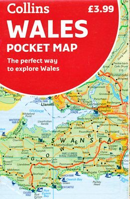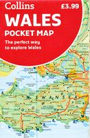
Wegenkaart - landkaart Pocket Map Wales | Collins

0
Kleine handzame kaart van Wales Handy little full colour map of Wales. Excellent value and very detailed for its size.   Key features of this map include: • Clear mapping at a scale of 3.95 miles to 1 inch • National Tourist Routes showing best routes through the most scenic areas • Top 100 places of interest • Park and Ride locations • Ideal comp...

Verkopers met dit product

Verkoper
Bezorging
Prijs
DeZwerver.nl logo
DeZwerver.nl
niet bekend
7,95

Anderen bekeken ook

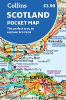
Wegenkaart - landkaart Pocket Map Scotland | Collins
Handy little full colour map of Scotland. Excellent value and very detailed for its size. Double-sided folded map with the Central Belt, southern Scotland and northern England on one side and northern Scotland including Orkney and Shetland on the reverse.   This map features:* Clear mapping at a scale of 8.7 miles to 1 inch* National Tourist Routes showing best routes through the most scenic areas* Top 100 places of interest* Park and Ride locations* Ideal companion to a sat-nav - it enables route planning and route sense-checking Essential for those planning a trip or who want an inexpensive and easy-to-use back up for a sat-nav.
7,95
Wegenkaart - landkaart Pocket Map Wild Atlantic Way | Collins
Handy full-colour map of Ireland’s Wild Atlantic Way with a high level of detail. Clear mapping of the full 2500 km (over 1500 miles) route, showing the road network and places of interest.   Clear, detailed Collins road mapping is presented in a handy format ideal for the pocket or handbag. It is excellent value and very detailed for its size, covering the whole of the Wild Atlantic Way.   Ideal for tourists, locals, hikers and adventurers. Places of interest marked, including famous film locations.   This map includes: • Clear mapping at a scale of 8.7 miles to 1 inch • National Tourist Routes showing best routes through the most scenic areas • Places of interest include film locations such as Star Wars • Tourist and signature locations clearly marked • Suggested itineraries • Detailed place names index • Ideal companion to a sat-nav – it enables route planning and route sense-checking
7,95
Wegenkaart - landkaart Planning Map Wales | Lonely Planet
🗺️ Lonely Planet Wales Planning Map – Watervaste reiskaart van Wales Plan je ideale rondreis door Wales met deze duurzame, watervaste en opvouwbare kaart van Lonely Planet. Van de ruige bergen van Snowdonia tot de puffins op Skomer Island – met deze overzichtelijke kaart navigeer je moeiteloos door het hart van Wales. 🧭 Wat vind je op deze kaart? Volledige kleurenkaart in een gemakkelijk opvouwbaar, waterbestendig formaat Alfanumeriek raster om bezienswaardigheden snel terug te vinden Reisplanner met reistijden – handig voor het uitstippelen van routes Topaanraders: kastelen, natuurparken, stranden, bergen, pubs en erfgoed Reistips en informatie over evenementen, vervoer en basis-Welshe woorden 🗺️ Gebieden op de kaart Cardiff, Brecon Beacons, Snowdonia, Pembrokeshire, Gower Peninsula, Anglesey, Aberystwyth en meer ✅ Voordelen Water- en scheurvast – perfect voor gebruik onderweg Compact en licht – past in je dagrugzak of jaszak ⚠️ Aandachtspunten …
10,95
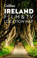
Wegenkaart - landkaart Pocket Map Ireland Film and TV Location Map | Collins
Full-colour, handy guide to more than 50 of the most popular film and TV locations in Ireland. Striking images and detailed descriptions allow for a comprehensive guide to Ireland's most recognisable filming sites in a convenient, travel-sized guide. Follow the journeys your favourite characters undertook in world-famous productions such as Game of Thrones and Star Wars as this guide covers the best Ireland has to offer Hollywood and Bollywood.   This map features: Clear mapping at a scale of 8.7 miles to 1 inch. Scenic images and detailed descriptions of famous filming locations. More than 50 Film and Television locations, including: Game of Thrones, Harry Potter, Star Wars, Derry Girls, Vikings, and P.S.   I Love You. Ideal companion to a sat-nav - it enables route planning and route sense-checking.
7,95
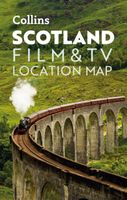
Wegenkaart - landkaart Pocket Map Scotland Film and TV Location Map | Collins
Full-colour, handy guide to more than 60 of the most popular film and TV locations in Scotland. Striking images and detailed descriptions allow for a comprehensive guide to Scotland's most recognisable filming sites in a convenient, travel-sized guide. Follow the journeys your favourite characters undertook from Hogwarts to Gotham City, Skyfall to Lallybroch, as this guide covers the best Scotland has to offer Hollywood and Bollywood.   This map features: Full coverage of the road, stations, and streets of ScotlandScenic images and detailed descriptions of famous filming locationsLocations include: Harry Potter, James Bond, The Da Vinci Code, Still Game, Outlander, Good Omens, and The CrownIdeal companion to a sat-nav - it enables route planning and route sense-checking  
7,95
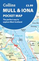
Wegenkaart - landkaart Pocket Map Mull and Iona | Collins
Explore new places with handy pocket maps from Collins. Handy little full colour map showing the islands of Mull and Iona. Excellent value and very detailed for its size.   Key features of this map include: Single-sided map showing the Scottish islands of Mull and IonaBeautiful pictures accompanied by informative textDetailed mapping with places of interest clearly markedExtensive index Essential for those planning a trip or who want an inexpensive and easy-to-use back up for a sat nav.
7,95
Stadsplattegrond Pocket Street Map Bath | A-Z Map Company
This up-to-date detailed A-Z street map includes more than 1,700 streets in and around Bath. This street map includes the following: Postcode districts, one-way streets and car parks Tourist attractions and places of interest marked On the reverse side of the map there is a handy index to streets, places of interest, place and area names, park and ride sites, national rail stations, hospitals and hospicesIdeal companion to a sat-nav - it enables route planning and route sense-checking Extensive mapping covers an area from Charlcombe in the north to Combe Down in the south, and from Bathampton Down in the east to Whiteway in the west. With clear mapping at a scale of 5.5 inches to 1 mile, this is the perfect reference map for finding your way around Bath.
7,95
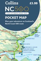
Wegenkaart - landkaart Pocket Map NC500 | Collins
Handy little full colour map of the popular North Coast 500 route. A perfect guide for travelling around Northern Scotland. Detailed mapping and tourist information ideal for any road trip.   Main features of this map include: • Clear mapping • Tourist attractions located and described • Ideal for touring with castles, museums, gardens, monuments, mountains, golf courses, walks and camping/caravan sites all on the map • Photographs of the main attractions along the route • Index to places of interest and place names   Essential for those planning a trip on the North Coast 500.
7,95
Wegenkaart - landkaart National Park Pocket Map Pembrokeshire Coast | Collins
Duidelijke pocket wandelkaart met belangrijke toeristische informatie, bezienswaardigheden, campeerplekken e.d. Handy little full colour map and guide of Pembrokeshire Coast National Park. Detailed mapping and visitor information to the National Park along with a selection of photographs. Map at a scale of 1:133,000 (2.1 miles to 1 inch or 1.33 km to 1cm).   This small map with additional text and photographs gives a great overview of the Pembrokeshire Coast National Park, and is the perfect companion for exploring this beautiful area of West Wales.   Clear, detailed mapping Key park, tourist and travel information Ideal for planning visits to the National Park Index to help locate and plan your trip
7,95
Wegenkaart - landkaart National Park Pocket Map Snowdonia | Collins
Duidelijke pocket wandelkaart met belangrijke toeristische informatie, bezienswaardigheden, campeerplekken e.d.   Handy little full colour map and guide of Snowdonia National Park. Detailed mapping and visitor information to the National Park along with a selection of photographs. Map at a scale of 1:119 000 (1.2cm to 1km, 1.9 miles to 1 inch).   This small map with additional text and photographs gives a great overview of the Snowdonia National Park, and is the perfect companion for exploring this beautiful area of North Wales.   Clear, detailed mapping Key park, tourist and travel information Ideal for planning visits to the National Park Index to help locate and plan your trip Information on historic railways, stargazing, mountain biking and places of interest
7,95

Klanten-reviews van Wegenkaart - landkaart Pocket Map Wales | Collins

Er zijn nog geen beoordelingen voor dit productBen jij de eerste die een review plaatst?

Meer over Wegenkaart - landkaart Pocket Map Wales | Collins

Productomschrijving

Kleine handzame kaart van Wales

Handy little full colour map of Wales. Excellent value and very detailed for its size.   Key features of this map include: • Clear mapping at a scale of 3.95 miles to 1 inch • National Tourist Routes showing best routes through the most scenic areas • Top 100 places of interest • Park and Ride locations • Ideal companion to a sat-nav – it enables route planning and route sense-checking  

Essential for those planning a trip or who want an inexpensive and easy-to-use back up for a sat-nav..

Verken gerelateerde categorieën

Webshop.nl maakt gebruik van cookies. Ga je verder op onze website, ga dan akkoord met het plaatsen van cookies en de verwerking van deze data door ons en vermelde partners.