webshop.nl
Categorieën
  Sluiten

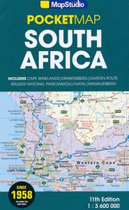
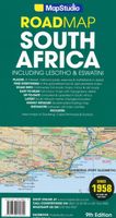
Wegenkaart - landkaart Pocket map South Africa Zuid Afrika | MapStudio

Handige kleine kaart van Zuid Afrika. South Africa Pocket Map is a  handy pocket map which is an ideal guide to South Africa for any tourist. The map includes detailed area maps of Kruger National Park, the Garden Route, Cape Winelands, Drakensberg, Magaliesberg & the Kwazulu-Natal coast.   South Africa Pocket Map display places of interest, wine e...
13,95

Webshops met dit product

Webshop
Bezorging
Prijs

Anderen bekeken ook

Wegenkaart - landkaart Zuid-Afrika - South Africa, Lesotho & Swaziland | MapStudio
Duidelijke overzichtskaart van Zuid Afrika, Lesotho en Swaziland. Met gedetailleerde kaarten van de regio's Gauteng, Kaapse Schiereiland en Durban. South Africa Lesotho and Swaziland map is a  new edition which includes major and minor routes with route markers, tourist regions and has an index to place names.   Content includes places of interest, mountain passes, topography, national parks & reserves, historic sites, railway lines & stations, route numbers, distance table and the latest toll routes and all route classifications.   Coverage includes a detailed map of South Africa at a scale of 1 : 1 500 000 along with detailed area maps of Gauteng, Durban and Cape Peninsula.
16,95
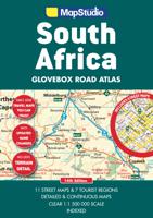
Wegenatlas Glovebox South Africa - Zuid-Afrika | A5-Formaat | Ringband | MapStudio
Handzame pocket atlas, A5 formaat, voor Zuid Afrika. Schaal 1 op 1.500.000 en in handige ringband.   This wiro bound Road Atlas South Africa Glovebox is a revised and updated compact atlas.   It includes: Detailed and continuous map section Highlights seven major tourist areas Features eleven street maps Freeways National roads Route numbers Nature reserves and parks Places of interest Tourist information Index to place names and GPS co-ordinates   This edition also features GPS co-ordinates at main interchanges.   COVERAGE: Includes a detailed map of South Africa at a scale of 1 : 1 500 000. The 7 major tourist areas of the Cape Peninsula, South Western Cape and Overberg Region, Garden Route, Gauteng, Kruger National Park, Drakensberg and Kwazulu-Natal coast. The 11 street maps are of Pietermaritzburg, Durban, Nelspruit, Polokwane, Pretoria, Johannesburg, Bloemfontein, Kimberley, East London, Port Elizabeth and Cape Town.  
18,95
Wegenkaart - landkaart 3204 Adventure Map South Africa - Zuid Afrika | National Geographic
Wegenkaart van Zuid Afrika met vermelding van veel bezienswaardigheden, nationale parken en attrakties. Watervast en scheurvast. Juist door deze vermeldingen onderscheidt de kaart zich van andere wegenkaarten. National Geographic’s South Africa Adventure Map is designed to meet the unique needs of adventure travelers—detailed, durable, and accurate. It includes the locations of thousands of major cities and towns with an index for easily locating them, plus a clearly marked road network complete with distances and designations for major highways, limited access highways, and more. Both paved and unpaved roads, tracks, and trails are marked for those adventurers who wish to explore less traveled routes.   What sets National Geographic Adventure Maps apart from traditional road maps are the hundreds of points-of-interest that highlight the diverse, unique, and exotic destinations within South Africa including national parks and reserves, sanctuaries, World Heritage sites, archeological s…
17,50
Wegenkaart - landkaart Kgalagadi - Tourist Map of Kgalagadi Transfrontier Park Botswana | Shell
Zeer bijzondere landkaart van het grensgebied van Botswana en Zuid Afrika. Uitermate handig zijn de GPS coordinaten van de meest belangrijke punten als campings of uitzichtpunten. De kaart is gebaseerd op een luchtfoto, waarbij alle details zijn ingetekend. The map: The map consists of a large map of the entire Park on the front of the map. On the back is enlargements of six maps - the South African side, Mabuasehube, Swart Pan area, Gemsbok Wilderness Trail, Mabuasehube Wilderness Trail and of the Kaa Kalahari Concession. Satellite images were used and the roads were tracked by GPS. There are 168 GPS coordinates on this map. Establishment of a Transfrontier Park: On the 7 th of April 1999 Botswana and South Africa signed a bilateral agreement in which they agreed to manage their adjacent national parks, Gemsbok National Park in Botswana and Kalahari Gemsbok National Park in South Africa, as a single ecological unit – the Kgalagadi Transfrontier Park. It is the first formally declared …
17,50
Wegenkaart - landkaart Zuid Afrika - South Africa | ITMB
Uitstekende wegenkaart van Zuid Afrika met zowel de toeristische informatie als Nationale Parken en bezienswaardigheden, maar ook de topografische details en afstanden. Gedrukt op 'waterproof' papier. Double-sided map of South Africa printed on waterproof and tear-resistant synthetic paper, with plans of Cape Town, Johannesburg and Pretoria. The map divides the country east/west with a small overlap between the two sides. Elevation tinting in feet shows the general relief. Mountain passes are marked, but there are no spot heights. Road network includes selected local tracks, gives driving distances on major and secondary roads and indicates border crossings. Railways, major ferry connections and local airports are also shown. National parks and protected areas are marked and symbols highlight various places of interest, campsites or huts, rest houses and other tourist accommodation, beaches and diving sites, etc. Presentation of Lesotho and Swaziland is the same as for South Africa. La…
13,95
Wegenkaart - landkaart 04 Mpumalanga, Kruger National Park & Panorama Route | MapStudio
Toeristische wegenkaart met veel aanduidingen van interessante punten. Heldere kaart, goed leesbaar. speciaal stukje Africa: Mpumalanga, Kruger National Park and Panorama Route Road Map covers the entire Kruger National Park, includes a detailed exploring map of Mpumalanga and the Panorama Route, plans of camps in the Kruger National Park and is up-to-date with all research compiled and updated in Africa   Detailed streetmaps and site maps with text and photography of Pilgrims Rest, Mashishing (Lydenburg), Dullstroom, Sudwala Caves, eMakhazeni (Belfast), eNtokozweni (Machadodorp), White River, Sabie, eMgwenya (Waterval Boven), Hazyview, Mbombela (Nelspruit) and Barberton   Easy-to-use map symbols showing hotel, lodges, rest camps, campsites, concession areas, bush camps, private rest camps and lodges, caravan facilities, caves, lookout points, waterholes, hides and much more. Information on hiking, trekking, walking and fly-fishing areas. Along with an alphabetised index, enlarged map …
16,95
Wegenkaart - landkaart Botswana | Infomap
Goede betrouwbare kaart van Botswana. Met GPS coordinaten. Easy to read in a vehicle Practical, user-friendly scale Extensive countrywide accommodation listing and contact details Experienced-based tips and route comments Includes many off-road tracks GPS co-ordinates of intersections Border post information Many points of interest Distances, fuel points, airports Booking details for national parks Roads and tracks in the national park and reserves Inset of Tuli Block A classic. Our Botswana map, now in its 14th edition, is one of our top sellers. From more frequented destinations such as the country’s famous game parks to other lesser known ones like Tsodilo Hills – Botswana’s World Heritage site with over 4000 rock paintings – this map is a one-stop resource for both self-drive travellers and fly-in tourists alike. Use it to navigate your way from Gaborone to Maun, from Kasane down the Hunters Road to Khubu Island, from Twee Rivieren to the Kalahari, or simply use it as a…
15,95
Wandkaart Africa - Afrika Zuid | 98 x 130 | Tracks4Africa
Our AFRICA WALL MAP is printed at a scale of 1:4 million and laminated on both sides. The size of the final map is 1300 X 980 mm.   The map includes countries from South Africa in the south to Ethiopia in the north.   Perfect for macro planning of self-drive trips through Southern and Eastern Africa and even to West Africa up to Gabon.   Printed in full colour, all major and secondary roads are shown with national parks and country borders clearly visible.   The Tracks4Africa Wall Map is printed to a scale of 1:4million and provides a surprising amount of detail to the self-drive traveller.  The map is perfect for macro planning of extended road trips across the African continent up to Ethiopia in the east and Gabon in west.  The map indicates major and secondary roads, parks, towns and a good number of tracks in remote areas.  Major tourist attractions are indicated  where space allows for it. International airports and country borders suitable for vehicle crossings are indicated.  …
89,95
Wegenkaart - landkaart Zimbabwe | Infomap
Easy to read in a vehicle Various accommodation options with contact details Major and secondary roads with many off-road tracks Roads in the national parks and reserves Distances between points on major roads Border post information Points of interest   While Zimbabwe has for many years now made headlines for its economic hardships, it’s worth remembering that for a long time this country was the ‘’breadbasket of Africa’ and one of the premier wildlife destinations on the continent. A changing political landscape in the late 90’s however, virtually caused a complete collapse in the tourism industry – a vital bloodline to the economy.   Those troubled times seem to be coming to a close and Zimbabwe is back on the tourist map. Foreign visitors are slowly rising and recently the country was voted the World’s Best Tourism Destination by the World Tourism Organisation. With a wealth of tourist-sites, activities and wildlife reserves, any trip to this country will be memorable. From …
15,95
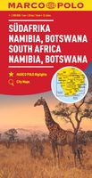
Wegenkaart - landkaart South Africa Namibia Botswana - Zuid Afrika Namibië Bostwana | Marco Polo
Duidelijke wegenkaart van Marco Polo: alle wegen, zowel de verharde als belangrijke onverharde wegen zijn weergegeven.  Mooie toeristisch interessante wegen die de moeite waard zijn, zijn groen gearceerd. Veel toeristische informatie is toegevoegd zoals de nationale parken, campings, kastelen en vliegvelden. Afstanden tussen belangrijke steden staan ook op de kaart. Een plaatsnamenregister ontbreekt niet.   ---   This Marco Polo map of South Africa features really easy to read cartography. Topography is highlighted with relief shading and loads of spot heights and the road network is clearly shown with roads ranging from motorways all the way through to minor secondary roads. The map also clearly indicates airports, places of interest, scenic/tourist routes, view points etc.   The map includes a booklet attached to the cover that contains some useful information and a very extensive index that covers locations, places of interest and geographical features. Also included are a distance/…
13,95

Klanten-reviews van Wegenkaart - landkaart Pocket map South Africa Zuid Afrika | MapStudio

Er zijn nog geen beoordelingen voor dit productBen jij de eerste die een review plaatst?

Meer over Wegenkaart - landkaart Pocket map South Africa Zuid Afrika | MapStudio

Productomschrijving

Handige kleine kaart van Zuid Afrika. South Africa Pocket Map is a  handy pocket map which is an ideal guide to South Africa for any tourist. The map includes detailed area maps of Kruger National Park, the Garden Route, Cape Winelands, Drakensberg, Magaliesberg & the Kwazulu-Natal coast.   South Africa Pocket Map display places of interest, wine estates, national parks & nature reserves, historical sites, accommodation, toll routes, route numbers and a distance table. Also included are border crossings, camps and tented camps.   This is a great map to have on a game drive or tour of South Africa!   Content includes the following as well: – Legend – Index to place names – Freeways – Interchanges – Route numbers – Nature reserves & parks – Tourist information  
Webshop.nl maakt gebruik van cookies. Ga je verder op onze website, ga dan akkoord met het plaatsen van cookies en de verwerking van deze data door ons en vermelde partners.