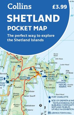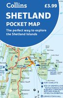
Wegenkaart - landkaart Pocket Map Shetland | Collins

0
Handy little full colour map of Shetland.   Main features of this map include: • Clear mapping • Main tourist attractions located and described • Ideal for touring with sights, places to stay, cafe/restaurant, golf courses, things to do all on the map • Essential travel information • Index to places of interest and place names   Essential for thos...

Verkopers met dit product

Verkoper
Bezorging
Prijs
DeZwerver.nl logo
DeZwerver.nl
2,95
7,95

Anderen bekeken ook

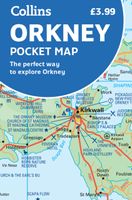
Wegenkaart - landkaart Pocket Map Orkney | Collins
Handy little full colour map of the Orkney Islands in Scotland. Detailed mapping and tourist information for Orkney mainland, Westray, Sanday, Stronsay, Shapinsay, Hoy, South Ronaldsay and the other islands. Excellent value and very detailed for its size. Main features of this map:   • Clear mapping at a scale of 2.7 miles to 1 inch • Tourist attractions located and described • Ideal for touring with sights, places to stay, cafe/restaurant, things to do all on the map • Transport links map showing how to get to and depart the islands • Index to places of interest and place names   Essential for those planning a trip around the Orkney Isles.
7,95
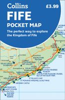
Wegenkaart - landkaart Pocket Map Fife | Collins
Handy little full colour map of the coastal Kingdom of Fife. Detailed mapping and tourist information from Dundee in the North to Edinburgh in the south and from Fife coast in the east to Stirling in the west.   Ancestral home of Scottish monarchs, world-famous for its golf and some of Scotland's best scenic attractions, the Kingdom of Fife has a distinct identity. Discover this unique area with this handy pocket map.   Main features of this map include: • Clear mapping at a scale of 2.3 miles to 1 inch / 1.5 km to 1 cm • Main tourist attractions located and described • Ideal for touring with sights, places to stay, cafe/restaurant, golf courses, things to do all on the map • Essential travel information • Index to places of interest and place names   Essential for those planning a trip around the mighty Kingdom of Fife.
7,95
Wegenkaart - landkaart Orkney Shetland | Philip's Maps
Whether it's the outstanding natural beauty, ancient sites or an activity-packed break calling you, the Philip's leisure and tourist map of Orkney and Shetland is all you need. Places of interest are clearly marked on the easy-to-read mapping - ideal for planning that all-important route.   This double-sided Philip's leisure and tourist map of Orkney and Shetland gives detailed coverage of the islands' road networks at an easy-to-read scale of approximately 2.5 miles to 1 inch. The Orkney Islands are featured on side one of the map, with the Shetland Islands shown on the reverse.   The maps show places of tourist and historic interest, including beaches, castles, camping sites, distilleries, galleries, gardens, golf courses, museums, nature trails, historic sites, sports and entertainment venues. From the ancient settlement of Orkney's Skara Brae and Scapa Flow to the Shetland Museum and Bobby's Bus Shelter, all the top places of interest are featured on each side of the map for Orkne…
11,50
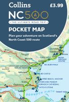
Wegenkaart - landkaart Pocket Map NC500 | Collins
Handy little full colour map of the popular North Coast 500 route. A perfect guide for travelling around Northern Scotland. Detailed mapping and tourist information ideal for any road trip.   Main features of this map include: • Clear mapping • Tourist attractions located and described • Ideal for touring with castles, museums, gardens, monuments, mountains, golf courses, walks and camping/caravan sites all on the map • Photographs of the main attractions along the route • Index to places of interest and place names   Essential for those planning a trip on the North Coast 500.
7,95
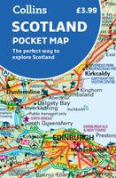
Wegenkaart - landkaart Pocket Map Scotland | Collins
Handy little full colour map of Scotland. Excellent value and very detailed for its size. Double-sided folded map with the Central Belt, southern Scotland and northern England on one side and northern Scotland including Orkney and Shetland on the reverse.   This map features:* Clear mapping at a scale of 8.7 miles to 1 inch* National Tourist Routes showing best routes through the most scenic areas* Top 100 places of interest* Park and Ride locations* Ideal companion to a sat-nav - it enables route planning and route sense-checking Essential for those planning a trip or who want an inexpensive and easy-to-use back up for a sat-nav.
7,95

Klanten-reviews van Wegenkaart - landkaart Pocket Map Shetland | Collins

Er zijn nog geen beoordelingen voor dit productBen jij de eerste die een review plaatst?

Meer over Wegenkaart - landkaart Pocket Map Shetland | Collins

Productomschrijving

Handy little full colour map of Shetland.   Main features of this map include: • Clear mapping • Main tourist attractions located and described • Ideal for touring with sights, places to stay, cafe/restaurant, golf courses, things to do all on the map • Essential travel information • Index to places of interest and place names   Essential for those planning a trip around the Shetland Islands.

Productinformatie

    Verken gerelateerde categorieën

    Webshop.nl maakt gebruik van cookies. Ga je verder op onze website, ga dan akkoord met het plaatsen van cookies en de verwerking van deze data door ons en vermelde partners.