webshop.nl
Categorieën
  Sluiten

Meer Collins
Meer Collins in Thrillers & fantasy boeken

Wegenkaart - landkaart Pocket Map Scotland Film and TV Location Map |

0
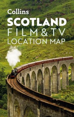
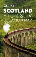
Full-colour, handy guide to more than 60 of the most popular film and TV locations in Scotland. Striking images and detailed descriptions allow for a comprehensive guide to Scotland's most recognisable filming sites in a convenient, travel-sized guide. Follow the journeys your favourite characters undertook from Hogwarts to Gotham City, Skyfall to ...

Webshops met dit product

Webshop
Bezorging
Prijs

Anderen bekeken ook

Wegenkaart - landkaart Pocket Map Scotland Film and TV Location Map |
Full-colour, handy guide to more than 60 of the most popular film and TV locations in Scotland. Striking images and detailed descriptions allow for a comprehensive guide to Scotland's most recognisable filming sites in a convenient, travel-sized guide. Follow the journeys your favourite characters undertook from Hogwarts to Gotham City, Skyfall to Lallybroch, as this guide covers the best Scotland has to offer Hollywood and Bollywood.   This map features: Full coverage of the road, stations, and streets of ScotlandScenic images and detailed descriptions of famous filming locationsLocations include: Harry Potter, James Bond, The Da Vinci Code, Still Game, Outlander, Good Omens, and The CrownIdeal companion to a sat-nav - it enables route planning and route sense-checking
7,95
Wegenkaart - landkaart Pocket Map Ireland Film and TV Location Map | C
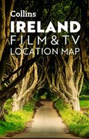
Full-colour, handy guide to more than 50 of the most popular film and TV locations in Ireland. Striking images and detailed descriptions allow for a comprehensive guide to Ireland's most recognisable filming sites in a convenient, travel-sized guide. Follow the journeys your favourite characters undertook in world-famous productions such as Game of Thrones and Star Wars as this guide covers the best Ireland has to offer Hollywood and Bollywood.   This map features: Clear mapping at a scale of 8.7 miles to 1 inch. Scenic images and detailed descriptions of famous filming locations. More than 50 Film and Television locations, including: Game of Thrones, Harry Potter, Star Wars, Derry Girls, Vikings, and P.S.   I Love You. Ideal companion to a sat-nav - it enables route planning and route sense-checking.
7,95
Wegenkaart - landkaart Pocket Map Scotland | Collins
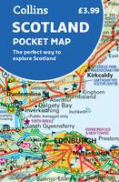
Handy little full colour map of Scotland. Excellent value and very detailed for its size. Double-sided folded map with the Central Belt, southern Scotland and northern England on one side and northern Scotland including Orkney and Shetland on the reverse.   This map features:* Clear mapping at a scale of 8.7 miles to 1 inch* National Tourist Routes showing best routes through the most scenic areas* Top 100 places of interest* Park and Ride locations* Ideal companion to a sat-nav - it enables route planning and route sense-checking Essential for those planning a trip or who want an inexpensive and easy-to-use back up for a sat-nav.
7,95
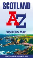
Wegenkaart - landkaart Visitors map Scotland - Schotland | A-Z Map Com
xplore the whole of Scotland from Dumfries and Galloway in the South to the Orkney Islands in the North. With detailed road mapping and illustrated town plans of major cities, this feature rich, helpful tourist guide is ideal for touring around Scotland. Published at a clear 8.7 miles to 1 inch scale (5.51 cm to 1 km), this handy map is a detailed and informative exploration of what Scotland has to offer.   Highlights include: 8 inset street maps to major cities and popular destinations, including: Edinburgh, Glasgow, Stirling, and Cairngorms National Park, with detailed descriptions and places of interestLocations of visitor centres and tourist information sitesUseful key to map symbols making it a clear and easy readMore than 700 places of interest The perfect map for exploring Scotland whether you are a tourist or a local.
11,50
Wegenkaart - landkaart Icefields Parkway | Gem Trek Maps
Whether you have a day or a week to spend exploring the sights along the spectacular Icefields Parkway highway, Gem Trek's ICEFIELDS PAKRWAY MAP, a combination map and guide, will help you make the most of your time. Like our much-loved hiking maps, our Icefields Parkway map features detailed cartography and is printed on waterproof and tear-resistant paper.   The Icefields Parkway Map shows all viewpoints, picnic areas, trailheads, campgrounds, hostels, lodges and other services along the Icefields Parkway, while the descriptions in the guide point you to the best of these - the best viewpoints of mountains and lakes, the most interesting points of interest and exhibits, and the best bets for spotting wildlife such as moose, bighorn sheep and mountain goats.   Also included are short descriptions of the ten best walks and day hikes along the Icefields Parkway—from the short stroll to Peyto Lake Viewpoint to the rewarding hike through alpine meadows to Helen Lake.   To make it easier t…
13,50
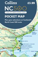
Wegenkaart - landkaart North Coast Road Trip Map | Destination Earth
This North Coast road trip map is the essential tool that will guide you through the breathtaking landscapes, stunning coastal views, and enchanting villages of the North Coast 500 in Scotland. Designed by travel enthusiasts, for travel enthusiasts, our map is more than just a navigation tool. It's a gateway to adventure, a treasure trove of hidden gems, and a companion that will make your journey even more extraordinary. Featuring a detailed and easy-to-read layout, this Destination NC500 Map will assist you in planning and navigating your way along the 500-mile route. With precise mile markers, highlighted attractions, and recommended stopping points, this map will ensure you don't miss a single sight along the way.   NC500 A1 Map Features:     Exact Locations: All of the exact locations of over 110+ Sights and Attractions, as well as Accommodation, Restaurants, Campervan Water and Waste Facilities, Electric Vehicle Charging Points, Train Stations, Airports, and much more! Must-know …
13,-

Klanten-reviews van Wegenkaart - landkaart Pocket Map Scotland Film and TV Location Map |

Er zijn nog geen beoordelingen voor dit productBen jij de eerste die een review plaatst?

Meer over Wegenkaart - landkaart Pocket Map Scotland Film and TV Location Map |

Productomschrijving

Full-colour, handy guide to more than 60 of the most popular film and TV locations in Scotland. Striking images and detailed descriptions allow for a comprehensive guide to Scotland's most recognisable filming sites in a convenient, travel-sized guide. Follow the journeys your favourite characters undertook from Hogwarts to Gotham City, Skyfall to Lallybroch, as this guide covers the best Scotland has to offer Hollywood and Bollywood.   This map features: Full coverage of the road, stations, and streets of ScotlandScenic images and detailed descriptions of famous filming locationsLocations include: Harry Potter, James Bond, The Da Vinci Code, Still Game, Outlander, Good Omens, and The CrownIdeal companion to a sat-nav - it enables route planning and route sense-checking

Productspecificaties

Artikelnummer(s)
Brand
Collins

Verken gerelateerde categorieën

Webshop.nl maakt gebruik van cookies. Ga je verder op onze website, ga dan akkoord met het plaatsen van cookies en de verwerking van deze data door ons en vermelde partners.