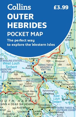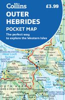
Wegenkaart - landkaart Pocket Map Outer Hebrides | Collins

0
Explore new places with handy pocket maps from Collins. Handy little full-colour map of the Western Isles of Scotland. Detailed mapping and tourist information for the islands of Lewis, Harris, Uist, Benbecula, Barra and St Kilda.   Excellent value and very detailed for its size. Famed for its stunning coastline, wildlife and traditional food and ...

Verkopers met dit product

Verkoper
Bezorging
Prijs
DeZwerver.nl logo
DeZwerver.nl
2,95
7,95

Anderen bekeken ook

Wegenkaart - landkaart Pocket Map Outer Hebrides | Collins
Explore new places with handy pocket maps from Collins. Handy little full-colour map of the Western Isles of Scotland. Detailed mapping and tourist information for the islands of Lewis, Harris, Uist, Benbecula, Barra and St Kilda.   Excellent value and very detailed for its size. Famed for its stunning coastline, wildlife and traditional food and drink, the Outer Hebrides have a distinct identity. Discover these unique islands with this handy pocket map.   Main features of this map include: Clear mapping at a scale of 3.2 miles to 1 inchTourist attractions located and describedSights, places to stay, cafe/restaurant, things to do are all highlighted on the mapTransport links map showing how to get to and depart the islandsIndex to places of interest and place names Essential for those planning a trip around the Western Isles.
7,95
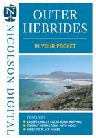
Wegenkaart - landkaart in your pocket Outer Hebrides | Nicolson
The Outer Hebrides In Your Pocket is our new essential map for visiting these beautiful islands. Exceptionally clear road mapping of the Outer Hebrides shows main tourist attractions, EV charge points and a full index to places & tourist attractions. Lewis & Harris are on the front and North & South Uist down to Berneray are on the reverse. A useful travel information section is also included allowing visitors to plan their perfect trip. Don't leave home without it!        Featuring:    Exceptionally clear, fully indexed road mapping EV charging points and tourist attractions shown Travel information section
7,95
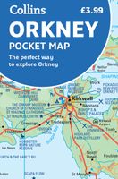
Wegenkaart - landkaart Pocket Map Orkney | Collins
Handy little full colour map of the Orkney Islands in Scotland. Detailed mapping and tourist information for Orkney mainland, Westray, Sanday, Stronsay, Shapinsay, Hoy, South Ronaldsay and the other islands. Excellent value and very detailed for its size. Main features of this map:   • Clear mapping at a scale of 2.7 miles to 1 inch • Tourist attractions located and described • Ideal for touring with sights, places to stay, cafe/restaurant, things to do all on the map • Transport links map showing how to get to and depart the islands • Index to places of interest and place names   Essential for those planning a trip around the Orkney Isles.
7,95
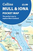
Wegenkaart - landkaart Pocket Map Mull and Iona | Collins
Explore new places with handy pocket maps from Collins. Handy little full colour map showing the islands of Mull and Iona. Excellent value and very detailed for its size.   Key features of this map include: Single-sided map showing the Scottish islands of Mull and IonaBeautiful pictures accompanied by informative textDetailed mapping with places of interest clearly markedExtensive index Essential for those planning a trip or who want an inexpensive and easy-to-use back up for a sat nav.
7,95
Reisgids Outer Hebrides Guide Book | Charles Tait
The Outer Hebrides Guide Book provides a thoroughly informative insight into unique life on the Scottish islands. Learn in fine photographic and written detail about the active traditional crafts, ancient archeology, geology and undisturbed nature and wildlife across these stunning islets.   This wonderfully written guide by experienced travel writer and photographer Charles Tait takes you around the main magical islands of the Outer Hebrides off the west coast of Scotland. Take a step back in time and explore the rich cultural, historical and natural delights of Lewis, Harris, The Uists, and Barra.   All the information provided in this guide is complimented by 12 hand-picked itineraries across the main islands of the Outer Hebrides. Each itinerary lists recommended sites, monuments and activities across a designated region or theme and are all accompanyed with Ordnance Survey maps for clarity.   How this guide is laid out   The Charles Tait guides for Scotland are brimming with info…
24,95
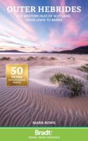
Reisgids Outer Hebrides - Hebriden - Schotland | Bradt Travel Guides
Voor vele landen en streken net zo goed, zo niet beter dan de Planet. soberder uitgevoerd, maar ook met veel informatie voor backpackers en met veel kaartmateriaal. Een aanrader! Voor de Hebriden is dit echt een unieke gids ... er is weinig beschkbaar met zulke goede informatie. This new, thoroughly updated third edition of Bradt's Outer Hebrides is the only up-to-date guidebook to focus solely on Scotland's Western Isles: the islands of Lewis, Harris, St Kilda, Berneray, North Uist, Benbecula, South Uist, Eriskay, Barra and Vatersay. Informed and intimate, this guidebook is ideal for people who travel with curious minds to discover places of great cultural, historical and wildlife interest. The Outer Hebrides is an archipelago of 15 inhabited islands and more than 50 others that are free of human footprint.   It is perfect for a staycation where you can get off the beaten track, switching off from the modern world. Huge variations in landscape are found across the islands - from L…
26,50
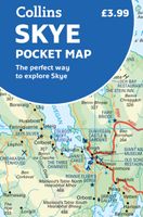
Wegenkaart - landkaart Pocket Map Skye | Collins
Handy little full colour Collins map of Skye with a high level of detail. Clear mapping of the Isle of Skye showing the road network, ferries and places of interest. Map at a scale of 1:175 000 (3 miles to 1 inch).   Clear, detailed, full colour Collins road mapping is presented in a handy format ideal for the pocket or handbag. It is excellent value and covers the whole of the Isle of Skye. This map includes:* Scotland route map* Caravan and camping sites* Tourist locations* Ferry links* Listing of major places to visit, with additional details for Dunvegan Castle, Old Man of Storr and Loch Coruisk* Detailed place names index
7,95
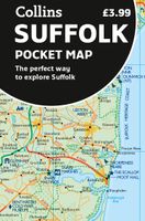
Wegenkaart - landkaart Pocket Map Suffolk | Collins
Explore new places with handy pocket maps from Collins. Handy little full-colour map of county of Suffolk. Detailed mapping, photographs, and tourist information.   Famed for its archaeological finds, swathes of rural farmland and open skies, Suffolk has a distinct identity. Discover this unique area with this handy pocket map. Main features of this map include: Clear mapping at a scale of 2.3 miles to 1 inch / 1.5 km to 1 cmMain tourist attractions located and describedSights, places to stay, cafe/restaurant, golf courses, and things to do all highlighted on the mapEssential travel informationIndex to places of interest and place names Essential for those planning a trip around Suffolk.
7,95
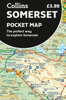
Wegenkaart - landkaart Pocket Map Somerset | Collins
Explore new places with handy pocket maps from Collins. Handy little full-colour map of county of Somerset. Detailed mapping, photographs and tourist information.   Famed for its cheddar cheese, cider, and apple orchards, Somerset has a distinct identity. Discover this unique area with this handy pocket map. Main features of this map include: Clear mapping at a scale of 2.3 miles to 1 inch / 1.5 km to 1 cmMain tourist attractions located and describedIdeal for touring with sights, places to stay, cafe/restaurant, golf courses, things to do all on the mapEssential travel informationIndex to places of interest and place names Essential for those planning a trip around Somerset.
7,95

Klanten-reviews van Wegenkaart - landkaart Pocket Map Outer Hebrides | Collins

Er zijn nog geen beoordelingen voor dit productBen jij de eerste die een review plaatst?

Meer over Wegenkaart - landkaart Pocket Map Outer Hebrides | Collins

Productomschrijving

Explore new places with handy pocket maps from Collins. Handy little full-colour map of the Western Isles of Scotland. Detailed mapping and tourist information for the islands of Lewis, Harris, Uist, Benbecula, Barra and St Kilda.   Excellent value and very detailed for its size. Famed for its stunning coastline, wildlife and traditional food and drink, the Outer Hebrides have a distinct identity. Discover these unique islands with this handy pocket map.   Main features of this map include: Clear mapping at a scale of 3.2 miles to 1 inchTourist attractions located and describedSights, places to stay, cafe/restaurant, things to do are all highlighted on the mapTransport links map showing how to get to and depart the islandsIndex to places of interest and place names Essential for those planning a trip around the Western Isles.

Productinformatie

    Verken gerelateerde categorieën

    Webshop.nl maakt gebruik van cookies. Ga je verder op onze website, ga dan akkoord met het plaatsen van cookies en de verwerking van deze data door ons en vermelde partners.