webshop.nl
Categorieën
  Sluiten

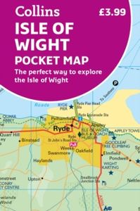
Wegenkaart - landkaart Pocket Map Isle of Wight | Collins

Handzame wegenkaart voor  Isle of Wight. Handy little full-colour map of the Isle of Wight. Detailed mapping and tourist information of the whole island.   With its stunning sea views and beautiful beaches, the Isle of Wight has a distinct identity. Discover this unique area with this handy pocket map.   Main features of this map include:   Clear ...
7,95

Webshops met dit product

Webshop
Bezorging
Prijs

Anderen bekeken ook

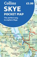
Wegenkaart - landkaart Pocket Map Skye | Collins
Handy little full colour Collins map of Skye with a high level of detail. Clear mapping of the Isle of Skye showing the road network, ferries and places of interest. Map at a scale of 1:175 000 (3 miles to 1 inch).   Clear, detailed, full colour Collins road mapping is presented in a handy format ideal for the pocket or handbag. It is excellent value and covers the whole of the Isle of Skye. This map includes:* Scotland route map* Caravan and camping sites* Tourist locations* Ferry links* Listing of major places to visit, with additional details for Dunvegan Castle, Old Man of Storr and Loch Coruisk* Detailed place names index
7,95
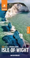
Reisgids Isle of Wight | Rough Guides
Een kleinere versie in zakformaat van de grotere versies van de Rough Guides. Als altijd weer vol met goede informatie over cultuur en praktische zaken. Achterin een kaart van de stad. This expert-curated guide book to Isle of Wight shines a spotlight on a more unusual British break, with a wealth of practical information on what to see and do. Each area or neighbourhood featured in this Isle of Wight travel guide is explored in-depth with detailed coverage of the points of interest, shops, restaurants, cafes and bars on offer. Excursions to surrounding areas give plenty of options for those looking to enjoy a longer stay. This Isle of Wight guide book has been fully updated post-COVID-19.   The Pocket Rough Guide to Isle of Wight covers: Cowes and around, Newport and around, Ryde and around, The east coast, The south coast, Ventnor to Blackgang, Brighstone to Alum Bay, Yarmouth and around.   Inside this travel guide to Isle of Wight you will find:   RECOMMENDATIONS FOR EVERY TYPE OF T…
13,95
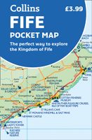
Wegenkaart - landkaart Pocket Map Fife | Collins
Handy little full colour map of the coastal Kingdom of Fife. Detailed mapping and tourist information from Dundee in the North to Edinburgh in the south and from Fife coast in the east to Stirling in the west.   Ancestral home of Scottish monarchs, world-famous for its golf and some of Scotland's best scenic attractions, the Kingdom of Fife has a distinct identity. Discover this unique area with this handy pocket map.   Main features of this map include: • Clear mapping at a scale of 2.3 miles to 1 inch / 1.5 km to 1 cm • Main tourist attractions located and described • Ideal for touring with sights, places to stay, cafe/restaurant, golf courses, things to do all on the map • Essential travel information • Index to places of interest and place names   Essential for those planning a trip around the mighty Kingdom of Fife.
7,95
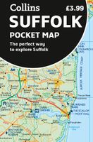
Wegenkaart - landkaart Pocket Map Suffolk | Collins
Explore new places with handy pocket maps from Collins. Handy little full-colour map of county of Suffolk. Detailed mapping, photographs, and tourist information.   Famed for its archaeological finds, swathes of rural farmland and open skies, Suffolk has a distinct identity. Discover this unique area with this handy pocket map. Main features of this map include: Clear mapping at a scale of 2.3 miles to 1 inch / 1.5 km to 1 cmMain tourist attractions located and describedSights, places to stay, cafe/restaurant, golf courses, and things to do all highlighted on the mapEssential travel informationIndex to places of interest and place names Essential for those planning a trip around Suffolk.
7,95
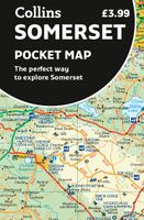
Wegenkaart - landkaart Pocket Map Somerset | Collins
Explore new places with handy pocket maps from Collins. Handy little full-colour map of county of Somerset. Detailed mapping, photographs and tourist information.   Famed for its cheddar cheese, cider, and apple orchards, Somerset has a distinct identity. Discover this unique area with this handy pocket map. Main features of this map include: Clear mapping at a scale of 2.3 miles to 1 inch / 1.5 km to 1 cmMain tourist attractions located and describedIdeal for touring with sights, places to stay, cafe/restaurant, golf courses, things to do all on the mapEssential travel informationIndex to places of interest and place names Essential for those planning a trip around Somerset.
7,95
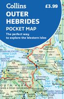
Wegenkaart - landkaart Pocket Map Outer Hebrides | Collins
Explore new places with handy pocket maps from Collins. Handy little full-colour map of the Western Isles of Scotland. Detailed mapping and tourist information for the islands of Lewis, Harris, Uist, Benbecula, Barra and St Kilda.   Excellent value and very detailed for its size. Famed for its stunning coastline, wildlife and traditional food and drink, the Outer Hebrides have a distinct identity. Discover these unique islands with this handy pocket map.   Main features of this map include: Clear mapping at a scale of 3.2 miles to 1 inchTourist attractions located and describedSights, places to stay, cafe/restaurant, things to do are all highlighted on the mapTransport links map showing how to get to and depart the islandsIndex to places of interest and place names Essential for those planning a trip around the Western Isles.
7,95
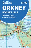
Wegenkaart - landkaart Pocket Map Orkney | Collins
Handy little full colour map of the Orkney Islands in Scotland. Detailed mapping and tourist information for Orkney mainland, Westray, Sanday, Stronsay, Shapinsay, Hoy, South Ronaldsay and the other islands. Excellent value and very detailed for its size. Main features of this map:   • Clear mapping at a scale of 2.7 miles to 1 inch • Tourist attractions located and described • Ideal for touring with sights, places to stay, cafe/restaurant, things to do all on the map • Transport links map showing how to get to and depart the islands • Index to places of interest and place names   Essential for those planning a trip around the Orkney Isles.
7,95
Wegenkaart - landkaart Pocket Map Wild Atlantic Way | Collins
Handy full-colour map of Ireland’s Wild Atlantic Way with a high level of detail. Clear mapping of the full 2500 km (over 1500 miles) route, showing the road network and places of interest.   Clear, detailed Collins road mapping is presented in a handy format ideal for the pocket or handbag. It is excellent value and very detailed for its size, covering the whole of the Wild Atlantic Way.   Ideal for tourists, locals, hikers and adventurers. Places of interest marked, including famous film locations.   This map includes: • Clear mapping at a scale of 8.7 miles to 1 inch • National Tourist Routes showing best routes through the most scenic areas • Places of interest include film locations such as Star Wars • Tourist and signature locations clearly marked • Suggested itineraries • Detailed place names index • Ideal companion to a sat-nav – it enables route planning and route sense-checking
7,95
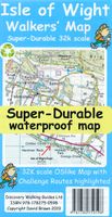
Wandelkaart Isle of Wight | Discovery Walking Guides
Goede scheur- en watervaste wandelkaart. Isle of Wight Walkers' Map at 32k scale with challenge routes and walking trails highlighted. OS 50k scale mapping is expanded in size to produce a 32k map. The OS features, text and logos are now 50% larger making them much easier to read under outdoor conditions.   Isle of Wight Challenge Route (66 miles) is specially highlighted in green and white so that the route stands out against the OS background map. Then we add the Earl Mountbatten Hospice's Walk (26.5 miles) highlighted in gold and white. A large range of gps surveyed walking trails are then highlighted in grey and white.   The result is an easy to read `OSlike' map with walking trails specially highlighted. We then split the island into East (cover side) and West (reverse side) with a ten mile common overlap to the two sides; meaning you will only have to turn the map over if you are undertaking the longest Challenge or Earl Mountbatten routes. The result is a double sided 840mm by 6…
15,95
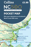
Wegenkaart - landkaart Pocket Map NC500 | Collins
Handy little full colour map of the popular North Coast 500 route. A perfect guide for travelling around Northern Scotland. Detailed mapping and tourist information ideal for any road trip.   Main features of this map include: • Clear mapping • Tourist attractions located and described • Ideal for touring with castles, museums, gardens, monuments, mountains, golf courses, walks and camping/caravan sites all on the map • Photographs of the main attractions along the route • Index to places of interest and place names   Essential for those planning a trip on the North Coast 500.
7,95

Klanten-reviews van Wegenkaart - landkaart Pocket Map Isle of Wight | Collins

Er zijn nog geen beoordelingen voor dit productBen jij de eerste die een review plaatst?

Meer over Wegenkaart - landkaart Pocket Map Isle of Wight | Collins

Productomschrijving

Handzame wegenkaart voor  Isle of Wight. Handy little full-colour map of the Isle of Wight. Detailed mapping and tourist information of the whole island.   With its stunning sea views and beautiful beaches, the Isle of Wight has a distinct identity. Discover this unique area with this handy pocket map.   Main features of this map include:   Clear mapping at a scale of 2.3 miles to 1 inch / 1.5 km to 1 cm Main tourist attractions located and described Places to stay, cafes/restaurants, golf courses are all highlighted on the map Essential travel information Index to places of interest and place names Essential for those planning a trip around the Isle of Wight.

Verken gerelateerde categorieën

Webshop.nl maakt gebruik van cookies. Ga je verder op onze website, ga dan akkoord met het plaatsen van cookies en de verwerking van deze data door ons en vermelde partners.