webshop.nl
Categorieën
  Sluiten

Meer Lonely Planet

Wegenkaart - landkaart Planning Map Grand Canyon National Park | Lonel

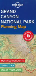
Handige kaart van dit Nationale Park. Goed te gebruiken als overzichtskaart en planningskaart om voor te bereiden wat je waar kunt doen. Op de ene kant een kaart van het park en op de andere zijde een globale kaart met inzetten van de hoogtepunten. Durable and waterproof, with a handy slipcase and an easy-fold format, Lonely Planet's Grand Canyon N...
10,95

Webshops met dit product

Webshop
Bezorging
Prijs

Anderen bekeken ook

Wegenkaart - landkaart Planning Map Grand Canyon National Park | Lonel
Handige kaart van dit Nationale Park. Goed te gebruiken als overzichtskaart en planningskaart om voor te bereiden wat je waar kunt doen. Op de ene kant een kaart van het park en op de andere zijde een globale kaart met inzetten van de hoogtepunten. Durable and waterproof, with a handy slipcase and an easy-fold format, Lonely Planet's Grand Canyon National Park Planning Map helps you get around with ease. Get more from your map and your trip with images and information about top attractions, itinerary suggestions, a transport guide, planning information, themed lists and practical travel tips. Durable and waterproof Easy-fold format and convenient size Handy slipcase Full color and easy to use Before-you-go info Beautiful imagery Tailored itineraries Can't-miss regional highlights Detailed town index Transport planner Themed lists Covers North Rim, North Kaibab Trail, Grand Canyon Lodge, Cape Royal Point, Point Imperial, South Rim, Grand Canyon Village, Desert View Watcht…
10,95
Wegenkaart - landkaart Planning Map Zion - Bryce Canyon National Parks
Handige kaart van dit Nationale Park. Goed te gebruiken als overzichtskaart en planningskaart om voor te bereiden wat je waar kunt doen. Op de ene kant een kaart van het park en op de andere zijde een globale kaart met inzetten van de hoogtepunten.   Durable and waterproof, with a handy slipcase and an easy-fold format, Lonely Planet’s Zion & Bryce Canyon National Parks Planning Map helps you get around with ease.   Get more from your map and your trip with images and information about top attractions, itinerary suggestions, a transport guide, planning information, themed lists and practical travel tips.   Durable and waterproof Easy-fold format and convenient size Handy slipcase Full color and easy to use Before-you-go info Beautiful imagery Tailored itineraries Can’t-miss regional highlights Detailed town index Transport planner Themed lists Covers Zion Canyon, Zion National Park, Angels Landing, The Narrows, Emerald Pools, Zion Canyon Scenic Drive, Bryce National Park, Navajo Loop T…
10,95
Wegenkaart - landkaart Planning Map Yosemite National Park | Lonely Pl
Handige kaart van dit Nationale Park. Goed te gebruiken als overzichtskaart en planningskaart om voor te bereiden wat je waar kunt doen. Op de ene kant een kaart van het park en op de andere zijde een globale kaart met inzetten van de hoogtepunten. Durable and waterproof, with a handy slipcase and an easy-fold format, Lonely Planet's Yosemite National Park Planning Map helps you get around with ease. Get more from your map and your trip with images and information about top attractions, itinerary suggestions, a transport guide, planning information, themed lists and practical travel tips. Durable and waterproof Easy-fold format and convenient size Handy slipcase Full color and easy to use Before-you-go info Beautiful imagery Tailored itineraries Can't-miss regional highlights Detailed town index Transport planner Themed lists Covers Yosemite Valley, El Capitan, Half Dome, Yosemite Falls, Wawona, Mariposa Grove, Chilnualna Falls, Pioneer Yosemite History Center, Tioga Roa…
10,95
Wegenkaart - landkaart Planning Map Yellowstone National Park | Lonely
Handige kaart van dit Nationale Park. Goed te gebruiken als overzichtskaart en planningskaart om voor te bereiden wat je waar kunt doen. Op de ene kant een kaart van het park en op de andere zijde een globale kaart met inzetten van de hoogtepunten. Durable and waterproof, with a handy slipcase and an easy-fold format, Lonely Planet's Yellowstone National Park Planning Map helps you get around with ease. Get more from your map and your trip with images and information about top attractions, itinerary suggestions, a transport guide, planning information, themed lists and practical travel tips. Durable and waterproof Easy-fold format and convenient size Handy slipcase Full color and easy to use Before-you-go info Beautiful imagery Tailored itineraries Can't-miss regional highlights Detailed town index Transport planner Themed lists Covers Yellowstone National Park
10,95
Wegenkaart - landkaart Planning Map Yosemite National Park | Lonely Pl
Handige kaart van dit Nationale Park. Goed te gebruiken als overzichtskaart en planningskaart om voor te bereiden wat je waar kunt doen. Op de ene kant een kaart van het park en op de andere zijde een globale kaart met inzetten van de hoogtepunten. Durable and waterproof, with a handy slipcase and an easy-fold format, Lonely Planet's Yosemite National Park Planning Map helps you get around with ease. Get more from your map and your trip with images and information about top attractions, itinerary suggestions, a transport guide, planning information, themed lists and practical travel tips. Durable and waterproof Easy-fold format and convenient size Handy slipcase Full color and easy to use Before-you-go info Beautiful imagery Tailored itineraries Can't-miss regional highlights Detailed town index Transport planner Themed lists Covers Yosemite Valley, El Capitan, Half Dome, Yosemite Falls, Wawona, Mariposa Grove, Chilnualna Falls, Pioneer Yosemite History Center, Tioga Roa…
10,95
Wegenkaart - landkaart Planning Map Great Smoky Mountains National Par
Handige kaart van dit Nationale Park. Goed te gebruiken als overzichtskaart en planningskaart om voor te bereiden wat je waar kunt doen. Op de ene kant een kaart van het park en op de andere zijde een globale kaart met inzetten van de hoogtepunten. Durable and waterproof, with a handy slipcase and an easy-fold format, Lonely Planet's Great Smoky Mountains National Park Planning Map helps you get around with ease. Get more from your map and your trip with images and information about top attractions, itinerary suggestions, a transport guide, planning information, themed lists and practical travel tips. Durable and waterproof Easy-fold format and convenient size Handy slipcase Full color and easy to use Before-you-go info Beautiful imagery Tailored itineraries Can't-miss regional highlights Detailed town index Transport planner Themed lists Covers Noah 'Bud' Ogle Nature Trail, Grotto Falls, Home of Ephraim Bales, Alfred Reagan Place, Place Of A Thousand Drips, Chimney Tops…
10,95
Wegenkaart - landkaart Planning Map USA | Lonely Planet
Durable and waterproof, with a handy slipcase and an easy-fold format, Lonely Planet USA Planning Map is your conveniently-sized passport to traveling with ease. Get more from your map and your trip with images and information about top country attractions, itinerary suggestions, a transport guide, planning information, themed lists and practical travel tips. With this easy-to-use, full colour navigation tool in your back pocket, you can truly get to the heart of the USA, so begin your journey now! Durable and waterproof Easy-fold format and convenient size Handy slipcase Full colour and easy-to-use Before-you-go info Beautiful imagery Tailored itineraries Can't-miss regional highlights Detailed town index Transport planner Themed lists Covers New York City, Washington, DC, Boston, New England, Walt Disney World, Miami, The Everglades, New Orleans, Nashville, Blue Ridge Parkway, Las Vegas, Grand Canyon National Park, Austin & San Antonio, Los Angeles, Pacific Coast High…
10,95

Klanten-reviews van Wegenkaart - landkaart Planning Map Grand Canyon National Park | Lonel

Er zijn nog geen beoordelingen voor dit productBen jij de eerste die een review plaatst?

Meer over Wegenkaart - landkaart Planning Map Grand Canyon National Park | Lonel

Productomschrijving

Handige kaart van dit Nationale Park. Goed te gebruiken als overzichtskaart en planningskaart om voor te bereiden wat je waar kunt doen. Op de ene kant een kaart van het park en op de andere zijde een globale kaart met inzetten van de hoogtepunten. Durable and waterproof, with a handy slipcase and an easy-fold format, Lonely Planet's Grand Canyon National Park Planning Map helps you get around with ease. Get more from your map and your trip with images and information about top attractions, itinerary suggestions, a transport guide, planning information, themed lists and practical travel tips. Durable and waterproof Easy-fold format and convenient size Handy slipcase Full color and easy to use Before-you-go info Beautiful imagery Tailored itineraries Can't-miss regional highlights Detailed town index Transport planner Themed lists Covers North Rim, North Kaibab Trail, Grand Canyon Lodge, Cape Royal Point, Point Imperial, South Rim, Grand Canyon Village, Desert View Watchtower, Shoshone Point, South Kaibab Trail, Colorado River, Deer Creek Falls, Havasu Canyon, Matkatamiba, Phantom Ranch (Canyon Bottom), Flagstaff, Tuweep

Productspecificaties

Artikelnummer(s)
Brand
Lonely Planet
Webshop.nl maakt gebruik van cookies. Ga je verder op onze website, ga dan akkoord met het plaatsen van cookies en de verwerking van deze data door ons en vermelde partners.