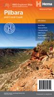
Wegenkaart - landkaart Pilbara and the Coral Coast | Hema Maps

0
Detailkaart van een deel van Australië. Zeer goed leesbaar, met naast de topografische details veel symbolen waarmee allerhande toeristische zaken worden aangeduid als campsites, nationale parken, attracties, wandelmogelijkheden etc. One of the last great frontiers in Australia, the Pilbara is real 4WD country. This map has been field-checked usin...

Verkopers met dit product

Verkoper
Bezorging
Prijs
DeZwerver.nl logo
DeZwerver.nl
2,95
17,50

Anderen bekeken ook

Wegenkaart - landkaart Tasmanië - Tasmania | Hema Maps
Op deze kaart staat Tasmanië in zijn geheel op 1 deel van de kaart. Goede, overzichtelijke, leesbare kaart van het hele eiland. Nationale Parken zijn er goed op te vinden en de afstanden worden weergegeven. Op de achterkant nog deelkaartjes van enkele steden en NP s. The fourth edition of Hema’s Tasmania State Map features Hema’s distinctive and informative maps fully, all of which have been field checked by Hema’s Map Patrol to ensure the best possible accuracy with the latest mapping data.    A fully indexed state map of Tasmania (TAS) at a scale of 1:500,000. Marked on the mapping are national parks, fuel locations as well as camping and rest areas.    The reverse side consists of:   a summary of the key things to see and do broken up into the North West, Launceston, Tamar and the North a table listing of National Parks and Reserves with key features and facilities (such as Camping and Caravan sites, BBQ, toilets and showers) Visitor centre listing Map of the area around Zeehan…
17,50
Wegenkaart - landkaart Brisbane to Cairns | Hema Maps
Detailkaart van een deel van Australië. Zeer goed leesbaar, met naast de topografische details veel symbolen waarmee allerhande toeristische zaken worden aangeduid als campsites, nationale parken, attracties, wandelmogelijkheden etc. An easy-to-follow map that shows both the coastal and inland routes from Brisbane to Cairns. Roadside rest areas, intermediate distances, and a quick-find distance chart are also shown. The map shows all the popular tourist destinations along the Queensland coast. Routes between Brisbane with Cairns in a series of touring maps connecting Australia’s main centres of population along some of the most spectacular routes such as the Great Ocean Road or the Savannah Way. The maps highlight 24-hour fuel supplies, roadside rest areas, camping facilities, places of interest, etc., and include distance charts and, in some titles, city maps. Road network indicates unsurfaced roads and tracks. The maps also show railway lines. There is no topographical information b…
17,50
Wegenkaart - landkaart Explorer Map North Queensland | Hema Maps
Detailkaart van een deel van Australië. Zeer goed leesbaar, met naast de topografische details veel symbolen waarmee allerhande toeristische zaken worden aangeduid als campsites, nationale parken, attracties, wandelmogelijkheden etc. Covering Australia's beautiful North Queensland. There is alot of town map insets, tourist information, and photographs on the reverse side Touring map of the northern half of Queensland, with enlargements of popular areas, street plans, lists of facilities, etc. The main map extends south to well beyond the Flinders Highway between Townsville and Mount Isa, including Mackay on the coast. The map shows the road network, including minor roads and unsurfaced tracks, plus railways and local airfields/aerodromes. Designated Tourist Routes are highlighted and symbols mark places of interest (many annotated with brief description), historical sites, tourist resorts, youth hostels, etc. Topography is indicated by names of mountain ranges and peaks, as well as by…
17,50
Wegenkaart - landkaart South West Western Australia | Hema Maps
Hema's South West Western Australia Map features unequalled road and track information for this picturesque corner in Australia's largest state. A regional map for discovering South West Western Australia (WA). On the reverse side of the map are detailed inset maps of Nambung National Park, Avon Valley National Park, Lane Poole Reservation, the South West Corner, Stirling Range National Park, D, Entrecastreaux National Park and Albany Coast. Also included is tourist information for the Coral Coast, Perth, Avon Valley, the Great Southern Region, Peel, Blackwood River Valley, the Southern Forests, the Margaret River region and the Southern Coast.   The southwestern portion of Western Australia has a spectacular coastline, great surfing beaches, flowing rivers, tall forests, wineries, farms, quaint towns, bustling cities and numerous other attractions. While forest communities remain quiet, the coastal area from Bunbury to Margaret River and Augusta bursts at the seams on long weekend…
17,50
Wegenkaart - landkaart Savannah Way - Cairns to Broome | Hema Maps
Detailkaart van een deel van Australië. Zeer goed leesbaar, met naast de topografische details veel symbolen waarmee allerhande toeristische zaken worden aangeduid als campsites, nationale parken, attracties, wandelmogelijkheden etc. Find out all you need to know about travelling the Savannah Way between Cairns and Broome. As well as providing a detailed road map for the entire length of the Savannah Way, this map includes handy advice on road conditions, average rainfall and safe driving tips. The useful information also highlights the features you pass in Queensland, Northern Territory and Western Australia. Routes between Cairns and Broome in Hema’s range of very popular touring maps showing roads connecting Australia’s main centres of population along some of the most spectacular routes such as the Great Ocean Road or the Savannah Way. The maps highlight 24-hour fuel supplies, roadside rest areas, camping facilities, places of interest, etc., and include distance charts and, in so…
17,50
Wegenkaart - landkaart Iconic Map The Kimberley - Gibb River road | Hema Maps
Detailkaart van een deel van Australië. Zeer goed leesbaar, met naast de topografische details veel symbolen waarmee allerhande toeristische zaken worden aangeduid als campsites, nationale parken, attracties, wandelmogelijkheden etc. A regional map of the Kimberley that features the iconic Gibb River Road. On the reverse are inset maps for Purnululu National Park, the Dampier Peninsula and the Parry Creek area. Detailed trip coverage and drive detail for the Gibb River Road is featured as well, with inset mapping covering the journey and corresponding text to guide explorers.   This edition of Hema’s best-selling Kimberley map features Hema's iconic mapping and detailed points of interest. It combines Hema’s entire database of remote roads and 4WD tracks with touring points of interest and topographic information.   Also included are national park information and relevant contact details for pre-trip planning and use on the road or track.   Key Features Waterproof paper Detailed 4WD…
17,50
Wegenkaart - landkaart Iconic Map Fraser Island - Australië | Hema Maps
Detailkaart van een deel van Australië. Zeer goed leesbaar, met naast de topografische details veel symbolen waarmee allerhande toeristische zaken worden aangeduid als campsites, nationale parken, attracties, wandelmogelijkheden etc. This map is the only complete map of Fraser Island that gives full topographic contours. In addition, all the tracks on the island have been graded accurately and located using Hema's GPS mapping system. The reverse side includes large colour photos, comprehensive text on the history, environment and attractions, and a telephone directory for accommodation, permits, tours and more. Detailed map of the island with contours at 20m intervals plus colouring and graphics to indicate various types of terrain and protected areas, including national and marine parks. Four scenic drives are highlighted and given brief descriptions. The map also shows vehicle entry restrictions, tracks, and footpaths, including the Fraser Island Great Walk. A wide range of symbols …
17,50
Wegenkaart - landkaart South Africa: Swartberg & Klein-Karoo | Slingsby Maps
All roads from National Highways to minor gravel roads are shown; the many classifications that indi- cate the quality of each road help you plan your route No less than 28 mountain passes are shown — all are public roads! Distances are clearly shown; comprehensive 4 x 4 information GPS coordinates in DD MM SS format are provided for every road-junction All tourism facilities and accommodation establishments are shown in the out-of-town areas; there are insets of the major towns The map links to our maps of the Baviaanskloof, the Garden Route, Overberg and the Tankwa-Karoo Additional info:   Swartberg and Klein-Karoo region on a contoured and GPS compatible, double-sided, waterproof and   tear-resistant map at 1:160,000 from Slingsby Maps, with excellent topographic detail and plenty of tourist information, including street plans of ten main towns.   The map provides a very detailed picture of this mountainous terrain, with altitude colouring, shading, con- tours at 20m intervals and …
29,95
Wegenkaart - landkaart Melbourne and Region Map | Hema Maps
Handige kaart van zowel de stad Melbourne als het omliggende gebied. Description Melbourne & Region The Melbourne and Region map features a primary map of Greater Melbourne (1:115,000) that includes highways, major roads and local streets, as well as 24-hour fuel, parks and caravan parks. On the reverse is a Melbourne CBD map with accommodation, shopping and other places of interest pinpointed, along with train and tram network maps and a Melbourne Region map. Key Features Highways, major roads and local streets Points of interest Accommodation Travel Information Parks Caravan Parks 24 Hour Fuel Tram lines Railway stations Suburbs Suburbs Index Shopping centres Theatres/Cinemas Sporting venues Tram and Train network maps The cosmopolitan capital of Victoria, Melbourne is a city of distinct districts: each with its own particular appeal. For a different view of the city head to the observation deck at the Eureka Skydeck for 360° views. A cruise along the Yarra River provides yet anothe…
14,50
Wegenkaart - landkaart Lamington National Park | Hema Maps
Detailkaart van een deel van Australië. Zeer goed leesbaar, met naast de topografische details veel symbolen waarmee allerhande toeristische zaken worden aangeduid als campsites, nationale parken, attracties, wandelmogelijkheden etc. This map covers the whole area of the park and all the graded walking tracks that start from Binna Burra and O'Reilly's. It has been drawn at a good walking scale of 1:35 000 and shows all points of interest in the park. The walking tracks are shown in different colours on the map and have been broken up into short walks, half day walks and full day walks. A detailed description of each of the walks is shown on the back of the map. Detailed contoured map of the park in southern Queensland on the NSW border. Overprint highlights several hiking routes, from 0.5km to 24km long. Symbols show various facilities in the park, including accommodation, camping areas, viewpoints, places of interest, etc. Enlargements show two areas with main facilities and accommod…
17,50

Klanten-reviews van Wegenkaart - landkaart Pilbara and the Coral Coast | Hema Maps

Er zijn nog geen beoordelingen voor dit productBen jij de eerste die een review plaatst?

Meer over Wegenkaart - landkaart Pilbara and the Coral Coast | Hema Maps

Productomschrijving

Detailkaart van een deel van Australië. Zeer goed leesbaar, met naast de topografische details veel symbolen waarmee allerhande toeristische zaken worden aangeduid als campsites, nationale parken, attracties, wandelmogelijkheden etc.

One of the last great frontiers in Australia, the Pilbara is real 4WD country. This map has been field-checked using Hema's GPS mapping system and includes tracks and roads that have never before appeared on maps. The information side of the map presents all the points of interest, the history, and all the important information a person needs to know in order to safely traverse this remote countryside.

Detailed, indexed road map with cartography similar to Hema’s excellent coverage of Australia’s interior in the “Great Desert Tracks” series: road information distinguishes between tracks plotted by the publishers themselves with GPS and those complied from the country’s topographic survey data. Topography is shown by relief shading, with colours and graphics indicating various types of terrain and highlighting national parks, protected areas, aboriginal lands, etc. A wide range of symbols indicate roadside facilities including accommodation, campsites, different types of fuels supplies, general stores and meals, medical facilities, etc. Latitude and longitude lines are drawn at 30’ intervals with ticks in steps of 5', full coordinates are given in the index, and GPS waypoints are marked for selected places.

On the reverse there are enlargements for Millstream Chichester National Park, Karijini National Park, and Rudall River National Park. The map also includes general notes and advice on places of interest and tourist information sources, lists of contact addresses, a table of facilities in the national parks, and distance tables.


Productinformatie

    Verken gerelateerde categorieën

    Webshop.nl maakt gebruik van cookies. Ga je verder op onze website, ga dan akkoord met het plaatsen van cookies en de verwerking van deze data door ons en vermelde partners.