webshop.nl
Categorieën
  Sluiten

Wegenkaart - landkaart Philip's Scotland Road Map | Philip's Maps

0
'THE CLEAREST AND MOST DETAILED MAPS OF EUROPE' David Williams MBE, former CEO Gem Motoring Assist The bestselling fold-out road map for navigating in Scotland has been updated for all travellers wanting to go places in the lowlands, highlands and islands, including the Western Isles, the Orkney and Shetland Islands. Whether driving through the mos...

Webshops met dit product

Webshop
Bezorging
Prijs

Anderen bekeken ook

Wegenkaart - landkaart Philip's Scotland Road Map | Philip's Maps
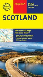
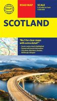
'THE CLEAREST AND MOST DETAILED MAPS OF EUROPE' David Williams MBE, former CEO Gem Motoring Assist The bestselling fold-out road map for navigating in Scotland has been updated for all travellers wanting to go places in the lowlands, highlands and islands, including the Western Isles, the Orkney and Shetland Islands. Whether driving through the most spectacular scenic routes the country has to offer in the Highlands or planning your trip from Edinburgh to Inverness, this handy map has all you need. - Super-clear mapping scale 1:330,000 (5.25 miles to 1 inch) - Key driving information: motorways, railways, ferry routes, road numbers, plus distances between towns - Fully revised and up-to-date with the latest tourist and leisure information - Scenic routes clearly highlighted - Places of interest added: from castles, heritage sites, beaches and national parks to theme parks, places of worship and ancient monuments - Includes the islands and sights of the Western Isles and the Orkney and …
9,95
Wegenkaart - landkaart Orkney Shetland | Philip's Maps
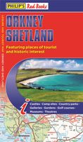
Whether it's the outstanding natural beauty, ancient sites or an activity-packed break calling you, the Philip's leisure and tourist map of Orkney and Shetland is all you need. Places of interest are clearly marked on the easy-to-read mapping - ideal for planning that all-important route.   This double-sided Philip's leisure and tourist map of Orkney and Shetland gives detailed coverage of the islands' road networks at an easy-to-read scale of approximately 2.5 miles to 1 inch. The Orkney Islands are featured on side one of the map, with the Shetland Islands shown on the reverse.   The maps show places of tourist and historic interest, including beaches, castles, camping sites, distilleries, galleries, gardens, golf courses, museums, nature trails, historic sites, sports and entertainment venues. From the ancient settlement of Orkney's Skara Brae and Scapa Flow to the Shetland Museum and Bobby's Bus Shelter, all the top places of interest are featured on each side of the map for Orkney…
11,50
Reisgids Scottish Highlands and Islands | Rough Guides
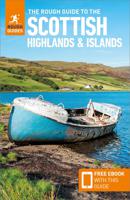
Een zeer uitvoerige reisgids voor zowel de zelfstandige als de georganiseerde reiziger. Veel informatie, zowel praktisch als over allerhande achtergronden van het land; met o.a. aandacht voor geschiedenis, taal ,flora & fauna en met veel plattegronden. This Scottish Highlands & Islands guidebook is perfect for independent travellers planning a longer trip. It features all of the must-see sights and a wide range of off-the-beaten-track places. It also provides detailed practical information on preparing for a trip and what to do on the ground. And this Scottish Highlands & Islands travel guidebook is printed on paper from responsible sources, and verified to meet the FSC's strict environmental and social standards.   This Scottish Highlands & Islands guidebook covers: Argyll, the central Highlands, the Great Glen, the north and northwest Highlands, Skye and the small Isles, the Western Isles, Orkney, Shetland.   Inside this Scottish Highlands & Islands travel book, you'll find:   - A wi…
22,50
Wegenatlas Scotland - Schotland | A-Z Map Company
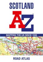
Handzame gedetailleerde wegenatlas van Schotland. Navigate your way around Scotland with this detailed, full-colour and easy-to-use A-Z Road Atlas. From the border to the north coast, the mainland pages scale is 3.5 miles to 1 inch and the Western Isles, Shetland Islands and Orkney Islands scale is 4.5 miles to 1 inch.   Covering the entire country, this road atlas includes the following features: • Motorways with full junction detail, primary routes and destinations, A & B roads, under construction and proposed roads, service areas, tolls, mileages, national, county and unitary authority boundaries • Cairngorms and Loch Lomond & The Trossachs National Park boundaries • Selected places of interest and tourist information centres   20 city and town street maps are included for Aberdeen, Aviemore, Ayr, Dumfries, Dundee, Dunfermline, Edinburgh, Glasgow, Falkirk, Fort William, Hamilton, Inverness, Kilmarnock, Kirkcaldy, Motherwell, Oban, Paisley, Perth, St Andrews and Stirling. Al…
13,50
Wegenkaart - landkaart Visitors map Scotland - Schotland | A-Z Map Com
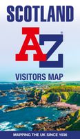
xplore the whole of Scotland from Dumfries and Galloway in the South to the Orkney Islands in the North. With detailed road mapping and illustrated town plans of major cities, this feature rich, helpful tourist guide is ideal for touring around Scotland. Published at a clear 8.7 miles to 1 inch scale (5.51 cm to 1 km), this handy map is a detailed and informative exploration of what Scotland has to offer.   Highlights include: 8 inset street maps to major cities and popular destinations, including: Edinburgh, Glasgow, Stirling, and Cairngorms National Park, with detailed descriptions and places of interestLocations of visitor centres and tourist information sitesUseful key to map symbols making it a clear and easy readMore than 700 places of interest The perfect map for exploring Scotland whether you are a tourist or a local.
11,50
Wegenkaart - landkaart Pocket Map Orkney | Collins
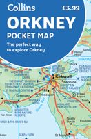
Handy little full colour map of the Orkney Islands in Scotland. Detailed mapping and tourist information for Orkney mainland, Westray, Sanday, Stronsay, Shapinsay, Hoy, South Ronaldsay and the other islands. Excellent value and very detailed for its size. Main features of this map:   • Clear mapping at a scale of 2.7 miles to 1 inch • Tourist attractions located and described • Ideal for touring with sights, places to stay, cafe/restaurant, things to do all on the map • Transport links map showing how to get to and depart the islands • Index to places of interest and place names   Essential for those planning a trip around the Orkney Isles.
7,95
Spoorwegenkaart - Wegenkaart - landkaart Scotland Far North & Islands
Great Britain, by its shape, is difficult to map. The population is dense, the road network intense, and the coastline convoluted. A map of the British Isles shows only the major features. Sectional maps of just England, or Just Wales, make little sense, due to the geographic shape of the island kingdom. Scotland also needs more than one map to show its treasures in sufficient detail. ITMB previously issued Scotland Central and South, and now extends its coverage at 1:300,000 to the sparsely-populated highlands and the isolated Western, Orkney, and Shetland island archipelagos that are usually shrunk to insignificance on most maps, as insets. This double-sided map covers the area from Loch Lochy south of Invergarry to John O’Groats in the north, and from the Western islands of Uist and Lewis to the Moray Firth and Craigellachie in the east. The second side has to duplicate part of the first side in order to extend the artwork further eastward to include Aberdeen and northward to includ…
13,95

Klanten-reviews van Wegenkaart - landkaart Philip's Scotland Road Map | Philip's Maps

Er zijn nog geen beoordelingen voor dit productBen jij de eerste die een review plaatst?

Meer over Wegenkaart - landkaart Philip's Scotland Road Map | Philip's Maps

Productomschrijving

'THE CLEAREST AND MOST DETAILED MAPS OF EUROPE' David Williams MBE, former CEO Gem Motoring Assist The bestselling fold-out road map for navigating in Scotland has been updated for all travellers wanting to go places in the lowlands, highlands and islands, including the Western Isles, the Orkney and Shetland Islands. Whether driving through the most spectacular scenic routes the country has to offer in the Highlands or planning your trip from Edinburgh to Inverness, this handy map has all you need. - Super-clear mapping scale 1:330,000 (5.25 miles to 1 inch) - Key driving information: motorways, railways, ferry routes, road numbers, plus distances between towns - Fully revised and up-to-date with the latest tourist and leisure information - Scenic routes clearly highlighted - Places of interest added: from castles, heritage sites, beaches and national parks to theme parks, places of worship and ancient monuments - Includes the islands and sights of the Western Isles and the Orkney and Shetland Islands - Double-sided maps - more for your money and easier to use - Detailed city plans: Aberdeen, Dundee, Edinburgh and Glasgow - Full index of place namesIn fact, everything you need for motoring in Scotland
Webshop.nl maakt gebruik van cookies. Ga je verder op onze website, ga dan akkoord met het plaatsen van cookies en de verwerking van deze data door ons en vermelde partners.