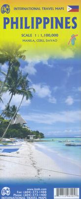
Wegenkaart - landkaart Philippines - Filipijnen | ITMB

0
Een degelijke kaart met aanduidingen van o.a. nationale parken, vliegveld, benzinepomp, dirt-roads en kleine plattegrond van hoofdstad. Als overzichtskaart goed te gebruiken. Inclusief plattegrond van Manilla 1:12000 This is an excellent map of the Philippines; newly updated. There are improvements on road classification a re-working of the Manila...

Verkopers met dit product

Verkoper
Bezorging
Prijs
DeZwerver.nl logo
DeZwerver.nl
niet bekend
13,95

Anderen bekeken ook

Wegenkaart - landkaart Guyana Suriname & French Guiana | ITMB
Een degelijke wegenkaart met aanduidingen van o.a. nationale parken, vliegveld, benzinepomp, dirt-roads en kleine plattegrond van hoofdstad. Als overzichtskaart goed te gebruiken.   The focus of this map is on Guyana, reflecting the changes coming about as a result of the growing assertiveness of Brasil, which has repaved the highway north from Manaus on the Amazon to the border with Guyana (at Bomfin). The Guyanese are improving the road to Georgetown, shortening travel times for goods in both directions by weeks. This new bridge also enables travelers to pass north and south much more easily. We have also re-done the inset map of Georgetown to bring it up to date. We have also changed the regional map on the reverse side, which used to cover all three Guianas countries, and replaced it by one concentrating on the other two countries. The most significant change we've made is to re-name Surinam to the country's preferred name of Suriname. As we made relatively few changes to the artw…
13,95
Wegenkaart - landkaart New Zealand - Nieuw Zeeland | ITMB
Een degelijke kaart met aanduidingen van o.a. nationale parken, vliegveld, benzinepomp, dirt-roads en kleine plattegrond van hoofdstad. Als overzichtskaart goed te gebruiken.   Legend Includes: Roads by classification, Points of Interest, Airports, Churches, Campsites, Caravan Sites, Caves, Lighthouses, Beaches, Fishing Spots, Surfing Spots, Ski Areas, Ho Springs, Museums, Golf Courses, Waterfalls, Mine, Harbours, Viewpoints, Sailing Spots, Scuba Diving Spots, Shipwrecks, National Parks, Lakes, Swamps, Glaciers, and much more.  
13,95
Nieuw
Wegenkaart - landkaart Cuba West | ITMB
Een degelijke wegenkaart met aanduidingen van o.a. nationale parken, vliegveld. Als overzichtskaart goed te gebruiken. his is a brand new title for ITMB and reflects the growing interest in travel to Cuba resulting from improved relations with the USA. Licenses to fly into the country from a dozen cities have already been approved; 60 more are awaiting approval. All are for flights into Havana and Varadero airports – in other words, the western half of the country. ITMB already has an exceptionally good map of the entire country. We also have a separate map of Havana. This map expands the scale and opens the information for the western half of the island nation as a double-sided map, with the portion west of Havana (La Habana) to Pinar del Rio province in the far west and south to the Isla de la Juventud (better known, but mis-named, as the Bay of Pigs Invasion Site). This side also has an excellent map of the Varadero beach resort area as an inset, and a map of greater Havana. The ot…
13,95
Nieuw
Wegenkaart - landkaart - Stadsplattegrond Los Angeles & California South Coast | ITMB
Dubbelzijdige kaart met aan de ene kant een plattegrond, 1 op 15.000, van Los Angeles. Aan de andere kant een degelijke kaart met aanduidingen van o.a. nationale parken, vliegveld, benzinepomp en campings van de zuidkust van Californië Als overzichtskaart goed te gebruiken.   Legend Includes: Roads by classification, Accommodation, Museum, Church, Building, Points of tourist, Post Office, Police Station, School, Bicycle Route, Hiking Path, Road Barrier, Tourist Information, Hospital, Live Theatre, Cinema, Dept. Store, Bus Terminal, Pedestrian Street, Staircase, International Airport, State Park with Campsites, State Park without Campsites, Campsite, Wayside or Roadside Park, Rest Area, Lodge, Point of Interest, Domestic/Regional Airport, Information Center, Golf Course, Hot Spring, Port of Entry, Border Crossing, Gas Station, Service Area, University or College, Skiing, Lighthouse, Beach, Cave, and more.
13,95
Wegenkaart - landkaart Afrika noordwest - Africa northwest | ITMB
Een degelijke kaart met aanduidingen van o.a. nationale parken, vliegveld, benzinepomp, dirt-roads en kleine plattegrond van hoofdstad. Als overzichtskaart goed te gebruiken. This is the detailed map of Africa emanating from our continental data base and, at an scale better than Michelin's famous regional map, we feel that this version is a winner. First, it is printed double-sided with the western coastal segment on one side and the eastern half on the other. Second, we have been able to improve the accuracy of the road information enormously at the better scale, and third we are making progress in developing a new series of travel maps for Africa by publishing the first of what we hope will become a new regional map covering Africa from top to bottom, or from Cape to Cairo, as Uncle Cecil used to say. The coverage of this map is from Morocco in the west to the Libyan/Egyptian border and from Senegal and Liberia in the southwest to the Chad/Sudan border in the southeast. This is also…
13,95
Wegenkaart - landkaart Cuzco Region - Cuzco & Peru South | ITMB
Een degelijke kaart met aanduidingen van o.a. nationale parken, vliegveld, benzinepomp, dirt-roads en kleine plattegrond van Cuzco excellent inset maps of Machu Picchu (schema), Inca Trail-scale 1:50,000, Cuzco-scale 1:11,000 and Lima-scale 1:13,500 to assist visitors – add a detailed map of the southern portion of Peru. Now, one map will cover all the routes to Cuzco, as well as the gem of South America – Machu Picchu! Legend Includes: Roads by classification, Inca trail, settlements, campings, parks, ruins, museums, accommodation, theatres, markets, bus stop, world heritage sites, Inca culture, tourist information, points of interest and other information
13,95
Nieuw
Wegenkaart - landkaart The Andes | ITMB
Een degelijke wegenkaart van de hele Andes met aanduidingen van o.a. nationale parken, vliegveld, Als overzichtskaart goed te gebruiken. We are pleased to be able to re-introduce this important title into our publishing range after a lapse caused by Covid. The Andes mountain chain is the southern extension of the Sierra Nevada chain through Mexico and Central America, which is, in turn the southern extension of the Rocky Mountain chain from Alaska to the Mexican border. The Andes is a magnificent series of high mountains that enters Colombia and spreads southwards through Ecuador and Peru all the way to southern Patagonia. The map is double-sided, with the Northern Andes on one side and the other side divided into two side-by-side maps portraying the Central Andes and the Southern Andes. Thus, the map coverage focuses on the Andes themselves, rather than on all of South America. All of Colombia and Peru are shown, most of Bolivia, all of Chile, and the Patagonian portion of Argentina …
13,95
Nieuw
Wegenkaart - landkaart Burkina Faso & West Africa | ITMB
Een degelijke kaart met aanduidingen van o.a. nationale parken, vliegveld, benzinepomp, dirt-roads en kleine plattegrond van hoofdstad. Als overzichtskaart goed te gebruiken.   Burkina Faso, formerly the French territory of Haute Volta, is one of those quiet countries of Africa that never seem to hit the headlines. It is typical of several of the countries of Africa that we have mapped - it sells steadily, but not spectacularly.  We have been able to re-draw and improve inset maps of the capital Ouagadougoa and of Bobo-Dioulasso, the main trading city on the border with Mali.   Legend Includes: Roads by classification, Points of Interest, Airports, Gas Stations, Post Offices, Hospitals, Hotels, Lodgings, Resthouse/hostels, Campsites/Huts, Border Crossings, Museums, Archeologic Sites, Mosques, Churches/Missions, Wells, Mine, Mountain Peaks, World Heritage Sites, Parks, Lakes, and much more.
13,95
Nieuw
Wegenkaart - landkaart - Stadsplattegrond Reykjavik & Iceland Southwest | ITMB
Een dubbelzijdige kaart met aan de ene kant een plattegrond van Reykjavík, schaal 1:10.000. Aan de andere zijde een overzichtskaart van zuidwest Ijsland, schaal 1:330.000, met aanduidingen van o.a. nationale parken, vliegveld, benzinepomp, dirt-roads.  Stads- en regiokaart van Reykjavik en Zuidwest-IJsland Met trots kondigen wij een gloednieuwe kaarttitel van ITMB aan: Reykjavik en Zuidwest-IJsland. Reykjavik, de hoofdstad van IJsland, is een fascinerende bestemming op zich. Op deze gedetailleerde stadskaart is Reykjavik op de voorzijde van het blad afgebeeld, inclusief het internationale vliegveld – de belangrijkste toegangspoort tot IJsland – en een uitgebreid overzicht van hotels. Dat is geen overbodige luxe, gezien het bloeiende toerisme in het land.   Het stadscentrum is helder in kaart gebracht, met een schaal die het mogelijk maakt de plattegrond te voorzien van het ‘footprint’-overzicht van alle gebouwen. Ook bevat de kaart een overzicht van de belangrijkste bezienswaardighede…
13,95
Nieuw
Wegenkaart - landkaart USA South - Atlantic States | ITMB
Een degelijke kaart met aanduidingen van o.a. nationale parken, vliegveld, benzinepomp, dirt-roads van de Oosttkust van de USA van Philadelphia tot Florida  . Als overzichtskaart goed te gebruiken. We call the map the Atlantic States guardedly for obvious reasons. First, the northeastern Atlantic States are missing and second, Florida's Caribbean coastline is included. Also, to cover an area so long, we had to go further inland than 'just' the coast, so all of Pennsylvania and West Virginia are included. The area of coverage of side A is Philadelphia/Pittsburg south to Augusta and Charleston. Side B continues south to the southernmost portion of Florida and west to Panama City. Inset maps of Orlando and Miami are included on this side as well. Both road and rail connections are shown, and distances between communities shown. Places of touristic interest are included, albeit suitable to the scale. An extensive place name index is included.  Legend Includes: Roads by classification, Riv…
13,95

Klanten-reviews van Wegenkaart - landkaart Philippines - Filipijnen | ITMB

Er zijn nog geen beoordelingen voor dit productBen jij de eerste die een review plaatst?

Meer over Wegenkaart - landkaart Philippines - Filipijnen | ITMB

Productomschrijving

Een degelijke kaart met aanduidingen van o.a. nationale parken, vliegveld, benzinepomp, dirt-roads en kleine plattegrond van hoofdstad. Als overzichtskaart goed te gebruiken. Inclusief plattegrond van Manilla 1:12000

This is an excellent map of the Philippines; newly updated. There are improvements on road classification a re-working of the Manila inset. double-sided.

Legend Includes:
Roads by classification, Point of Interest, National Park, Museum, Church, Cave, Beach, Dive Site, Golf Course, Airports and more.

Verken gerelateerde categorieën

Webshop.nl maakt gebruik van cookies. Ga je verder op onze website, ga dan akkoord met het plaatsen van cookies en de verwerking van deze data door ons en vermelde partners.