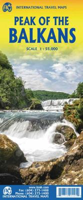
Wegenkaart - landkaart Peaks of the Balkan - Balkan & Bergtoppen van de Balkan | ITMB

0

Verkopers met dit product

Verkoper
Bezorging
Prijs
DeZwerver.nl logo
DeZwerver.nl
2,95
13,95

Anderen bekeken ook

Nieuw
Wegenkaart - landkaart Kosovo & Westelijke Balkan | ITMB
Kosovo is the country that shouldn’t exist, but does. When Yugoslavia fells to pieces after Tito died, Kosovo was lumped in with Serbia but was very unhappy with being a part of an Eastern Orthodox regime. It broke away, resulting in genocidal fighting until the Americans stepped in and stopped the fighting. The region was then placed under a European Union control in the faint hope that it would merge with Albania, or Montenegro, but it didn’t. Relations with Serbia are still quite strained, but Kosovo is still surviving as a mountainous Balkan state. Fought over for centuries by Turks and Serbs, Kosovo is emerging as a small but touristic European country. This is definitely an off-the-beaten-path travel destination! The second side of the sheet provides an excellent regional coverage for the Western Balkans, essentially Slovenia, Croatia, Montenegro, Serbia, and reasonably large tracks of land for Hungary, Albania, and North Macedonia, showing the growing number of wilderness parks…
13,95
Wegenkaart - landkaart The Andes | ITMB
Een degelijke wegenkaart van de hele Andes met aanduidingen van o.a. nationale parken, vliegveld, Als overzichtskaart goed te gebruiken. We are pleased to be able to re-introduce this important title into our publishing range after a lapse caused by Covid. The Andes mountain chain is the southern extension of the Sierra Nevada chain through Mexico and Central America, which is, in turn the southern extension of the Rocky Mountain chain from Alaska to the Mexican border. The Andes is a magnificent series of high mountains that enters Colombia and spreads southwards through Ecuador and Peru all the way to southern Patagonia. The map is double-sided, with the Northern Andes on one side and the other side divided into two side-by-side maps portraying the Central Andes and the Southern Andes. Thus, the map coverage focuses on the Andes themselves, rather than on all of South America. All of Colombia and Peru are shown, most of Bolivia, all of Chile, and the Patagonian portion of Argentina …
13,95
Nieuw
Wegenkaart - landkaart Japan | ITMB
Een degelijke kaart met aanduidingen van o.a. nationale parken, vliegveld, benzinepomp, dirt-roads en kleine plattegrond van hoofdstad. Als overzichtskaart goed te gebruiken. Japan Travel Reference Map 7th Ed. 2010 1:1,100,000. It is becoming difficult to think of anything new to say about our very popular map of Japan. Now into its 7th Edition, we’ve added new information about the steady improvements to the Shinkansen rail network and to the motorway system. Later this year, we plan on issuing two new maps of sections of Japan, as it is becoming increasingly difficult to portray all the treasures of this beautiful island on one sheet of paper. Printed on ITM plastic paper, double-sided, waterproof. Legend Includes: Roads by classification, Lakes, Rivers, Waterfalls, National Parks, Caves, Mines, Bridges, Seaports, Volcanoes, High Towers, Tourist Sites, Buddhist Temples, Shinto Shrines, Hot Springs, Ski Resorts, Beaches, Lighthouses, Airports, Heritage Sites, Golf and more.
13,95
Nieuw
Wegenkaart - landkaart Bermuda | ITMB
Een degelijke kaart met aanduidingen van o.a. nationale parken, vliegveld, benzinepomp, dirt-roads. Als overzichtskaart goed te gebruiken. Bermuda is a lovely mid-Atlantic island far off the coast of South Carolina. It is full of colonial architecture and an ‘island’ way of life. Tourism is a key ingredient of the colony’s lifeblood and the island is very popular with cruise ships. There is ample accommodation for longer-term visitors, good roads, and much history. The airport was built by the US Navy during WW2 and is still a US Naval Air Station, but shares the runway with civil aviation. The map includes an excellent inset of St. George’s, which still has its stocks close to the town hall, and another of Hamilton, the capital. This is where most cruise ships dock. For those with the time, the map shows the Railway Trail along the former route of the island’s now-defunct rail line. Lots to see; lots to do!   Map size: 27*39"   Legend Includes: Roads by classification, Rivers and Lak…
13,95
Nieuw
Wegenkaart - landkaart Nepal | ITMB
Een degelijke kaart met aanduidingen van o.a. nationale parken, vliegveld, benzinepomp, dirt-roads en kleine plattegrond van hoofdstad. Als overzichtskaart goed te gebruiken. This is a completely new map, using original ITMB artwork (the previous edition was licenced from a British firm). It is a double-sided (east half/west half) map with good inset maps of Kathmandu and of its surrounding valley, excellent hypsometry, and as detailed a rendering of the roads as has been possible. The civil unrest that beset this lovely country is now a thing of the past, and Nepal is enjoying a well-deserved touristic boom. The map is printed on paper, double-sided Legend Includes: Roads by classification, airports, international and regional boundaries, forts, rivers, lakes, caves, parks, museums, temples, viewpoints, palaces, motels, hotels, tourist information centres, and more.
13,95
Nieuw
Wegenkaart - landkaart Madagascar | ITMB
Een degelijke kaart met aanduidingen van o.a. nationale parken, vliegveld, benzinepomp, dirt-roads en kleine plattegrond van hoofdstad. Als overzichtskaart goed te gebruiken. Tweezijdig! IThe large island off the east coast of Africa is Madagascar. The actual name of the country is the Malagasy Republic, but the public is much more likely to know the country by its island name, so we call our map by the island’s name, rather than using the country name. Makes sense to us! Regardless, this is a major touristic destination. The double-sided map covers the island in great detail, with an inset map of the capital city, Antananarivo. As with other ITMB maps, this one includes a listing of ‘must see’ attractions, such as Tsingy National Park and the famous Lemur’s Park. The island also has a regular surface route to the Comoro Islands, which are also included on this map. Legend Includes: Railroads, Forest, Mational Park, International Airport, Domestic Airport, Fort, holtel, Cave, Museum, …
13,95

Klanten-reviews van Wegenkaart - landkaart Peaks of the Balkan - Balkan & Bergtoppen van de Balkan | ITMB

Er zijn nog geen beoordelingen voor dit productBen jij de eerste die een review plaatst?

Meer over Wegenkaart - landkaart Peaks of the Balkan - Balkan & Bergtoppen van de Balkan | ITMB

Verken gerelateerde categorieën

Webshop.nl maakt gebruik van cookies. Ga je verder op onze website, ga dan akkoord met het plaatsen van cookies en de verwerking van deze data door ons en vermelde partners.