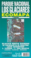
Wegenkaart - landkaart Parque Nacional los Glaciares | Zagier & Urruty

0
LOS GLACIARES NATIONAL PARK ECOMAP The most incredible Park of Patagonia, including Perito Moreno Glacier and Mount Fitz Roy. Satellite relief, roads, navigation, camping, inns and estancias, etc. El Parque mas espectacular de la Patagonia, donde sobresalen el Glaciar Perito Moreno y el Monte Fitz Roy. Rutas, navegaciones, estancias turisticas, pa...

Verkopers met dit product

Verkoper
Bezorging
Prijs
DeZwerver.nl logo
DeZwerver.nl
2,95
17,95

Anderen bekeken ook

Wegenkaart - landkaart Argentinië - Argentina | Borch
Mooie, geplastificeerde kaart van het Argentinië. Deze kaart biedt een goed overzicht van het land met detailkaarten.   Our soft-laminated folded map of Argentina shows: Argentina 1:3 800 000, Isla Grande de Tierra del Fuego 1:1 900 000, Los Glaciares National Park 1:750 000, Mount Fitz Roy 1: 250 000, Greater Buenos Aires 1:650 000, Buenos Aires 1:18 000, Cordoba 1:14 000, Salta 1:16 000, Argentina administrative and time zones. Borch Maps are easy to fold, durable and water-repellent with a wipeable surface. Borch Maps show hotels, museums, monuments, markets, public transport, top sights and points of interest, useful statistics, conversion charts for temperatures, weights and measurements, climate charts showing temperatures, sunshine hours, precipitation and humidity, overview maps, time zones, and much more...   Enchanted by the sophisticated European flair of Buenos Aires, watching the world go by from a sidewalk café whilst taking a break from the buzzing nightlife, one could …
11,50
Reisgids Patagonië - Patagonia | Moon Travel Guides
Uitstekende Amerikaanse reisgids van uitgever Moon. De gids is vergelijkbaar met Lonely Planet en Rough guide en is voor de backpacker - zelfstandige reiziger geschreven; toch is deze door de grote mate van details en achtergronden geschikt voor alle reizigers! De gids onderscheidt zich door gedegen en uitgebreide achtergrondinformatie over bijvoorbeeld natuur en cultuur. Patagonia’s staggering landscapes, titanic glaciers, and rugged mountains evoke mystery and inspire self-discovery. Explore the ends of the earth with Moon Patagonia.   What You’ll Find in Moon Patagonia: Expert author and world traveler Wayne Bernhardson shares his perspective on his favorite place on earth Full-color guidebook with vibrant, helpful photos Detailed directions and maps for getting around and exploring on your own Strategic itineraries, including The Best of Patagonia, Wildlife Encounters, Explore the Natural World, Glacier Gazing, and Classic Patagonia Road Trips Activities and ideas for every t…
32,95
Reisgids Argentina - Argentinië | Rough Guides
Zeer goede reisgids voor zowel de georganiseerde maar vooral voor de zelfstandige reiziger. Boordevol informatie over reizen, slapen, eten, maar ook musea en cultuur. Uitputtende bron van informatie, veelal nog completer dan de Lonely Planet. Inleidende informatie over land en cultuur is zeer goed. Ideal for independent travellers, this guidebook to Argentina, written by destination experts, combines must-see sights with hidden gems and offers essential tips for both planning and on-the-ground adventures. It's sustainably printed to ensure environmental responsibility.   Inside this Argentina travel book, you'll find:   - Regional deep dive - coverage of key regions, offering a rich selection of places and experiences, and honest reviews of each one - Itinerary samples - designed for various durations and interests - Practical information - tips on how to get there and get around, use public transport, beat the crowds, save time and money, travel responsibly and more - Expert …
27,50
Reisgids Argentinie - Argentina | Insight Guides
Een rijk geillustreerde reisgids met diepgaande teksten: één van de beste reisgidsen die er bestaan. Eerste deel bestaat uit een beschrijving van de unieke aspecten van de regio, daarna een deel echte reisgids en als afsluiting een deel met praktische informatie. De uitstekende informatie wordt vergezeld van prachtige foto's en heldere kaarten. Niet alleen om mee te nemen, maar ook om vooraf en zelfs achteraf weer in de stemming te komen This Argentina guidebook is ideal for travellers seeking inspirational guides and planning a more extended trip. It provides interesting facts about Argentina's people, history and culture and detailed coverage of the best places to see. This Argentina travel book has the style of an illustrated magazine to inspire you and give a taste of Argentina. The book is printed on paper from responsible sources, and verified to meet FSC's strict environmental and social standards. This Argentina guidebook covers: Buenos Aires, Around Buenos Aires, Mar y Sierra…
25,95
Wandelkaart Monte Fitz Roy - Cerro Torre - Lago del Desierto | Zagier & Urruty
Wandelkaart van het fascinerende Fitz Roy massif. Ideale kaart voor trekkings in de regio. Fitz Roy en Cerro Torre in schaal 50.000 en Lago del Desierto in 100.000 Trekking and mountaineering map based on aerophotography. Relief, contours forms, glaciers, woods, camping and trails. Geological chart and landsat image. Includes Lago del Desierto and Route 23 that reaches the zone. Also new trails and shelters. Landscape view of the peaks with their name and height. Afmeting 65 x 95 cm
17,95
Wandelgids Trekking Torres del Paine - Chili | Cicerone
Guidebook to trekking in the heart of Patagonia, with routes in Torres del Paine National Park (Chile) and Los Glaciares National Park (Argentina). While the region is primarily a remote and mountainous glaciated wilderness, walking is easily accessible with clear trails, good public transport and regular mountain huts and campsites. The centrepiece of this dramatic area is the 10-11 day Torres del Paine Circuit (also known as the 'O' Circuit), while the shorter Half Circuit (the 'W') visits much of the same sights in 4-5 days.   The guidebook also includes four shorter day walks, a multi-day trek in Argentina's Los Glaciares national park, and several excursions from Puerto Natales and El Calafate. This guidebook includes advice on getting to and around the regions, languages, visa, currency, accommodation and facilities in the National Parks, as well as useful guidance on what to take and expect on the treks. Also featured is background information on the geology, history, wildlife,…
27,50
Wegenkaart - landkaart 3400 Adventure Map Argentina - Argentinië | National Geographic
Wegenkaart van Argentinië met vermelding van veel bezienswaardigheden, nationale parken en attrakties. Watervast en scheurvast. Juist door deze vermeldingen onderscheidt de kaart zich van andere wegenkaarten. National Geographic's Argentina Adventure Map is designed to meet the unique needs of adventure travelers—detailed, durable, and accurate. Argentina includes the locations of thousands of major cities and towns with an index for easily locating them, plus a clearly marked road network complete with distances and designations for major highways, limited access highways, minor roads, and more.   What sets National Geographic Adventure Maps apart from traditional road maps are the hundreds of points-of-interest that highlight the diverse, unique, and exotic destinations within Argentina including national parks and preserves, World Heritage sites, archeological sites, churches of interest, scenic viewpoints, natural points of interest, and important travel aids like airports, airstr…
17,50
Wegenkaart - landkaart The Andes | ITMB
Een degelijke wegenkaart van de hele Andes met aanduidingen van o.a. nationale parken, vliegveld, Als overzichtskaart goed te gebruiken. We are pleased to be able to re-introduce this important title into our publishing range after a lapse caused by Covid. The Andes mountain chain is the southern extension of the Sierra Nevada chain through Mexico and Central America, which is, in turn the southern extension of the Rocky Mountain chain from Alaska to the Mexican border. The Andes is a magnificent series of high mountains that enters Colombia and spreads southwards through Ecuador and Peru all the way to southern Patagonia. The map is double-sided, with the Northern Andes on one side and the other side divided into two side-by-side maps portraying the Central Andes and the Southern Andes. Thus, the map coverage focuses on the Andes themselves, rather than on all of South America. All of Colombia and Peru are shown, most of Bolivia, all of Chile, and the Patagonian portion of Argentina …
13,95
Wegenkaart - landkaart Lagos del Sur - Araucania - Puerto Montt - Bariloche | Zagier & Urruty
Overzichtskaart van dit met name door Zuidamerikanen zelf veel bezocht gebied. The most popular Parks of northern Patagonia: Nahuel Huapi, Lanin, Los Arrayanes, Villarrica, Puyehue, Alerce Andino, Vicente Perez Rosales, Hornopiren. Relief, roads, trails, distances, camping, fishing, etc. Roads to Bariloche, Puerto Montt, San Mart�n de los Andes, Alumine, El Bolson, La Angostura, Osorno, Temuco, Valdivia. afmeting 70 x 95 cm
17,95
Wegenkaart - landkaart Antarctic Peninsula - Antarctica | Zagier & Urruty
Kaart van het Antarctisch Schiereiland met tekeningen van de voorkomende Fauna. Dit is het stuk van Antarctica waar vrijwel alle toeristen rondvaren op de cruiseschepen of zeilboten. The North of the Peninsula is the most visited part of Antarctica every summer. Glaciers, inlets and sailing ports, scientific stations, etc. On the back side large maps of the main visited islands and ports. Artistic drawings of birds and mammals.
17,95

Klanten-reviews van Wegenkaart - landkaart Parque Nacional los Glaciares | Zagier & Urruty

Er zijn nog geen beoordelingen voor dit productBen jij de eerste die een review plaatst?

Meer over Wegenkaart - landkaart Parque Nacional los Glaciares | Zagier & Urruty

Productomschrijving

LOS GLACIARES NATIONAL PARK ECOMAP The most incredible Park of Patagonia, including Perito Moreno Glacier and Mount Fitz Roy. Satellite relief, roads, navigation, camping, inns and estancias, etc. El Parque mas espectacular de la Patagonia, donde sobresalen el Glaciar Perito Moreno y el Monte Fitz Roy. Rutas, navegaciones, estancias turisticas, paradores, camping, etc. Spanish / English edition.

Southern Patagonia’s main National Park, Los Glaciares, with the world's only advancing glacier. The map uses satellite imagery, enhanced with colours and hill-shading to give a vivid representation of the relief. Many local peaks, glaciers and other geographical features are marked and named. Road network includes unpaved roads and dirt tracks, with locations of petrol stations and intermediate driving distances. Ferry connections on the region’s numerous lakes are also indicated. Symbols highlight accommodation and restaurant facilites. Latitude and longitude lines are drawn at 15' intervals. Map legend is in Spanish and English.

Verken gerelateerde categorieën

Webshop.nl maakt gebruik van cookies. Ga je verder op onze website, ga dan akkoord met het plaatsen van cookies en de verwerking van deze data door ons en vermelde partners.