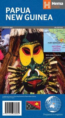
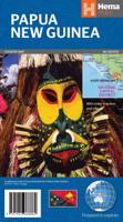
Wegenkaart - landkaart Papoea Nieuw Guinea | Hema Maps

0

Verkopers met dit product

Verkoper
Bezorging
Prijs
DeZwerver.nl logo
DeZwerver.nl
2,95
17,95

Anderen bekeken ook

Wegenkaart - landkaart Papua New Guinea - Papua Nieuw Guinea - West Papua - Molukken | Reise Know-How Verlag
Tweetalige kaart (Engels en Duits). Door ingetekende lengte- en breedtegraden is het gebruik van GPS mogelijk. Met hoogtelijnen en uitgebreid wegennetwerk: daarnaast worden ook de afstanden tussen belangrijke plaatsen duidelijk leesbaar weergegeven. Het kleurgebruik is zodanig dat je een goede indruk krijgt van hoogteverschillen en soorten landschap. Natuurlijk staan de toeristische bezienswaardigheden duidelijk vermeld.    Gedrukt op water- en scheurvast papier! Polyart is een synthetisch product vrij van giftige stoffen dus duurzaam. Het papier gaat echt lang mee.   Topography is indicated by altitude colouring with numerous spot heights and names of mountain ranges and passes. Salt lakes, swamps, seasonal rivers and glacier are also shown. Detailed presentation of the road network includes minor roads and tracks and railways are also shown.   Internal administrative units are presented with their boundaries and names. National parks and other protected areas are highlighted. A wide…
11,50
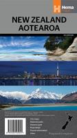
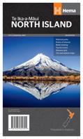
Wegenkaart - landkaart Nieuw Zeeland - New Zealand - Aotearoa | Hema Maps
Folded, indexed road and tourist map of New Zealand, showing all major and many minor roads, cities, and towns in detail. Map shows highways, road numbers, distance chart, railways, scenic routes, places of particular interest, places of scenic beauty, national parks, and political boundaries. Reverse of map shows city insets of Auckland, Wellington, Christchurch, Rotorua, Dunedin, and Queenstown. Legend is in English. Heldere goed leesbare kaart van de kaartenmaker van Nieuw Zeeland: de HEMA maps.
17,50
Wegenkaart - landkaart Tasmanië - Tasmania | Hema Maps
Op deze kaart staat Tasmanië in zijn geheel op 1 deel van de kaart. Goede, overzichtelijke, leesbare kaart van het hele eiland. Nationale Parken zijn er goed op te vinden en de afstanden worden weergegeven. Op de achterkant nog deelkaartjes van enkele steden en NP s. The fourth edition of Hema’s Tasmania State Map features Hema’s distinctive and informative maps fully, all of which have been field checked by Hema’s Map Patrol to ensure the best possible accuracy with the latest mapping data.    A fully indexed state map of Tasmania (TAS) at a scale of 1:500,000. Marked on the mapping are national parks, fuel locations as well as camping and rest areas.    The reverse side consists of:   a summary of the key things to see and do broken up into the North West, Launceston, Tamar and the North a table listing of National Parks and Reserves with key features and facilities (such as Camping and Caravan sites, BBQ, toilets and showers) Visitor centre listing Map of the area around Zeehan…
17,50
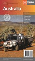
Wegenkaart - landkaart Australia - Australië | Hema Maps
Mooie, grote, duidelijke kaart van Australië met veel informatie. Oa bezinestations (ook in de outback) en een goed overzicht van de doorgaande (grote) wegen waardoor de kaart erg handig is van het plannen van uw route. Ook staan er afstanden op vermeld.   Verder staan er stadkaartjes op van het (centrum) van de belangrijkste Australische steden:   Adelaide, Brisbane, Canberra, Darwin, Hobart, Melbourne, Perth en Sydney   Hema’s iconic large map of Australia is ideal as a trip planning tool and travel companion. Marked on the map are localities, the major road network, distances and major national parks. The map also shows localities, the major road network, distances and major national parks. The visual appeal makes it perfect as a decorative map or an educational tool. On the reverse side is an overview of Australia's iconic touring regions featuring history, geology and landforms, nature, bucket-list attractions and iconic 4WD tracks.   Key Features Hema's iconic map of Austra…
17,50
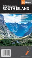
Wegenkaart - landkaart South Island (Zuider Eiland - Nieuw Zeeland) | Hema Maps
Uitstekende overzichtskaart met index, afstandstabel, nationale parken en toeristische informatie. Gedetailleerder dan de gehele Nieuw - Zeeland kaart. This map is easy to read and feature clear, easy to read cartography, reliefshading, National Parks, Points of Interest, Tourist Routes, Distance Grid and Walking Tracks. Printed one sided and complete with index these are an ideal planning tool as well as an ideal travel companion. This regional map of the South Island of New Zealand (NZ) is at a scale of 1:1,000,000 and shows points of interests, tourist routes, walking tracks and national parks for touring the island. On the reverse side are handy city maps of Christchurch, Picton, Nelson, Queenstown, Dunedin, Blenheim and Invercargill, and suburb maps of Christchurch and Dunedin. It also includes detailed maps of Fiordland, Kahurangi, Arthur’s Pass and Aoraki National Parks along with a distance grid.   PRODUCT FEATURES   • National parks • Topographic maps • Tourist routes • Dista…
17,50

Klanten-reviews van Wegenkaart - landkaart Papoea Nieuw Guinea | Hema Maps

Er zijn nog geen beoordelingen voor dit productBen jij de eerste die een review plaatst?

Meer over Wegenkaart - landkaart Papoea Nieuw Guinea | Hema Maps

Productinformatie

    Verken gerelateerde categorieën

    Webshop.nl maakt gebruik van cookies. Ga je verder op onze website, ga dan akkoord met het plaatsen van cookies en de verwerking van deze data door ons en vermelde partners.