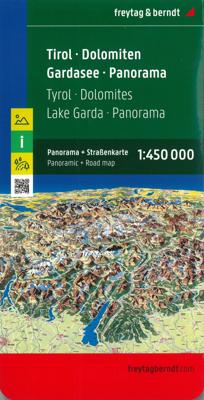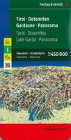
Wegenkaart - landkaart Panoramakaart Tirol - Dolomieten - Gardameer | Freytag & Berndt

0
Tweezijdige panorama kaart van dit berggebied in Tirol, de Dolomieten en het Gardameer: door 3D afbeelding krijg je een mooi overzicht hoe de valleien lopen en de gebergtes liggen ten opzichte van elkaar.   Explore Tyrol and the Dolomites area with this Freytag&Berndt double-sided panoramic map. The best way to plan your trip, prepare your itinera...

Verkopers met dit product

Verkoper
Bezorging
Prijs
DeZwerver.nl logo
DeZwerver.nl
2,95
14,95

Anderen bekeken ook

Wegenkaart - landkaart Dolomieten / Noordoost-Italië | ITMB
The mountainous northern portion of Italy is one of today’s touristic highlights. This is a new title for ITMB and one that required considerable research to accomplish. It not only shows the roads and rail lines in the region, but hotels, castles/fortresses, museums, and a significant number of footpaths. This is the first new map of this important region, covering from Trento in the south to Sterzing-Vipiteno in the north. It also has a Top Attractions list to assist users. The reverse side is a more general map of northeastern Italy from the Slovenian border west to Brescia and from the Swiss border south to Siena, for the assistance of end users. This side has its own Top Attractions list and an outline of the area covered in better detail that is on the other side of the sheet.
12,50
Nieuw
Wegenkaart - landkaart Europa Midden Oosten - Centraal Azië | Freytag & Berndt
Explore Europe, the Middle East and Central Asia with this Freytag & Berndt road map. The best way to plan your trip, prepare your itinerary, and to travel independently in this country.  One side is the detailed map of these areas, and the other side is a full index for this map.    Touristic information on the map include:    Places of interest Airports, castles & antique sites World Heritage sites   The legend is in English, Arabic, French, German, Italian, Spanish, Dutch, Hungarian, Slovak, and Czech.  
14,95
Nieuw
Wegenkaart - landkaart Corsica - Korsika | Freytag & Berndt
Deze bijzonder gedetailleerde Freytag & Berndt Wegenkaart van Corsica is aan één kant geprint en heeft een schaal van 1:150.000. Op deze kaart staan o.a. fietsroutes, lange afstandswandelpaden, toeristische wegen en bezienwaardigheden aangegeven. In de omslag van de kaart is een apart boekje geniet met een korte beschrijving van de TOP 10 van bezienswaardigheden, een uitgebreide index en plattegrondjes van enkele toeristische plaatsen. Explore the Mediterranean island of Corsica with this Freytag & Berndt single-sided road and leisure map. The best way to plan your trip, prepare your itinerary, and to travel independently on this region. As with all Freytag & Berndt maps, the cartography is clear and detailed with the topography shown with relief shading with plenty of spot heights.   This map features a full map of the island. Using Freytag & Berndt's icon system, important tourist information is shown. You will see icons for tourist information such as:   Picturesque towns and panor…
14,95
Nieuw
Wegenkaart - landkaart 77 Tirol | Freytag & Berndt
Gedetailleerde wegenkaart van een deel van Oostenrijk. Deze kaart is bijzonder duidelijk leesbaar en door de schaal met veel details als campings, berghutten, hoofdwandelroutes en alle berijdbare wegen en plaatsen. Met register This is  a series of detailed road maps at 1:150,000 from Freytag & Berndt   The road and leisure map of Tyrol on a scale of 1:150,000 contains a lot of information that is useful and helpful for a trip to the west of Austria. The complex road and rail network is shown in detail and many regional cycle paths and long-distance cycle paths are shown on the map. Tourist roads and scenic roads are highlighted in color and many attractive destinations are visible.   The Top Tips series offers a brief summary of the ten most attractive places in Tyrol and their sights. All texts are also translated into English. Popular tourist attractions include Innsbruck's old town, the Kufstein Fortress or Landeck Castle. Nature lovers can visit the Karwendel Nature Park and …
14,95
Nieuw
Wegenkaart - landkaart Balkan - Zuidoost Europa | Freytag & Berndt
A nicely detailed travelers map of Southeast Europe from Prague east to Odessa and south to Italy, Greece and western Turkey, including the Danube, Romania, Bulgaria and the Black Sea from Odessa to Istanbul. At a scale of 1:2,000,000.  Explore the Balkans and South-East Europe with this Freytag & Berndt road map - the best way to prepare your trip, to plan your itinerary, and to travel independently.    This map covers the following countries: Greece, Albania, FYROM, Bulgaria, Kosovo, Serbia, Montenegro, Bosnia Herzegocina, Croatia, Slovenia, Hungary, Romania, Moldova, the Czech & Slovak Republics, Western Turkey, Western Ukraine, Austria, and Southern Italy.   The map includes a localities index and more detailed city maps of Athens, Belgrade, Bratislava, Bucarest, Budapest, Chisinau, Istanbul, Kiev, Ljubljana, Podgorica, Prague, Pristina, Sarajevo, Skopje, Sofija, Tirana, Vienna, and Zagreb.
14,95
Nieuw
Wegenkaart - landkaart Corfu - Korfoe | Freytag & Berndt
Goede wegenkaart van Corfu, die ook behoorlijk veel detail weergeeft als het gaat om wandelpaden, fietsbare wegen en met veel symbolen voor toeristische bezienswaardigheden. De berijdbare wegen zijn goed weergeven, zowel de hoofdwegen als provinciale en lokale wegen; wegnummers worden vermeld. Afstanden tussen plaatsen zijn in kilometers op de kaart ingetekend, daarnaast worden ook op belangrijke plekken benzinepompen gemarkeerd. In het kaartbeeld wordt door middel van schaduw het reliëf weergegeven en soms enkele punten in het landschap met de daadwerkelijke hoogte. Provinciegrenzen zijn goed terug te vinden, nationale parken en reservaten ook. Met allerhande symbolen worden toeristische bezienswaardigheden weergegeven als monumenten, historisch belangrijke plekken en uitzichtpunten. In bepaalde plaatsen zijn hotels en campings te vinden, luchthavens, treinverbindingen en havens vindt u er ook op! Explore Corfu, the second largest of the Ionian Islands located in Greece; with this Fr…
14,95
Nieuw
Wegenkaart - landkaart Südtirol Alto Adige - Dolomiti - Zuid Tirol - Dolomieten | Tabacco Editrice
Heel duidelijke wegenkaart van Zuid Tirol. De kaart is goed leesbaar met mooie kleurstellin waardoor goed duidelijk wordt hoe en waar de bergbieden en nationale parken liggen.  The South Tyrol region of north-eastern Italy on a durable, waterproof and tear-resistant road map at 1:150,000 from Tabacco with excellent presentation of the topography derived from the publishers’ highly regarded and popular hiking maps, plus on the reverse a panorama drawing of the mountains. Coverage extends from the Austrian border to just past Trento and Feltre, and west/east from Bormio to well east of Belluno.   The map provides a very clear picture of the region’s landscape through graphic relief for its exposed rocky areas, plus relief shading and contours at 100m intervals, and has plenty of names of individual groups, peaks, valleys, etc. Additional colouring indicates woodlands and boundaries of national parks and other protected areas are marked. Minor roads are drawn without generalizing their c…
12,50
Nieuw
Wandelkaart - Wegenkaart - landkaart Liparische eilanden | Freytag & Berndt
Gedetailleerde wegenkaart en wandelkaart (géén wandelroutes ingetekend!) met uitgebreide legenda en plaatsnamenregister. Meer wegenkaart dan wandelkaart. Aeolian (Lipari) Islands at 1:20,000 from Freytag & Berndt on a double-sided map which presents on the reverse coverage of Italy south of Rome at 1:600,000 and shows ferry access to the islands from the mainland or Sicily.   On one side the islands are shown in a series of panels, with the three largest: Salina, Lipari and Vulcano together, and Alicudi, Filicudi, Panarea and Basiluzzo plus Stromboli as separate insets. Topography is shown by contours at 50m intervals enhanced by relief shading, with names of peaks, valleys, etc. All place names are in large, easy to read print.   Road network includes country tracks and a selection of hiking paths. Various places of interest and facilities are highlighted, including beaches, marinas, campsites, etc. Each individual inset has latitude and longitude lines at intervals of 1’.   Ferry po…
14,95
Nieuw
Wandelkaart - Wegenkaart - landkaart Kefallonia - Kefalonia | Freytag & Berndt
Goede wegenkaart van Kefallonia / Kefalonia, waarbij ook de kleinere wegen nog goed te lezen zijn. Gedetailleerde schaal van 1:50.000. Veel toeristische symbolen voor bezienswaardigheden als grotten, tempels, opgravingen maar ook mooie stranden etc. Ook handig is de Nederlandstalige Reisgids van Kefalonia "Ontdek Kefalonia" "Ontdek Kefalonia" Explore Kefallonia, the largest of the Ionian Islands located in Greece; with this Freytag & Berndt single-sided road and leisure map. The map will allow you to travel independently, and plan your journey well.   The map also features full colour photographs of some of the scenery to be found on Kefallonia, as well as an inset showing Kefallonia's position within the nation of Greece. An inset is also provided showing a city plan of the main township on Kefallonia, Argostoli. The topography is clear, with shading showing land gradients.    As with all Freytag & Berndt maps, icons and markings are used to denote tourist information and points of i…
14,95
Wegenkaart - landkaart Tahiti - French Polynesia | ITMB
Anyone who has visited Tahiti retains fond memories of a wonderful Polynesian paradise. This map shows the major islands of French Polynesia as a series of large insets on Side 1. An overall inset map showing the many islands is also shown, but for showing detail, one must expand the individual islands. The largest one is the volcanic Tahiti Nui, with the capital city of Pape’ete (or Papeete in English), for which a detailed inset map is included. Most visitors stay in the vicinity of Papeete, along the coast. We show several popular resorts. There is a good circular road around the island’s shoreline, but no roads in the interior. The island is joined to another, called Tahiti Iti, or Little Tahiti, and roads extend partway around this less-developed part of the combined island. Most of the other islands are rarely visited, although they have resorts, beaches, and a lifestyle of their own. Names like Huahine, Riatea, Tahaa, and Maiao may not be as familiar as they should be, but all …
14,95

Klanten-reviews van Wegenkaart - landkaart Panoramakaart Tirol - Dolomieten - Gardameer | Freytag & Berndt

Er zijn nog geen beoordelingen voor dit productBen jij de eerste die een review plaatst?

Meer over Wegenkaart - landkaart Panoramakaart Tirol - Dolomieten - Gardameer | Freytag & Berndt

Productomschrijving

Tweezijdige panorama kaart van dit berggebied in Tirol, de Dolomieten en het Gardameer: door 3D afbeelding krijg je een mooi overzicht hoe de valleien lopen en de gebergtes liggen ten opzichte van elkaar.   Explore Tyrol and the Dolomites area with this Freytag&Berndt double-sided panoramic map. The best way to plan your trip, prepare your itinerary, and to travel independently in this part of Austria and Italy.    One side shows a road map of Tyrol, Northeast Italy and Southern Bavaria. The other side shows the same area with a panoramic view.    Touristic information: places of interest, nature reserves, scenic views, religious buildings, castles, monuments, ruins, antique sites, airports, camping, youth hostels.    The legend is in English, German, French, Italian, Dutch, Spanish, Czech, Slovak, Polish and Hungarian.

Verken gerelateerde categorieën

Webshop.nl maakt gebruik van cookies. Ga je verder op onze website, ga dan akkoord met het plaatsen van cookies en de verwerking van deze data door ons en vermelde partners.