webshop.nl
Categorieën
  Sluiten

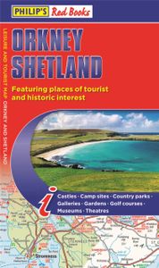
Wegenkaart - landkaart Orkney Shetland | Philip's Maps

Whether it's the outstanding natural beauty, ancient sites or an activity-packed break calling you, the Philip's leisure and tourist map of Orkney and Shetland is all you need. Places of interest are clearly marked on the easy-to-read mapping - ideal for planning that all-important route.   This double-sided Philip's leisure and tourist map of Orkn...
11,50

Webshops met dit product

Webshop
Bezorging
Prijs

Anderen bekeken ook

Wegenkaart - landkaart Philip's Scotland Road Map | Philip's Maps
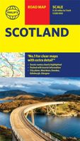
'THE CLEAREST AND MOST DETAILED MAPS OF EUROPE' David Williams MBE, former CEO Gem Motoring Assist The bestselling fold-out road map for navigating in Scotland has been updated for all travellers wanting to go places in the lowlands, highlands and islands, including the Western Isles, the Orkney and Shetland Islands. Whether driving through the most spectacular scenic routes the country has to offer in the Highlands or planning your trip from Edinburgh to Inverness, this handy map has all you need. - Super-clear mapping scale 1:330,000 (5.25 miles to 1 inch) - Key driving information: motorways, railways, ferry routes, road numbers, plus distances between towns - Fully revised and up-to-date with the latest tourist and leisure information - Scenic routes clearly highlighted - Places of interest added: from castles, heritage sites, beaches and national parks to theme parks, places of worship and ancient monuments - Includes the islands and sights of the Western Isles and the Orkney and …
9,95
Wegenkaart - landkaart The Cotswolds | Philip's Maps
A new edition of this double-sided map of the Cotswolds clearly featuring places of tourist and historic interest in an easy-to-read style of mapping, alongside six handy town centre plans. This leisure and tourist map of the Cotswolds gives detailed coverage of the area's road network at a scale of approximately 2 miles to 1 inch (1:125,000). The coverage stretches from Abingdon in the east to Gloucester in the west, and from Swindon in the south to Great Malvern in the north. The map shows places of tourist and historic interest, including castles, camping and caravanning sites, country parks, galleries, gardens, golf courses, museums, nature trails, historic sites, sports venues, theatres and wildlife parks. An index to principal places of interest is also featured. With some of the most enchanting towns and cities in England in the area - all with extraordinary history and notable natural beauty - use the Philip's Leisure Map to explore and delight in the Cotswold magic. Include…
11,50
Wegenkaart - landkaart Pocket Map Orkney | Collins
Handy little full colour map of the Orkney Islands in Scotland. Detailed mapping and tourist information for Orkney mainland, Westray, Sanday, Stronsay, Shapinsay, Hoy, South Ronaldsay and the other islands. Excellent value and very detailed for its size. Main features of this map:   • Clear mapping at a scale of 2.7 miles to 1 inch • Tourist attractions located and described • Ideal for touring with sights, places to stay, cafe/restaurant, things to do all on the map • Transport links map showing how to get to and depart the islands • Index to places of interest and place names   Essential for those planning a trip around the Orkney Isles.
7,95
Wegenkaart - landkaart Highlands of Scotland | Philip's Maps
Zeer duidelijke wegenkaart van het noorden van Schotland. This leisure and tourist map of the Highlands of Scotland gives detailed coverage of the area's road network at a scale of 4.34 miles to 1 inch. The map shows places of tourist and historic interest, including castles, camping sites, country parks, galleries, gardens, golf courses, marinas, museums, nature trails, historic sites, sports venues, theatres, theme parks, wildlife parks and zoos. An index to principal places of interest is also featured. In a convenient folded format, this single-sided sheet map is ideally suited for both leisure and business use, whether by locals or visitors.
9,95
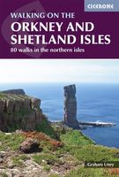
Wandelgids Walking guide to the Orkney and Shetland Isles | Cicerone
Uitstekende wandelgids van dit geweldige gebied. goed beschreven met veel praktische informatie om de route te kunnen lopen, inclusief redelijke kaarten. A guidebook to 80 walking routes on Scotland's Northern Isles of Orkney and Shetland. Routes are described on the islands of Orkney (Orkney Mainland, Hoy, South Ronaldsay, Burray, Rousay, Eday, Westray, Papa Westray, North Ronaldsay) and the islands of Shetland (Shetland Mainland, West Burra, East Burra, Foula, Fair Isle, Isle of Noss, Bressay, Whalsay, Papa Stour, Muckle Roe, Out Skerries, Esha Ness, Yell, Fetlar and Unst).   Routes vary in length from 1 mile to 16 miles, with something to suit all abilities. Offering a variety of landscapes together with a wealth of remarkable archaeological sites such as Skara Brae and Jarlshof, Orkney and Shetland are a walker's dream.   Step-by-step route descriptions are accompanied by clear OS mapping and a time estimate for completing each route. The book includes plenty of information on the …
22,50
Wandelgids 82 Pathfinder Guides Orkney and Shetland | Ordnance Survey
Wandelgids van een deel van Engeland. Deze gids bevat 28 dagwandelingen, variërend van korte tochten tot pittige dagtochten. De bijbehorende kaarten zijn uitstekend: men heeft de topografische kaarten van Ordnance Survey gebruikt waarop de route is ingetekend. Daarnaast praktische informatie over de wandeling en wat beschrijvingen van het gebied. 28 outstanding walks – 23 circular and five there-and-back routes visiting eleven islands across both archipelagos. The size and nature of the islands lend themselves best to short and half-day walks where unhurried and free-range walking is encouraged and the endless distractions of scenery, seabirds, wildflowers and sea watching are best appreciated and enjoyed at a relaxed pace.   In Orkney, the first walk is a short stroll around Hoxa Head with its extensive views across Scapa Flow and subsequent routes go on to explore more widely over Mainland Orkney and take in the islands of Hoy, Rousay and South Ronaldsay, concluding with a ramble alo…
18,50
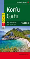
Wegenkaart - landkaart Corfu - Korfoe | Freytag & Berndt
Goede wegenkaart van Corfu, die ook behoorlijk veel detail weergeeft als het gaat om wandelpaden, fietsbare wegen en met veel symbolen voor toeristische bezienswaardigheden. De berijdbare wegen zijn goed weergeven, zowel de hoofdwegen als provinciale en lokale wegen; wegnummers worden vermeld. Afstanden tussen plaatsen zijn in kilometers op de kaart ingetekend, daarnaast worden ook op belangrijke plekken benzinepompen gemarkeerd. In het kaartbeeld wordt door middel van schaduw het reliëf weergegeven en soms enkele punten in het landschap met de daadwerkelijke hoogte. Provinciegrenzen zijn goed terug te vinden, nationale parken en reservaten ook. Met allerhande symbolen worden toeristische bezienswaardigheden weergegeven als monumenten, historisch belangrijke plekken en uitzichtpunten. In bepaalde plaatsen zijn hotels en campings te vinden, luchthavens, treinverbindingen en havens vindt u er ook op! Explore Corfu, the second largest of the Ionian Islands located in Greece; with this Fre…
14,95
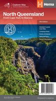
Wegenkaart - landkaart Explorer Map North Queensland | Hema Maps
Detailkaart van een deel van Australië. Zeer goed leesbaar, met naast de topografische details veel symbolen waarmee allerhande toeristische zaken worden aangeduid als campsites, nationale parken, attracties, wandelmogelijkheden etc. Covering Australia's beautiful North Queensland. There is alot of town map insets, tourist information, and photographs on the reverse side Touring map of the northern half of Queensland, with enlargements of popular areas, street plans, lists of facilities, etc. The main map extends south to well beyond the Flinders Highway between Townsville and Mount Isa, including Mackay on the coast. The map shows the road network, including minor roads and unsurfaced tracks, plus railways and local airfields/aerodromes. Designated Tourist Routes are highlighted and symbols mark places of interest (many annotated with brief description), historical sites, tourist resorts, youth hostels, etc. Topography is indicated by names of mountain ranges and peaks, as well as by …
13,95
Wegenkaart - landkaart - Fietskaart Kerry (Ierland) | Xploreit Maps
Mooie geplastificeerde en scheurvaste kaart met index The Xploreit Map of County Kerry includes all of the 'Kingdom' of Kerry along with parts of counties Clare, Limerick and a large part of County Cork. Famous tourist destinations such as Killarney National Park, the Dingle Peninsula, the Skellig Islands (a UNESCO listed World Heritage Site), Derrynane House and the 'Ring of Kerry' scenic route are all shown on one double-sided map sheet. It illustrates a magical landscape of mountains, lakes, woodlands, rivers and streams bordered by a rugged atlantic coastline which is the longest of any county in Ireland. Golf courses, angling locations, beaches for swimming and surfing, historic sites, tourist centres and a host of other points of interest are clearly identified making this map an invaluable tool for both visitors and locals alike. Several scenic drives, cycle routes and waymarked walks are shown. The scale of the Kerry map is 1:100,000. Walking Routes It has been possible to incl…
23,50
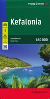
Wandelkaart - Wegenkaart - landkaart Kefallonia - Kefalonia | Freytag & Berndt
Goede wegenkaart van Kefallonia / Kefalonia, waarbij ook de kleinere wegen nog goed te lezen zijn. Gedetailleerde schaal van 1:50.000. Veel toeristische symbolen voor bezienswaardigheden als grotten, tempels, opgravingen maar ook mooie stranden etc. Ook handig is de Nederlandstalige Reisgids van Kefalonia "Ontdek Kefalonia" "Ontdek Kefalonia" Explore Kefallonia, the largest of the Ionian Islands located in Greece; with this Freytag & Berndt single-sided road and leisure map. The map will allow you to travel independently, and plan your journey well.   The map also features full colour photographs of some of the scenery to be found on Kefallonia, as well as an inset showing Kefallonia's position within the nation of Greece. An inset is also provided showing a city plan of the main township on Kefallonia, Argostoli. The topography is clear, with shading showing land gradients.    As with all Freytag & Berndt maps, icons and markings are used to denote tourist information and points of in…
14,95

Klanten-reviews van Wegenkaart - landkaart Orkney Shetland | Philip's Maps

Er zijn nog geen beoordelingen voor dit productBen jij de eerste die een review plaatst?

Meer over Wegenkaart - landkaart Orkney Shetland | Philip's Maps

Productomschrijving

Whether it's the outstanding natural beauty, ancient sites or an activity-packed break calling you, the Philip's leisure and tourist map of Orkney and Shetland is all you need. Places of interest are clearly marked on the easy-to-read mapping - ideal for planning that all-important route.   This double-sided Philip's leisure and tourist map of Orkney and Shetland gives detailed coverage of the islands' road networks at an easy-to-read scale of approximately 2.5 miles to 1 inch. The Orkney Islands are featured on side one of the map, with the Shetland Islands shown on the reverse.   The maps show places of tourist and historic interest, including beaches, castles, camping sites, distilleries, galleries, gardens, golf courses, museums, nature trails, historic sites, sports and entertainment venues. From the ancient settlement of Orkney's Skara Brae and Scapa Flow to the Shetland Museum and Bobby's Bus Shelter, all the top places of interest are featured on each side of the map for Orkney and Shetland respectively.   Easily folded (and unfolded), this double-sided sheet map is ideally suited for both leisure and business use, whether by locals or visitors to the islands.

Verken gerelateerde categorieën

Webshop.nl maakt gebruik van cookies. Ga je verder op onze website, ga dan akkoord met het plaatsen van cookies en de verwerking van deze data door ons en vermelde partners.