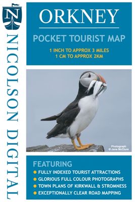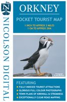
Wegenkaart - landkaart Orkney Pocket Tourist Map | Nicolson

0
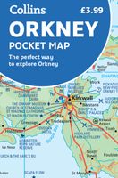
This Nicolson Digital Pocket Tourist Map is the latest addition to our range & ideal for your visit to Orkney. Tourist attractions & places are clearly marked. Detailed street maps included for main towns within the area shown.   Topography is shown by layer tints & peak heights. Quality information for a budget-friendly price! Glorious colour pho...

Verkopers met dit product

Verkoper
Bezorging
Prijs
DeZwerver.nl logo
DeZwerver.nl
niet bekend
6,95

Anderen bekeken ook

Wegenkaart - landkaart Islay, Jura & Colonsay Tourist Map | Nicolson
Nicolson Digital Tourist Maps are ideal for planning your visit to some of the most beautiful areas of Scotland.  Tourist attractions and places are clearly marked. Topography is shown through layer tints with major peaks highlighted.  Detailed street maps included for main towns within the area shown.  A must for every visitor!Featuring:Exceptionally clear road mappingIndex to place names & major tourist attractionsIndexed street plans of Lerwick & ScallowayLayer tints and peak heights. The ideal map for any tourist visiting Islay & Jura
12,95
Wegenkaart - landkaart in your pocket Isle of Skye | Nicolson
The Isle of Skye In Your Pocket is our new essential map for visiting Skye. The front has exceptionally clear road mapping of the whole island showing main tourist attractions, EV charge points and full index to places & tourist attractions. The reverse has detailed town maps of Portree and Broadford at 1:14,000, useful travel information and glorious full colour photographs of some of the famous sights - you will want to visit them and many more. Don't leave home without it!    Featuring:    Exceptionally clear, fully indexed road mapping Detailed town plans of Portree & Broadf ord EV charging points and tourist attractions shown Travel information and glorious full colour photographs
7,95
Wegenkaart - landkaart Pocket Map Orkney | Collins
Handy little full colour map of the Orkney Islands in Scotland. Detailed mapping and tourist information for Orkney mainland, Westray, Sanday, Stronsay, Shapinsay, Hoy, South Ronaldsay and the other islands. Excellent value and very detailed for its size. Main features of this map:   • Clear mapping at a scale of 2.7 miles to 1 inch • Tourist attractions located and described • Ideal for touring with sights, places to stay, cafe/restaurant, things to do all on the map • Transport links map showing how to get to and depart the islands • Index to places of interest and place names   Essential for those planning a trip around the Orkney Isles.
7,95
Wegenkaart - landkaart Scotland Tourist Map | Nicolson
The Nicolson Digital Scotland Tourist Map is a must-have for planning your trip to Scotland. Clearly shows main tourist attractions, places, national & fore st parks, the increasingly popular long distance driving routes and locations for wild swimming, kayaking & paddleboarding. National cycle routes and long distance footpaths are also included.    Featuring: Clear road mapping with mileagesIndex to place names and main tourist attractionsLong distance driving routes footpaths & national cycle routesNational & forest parksLocations for wild swimming, kayaking & paddleboarding  
9,95
Wegenkaart - landkaart Orkney Shetland | Philip's Maps
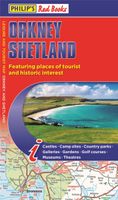
Whether it's the outstanding natural beauty, ancient sites or an activity-packed break calling you, the Philip's leisure and tourist map of Orkney and Shetland is all you need. Places of interest are clearly marked on the easy-to-read mapping - ideal for planning that all-important route.   This double-sided Philip's leisure and tourist map of Orkney and Shetland gives detailed coverage of the islands' road networks at an easy-to-read scale of approximately 2.5 miles to 1 inch. The Orkney Islands are featured on side one of the map, with the Shetland Islands shown on the reverse.   The maps show places of tourist and historic interest, including beaches, castles, camping sites, distilleries, galleries, gardens, golf courses, museums, nature trails, historic sites, sports and entertainment venues. From the ancient settlement of Orkney's Skara Brae and Scapa Flow to the Shetland Museum and Bobby's Bus Shelter, all the top places of interest are featured on each side of the map for Orkne…
11,50
Wegenkaart - landkaart South Africa: Swartberg & Klein-Karoo | Slingsby Maps
All roads from National Highways to minor gravel roads are shown; the many classifications that indi- cate the quality of each road help you plan your route No less than 28 mountain passes are shown — all are public roads! Distances are clearly shown; comprehensive 4 x 4 information GPS coordinates in DD MM SS format are provided for every road-junction All tourism facilities and accommodation establishments are shown in the out-of-town areas; there are insets of the major towns The map links to our maps of the Baviaanskloof, the Garden Route, Overberg and the Tankwa-Karoo Additional info:   Swartberg and Klein-Karoo region on a contoured and GPS compatible, double-sided, waterproof and   tear-resistant map at 1:160,000 from Slingsby Maps, with excellent topographic detail and plenty of tourist information, including street plans of ten main towns.   The map provides a very detailed picture of this mountainous terrain, with altitude colouring, shading, con- tours at 20m intervals and …
29,95
Wegenkaart - landkaart Visitors map Scotland - Schotland | A-Z Map Company
xplore the whole of Scotland from Dumfries and Galloway in the South to the Orkney Islands in the North. With detailed road mapping and illustrated town plans of major cities, this feature rich, helpful tourist guide is ideal for touring around Scotland. Published at a clear 8.7 miles to 1 inch scale (5.51 cm to 1 km), this handy map is a detailed and informative exploration of what Scotland has to offer.   Highlights include: 8 inset street maps to major cities and popular destinations, including: Edinburgh, Glasgow, Stirling, and Cairngorms National Park, with detailed descriptions and places of interestLocations of visitor centres and tourist information sitesUseful key to map symbols making it a clear and easy readMore than 700 places of interest The perfect map for exploring Scotland whether you are a tourist or a local.
11,50
Wegenkaart - landkaart North Coast Journey | Nicolson
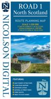
Nicolson Digital Tourist Maps are ideal for planning your visit on a circular tour round the Northern Scotland tourist route. A great map to use along with Bridget Benson’s North Coast Journey.   Our sectional map showing the popular tourist route round the North of Scotland.   Starting at Inverness, heading west through Applecross then North to Gairloch, Ullapool to Lochinver then on to Durness. Along the Northern Coastline to John O'Groats and back down the east coast to finish in Inverness   Back of the map has the index to places & attractions for each section   Featuring: Exceptionally clear road mapping Popular tourist and historical sites Alternative routes for large vehicles Electric Vehicle Charging points & Petrol Stations 1/150000 Tourist Mapping   Card cover   Cover size approx 135 mm wide x 240mm tall   Sheet size (unfolded) 1000 mm wide x 690mm tall    
12,95
Wegenkaart - landkaart Ukraine - Moldova | Gizi Map
Kaart van Oekraïne met Moldavië, met een uitbreiding met de Krim in meer detail, plus plattegronden van het centrum van Kiev en Lviv. Wegennet is ingedeeld in zes typen, rij-afstanden aangegeven op hoofd-en secundaire routes, en verder worden grensovergangen weergegeven. Ukraine with Moldova on an indexed road map at 1:1,100,000 from Gizi Map, with an enlargement showing southern Crimea in greater detail, plus street plans of central Kiev and Lviv. All place names are shown transliterated into Latin alphabet, with those of major cities also given in their Cyrillic versions. Altitude colouring with relief shading indicates the mountainous regions, with the marshlands of northern Ukraine also marked. National parks and other protected areas are highlighted. Road network is graded into six types, driving distances are marked on main and secondary routes, and border crossings are shown. Railway lines, ferry routes on the Black Sea and Azov Sea, and local airports are included. Symbols hig…
15,95
Wegenkaart - landkaart Explorer Map North Queensland | Hema Maps
Detailkaart van een deel van Australië. Zeer goed leesbaar, met naast de topografische details veel symbolen waarmee allerhande toeristische zaken worden aangeduid als campsites, nationale parken, attracties, wandelmogelijkheden etc. Covering Australia's beautiful North Queensland. There is alot of town map insets, tourist information, and photographs on the reverse side Touring map of the northern half of Queensland, with enlargements of popular areas, street plans, lists of facilities, etc. The main map extends south to well beyond the Flinders Highway between Townsville and Mount Isa, including Mackay on the coast. The map shows the road network, including minor roads and unsurfaced tracks, plus railways and local airfields/aerodromes. Designated Tourist Routes are highlighted and symbols mark places of interest (many annotated with brief description), historical sites, tourist resorts, youth hostels, etc. Topography is indicated by names of mountain ranges and peaks, as well as by…
17,50

Klanten-reviews van Wegenkaart - landkaart Orkney Pocket Tourist Map | Nicolson

Er zijn nog geen beoordelingen voor dit productBen jij de eerste die een review plaatst?

Meer over Wegenkaart - landkaart Orkney Pocket Tourist Map | Nicolson

Productomschrijving

This Nicolson Digital Pocket Tourist Map is the latest addition to our range & ideal for your visit to Orkney. Tourist attractions & places are clearly marked. Detailed street maps included for main towns within the area shown.   Topography is shown by layer tints & peak heights. Quality information for a budget-friendly price! Glorious colour photographs & tourist informationIndex to place names & major tourist attractionsIndexed street plans of Kirkwall & StromnessExceptionally clear road mapping

Verken gerelateerde categorieën

Webshop.nl maakt gebruik van cookies. Ga je verder op onze website, ga dan akkoord met het plaatsen van cookies en de verwerking van deze data door ons en vermelde partners.