webshop.nl
Categorieën
  Sluiten

Meer Nicolson

Wegenkaart - landkaart Orkney Pocket Tourist Map | Nicolson

0
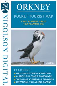
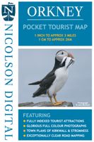
This Nicolson Digital Pocket Tourist Map is the latest addition to our range & ideal for your visit to Orkney. Tourist attractions & places are clearly marked. Detailed street maps included for main towns within the area shown.   Topography is shown by layer tints & peak heights. Quality information for a budget-friendly price! Glorious colour phot...

Webshops met dit product

Webshop
Bezorging
Prijs

Anderen bekeken ook

Wegenkaart - landkaart Orkney Pocket Tourist Map | Nicolson
This Nicolson Digital Pocket Tourist Map is the latest addition to our range & ideal for your visit to Orkney. Tourist attractions & places are clearly marked. Detailed street maps included for main towns within the area shown.   Topography is shown by layer tints & peak heights. Quality information for a budget-friendly price! Glorious colour photographs & tourist informationIndex to place names & major tourist attractionsIndexed street plans of Kirkwall & StromnessExceptionally clear road mapping
6,95
Wegenkaart - landkaart Islay, Jura & Colonsay Tourist Map | Nicolson
Nicolson Digital Tourist Maps are ideal for planning your visit to some of the most beautiful areas of Scotland.  Tourist attractions and places are clearly marked. Topography is shown through layer tints with major peaks highlighted.  Detailed street maps included for main towns within the area shown.  A must for every visitor!Featuring:Exceptionally clear road mappingIndex to place names & major tourist attractionsIndexed street plans of Lerwick & ScallowayLayer tints and peak heights. The ideal map for any tourist visiting Islay & Jura
12,95
Wegenkaart - landkaart Pocket Map Orkney | Collins
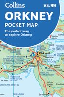
Handy little full colour map of the Orkney Islands in Scotland. Detailed mapping and tourist information for Orkney mainland, Westray, Sanday, Stronsay, Shapinsay, Hoy, South Ronaldsay and the other islands. Excellent value and very detailed for its size. Main features of this map:   • Clear mapping at a scale of 2.7 miles to 1 inch • Tourist attractions located and described • Ideal for touring with sights, places to stay, cafe/restaurant, things to do all on the map • Transport links map showing how to get to and depart the islands • Index to places of interest and place names   Essential for those planning a trip around the Orkney Isles.
7,95
Wegenkaart - landkaart in your pocket Isle of Skye | Nicolson
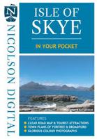
The Isle of Skye In Your Pocket is our new essential map for visiting Skye. The front has exceptionally clear road mapping of the whole island showing main tourist attractions, EV charge points and full index to places & tourist attractions. The reverse has detailed town maps of Portree and Broadford at 1:14,000, useful travel information and glorious full colour photographs of some of the famous sights - you will want to visit them and many more. Don't leave home without it!    Featuring:    Exceptionally clear, fully indexed road mapping Detailed town plans of Portree & Broadf ord EV charging points and tourist attractions shown Travel information and glorious full colour photographs
7,95
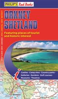
Wegenkaart - landkaart Orkney Shetland | Philip's Maps
Whether it's the outstanding natural beauty, ancient sites or an activity-packed break calling you, the Philip's leisure and tourist map of Orkney and Shetland is all you need. Places of interest are clearly marked on the easy-to-read mapping - ideal for planning that all-important route.   This double-sided Philip's leisure and tourist map of Orkney and Shetland gives detailed coverage of the islands' road networks at an easy-to-read scale of approximately 2.5 miles to 1 inch. The Orkney Islands are featured on side one of the map, with the Shetland Islands shown on the reverse.   The maps show places of tourist and historic interest, including beaches, castles, camping sites, distilleries, galleries, gardens, golf courses, museums, nature trails, historic sites, sports and entertainment venues. From the ancient settlement of Orkney's Skara Brae and Scapa Flow to the Shetland Museum and Bobby's Bus Shelter, all the top places of interest are featured on each side of the map for Orkney…
11,50
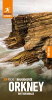
Reisgids British Breaks Orkney | Rough Guides
Deze praktische zakgidsen, zorgvuldig samengesteld door experts, belichten minder bekende Britse bestemmingen voor stedentrips, kustvakanties en eilanduitjes. Ze bieden een schat aan informatie over wat er te zien en te doen is, inclusief gedetailleerde verkenning van elke wijk of buurt in de bestemming, met de beste bezienswaardigheden, winkels, restaurants, cafés en bars. Bovendien bieden ze excursies naar nabijgelegen gebieden voor diegenen die een langere vakantie willen genieten. These expert-curated pocket guide books shine a spotlight on more unusual British city break, coastal and island holiday destinations, with a wealth of practical information on what to see and do. Each area or neighbourhood in the destination is explored in-depth with detailed coverage of the points of interest, shops, restaurants, cafes and bars on offer. Excursions to surrounding areas give plenty of options for those looking to enjoy a longer stay. The Pocket Rough Guide to Orkney covers: Stromness, S…
13,95

Klanten-reviews van Wegenkaart - landkaart Orkney Pocket Tourist Map | Nicolson

Er zijn nog geen beoordelingen voor dit productBen jij de eerste die een review plaatst?

Meer over Wegenkaart - landkaart Orkney Pocket Tourist Map | Nicolson

Productomschrijving

This Nicolson Digital Pocket Tourist Map is the latest addition to our range & ideal for your visit to Orkney. Tourist attractions & places are clearly marked. Detailed street maps included for main towns within the area shown.   Topography is shown by layer tints & peak heights. Quality information for a budget-friendly price! Glorious colour photographs & tourist informationIndex to place names & major tourist attractionsIndexed street plans of Kirkwall & StromnessExceptionally clear road mapping

Productspecificaties

Artikelnummer(s)
Brand
Nicolson
Webshop.nl maakt gebruik van cookies. Ga je verder op onze website, ga dan akkoord met het plaatsen van cookies en de verwerking van deze data door ons en vermelde partners.