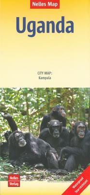
Wegenkaart - landkaart Oeganda - Uganda | Nelles Verlag

0
Goede kaart van Uganda. Aan beide kanten bedrukt. Met veel toeristische aanduidingen als nationale parken en culturele bezienswaardigheden. Prima leesbare kaart. Kampala 1 : 15.000 Uganda at 1:700,000 on a double-sided map from Nelles with a smaller size sheet offering a convenient format for use when travelling. The map also includes a street pla...

Verkopers met dit product

Verkoper
Bezorging
Prijs
DeZwerver.nl logo
DeZwerver.nl
2,95
11,95

Anderen bekeken ook

Wegenkaart - landkaart Oeganda - Uganda | Nelles Verlag
Goede kaart van Uganda. Aan beide kanten bedrukt. Met veel toeristische aanduidingen als nationale parken en culturele bezienswaardigheden. Prima leesbare kaart. Kampala 1 : 15.000 Uganda at 1:700,000 on a double-sided map from Nelles with a smaller size sheet offering a convenient format for use when travelling. The map also includes a street plan of central Kampala highlighting public buildings and selected accommodation.    The map divides the country north/south with a good overlap between the sides.
11,95
Wegenkaart - landkaart Uganda - Oeganda | Reise Know-How Verlag
Tweetalige kaart (Engels en Duits). Door ingetekende lengte- en breedtegraden is het gebruik van GPS mogelijk. Met hoogtelijnen en uitgebreid wegennetwerk: daarnaast worden ook de afstanden tussen belangrijke plaatsen duidelijk leesbaar weergegeven. Het kleurgebruik is zodanig dat je een goede indruk krijgt van hoogteverschillen en soorten landschap. Natuurlijk staan de toeristische bezienswaardigheden duidelijk vermeld.   Gedrukt op water- en scheurvast papier! Polyart is een synthetisch product vrij van giftige stoffen dus duurzaam. Het papier gaat echt lang mee.   Topography is indicated by altitude colouring with numerous spot heights and names of mountain ranges and passes. Salt lakes, swamps, seasonal rivers and glacier are also shown. Detailed presentation of the road network includes minor roads and tracks and railways are also shown.   Internal administrative units are presented with their boundaries and names. National parks and other protected areas are highlighted. A wide …
15,95
Reisgids Uganda - Oeganda | Bradt Travel Guides
Er bestaat geen Lonely Planet van Oeganda. Voor Afrikaanse landen net zo goed, zo niet beter dan de Planet. Beduidend soberder uitgevoerd, maar ook met veel informatie voor backpackers en met veel kaartmateriaal. Een aanrader! The Bradt Guide to Uganda, now more than 500-pages long, is the definitive travel handbook to this wonderful but oft-neglected destination, not only providing comprehensive background information to its varied national parks, towns and other cultural attractions, but also including detailed reviews of the ever-growing selection of world-class lodges and budget hotels that service them. Bradt's Uganda has for many years been considered the go-to source of information for travellers heading to or interested in this extraordinary country. This new ninth edition of the most comprehensive guide available has been fully updated by Philip Briggs, arguably the world's most experienced guidebook author and certainly the most experienced writer on Africa, and also include…
28,95
Reisgids Uganda - Ruanda, Oeganda en Rwanda | Reise Know-How Verlag
Toonaangevende reisgids van Duitse makelij. Zeer degelijk, boordevol praktische informatie en achtergrondbeschrijvingen. Absoluut de beste gids op dit moment .... Een aanrader voor zowel de zelfstandige als de georganiseerde reiziger.   Der perfekte Reiseführer für individuelle Entdeckungstouren in Uganda und Ruanda:   Sorgfältige Beschreibung aller sehenswerten Städte, Landschaften und Nationalparks: von Kampala bis zum Kidepo Valley NP, vom Albertsee bis zum Parc National des Volcans.   Alles Wissenswerte und praktische Informationen zu Schimpansen- und Gorilla-Tracking.   Ausführliche Länderkunde: Bevölkerung, Kultur, Geschichte und Politik, Sprache, Wirtschaft, Religion, Natur.   Unterkunfts-Empfehlungen für jeden Geldbeutel: Hotels, Lodges, Safari Lodges, Luxury Tented Camps, Guest Houses, Camping, Bandas, Hostels, etc.   Alle Transportmöglichkeiten: Flugzeug, Schiff/Fähre, Bus, Boda-Boda, Piki-Piki, (Sammel-)Taxi, Mietwagen, Fahrrad.   Bergsteigen und Trekking: Informationen und…
29,50
Reisgids Oeganda - Uganda | Uitgeverij Elmar
Praktische en culturele reisgids met alle bezienswaardigheden   In het reishandboek Uganda (Oeganda) vind je uitgebreide informatie over de bezienswaardigheden van dit bijzondere land. Deze reisgids laat je ook kennismaken met de historie, de flora en de fauna van Uganda. Het bevat veel praktische tips over het dagelijks leven in Uganda en over het bezoeken van nationale parken en wildreservaten. Dit reishandboek kan je gebruiken als leidraad bij je voorbereidingen van een onvergetelijke reis, maar ook als informatiebron als je meer wilt weten over het land en de bevolking van Uganda. Het reishandboek Uganda, geschreven door een Nederlandse auteur, is een must-have voor elke reiziger die interesse heeft in Uganda.   Bezienswaardigheden Uganda Uganda ligt in Centraal-Afrika en heeft als buurlanden Tanzania, Rwanda, R.D. Congo, Soedan en Kenia. Het land heeft het hele jaar door een aangenaam klimaat. De vele nationale parken brengen de reiziger dicht bij de natuur met haar berggorilla's…
21,99
Reisgids Uganda - Oeganda | Iwanowski's
Eén van de beste reisgidsen voor Oeganda, weliswaar Duits maar mede daardoor zeer uitputtend. Mit seinen Naturschönheiten wie dem Weißen Nil mit seinen zahlreichen Wasserfällen, dem riesigen Viktoria-See und seiner einmaligen Vielfalt an Primaten rückt Uganda immer mehr in den touristischen Fokus. Nicht nur ist der ostafrikanische Binnenstaat politisch stabil und verfügt über eine der höchsten Wirtschaftswachstumsraten des Kontinents, Urlaubern bietet die „Perle Afrikas“ (Winston Churchill) auch zahlreiche Aktivitäten: von Wildwasser- und Kanufahrten über Safaris im Murchison-Falls- oder im Queen-Elizabeth-Nationalpark bis hin zum Berggorilla- und Schimpansen-Tracking im Bwindi- bzw. Kibale-Nationalpark. Wanderer und Bergsteiger können sich an den 5.000er im schneebedeckten Ruwenzori-Gebirge, dem dritthöchsten Afrikas, versuchen. Iwanowski‘s Reisehandbuch Uganda bietet Informationen, Vorschläge und Hinweise für eine individuelle Reiseplanung und ist eine Fundgrube an nötigem Hinter…
32,50
Wegenkaart - landkaart 3 China centraal | Nelles Verlag
Goede wegenkaart van een deel van China. Aan beide kanten bedrukt. Met veel toeristische aanduidingen als nationale parken en culturele bezienswaardigheden. Prima leesbare kaart. Cental China at 1:1,750,000 from Nelles in a convenient format for use when travelling, with street plans of central Beijing and Shanghai. The map is double-sided, with an overlap between the sides, and provides coverage from just north of the capital, to include the local sections of the Great Wall, to Wenzhou and westwards to include Xian. All place names are in the Latin alphabet only with, where useful, their historical pre-Pinyin names (Peking, Tsingtao, etc).   Maps in the Nelles series for China present road and rail networks on a base with topography indicated by relief shading, with names of mountain ranges and peaks plus additional spot heights. Local airports are marked and the maps also show internal administrative boundaries with names of the provinces. Places of interest, including historical si…
11,95
Wegenkaart - landkaart Cuba | Nelles Verlag
Goede wegenkaart van Cuba. Aan beide kanten bedrukt. Met veel toeristische aanduidingen als nationale parken en culturele bezienswaardigheden. Prima leesbare kaart, nu ook op scheur- en watervast papier Folded road and tourist map of Cuba at 1:775 000 scale. Places of interest, national parks, and beaches are all highlighted and shaded-relief colouring clearly depicts the topography.   The map includes insets showing Varadero at 1:32 000, Camaguey at 1:15 000, Santiago de Cuba at 1:15 000, La Habana (Havana) at 1:15 000, Cienfuegos at 1:23 000 and Trinidad at 1:12 100. The legend is in four languages, including English.   For over 20 years Nelles maps have been renowned throughout the world for their quality, faithfulness to detail and up-to-dateness.    So that streets, ferry links, railway lines, etc are always up to date, Nelles are continuously upgrading their maps - with the help of their international team of correspondents. Roads are provided with an exact kilometerage. Sights …
11,95
Wegenkaart - landkaart Myanmar - Birma | Nelles Verlag
Goede overzichtskaart van Myanmar / Birma. Aan beide kanten bedrukt. Met veel toeristische aanduidingen als culturele bezienswaardigheden en nationale parken. Prima leesbare kaart en bovendien gedrukt op scheur-en watervast papier. Myanmar (Burma) at 1:1,500,000 from Nelles Verlag, with street plans of Yangon (Rangoon) and Mandalay, plus a plan of the World Heritage site at Bagan. The map is double-sided, with its smaller size offering a convenient format for use when travelling.    The country is divided north/south, with the panhandle shown as an inset on the southern side. Vivid relief shading with spot heights and names of mountain ranges presents the topography. National parks and/or protected area are indicated. Bagan 1 : 60.000 Mandalay 1 : 30.000 Yangon (Rangoon) 1 : 60.000
11,95

Klanten-reviews van Wegenkaart - landkaart Oeganda - Uganda | Nelles Verlag

Er zijn nog geen beoordelingen voor dit productBen jij de eerste die een review plaatst?

Meer over Wegenkaart - landkaart Oeganda - Uganda | Nelles Verlag

Productomschrijving

Goede kaart van Uganda. Aan beide kanten bedrukt. Met veel toeristische aanduidingen als nationale parken en culturele bezienswaardigheden. Prima leesbare kaart.

Kampala 1 : 15.000

Uganda at 1:700,000 on a double-sided map from Nelles with a smaller size sheet offering a convenient format for use when travelling. The map also includes a street plan of central Kampala highlighting public buildings and selected accommodation.    The map divides the country north/south with a good overlap between the sides.

Productinformatie

    Verken gerelateerde categorieën

    Webshop.nl maakt gebruik van cookies. Ga je verder op onze website, ga dan akkoord met het plaatsen van cookies en de verwerking van deze data door ons en vermelde partners.