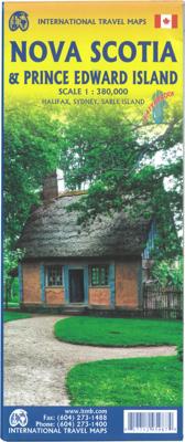
Wegenkaart - landkaart Nova Scotia & Prins Edwardeiland | ITMB

0

Verkopers met dit product

Verkoper
Bezorging
Prijs
DeZwerver.nl logo
DeZwerver.nl
niet bekend
2,95
13,95

Anderen bekeken ook

Waterkaart Halifax & Nova Scotia | ITMB
Halifax & Nova Scotia Travel Reference Map 1:9,000/1:535,000   Halifax was founded by the British navy in 1745 as a base to patrol the North Atlantic and to place pressure on the nearby French possessions of Acadia and Quebec. It has an excellent harbour, and is still the main base for the Canadian naval fleet. The city is also the eastern terminus of the Trans-Canada rail network and a major harbour for shipping goods to Europe. For modern travellers, it is also a major port call for cruise ships and its airport is convenient for flights from Europe. The urban area is actually two separate cities, with Halifax on the western side of the harbour and Dartmouth on the eastern side. Both are shown in excellent detail on this map. The downtown area of Halifax is the most historic part of the city, with the citadel dominating the landscape (well worth a visit!). The second side is a good map of Nova Scotia and most of Prince Edward Island. It isn’t as detailed as our double-sided map of th…
13,95
Wegenkaart - landkaart Scotland - Schotland | ITMB
Anyone who has been in this business for a few years remembers Ordnance Survey and their brilliantly detailed artwork. They should also remember that OS guarded this artwork religiously. That all changed when the then head of government in the UK, one soon-forgotten Gordon Brown, decreed that commercial OS artwork had to be discontinued and artwork had to be made more freely available to users. I expected an outpouring of new artwork by private UK firms. It did not happen; in fact, the range of travel maps decreased dramatically. However, OS artwork is still an excellent source of mapping artwork. This is a wonderful double-sided, detailed map of Scotland. It is both extremely detailed and accurate. We have added symbols for parks, historic sites, battlefields, country hotels, and anything else that we think would interest visitors. In order to portray Scotland to best scale advantage, the only inset included with this map are those of outlying islands, such as the Shetlands. ITMB als…
13,95
Wegenkaart - landkaart Queensland | ITMB
Een degelijke wegenkaart van Queensland met aanduidingen van o.a. nationale parken, vliegveld, benzinepomp, dirt-roads en kleine plattegrond van hoofdstad. Als overzichtskaart goed te gebruiken. We complete our series of regional maps covering Australia with this map of Queensland, which nicely fills a double-sided sheet with only small portions of adjoining states showing. The map also includes a large inset map of central Brisbane. At this scale, the road/rail network of this part of Australia becomes very clear. The first side concentrates on the northern portion of the state, and the other side, the more densely-developed southern half. The map includes a listing of the state’s top attractions, and notes al major touristic attractions. Although gas/petrol stations are commonly found, we have included some gas symbols in remoter parts of Queensland to encourage drivers to venture into roads less travelled. All states and territories of Australia are now available from ITMB as separ…
13,95
Wegenkaart - landkaart - Stadsplattegrond Edinburgh & Southern Scotland | ITMB
Plattegrond van Edinburgh, schaal 1:10.000, met op de achterzijde een overzichtskaart van zuid Schotland, schaal 1:370.000. Legend Includes: Roads by classification, Airports, Ferry lines, Railways, Railway stations, Bus terminals, Bicycle Trails, Pedestrian streets, Staircases, Fishing, Caves, Camps sites, Accomodation, Tourism information centers, Museums, Live Theatres, Cinemas, Post offices, Police Stations, Shopping centers, Schools, Universities, Hospitals, Churches, Mosques, Synagogues, Buddhist temples, Stadiums, Playing fields, Golfing, Beaches, Points of interest, Ruins, Lighthouses, Castles and much more.
13,95

Klanten-reviews van Wegenkaart - landkaart Nova Scotia & Prins Edwardeiland | ITMB

Er zijn nog geen beoordelingen voor dit productBen jij de eerste die een review plaatst?

Meer over Wegenkaart - landkaart Nova Scotia & Prins Edwardeiland | ITMB

Productinformatie

    Verken gerelateerde categorieën

    Webshop.nl maakt gebruik van cookies. Ga je verder op onze website, ga dan akkoord met het plaatsen van cookies en de verwerking van deze data door ons en vermelde partners.