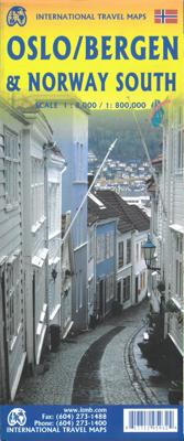
Wegenkaart - landkaart Norway South, Oslo, Bergen | ITMB

0
Een degelijke wegenkaart van zuid Noorwegen, tot iets boven Trondheim, met aanduidingen van o.a. nationale parken, vliegveld. Als overzichtskaart goed te gebruiken. Daarnaast plattegronden van Oslo en Bergen.   Legend Includes: Roads by classification, Rivers and Lakes, National Park, Airports, Points of Interests, Mining, Highways, Main Roads, Zo...

Verkopers met dit product

Verkoper
Bezorging
Prijs
DeZwerver.nl logo
DeZwerver.nl
2,95
13,95

Anderen bekeken ook

Wegenkaart - landkaart USA South - Atlantic States | ITMB
Een degelijke kaart met aanduidingen van o.a. nationale parken, vliegveld, benzinepomp, dirt-roads van de Oosttkust van de USA van Philadelphia tot Florida  . Als overzichtskaart goed te gebruiken. We call the map the Atlantic States guardedly for obvious reasons. First, the northeastern Atlantic States are missing and second, Florida's Caribbean coastline is included. Also, to cover an area so long, we had to go further inland than 'just' the coast, so all of Pennsylvania and West Virginia are included. The area of coverage of side A is Philadelphia/Pittsburg south to Augusta and Charleston. Side B continues south to the southernmost portion of Florida and west to Panama City. Inset maps of Orlando and Miami are included on this side as well. Both road and rail connections are shown, and distances between communities shown. Places of touristic interest are included, albeit suitable to the scale. An extensive place name index is included.  Legend Includes: Roads by classification, Riv…
13,95
Wegenkaart - landkaart New South Wales, Victoria, & Tasmania | ITMB
Een degelijke wegenkaart , schaal 1:1.900.000, met aanduidingen van o.a. nationale parken, vliegveld, benzinepomp, dirt-roads. Als overzichtskaart goed te gebruiken. We are pleased to announce the completion of our regional maps covering Australia with this map of the south-eastern segment of the country. This is the most densely-populated part of Australia, stretching from Lismore in the northeast to the Tasman Sea in the south. It includes all of New South Wales (NSW) and Victoria State, with South Australia as far west as Adelaide. It also shows Tasmania, Australia’s only island state, in good detail, as well as Flinders Island and King Island. The map includes two very large inset maps of Melbourne and of Sydney. This map covers the travel plans of 90% of the visitors travelling around Australia, a continental country that is very difficult to see all of in one trip. The expanded scale we’ve used allows adequate room to include wilderness campgrounds, recreational vehicle parks, a…
13,95
Wegenkaart - landkaart - Stadsplattegrond China South - Zuid | ITMB
Een degelijke wegenkaart met aanduidingen van o.a. nationale parken, vliegveld, benzinepomp, dirt-roads. Als overzichtskaart goed te gebruiken.   China is a very large country. While our map of the entire country is fine for general travel and sells well, China is too large to show areas in detail. This map concentrates on the part of China from Shanghai south and all the way west to Lhasa and includes Taiwan and Hainan Island. We are not trying to make any sort of political comment here, but geographically, both Tibet and Taiwan fall within the area of coverage and are both included for this reason alone. The map also includes insets of Hong Kong, Guangzhou and Shanghai   Legend Includes: Roads by classification, Points of Interest, National Parks, Airports, Golf Courses, Beaches, Campsites, Waterfalls, Viewpoints, Churches, Surfing/Scuba Diving Spots, Fishing Spots, Hospitals, harbours/Ports, Lighthouses, Museums, Monuments, Caves, Mosques, Mountain Peaks, Botanic Gardens, Wildlife …
13,95
Wegenkaart - landkaart Japan Central | ITMB
Een degelijke kaart met aanduidingen van o.a. nationale parken, vliegveld, benzinepomp, dirt-roads. Als overzichtskaart goed te gebruiken.   This is a brand new title for ITMB, a double-sided map covering the ‘core’ regions of Japan most visited by tourists exploring Japan. Side 1 covers from Tokyo north to Sendai/Nigata and west to Nagoya. Side two covers all of Japan as far as Hiroshima, with insets of the Osaka/Kobe and Kyoto/Nara regions. Naturally, all touristic attractions are noted.   Legend Includes: Roads by classification, Rivers and Lakes, National Park, Airports, Points of Interests, Highways, Main Roads, Zoos, Fishing, and much more...
13,95
Wegenkaart - landkaart Mexico South | ITMB
Een degelijke wegenkaart met aanduidingen van o.a. nationale parken, vliegveld, benzinepomp, dirt-roads. Als overzichtskaart goed te gebruiken (De kaart beschrijft Mexico ten Zuiden van Tampico). Folded road and travel map in color. Scale 1:1,200,000. Distinguishes 5 types of roads, ranging from expressways to tracks. Legend shows international/provincial borders, international/domestic airports, airstrips, railways, trails, points of interest, archaeological sites, beaches, caves, gas stations, reefs, National Parks, swamps/mangroves. Map includes extensive index. Shown are also parts of Belize and Guatemala.  
13,95
Wegenkaart - landkaart Scandinavia - Scandinavië | ITMB
Een degelijke wegenkaart met aanduidingen van o.a. nationale parken, vliegveld. Als overzichtskaart goed te gebruiken. This is a new title for ITMB, providing detailed coverage of almost all of what most of us consider to be the Scandinavian countries. Only the southernmost portions of Denmark had to be left off. The map is double-sided, with Denmark and most of Norway and Sweden on one side and their balances and Finland on the reverse side. The road network, particularly the motorways and A-type roads shown up very well. Secondary roads show well and also are easy to see. Rail lines are present as well as ferry routes, of which there are many. The area of Scandinavia is so large in the European context that little attention has been paid to the region. When mapping a large area such as this is, it is difficult to show every detail. We have done our best and included all world heritage sites, major churches, castles, some campsites, and as many touristic attractions as could be fitte…
13,95
Wegenkaart - landkaart Wales & south of England - Zuid Engeland | ITMB
Een degelijke kaart met aanduidingen van o.a. nationale parken, vliegveld, benzinepompen. We are gradually increasing the scales for our data of Great Britain and this is our latest effort. Most visitors to the UK fly into one of London's four airports and combine a visit to the city with an opportunity to travel to various destinations within striking distance of London. England is so incredibly rich in heritage and scenic attractions that it is extremely difficult to portray the country as a map of the entire entity. As a result, England lends itself nicely to be divided into a central/northern portion and a southern portion. To fit areas as diverse as Cornwall and Norwich on one sheet, one needs to have a vertical frame, with Devon/Cornwall up to the top of Wales on one side and Wiltshire to Kent up to York (admittedly, not normally considered to be part of 'southern', but vertically, that's what happens. At this scale, all of southern England and all of Wales can be shown in good …
13,95
Wegenkaart - landkaart Australia South & Northern Territory | ITMB
Australia was one of the first countries ITMB published, back in the 1980s, albeit a licensed version. Our own original artwork was completed in the mid-1990s, but until recently, we have not focused on sectional maps of the country based on individual states. In 2019, we published Brisbane and Queensland, and Sydney and New South Wales. Now, we are issuing the ‘middle’ states of South Australia and Northern Territory to provide better coverage of these important parts of Australia at a better scale than a country map could provide. South Australia can be thought of as having two parts; the fertile farming economy surrounding Adelaide in the south and the much more arid northern portion. The road network in the south tends to be well developed, with paved roads going more or less east-west to NSW and WA. Northerly roads tend to be gravel or dirt, such as the Birdville Track, and the north-westerly roads tend to pass through land ceded to aboriginals and require permits. Northern Terri…
13,95

Klanten-reviews van Wegenkaart - landkaart Norway South, Oslo, Bergen | ITMB

Er zijn nog geen beoordelingen voor dit productBen jij de eerste die een review plaatst?

Meer over Wegenkaart - landkaart Norway South, Oslo, Bergen | ITMB

Productomschrijving

Een degelijke wegenkaart van zuid Noorwegen, tot iets boven Trondheim, met aanduidingen van o.a. nationale parken, vliegveld. Als overzichtskaart goed te gebruiken. Daarnaast plattegronden van Oslo en Bergen.   Legend Includes: Roads by classification, Rivers and Lakes, National Park, Airports, Points of Interests, Mining, Highways, Main Roads, Zoos, Fishing, , and much more

Productinformatie

    Verken gerelateerde categorieën

    Webshop.nl maakt gebruik van cookies. Ga je verder op onze website, ga dan akkoord met het plaatsen van cookies en de verwerking van deze data door ons en vermelde partners.