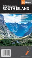
Wegenkaart - landkaart South Island (Zuider Eiland - Nieuw Zeeland) | Hema Maps
Uitstekende overzichtskaart met index, afstandstabel, nationale parken en toeristische informatie. Gedetailleerder dan de gehele Nieuw - Zeeland kaart. This map is easy to read and feature clear, easy to read cartography, reliefshading, National Parks, Points of Interest, Tourist Routes, Distance Grid and Walking Tracks. Printed one sided and complete with index these are an ideal planning tool as well as an ideal travel companion. This regional map of the South Island of New Zealand (NZ) is at a scale of 1:1,000,000 and shows points of interests, tourist routes, walking tracks and national parks for touring the island. On the reverse side are handy city maps of Christchurch, Picton, Nelson, Queenstown, Dunedin, Blenheim and Invercargill, and suburb maps of Christchurch and Dunedin. It also includes detailed maps of Fiordland, Kahurangi, Arthur’s Pass and Aoraki National Parks along with a distance grid. PRODUCT FEATURES • National parks • Topographic maps • Tourist routes • Dista…
17,50


