Wegenkaart - landkaart North Coast Road Trip Map | Destination Earth

0
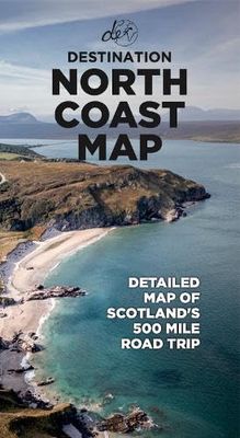
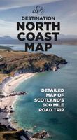
This North Coast road trip map is the essential tool that will guide you through the breathtaking landscapes, stunning coastal views, and enchanting villages of the North Coast 500 in Scotland. Designed by travel enthusiasts, for travel enthusiasts, our map is more than just a navigation tool. It's a gateway to adventure, a treasure trove of hidde...

Verkopers met dit product

Webshop
Bezorging
Prijs
DeZwerver.nl logo
DeZwerver.nl
niet bekend
13,-

Anderen bekeken ook

Reisgids Destination Atlantic Way | Destination Earth
Destination Atlantic Way Guidebook Features   In-depth, relatable, and picturesque: Destination Atlantic Way guidebook is 280 pages of the most in-depth, relatable, and picturesque guidebook on the market. It will help you to plan a road trip around Ireland's most scenic landscape, the Wild Atlantic Way, offering a guide to the best and most popular sights along the route, as well as the hidden gems that most overlook.     Must-know Details:   - Detailing campervan facility locations, the best restaurants, cafes, and bars, accommodation options across the route, from hotels to campsites, and over 110 of the best sights to see on the Wild Atlantic Way. - Produced with care: During the production of this guidebook, the authors spent two months living on the Wild Atlantic Way route, turning over every rock and leaf to ensure that all the best-hidden sights and attractions that the WAW has to offer are included. - Reliable and detailed: Maps of each region of the route, detailing the exac…
31,95
Reisgids Destination NC500 | Destination Earth
Presenting the most in-depth, relatable, and picturesque guidebook to the North Coast 500 on the market, this is Destination NC500.   Plan your trip to the northern coast of Scotland and enjoy a road trip around the most scenic landscape in the world with this relatable and reliable guidebook, detailing not only the best and most popular sights along the route but also the hidden gems that most overlook. During the production of this book, we spent two months living on the route, turning over every rock and leaf to make sure that we include all of the best-hidden sights and attractions that the NC500 has to offer
30,95
Wegenkaart - landkaart Visitors map Lake District | A-Z Map Company
Explore the whole region and area extending from Cockermouth and Penrith in the north to Ulverston and Grange-over-Sands in the south and from the M6 in the east to the coast in the west. Published at a clear 2.45 miles to 1 inch scale, this detailed visitors map of the Lake District includes primary route destinations and selected caravan and camping sites. Plus, there is detailed informative text for visitor attractions and places of interest.   There are also 12 town centre street maps of: Ambleside, Cockermouth, Coniston, Grange-over-Sands, Grasmere, Hawkshead, Kendal, Keswick, Penrith, Ulverston, Windermere and Bowness-on-Windermere. Each town centre map includes descriptive text and useful information about its visitor attractions and places of interest. Each town plan also has a separate index, while the main road map index lists towns, villages, hamlets and locations.   The 'Index to Places of Interest' lists tourist sites by feature type. For 2024, there is also now added ele…
12,50
Wegenkaart - landkaart Pocket Map Fife | Collins
Handy little full colour map of the coastal Kingdom of Fife. Detailed mapping and tourist information from Dundee in the North to Edinburgh in the south and from Fife coast in the east to Stirling in the west.   Ancestral home of Scottish monarchs, world-famous for its golf and some of Scotland's best scenic attractions, the Kingdom of Fife has a distinct identity. Discover this unique area with this handy pocket map.   Main features of this map include: • Clear mapping at a scale of 2.3 miles to 1 inch / 1.5 km to 1 cm • Main tourist attractions located and described • Ideal for touring with sights, places to stay, cafe/restaurant, golf courses, things to do all on the map • Essential travel information • Index to places of interest and place names   Essential for those planning a trip around the mighty Kingdom of Fife.
7,95
Reisgids The North Coast 500 | Rough Guides
This practical travel guide to the North Coast 500 features detailed factual travel tips and points-of-interest structured lists of all iconic must-see sights as well as some off-the-beaten-track treasures. Our itinerary suggestions and expert author picks of things to see and do will make it a perfect companion both, ahead of your trip and on the ground. This North Coast 500 guide book is packed full of details on how to get there and around, pre-departure information and top time-saving tips, including a visual list of things not to miss.   Our colour-coded maps make the North Coast 500 easier to navigate while you're there. This guide book to the North Coast 500 has been fully updated post-COVID-19 and it comes with a free eBook. The Rough Guide to the North Coast 500 covers: Inverness to the Black Isle and beyond, the road to John O'Groats, along the North Coast, exploring the Northwest and Wester Ross to Inverness.   Inside this North Coast 500 travel guide you'll find: RECOMMEND…
13,95
Wegenkaart - landkaart in your pocket North Coast Scotland NSC500 | Nicolson
The North Coast Journey In Your Pocket is the essential guide to driving the 500 miles around the Scottish Coast. The front has a full route overview map with main tourist attractions. Ten detailed routes are shown on the reverse clearly showing petrol stations, EV charging points and tourist attractions. Both sides highlight alternative routes for large vehicles and mileage pins between various points ensuring that you don't get stranded! Don't leave home without it!    Featuring:    Full 500 mile driving route overview map at 6.2 miles to the inch Ten detailed individual route maps at 3.6 miles to the inch Petrol stations, EV charging points and tourist attractions shown Alternative route for large vehicles clearly marked
7,95
Wegenkaart - landkaart North Coast Journey | Nicolson
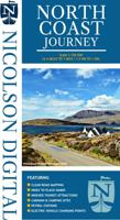
Nicolson Digital Tourist Maps are ideal for planning your visit on a circular tour round the Northern Scotland tourist route. A great map to use along with Bridget Benson’s North Coast Journey.   Our sectional map showing the popular tourist route round the North of Scotland.   Starting at Inverness, heading west through Applecross then North to Gairloch, Ullapool to Lochinver then on to Durness. Along the Northern Coastline to John O'Groats and back down the east coast to finish in Inverness   Back of the map has the index to places & attractions for each section   Featuring: Exceptionally clear road mapping Popular tourist and historical sites Alternative routes for large vehicles Electric Vehicle Charging points & Petrol Stations 1/150000 Tourist Mapping   Card cover   Cover size approx 135 mm wide x 240mm tall   Sheet size (unfolded) 1000 mm wide x 690mm tall    
12,95
Wegenkaart - landkaart 50 Miles Around London Road Map | A-Z Map Company
This A-Z 50 Miles around London map is a full colour, single sided, fold-out road map featuring continuous mapping extending from Rugby and Bury St. Edmunds to the south coast and from Oxford and Winchester to Margate and Felixstowe in the east.   Published at a clear 3.5 miles to 1 inch the following features are shown on the road mapping:   Motorways open with full junction detail, motorways under construction and proposed, service areas, primary routes and destinations, A & B roads, selected minor roads, gradients 1:5 and steeper, tolls, mileages, county boundaries, spot heights and hill shading Selected safety camera locations with maximum speed limits Selected fuel stations A wide range of ancillary and tourist information South Downs National Park boundary An index to cities, towns, villages, hamlets and locations is adjacent to the map.   Two overview maps are printed on the inside of the cover:   The London Congestion Charging Zone The Greater London Low Emission Zone
9,95
Reisgids Marco Polo ENG Dubrovnik and Dalmatian Coast | MairDumont
Handige en overzichtelijke, kleine reisgids voor een eerste kennismaking met de vakantiebestemming. Globale uitklapkaart achterin, makkelijk binnenzakformaat. Let Marco Polo Croatia Coast guide you around this beautiful coastline. Explore the Croatia Coast with this handy, pocket-sized, authoritative travel guide, packed with Insider Tips. Discover boutique hotels, authentic restaurants, the region’s trendiest places, and get tips on shopping and what to do on a limited budget.   There are also lots of ideas for travel with kids. Let Marco Polo show you all that Croatia Coast has to offer. The Croatia Coast with Dalmatia, Dubrovnik and Split is a holiday paradise, transformed by world-class hotels, elegant restaurants and a vibrant nightlife.   Let Marco Polo show you around one of the top destinations in the Adriatic. The calm, often austere beauty of the islands and bays, the crystal-clear water, the romantic settings of medieval harbour towns full of historical gems are just…
13,95
Wegenkaart - landkaart Planning Map Ireland | Lonely Planet
Durable and waterproof, with a handy slipcase and an easy-fold format, Lonely Planet's Ireland Planning Map is your essential navigation tool. This full-colour map features accompanying images   and information about top attractions, itinerary suggestions, a transport guide, themed lists and practical travel tips.         Durable and waterproof   Easy-fold format and convenient size   Handy slipcase   Full colour and easy to use   Before-you-go info   Beautiful imagery   Tailored itineraries   Can't-miss regional highlights   Detailed town index   Transport planner   Themed lists   Covers Dublin, County Wicklow, Enniskerry, Wicklow Mountains, Glendalough, County Meath, Brú na Bóinne, Cork, Ring of Kerry, Dingle, Cliffs of Moher, The Burren, Adare, Kilkenny, Rock of Cashel, Waterford City, Connemara, Galway City, Ennis, Killarney, Aran Islands, Donegal, Belfast, Causeway Coast, Derry City   Looking for more extensive coverage? Check out Lonely Planet's Ireland, our most comprehensive g…
10,95

Klanten-reviews van Wegenkaart - landkaart North Coast Road Trip Map | Destination Earth

Er zijn nog geen beoordelingen voor dit productBen jij de eerste die een review plaatst?

Meer over Wegenkaart - landkaart North Coast Road Trip Map | Destination Earth

Productomschrijving

This North Coast road trip map is the essential tool that will guide you through the breathtaking landscapes, stunning coastal views, and enchanting villages of the North Coast 500 in Scotland. Designed by travel enthusiasts, for travel enthusiasts, our map is more than just a navigation tool. It's a gateway to adventure, a treasure trove of hidden gems, and a companion that will make your journey even more extraordinary. Featuring a detailed and easy-to-read layout, this Destination NC500 Map will assist you in planning and navigating your way along the 500-mile route. With precise mile markers, highlighted attractions, and recommended stopping points, this map will ensure you don't miss a single sight along the way.   NC500 A1 Map Features:     Exact Locations: All of the exact locations of over 110+ Sights and Attractions, as well as Accommodation, Restaurants, Campervan Water and Waste Facilities, Electric Vehicle Charging Points, Train Stations, Airports, and much more! Must-know Details: Directions to over 110+ sights and attractions across the northern coast of Scotland. Know exactly how to reach each of Scotland’s ost beautiful attractions. Simple Design and Informative Layout: Plan your trip with this large and portable A1 folded map, containing all of the information that you need to know about the NC500 road trip. Produced with care: During the production of this map, the authors spent years living on the NC500 route, turning over every rock and leaf to ensure that all the best-hidden sights and attractions that the NC500 has to offer are included. FREE Electronic Version: Scan the QR code inside for the FREE electronic version of the map, making navigation easy and stress-free. Perfectly Paired with Destination NC500: Pair this detailed map with the Destination NC500 guidebook to make your North Coast 500 journey as easy as it can be.   Main Features ● Large A1 size folded down to a pocket-size for ease of use ● Campervan water and waste facility locations ● Electric Vehicle Charging Points and exact locations ● 110+ of the best sights and attractions ● Exact directions to each location ● Restaurants and cafes around the route ● Accommodation locations - Hotels, B&Bs, Campsites
Verken gerelateerde categorieën

Webshop.nl maakt gebruik van cookies. Ga je verder op onze website, ga dan akkoord met het plaatsen van cookies en de verwerking van deze data door ons en vermelde partners.