webshop.nl
Categorieën
  Sluiten

Meer Destination Earth

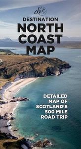
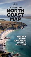
Wegenkaart - landkaart North Coast Road Trip Map | Destination Earth

0
This North Coast road trip map is the essential tool that will guide you through the breathtaking landscapes, stunning coastal views, and enchanting villages of the North Coast 500 in Scotland. Designed by travel enthusiasts, for travel enthusiasts, our map is more than just a navigation tool. It's a gateway to adventure, a treasure trove of hidden...

Webshops met dit product

Webshop
Bezorging
Prijs

Anderen bekeken ook

Wegenkaart - landkaart North Coast Road Trip Map | Destination Earth
This North Coast road trip map is the essential tool that will guide you through the breathtaking landscapes, stunning coastal views, and enchanting villages of the North Coast 500 in Scotland. Designed by travel enthusiasts, for travel enthusiasts, our map is more than just a navigation tool. It's a gateway to adventure, a treasure trove of hidden gems, and a companion that will make your journey even more extraordinary. Featuring a detailed and easy-to-read layout, this Destination NC500 Map will assist you in planning and navigating your way along the 500-mile route. With precise mile markers, highlighted attractions, and recommended stopping points, this map will ensure you don't miss a single sight along the way.   NC500 A1 Map Features:     Exact Locations: All of the exact locations of over 110+ Sights and Attractions, as well as Accommodation, Restaurants, Campervan Water and Waste Facilities, Electric Vehicle Charging Points, Train Stations, Airports, and much more! Must-know …
13,-
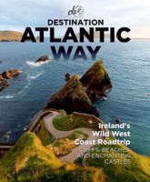
Reisgids Destination Atlantic Way | Destination Earth
Destination Atlantic Way Guidebook Features   In-depth, relatable, and picturesque: Destination Atlantic Way guidebook is 280 pages of the most in-depth, relatable, and picturesque guidebook on the market. It will help you to plan a road trip around Ireland's most scenic landscape, the Wild Atlantic Way, offering a guide to the best and most popular sights along the route, as well as the hidden gems that most overlook.     Must-know Details:   - Detailing campervan facility locations, the best restaurants, cafes, and bars, accommodation options across the route, from hotels to campsites, and over 110 of the best sights to see on the Wild Atlantic Way. - Produced with care: During the production of this guidebook, the authors spent two months living on the Wild Atlantic Way route, turning over every rock and leaf to ensure that all the best-hidden sights and attractions that the WAW has to offer are included. - Reliable and detailed: Maps of each region of the route, detailing the exact…
31,95
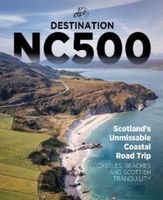
Reisgids Destination NC500 | Destination Earth
Presenting the most in-depth, relatable, and picturesque guidebook to the North Coast 500 on the market, this is Destination NC500.   Plan your trip to the northern coast of Scotland and enjoy a road trip around the most scenic landscape in the world with this relatable and reliable guidebook, detailing not only the best and most popular sights along the route but also the hidden gems that most overlook. During the production of this book, we spent two months living on the route, turning over every rock and leaf to make sure that we include all of the best-hidden sights and attractions that the NC500 has to offer
30,95
Wegenkaart - landkaart Spain Mediterranean Coast | ITMB
Een degelijke overzichtskaart van het oosten en zuiden van Spanje. Spain is one of the most popular travel destinations in Europe. The country is extremely diverse, reflecting its history. The coastal areas of the Mediterranean were probably first settled by Phoenicians, then Greeks, then Romans, and then Arabs before being brought into a united Spain at the time Columbus was seeking a sponsor to fund his proposed journey to discover new lands to the west. This map focuses on the coast from the French border south through Catalunya all the way to the Straits of Gibraltar and Cadiz. The offshore islands of Mallorca, Ibiza, and Menorca are included, as is the North African Spanish enclave of Ceuta and the British enclave of Gibraltar. All road and rail lines are shown, including the new Cadiz to Madrid fast train. By the nature of mapping, a considerable amount of the interior is on the map as well, so this map is much more than just a coastal journey through Valencia and Murcia to reach…
13,95
Wegenkaart - landkaart 3019 Adventure Map Turkey Mediterranean Coast T
Wegenkaart van de zuidelijke kust van Turkije met vermelding van veel bezienswaardigheden, nationale parken en attrakties. Watervast en scheurvast.   National Geographic's Turkey, Mediterranean Coast Adventure Map is designed to meet the unique needs of adventure travelers with its durability and accurate information. This folded map provides global travelers with the perfect combination of detail and perspective, highlighting hundreds of points of interest and the diverse and unique destinations within the country.   The front side of the Turkey Mediterranean Coast map details the southern coastal region of the country. This side shows the Mediterranean Sea to the south and Syria to the east. The coastline extends from Kas to Iskenderum. The reverse side of the map details Turkey’s western coastal region of the country and its border with Greece and Bulgaria. This side shows the western coast from the Sea of Marmara down to the Mediterranean Sea. The map includes the locations of citi…
17,50
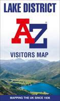
Wegenkaart - landkaart Visitors map Lake District | A-Z Map Company
Explore the whole region and area extending from Cockermouth and Penrith in the north to Ulverston and Grange-over-Sands in the south and from the M6 in the east to the coast in the west. Published at a clear 2.45 miles to 1 inch scale, this detailed visitors map of the Lake District includes primary route destinations and selected caravan and camping sites. Plus, there is detailed informative text for visitor attractions and places of interest.   There are also 12 town centre street maps of: Ambleside, Cockermouth, Coniston, Grange-over-Sands, Grasmere, Hawkshead, Kendal, Keswick, Penrith, Ulverston, Windermere and Bowness-on-Windermere. Each town centre map includes descriptive text and useful information about its visitor attractions and places of interest. Each town plan also has a separate index, while the main road map index lists towns, villages, hamlets and locations.   The 'Index to Places of Interest' lists tourist sites by feature type. For 2024, there is also now added elec…
12,50

Klanten-reviews van Wegenkaart - landkaart North Coast Road Trip Map | Destination Earth

Er zijn nog geen beoordelingen voor dit productBen jij de eerste die een review plaatst?

Meer over Wegenkaart - landkaart North Coast Road Trip Map | Destination Earth

Productomschrijving

This North Coast road trip map is the essential tool that will guide you through the breathtaking landscapes, stunning coastal views, and enchanting villages of the North Coast 500 in Scotland. Designed by travel enthusiasts, for travel enthusiasts, our map is more than just a navigation tool. It's a gateway to adventure, a treasure trove of hidden gems, and a companion that will make your journey even more extraordinary. Featuring a detailed and easy-to-read layout, this Destination NC500 Map will assist you in planning and navigating your way along the 500-mile route. With precise mile markers, highlighted attractions, and recommended stopping points, this map will ensure you don't miss a single sight along the way.   NC500 A1 Map Features:     Exact Locations: All of the exact locations of over 110+ Sights and Attractions, as well as Accommodation, Restaurants, Campervan Water and Waste Facilities, Electric Vehicle Charging Points, Train Stations, Airports, and much more! Must-know Details: Directions to over 110+ sights and attractions across the northern coast of Scotland. Know exactly how to reach each of Scotland’s ost beautiful attractions. Simple Design and Informative Layout: Plan your trip with this large and portable A1 folded map, containing all of the information that you need to know about the NC500 road trip. Produced with care: During the production of this map, the authors spent years living on the NC500 route, turning over every rock and leaf to ensure that all the best-hidden sights and attractions that the NC500 has to offer are included. FREE Electronic Version: Scan the QR code inside for the FREE electronic version of the map, making navigation easy and stress-free. Perfectly Paired with Destination NC500: Pair this detailed map with the Destination NC500 guidebook to make your North Coast 500 journey as easy as it can be.   Main Features ● Large A1 size folded down to a pocket-size for ease of use ● Campervan water and waste facility locations ● Electric Vehicle Charging Points and exact locations ● 110+ of the best sights and attractions ● Exact directions to each location ● Restaurants and cafes around the route ● Accommodation locations - Hotels, B&Bs, Campsites
Productspecificaties

Artikelnummer(s)
Brand
Destination Earth
Webshop.nl maakt gebruik van cookies. Ga je verder op onze website, ga dan akkoord met het plaatsen van cookies en de verwerking van deze data door ons en vermelde partners.