webshop.nl
Categorieën
  Sluiten

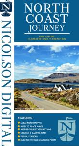
Wegenkaart - landkaart North Coast Journey | Nicolson

Nicolson Digital Tourist Maps are ideal for planning your visit on a circular tour round the Northern Scotland tourist route. A great map to use along with Bridget Benson’s North Coast Journey.   Our sectional map showing the popular tourist route round the North of Scotland.   Starting at Inverness, heading west through Applecross then North ...
12,95

Webshops met dit product

Webshop
Bezorging
Prijs

Anderen bekeken ook

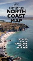
Wegenkaart - landkaart North Coast Road Trip Map | Destination Earth
This North Coast road trip map is the essential tool that will guide you through the breathtaking landscapes, stunning coastal views, and enchanting villages of the North Coast 500 in Scotland. Designed by travel enthusiasts, for travel enthusiasts, our map is more than just a navigation tool. It's a gateway to adventure, a treasure trove of hidden gems, and a companion that will make your journey even more extraordinary. Featuring a detailed and easy-to-read layout, this Destination NC500 Map will assist you in planning and navigating your way along the 500-mile route. With precise mile markers, highlighted attractions, and recommended stopping points, this map will ensure you don't miss a single sight along the way.   NC500 A1 Map Features:     Exact Locations: All of the exact locations of over 110+ Sights and Attractions, as well as Accommodation, Restaurants, Campervan Water and Waste Facilities, Electric Vehicle Charging Points, Train Stations, Airports, and much more! Must-know …
13,-
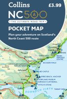
Wegenkaart - landkaart Pocket Map NC500 | Collins
Handy little full colour map of the popular North Coast 500 route. A perfect guide for travelling around Northern Scotland. Detailed mapping and tourist information ideal for any road trip.   Main features of this map include: • Clear mapping • Tourist attractions located and described • Ideal for touring with castles, museums, gardens, monuments, mountains, golf courses, walks and camping/caravan sites all on the map • Photographs of the main attractions along the route • Index to places of interest and place names   Essential for those planning a trip on the North Coast 500.
7,95
Fietskaart Cycling guides Exmoor - North Devon | Goldeneye
Scheur- en watervast foetskaart van Exmoor en Noord Devon met ingetekende fietsroutes.   Our maps are double-sided, printed on an A2 sheet with a concertina fold. This allows for easy folding and folding, and an ease of access to the mapping. The material is rain and tear-resistant. Our early maps were designed at the scale of 2 miles to 1 inch/1:126,720. The later designs along with digitalisation are 1: 100,000. We were encouraged by the Cycle Touring Club to convert our cartography toward the cycle market (to replace the out-of-print Bartholomew series). As time and the series progressed we have added more data: The National Cycle Network routes, Regional Routes, and Traffic-Free Family Routes, as and when they are developed. These routes are in addition to the Circular Routes Goldeneye Commissioned at the outset of our publishing schedule. We are also adding to new editions; bike shops, cycle hire, and tea rooms, along with the tourist attractions already featured. Our plan is to m…
12,95
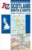
Wegenkaart - landkaart Scotland North & South | A-Z Map Company
The Great Britain Road Map series comprises of five fold-out sheet maps which together cover the whole of Great Britain. Shown at a scale of 5 miles to 1 inch, a continuous grid referencing system permits several or all of the sheets to be mounted together whilst retaining index compatibility.   This A-Z map of Scotland North and South is a full colour, double-sided, fold-out road map.   The Northern Scotland map covers the mainland of northern Scotland from Oban and Perth in the south to Cape Wrath and John o' Groats in the north, including the Isle of Skye, the Inner Hebrides and the Western Isles. The Orkney and Shetland Islands are featured in an inset map at a scale of approximately 12.5 inches to 1 mile. The Southern Scotland map covers the remainder of Scotland southwards and a large section of Northern England to include Berwick-upon-Tweed, Newcastle-upon-Tyne, Middlesbrough, York, Skipton, Fleetwood, Whitehaven and Carlisle. The Isle of Man and part of Northern Ireland are als…
10,95
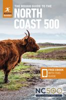
Reisgids The North Coast 500 | Rough Guides
This practical travel guide to the North Coast 500 features detailed factual travel tips and points-of-interest structured lists of all iconic must-see sights as well as some off-the-beaten-track treasures. Our itinerary suggestions and expert author picks of things to see and do will make it a perfect companion both, ahead of your trip and on the ground. This North Coast 500 guide book is packed full of details on how to get there and around, pre-departure information and top time-saving tips, including a visual list of things not to miss.   Our colour-coded maps make the North Coast 500 easier to navigate while you're there. This guide book to the North Coast 500 has been fully updated post-COVID-19 and it comes with a free eBook. The Rough Guide to the North Coast 500 covers: Inverness to the Black Isle and beyond, the road to John O'Groats, along the North Coast, exploring the Northwest and Wester Ross to Inverness.   Inside this North Coast 500 travel guide you'll find: RECOMMENDA…
13,95
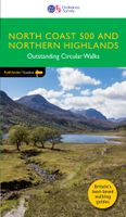
Wandelgids 83 Pathfinder Guides North Coast 500 and Northern Highlands | Ordnance Survey
Enhance your North Coast 500 tour with the only walking guidebook featuring routes based on or accessible from Scotland’s ultimate road trip. Discover Britain’s remotest sandy beaches, Scotland’s most northerly munro, some of the oldest rocks on Earth and more with 28 breathtaking walks accessed from the North Coast 500 as well as 32 unmissable stop-off-and-stroll recommendations.   Featured North Coast 500 and Northern Highlands walks include:   - Circle Loch Coulin where Beinn Eighe and Liathach are reflected in the still waters - Wander the astounding landscape of Knockan Crag, where some of the oldest rocks on Earth can be seen - Climb Ben Hope, Scotland’s most northerly munro, towering above the Flow Country - See the waterfalls and rocks walls of the Big Burn as you ascend Ben Bhraggie for views over the Dornoch Firth - Explore the landscape and history of the Applecross peninsula with sublime views of Raasay - Take a moorland and clifftop route to the vast golden sands of Sandwo…
18,50
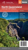
Wegenkaart - landkaart Explorer Map North Queensland | Hema Maps
Detailkaart van een deel van Australië. Zeer goed leesbaar, met naast de topografische details veel symbolen waarmee allerhande toeristische zaken worden aangeduid als campsites, nationale parken, attracties, wandelmogelijkheden etc. Covering Australia's beautiful North Queensland. There is alot of town map insets, tourist information, and photographs on the reverse side Touring map of the northern half of Queensland, with enlargements of popular areas, street plans, lists of facilities, etc. The main map extends south to well beyond the Flinders Highway between Townsville and Mount Isa, including Mackay on the coast. The map shows the road network, including minor roads and unsurfaced tracks, plus railways and local airfields/aerodromes. Designated Tourist Routes are highlighted and symbols mark places of interest (many annotated with brief description), historical sites, tourist resorts, youth hostels, etc. Topography is indicated by names of mountain ranges and peaks, as well as by …
13,95
Wegenkaart - landkaart Spain Mediterranean Coast | ITMB
Een degelijke overzichtskaart van het oosten en zuiden van Spanje. Spain is one of the most popular travel destinations in Europe. The country is extremely diverse, reflecting its history. The coastal areas of the Mediterranean were probably first settled by Phoenicians, then Greeks, then Romans, and then Arabs before being brought into a united Spain at the time Columbus was seeking a sponsor to fund his proposed journey to discover new lands to the west. This map focuses on the coast from the French border south through Catalunya all the way to the Straits of Gibraltar and Cadiz. The offshore islands of Mallorca, Ibiza, and Menorca are included, as is the North African Spanish enclave of Ceuta and the British enclave of Gibraltar. All road and rail lines are shown, including the new Cadiz to Madrid fast train. By the nature of mapping, a considerable amount of the interior is on the map as well, so this map is much more than just a coastal journey through Valencia and Murcia to reach…
13,95
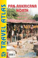
Wegenkaart - landkaart - Wegenatlas Pan-Americana North | ITMB
Wegenatlas - A5 formaat - verschillende schalen - voor de het Noord-Amerikaanse gedeelte van de Pan-Americana ( Pan-American Highway ) van Alaska langs the Pacific kust van British Colombia in Canada, de staten Washington, Oregon en Californie, Mexico, Guatemala tot Panama.   The Pan-American Highway was created by the USA to improve road communications within the Western Hemisphere post-WW2. The highway started at the Mexican border and eventually reached somewhere south of Santiago in Chile. It was a vote-buying gimmick by the Americans to fund allies, but it also created an essential 'spine' road through Central America to the Darien Gap and along the west coast of South America to the then-limits of Chile. Driving the Pan-Am has become a travel experience. More recently, the improvement in more northerly highways, such as the Dalton Highway from Fairbanks to Prudhoe Bay in Alaska, the paving of most of the Stewart Highway through British Columbia, and the tremendous improvement in …
16,50
Wandelatlas 2 Adventure Atlas South West Coast Path North Cornwall | A-Z Map Company
AZ heeft de meest gedetailleerde wandelkaarten van delen van het South West Coast Path  gebundeld in een atlasje. Daardoor is het heel handig qua formaat. De kaarten zelf zijn perfect voor het wandelen. Schaal 1:25.000 The perfect companion for those who love the great outdoors, the A-Z Adventure Series features OS 1:25000 scale mapping in a convenient book, complete with index.   The South West Coast Path is a National Trail along the Somerset, Devon, Cornwall and Dorset coasts. This stunning walk from Minehead, Somerset covers 630 miles to South Haven Point in Poole Harbour, passing through two World Heritage Sites (the Jurassic Coast and the Cornwall and West Devon Mining Landscape), Exmoor National Park, Land's End and many areas of outstanding natural beauty.   A series of five A-Z Adventure Atlases together cover the South West Coast Path:   SW Coast Path North Devon and Somerset SW Coast Path North Cornwall SW Coast Path South Cornwall SW Coast Path South Devon SW Coast Path Dor…
12,95

Klanten-reviews van Wegenkaart - landkaart North Coast Journey | Nicolson

Er zijn nog geen beoordelingen voor dit productBen jij de eerste die een review plaatst?

Meer over Wegenkaart - landkaart North Coast Journey | Nicolson

Productomschrijving

Nicolson Digital Tourist Maps are ideal for planning your visit on a circular tour round the Northern Scotland tourist route. A great map to use along with Bridget Benson’s North Coast Journey.   Our sectional map showing the popular tourist route round the North of Scotland.   Starting at Inverness, heading west through Applecross then North to Gairloch, Ullapool to Lochinver then on to Durness. Along the Northern Coastline to John O'Groats and back down the east coast to finish in Inverness   Back of the map has the index to places & attractions for each section   Featuring: Exceptionally clear road mapping Popular tourist and historical sites Alternative routes for large vehicles Electric Vehicle Charging points & Petrol Stations 1/150000 Tourist Mapping   Card cover   Cover size approx 135 mm wide x 240mm tall   Sheet size (unfolded) 1000 mm wide x 690mm tall    

Verken gerelateerde categorieën

Webshop.nl maakt gebruik van cookies. Ga je verder op onze website, ga dan akkoord met het plaatsen van cookies en de verwerking van deze data door ons en vermelde partners.