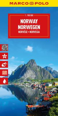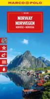
Wegenkaart - landkaart Noorwegen - Norge - Norway | Marco Polo

0
Uitstekende kaart van Noorwegen . Met informatie als benzinepompen, kilometerafstanden, toeristische symbolen. Met index en enkele stadsplattegronden.   De kaart dekt ook Zweden, Denemarken en een klein gedeelte van noord Duitsland en Finland   This Marco Polo map of Norway features really easy to read cartography. Topography is highlighted with r...

Verkopers met dit product

Verkoper
Bezorging
Prijs
DeZwerver.nl logo
DeZwerver.nl
2,95
14,95

Anderen bekeken ook

Wegenkaart - landkaart Noorwegen - Norge - Norway | Marco Polo
Uitstekende kaart van Noorwegen . Met informatie als benzinepompen, kilometerafstanden, toeristische symbolen. Met index en enkele stadsplattegronden.   De kaart dekt ook Zweden, Denemarken en een klein gedeelte van noord Duitsland en Finland   This Marco Polo map of Norway features really easy to read cartography. Topography is highlighted with relief shading and loads of spot heights and the road network is clearly shown with roads ranging from motorways all the way through to minor secondary roads. The map also clearly indicates airports, places of interest, scenic/tourist routes, view points etc.   The map includes a booklet attached to the cover that contains some useful information and a very extensive index that covers locations, places of interest and geographical features. Also included are a distance/driving time chart, a fold out flap on the cover with an overview map of the region covered and 6 reasonably detailed enlargements showing the major cities in the region.   A un…
14,95
Wegenkaart - landkaart Norway - Noorwegen | ITMB
Norway is one of the most popular countries for visitors in Europe. We spent an interesting time researching this map in Norway, travelling all the way north to Nordkapp, a trip that took a week. We were actually on a cruise ship for much of the travel time. We also discovered a bookstore in Narvik that sells travel maps and obtained valuable research material there. Norway, as a country, is one of the prime travel destinations in the world – lots of wide open spaces, all the mod-cons, and fantastic scenery. Obviously, Nordkapp is a huge attraction, being the most northerly part of Europe one can access, but Norway has lots of other attractions. Roads in Norway tend to be of a very good quality, but are mostly two-laned and winding. There are coastal ferries joining isolated communities from south to north, and lots of ferries for car crossings of fiords. We took a local ferry from Alesund into the interior of Stor Fiord. It took all day to make the trip, but it was a great experience…
14,95
Wegenkaart - landkaart 3301 Adventure Map Southern Sweden & Norway | Zuid Zweden en Noorwegen | National Geographic
Wegenkaart van Zuid Zweden en Noorewegen met vermelding van veel bezienswaardigheden, nationale parken en attrakties. Watervast en scheurvast. Juist door deze vermeldingen onderscheidt de kaart zich van andere wegenkaarten. National Geographic's Southern Sweden and Norway Adventure Map is designed to meet the unique needs of adventure travelers—detailed, durable, and accurate. Southern Sweden and Norway includes the locations of thousands of cities and towns with an index for easily locating them, plus a clearly marked road network complete with distances and designations for expressways, motorways, and more. Transportation within and beyond the country is made easier with the locations of airports, airfields, railroads, ferry routes, lighthouses, harbors, and international border checkpoints. What sets National Geographic Adventure Maps apart from traditional road maps are the hundreds of points of interest that highlight the diverse and unique destinations within Southern Sweden and…
17,50
Reisgids Norway - Noorwegen | Rough Guides
Zeer goede reisgids voor zowel de georganiseerde maar vooral voor de zelfstandige reiziger. Boordevol informatie over reizen, slapen, eten, maar ook musea en cultuur. Voor Europese landen en steden meestal completer en beter dan de Lonely Planet ! Practical travel guide to Norway with a free eBook featuring points-of-interest structured lists of all sights and off-the-beaten-track treasures, with detailed colour-coded maps, practical details about what to see and to do in Norway, how to get there and around, pre-departure information, as well as top time-saving tips, like a visual list of things not to miss in Norway, expert author picks and itineraries to help you plan your trip.   The Rough Guide to Norway covers: Oslo, Oslofjord, Geirangerfjord, Bergen, Trondheim, Stavanger, Tromsø, Balestrand, Lofthus, Loen, Fla°m, Ulvik, Mundal, A°lesund, Arendal, Mandal, Fla°m   Inside this travel guide you'll find:   RECOMMENDATIONS FOR EVERY TYPE OF TRAVELLER Experiences selected for every kin…
23,95
Wegenkaart - landkaart Noorwegen - Norwegen | Kümmerly & Frey
For everyone who travels around Europe frequently and needs or wants to plan his/her route in advance we recommend the Kummerly and Frey 1:750 000 road map series. These maps provide a quick overview of the travel route, indicate distances and offer information on road classes as well as being reliable travelling companions. Large, indexed map of Norway, presenting the whole country in two panels side by side.  Clear, well-presented cartography has fine relief shading and spot heights to indicate the topography, with national parks prominently marked. Detailed presentation of the road network includes scenic routes, roads closed to traffic, seasonal closures of mountain passes, etc. Towns and places of particular interest are highlighted.
14,95
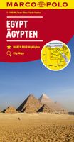
Wegenkaart - landkaart Egypt - Egypte | Marco Polo
Duidelijke wegenkaart van Marco Polo: alle wegen, zowel de verharde als belangrijke onverharde wegen zijn weergegeven.  Mooie toeristisch interessante wegen die de moeite waard zijn, zijn groen gearceerd. Veel toeristische informatie is toegevoegd zoals de nationale parken, campings, kastelen en vliegvelden. Afstanden tussen belangrijke steden en benzinestations staan ook op de kaart. Een plaatsnamenregister ontbreekt niet. This Marco Polo map of Egypt features really easy to read cartography. Topography is highlighted with relief shading and loads of spot heights and the road network is clearly shown with roads ranging from motorways all the way through to minor secondary roads. The map also clearly indicates airports, places of interest, scenic/tourist routes, view points etc.   The map includes a booklet attached to the cover that contains some useful information and a very extensive index that covers locations, places of interest and geographical features. Also included are a dist…
14,95
Wegenkaart - landkaart Portugal | Marco Polo
Duidelijke wegenkaart van Marco Polo: alle wegen, zowel de verharde als belangrijke onverharde wegen zijn weergegeven.  Mooie toeristisch interessante wegen die de moeite waard zijn, zijn groen gearceerd. Veel toeristische informatie is toegevoegd zoals de nationale parken, campings, kastelen en vliegvelden. Afstanden tussen belangrijke steden en benzinestations staan ook op de kaart. Een plaatsnamenregister ontbreekt niet.   ---   This Marco Polo map features really easy to read cartography. Topography is highlighted with relief shading and loads of spot heights and the road network is clearly shown with roads ranging from motorways all the way through to minor secondary roads. The map also clearly indicates airports, places of interest, scenic/tourist routes, view points etc.   The map includes a booklet attached to the cover that contains some useful information and a very extensive index that covers locations, places of interest and geographical features. Also included are a dista…
14,95
Wegenkaart - landkaart India | Marco Polo
Duidelijke wegenkaart van Marco Polo: alle wegen, zowel de verharde als belangrijke onverharde wegen zijn weergegeven.  Mooie toeristisch interessante wegen die de moeite waard zijn, zijn groen gearceerd. Veel toeristische informatie is toegevoegd zoals de nationale parken, campings, kastelen en vliegvelden. Afstanden tussen belangrijke steden en benzinestations staan ook op de kaart. Een plaatsnamenregister ontbreekt niet.   ---   This Marco Polo map features really easy to read cartography. Topography is highlighted with relief shading and loads of spot heights and the road network is clearly shown with roads ranging from motorways all the way through to minor secondary roads. The map also clearly indicates airports, places of interest, scenic/tourist routes, view points etc.   The map includes a booklet attached to the cover that contains some useful information and a very extensive index that covers locations, places of interest and geographical features. Also included are a dista…
14,95
Wegenkaart - landkaart Montenegro | Marco Polo
Duidelijke wegenkaart van Marco Polo: alle wegen, zowel de verharde als belangrijke onverharde wegen zijn weergegeven.  Mooie toeristisch interessante wegen die de moeite waard zijn, zijn groen gearceerd. Veel toeristische informatie is toegevoegd zoals de nationale parken, campings, kastelen en vliegvelden. Afstanden tussen belangrijke steden en benzinestations staan ook op de kaart. Een plaatsnamenregister ontbreekt niet.   ---   This Marco Polo map features really easy to read cartography. Topography is highlighted with relief shading and loads of spot heights and the road network is clearly shown with roads ranging from motorways all the way through to minor secondary roads. The map also clearly indicates airports, places of interest, scenic/tourist routes, view points etc.   The map includes a booklet attached to the cover that contains some useful information and a very extensive index that covers locations, places of interest and geographical features. Also included are a dista…
14,95
Wegenkaart - landkaart Denmark - Denemarken | Marco Polo
Duidelijke wegenkaart van Marco Polo: alle wegen, zowel de verharde als belangrijke onverharde wegen zijn weergegeven.  Mooie toeristisch interessante wegen die de moeite waard zijn, zijn groen gearceerd. Veel toeristische informatie is toegevoegd zoals de nationale parken, campings, kastelen en vliegvelden. Afstanden tussen belangrijke steden en benzinestations staan ook op de kaart. Een plaatsnamenregister ontbreekt niet.   ---   This Marco Polo map features really easy to read cartography. Topography is highlighted with relief shading and loads of spot heights and the road network is clearly shown with roads ranging from motorways all the way through to minor secondary roads. The map also clearly indicates airports, places of interest, scenic/tourist routes, view points etc.   The map includes a booklet attached to the cover that contains some useful information and a very extensive index that covers locations, places of interest and geographical features. Also included are a dista…
14,95

Klanten-reviews van Wegenkaart - landkaart Noorwegen - Norge - Norway | Marco Polo

Er zijn nog geen beoordelingen voor dit productBen jij de eerste die een review plaatst?

Meer over Wegenkaart - landkaart Noorwegen - Norge - Norway | Marco Polo

Productomschrijving

Uitstekende kaart van Noorwegen . Met informatie als benzinepompen, kilometerafstanden, toeristische symbolen. Met index en enkele stadsplattegronden.   De kaart dekt ook Zweden, Denemarken en een klein gedeelte van noord Duitsland en Finland   This Marco Polo map of Norway features really easy to read cartography. Topography is highlighted with relief shading and loads of spot heights and the road network is clearly shown with roads ranging from motorways all the way through to minor secondary roads. The map also clearly indicates airports, places of interest, scenic/tourist routes, view points etc.   The map includes a booklet attached to the cover that contains some useful information and a very extensive index that covers locations, places of interest and geographical features. Also included are a distance/driving time chart, a fold out flap on the cover with an overview map of the region covered and 6 reasonably detailed enlargements showing the major cities in the region.   A unique feature of the Marco Polo maps is "mark it" stickers, a set of seven reusable stickers (ie they don't damage the map when removed and placed elsewhere) that can be used to highlight interesting places, the route you plan to take (to make navigation easier), or whatever you want really.   The legend is in a multitude of languages including English.

Productinformatie

    Verken gerelateerde categorieën

    Webshop.nl maakt gebruik van cookies. Ga je verder op onze website, ga dan akkoord met het plaatsen van cookies en de verwerking van deze data door ons en vermelde partners.