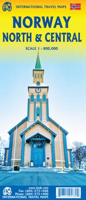
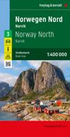
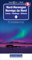
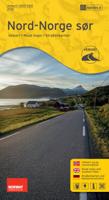
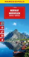
Wegenkaart - landkaart Noorwegen Noord & Midden | ITMB

0

Verkopers met dit product

Verkoper
Bezorging
Prijs
DeZwerver.nl logo
DeZwerver.nl
2,95
14,50

Anderen bekeken ook

Wegenkaart - landkaart Norway - Noorwegen | ITMB
Norway is one of the most popular countries for visitors in Europe. We spent an interesting time researching this map in Norway, travelling all the way north to Nordkapp, a trip that took a week. We were actually on a cruise ship for much of the travel time. We also discovered a bookstore in Narvik that sells travel maps and obtained valuable research material there. Norway, as a country, is one of the prime travel destinations in the world – lots of wide open spaces, all the mod-cons, and fantastic scenery. Obviously, Nordkapp is a huge attraction, being the most northerly part of Europe one can access, but Norway has lots of other attractions. Roads in Norway tend to be of a very good quality, but are mostly two-laned and winding. There are coastal ferries joining isolated communities from south to north, and lots of ferries for car crossings of fiords. We took a local ferry from Alesund into the interior of Stor Fiord. It took all day to make the trip, but it was a great experience…
14,95
Nieuw
Wegenkaart - landkaart Thailand North - noord | ITMB
Een degelijke wegenkaart met aanduidingen van o.a. nationale parken, vliegveld, benzinepomp, dirt-roads. Als overzichtskaart goed te gebruiken.   The map actually goes from Bangkok north, and side one includes a very good inset map of Bangkok’s central area. Probably the most interesting spot on this side is the town of Kanchanaburi, which is within easy striking distance of Bangkok. This was the site made famous by the war movie Bridge on the River Kwai (now Khwae) on the Japanese-built Burma Railway. The current bridge is not the original, but the Commonwealth Graves Cemetery is well worth a visit. The other side concentrates on the wilder portion of Thailand, the far north. All known points of interest have been included, including a lovely inset map of Chiang Mai, the focal point of the north. The rail line ends here, but if the city’s many temples and pagodas don’t overwhelm you, tours to nearby temple sites abound. The temple complex near Phrae, further to the east, are also sho…
13,95
Wegenkaart - landkaart Africa North - Noord Afrika | ITMB
Een degelijke wegenkaart met aanduidingen van o.a. nationale parken, vliegveld, benzinepomp, dirt-roads. Als overzichtskaart goed te gebruiken. ITMB continues to refine its data base for Africa and introduce new titles that we hope meet market expectations. This map is one of the first of our enhanced scale maps that will gradually become the norm for regional maps of parts of the African continent. This map is also unique in that it does what I do not believe has been attempted before by any publisher - portraying the entire Mediterranean coastline from Morocco to the eastern edge of Egypt in one double-sided map. I admit, current political realities make this map somewhat challenging. One cannot cross, for example, between Morocco and Algeria, and Libya is in such a state of disarray at the moment that it is not practical to visit the country. However, the strength of this title is that it breaks new ground and looks at the countries north of Sahara as a comprehensive entity in grea…
13,95
Wegenkaart - landkaart Midden Amerika - Central America | ITMB
Een degelijke kaart met aanduidingen van o.a. nationale parken, vliegveld, benzinepomp, dirt-roads. Als overzichtskaart goed te gebruiken. Met Belize, Guatemala, Honduras, El Salvador, Nicaragua, Costa Rica en Panama. Folded color road and travel map. Scale 1:1,100,000. Distinguishes roads ranging from highways (paved/unpaved) to seasonal tracks. Legend includes swamps, glaciers, reefs, active volcanoes, railways, ferry routes, protected areas/national parks, international airports, domestic airports with scheduled services, landing grounds, points of interest, ruins, lighthouses, mines, beaches, gas stations, border crossing points. Includes inset map of Panama Canal Area, Isla del Coco. Extensive index, general information on the listed countries.  
13,95

Klanten-reviews van Wegenkaart - landkaart Noorwegen Noord & Midden | ITMB

Er zijn nog geen beoordelingen voor dit productBen jij de eerste die een review plaatst?

Meer over Wegenkaart - landkaart Noorwegen Noord & Midden | ITMB

Verken gerelateerde categorieën

Webshop.nl maakt gebruik van cookies. Ga je verder op onze website, ga dan akkoord met het plaatsen van cookies en de verwerking van deze data door ons en vermelde partners.