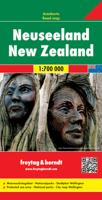
Wegenkaart - landkaart Nieuw Zeeland - New Zealand | Freytag & Berndt

0
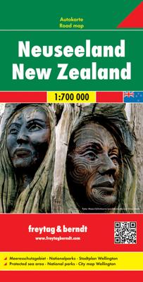
Gedetailleerde, tweezijdige landkaart van Nieuw Zeeland, prima geschikt voor planning en rondtrekken. De berijdbare wegen zijn goed weergeven, zowel de hoofdwegen als provinciale en lokale wegen; wegnummers worden vermeld. Afstanden tussen plaatsen zijn in kilometers op de kaart ingetekend, daarnaast worden ook op belangrijke plekken benzinepompen...

Verkopers met dit product

Verkoper
Bezorging
Prijs
DeZwerver.nl logo
DeZwerver.nl
2,95
14,95

Anderen bekeken ook

Wegenkaart - landkaart Nieuw Zeeland - New Zealand | Freytag & Berndt
Gedetailleerde, tweezijdige landkaart van Nieuw Zeeland, prima geschikt voor planning en rondtrekken. De berijdbare wegen zijn goed weergeven, zowel de hoofdwegen als provinciale en lokale wegen; wegnummers worden vermeld. Afstanden tussen plaatsen zijn in kilometers op de kaart ingetekend, daarnaast worden ook op belangrijke plekken benzinepompen gemarkeerd. In het kaartbeeld wordt door middel van schaduw het reliëf weergegeven en soms enkele punten in het landschap met de daadwerkelijke hoogte. Provinciegrenzen zijn goed terug te vinden, nationale parken en reservaten ook. Met allerhande symbolen worden toeristische bezienswaardigheden weergegeven als monumenten, historisch belangrijke plekken, uitzichtpunten, hotels en campings. Ook luchthavens, treinverbindingen en havens vindt u er op!   Explore New Zealand with this Freytag & Berndt map. The best way to plan your trip, prepare your itinerary, and to travel independently in this country. As with all Freytag & Berndt maps the car…
14,95
Wegenkaart - landkaart Nieuw Zeeland - New Zealand | Reise Know-How Verlag
Tweetalige kaart (Engels en Duits). Door ingetekende lengte- en breedtegraden is het gebruik van GPS mogelijk. Met hoogtelijnen en uitgebreid wegennetwerk: daarnaast worden ook de afstanden tussen belangrijke plaatsen duidelijk leesbaar weergegeven. Het kleurgebruik is zodanig dat je een goede indruk krijgt van hoogteverschillen en soorten landschap. Natuurlijk staan de toeristische bezienswaardigheden duidelijk vermeld.   Gedrukt op water- en scheurvast papier! Polyart is een synthetisch product vrij van giftige stoffen dus duurzaam. Het papier gaat echt lang mee.   Topography is indicated by altitude colouring with numerous spot heights and names of mountain ranges and passes. Salt lakes, swamps, seasonal rivers and glacier are also shown. Detailed presentation of the road network includes minor roads and tracks and railways are also shown.   Internal administrative units are presented with their boundaries and names. National parks and other protected areas are highlighted. A wide …
11,50
Wegenkaart - landkaart Nieuw Zeeland - New Zealand - Aotearoa | Hema Maps
Folded, indexed road and tourist map of New Zealand, showing all major and many minor roads, cities, and towns in detail. Map shows highways, road numbers, distance chart, railways, scenic routes, places of particular interest, places of scenic beauty, national parks, and political boundaries. Reverse of map shows city insets of Auckland, Wellington, Christchurch, Rotorua, Dunedin, and Queenstown. Legend is in English. Heldere goed leesbare kaart van de kaartenmaker van Nieuw Zeeland: de HEMA maps.
17,50
Wegenkaart - landkaart 790 New Zealand - Nieuw Zeeland | Michelin
Zoals je van Michelin mag verwachten is deze kaart zeer overzichtelijk en heeft een duidelijk helder kaartbeeld. De kaart geeft uitgebreide toeristische informatie weer. De perfecte overzichtskaart!   This New Zealand map from Michelin is part of their red national map series. These are perfect for route planning as well as getting around by car once you're there. They clearly mark out major roads and also show many of the more important minor roads.    The map's simple folding design with durable paper cover, allows it to be read like a book and easily folded back together. Road numbers and intermediate distances are clearly displayed with the more scenic routes highlighted in green.   The map also features:   Political boundaries Regional and National Parks Important sights (points of interest, historic sites, etc.) Driving Times and Distances Road Safety Information A legend in multiple languages (Dutch, English, French, German and Spanish) Michelin New Zealand Map 790 is a new add…
12,95
Wegenkaart - landkaart 3500 Adventure Map New Zealand - Nieuw Zeeland | National Geographic
Wegenkaart van Nieuw Zeeland met vermelding van veel bezienswaardigheden, nationale parken en attrakties. Watervast en scheurvast. Juist door deze vermeldingen onderscheidt de kaart zich van andere wegenkaarten. National Geographic's New Zealand Adventure Map is designed to meet the unique needs of adventure travelers—detailed, durable, and accurate. The map includes the locations of thousands of major cities and towns with an index for easily locating them, plus a clearly marked road network complete with distances and designations for major highways, toll roads, limited access highways and more.   What sets National Geographic Adventure Maps apart from traditional road maps are the hundreds of points-of-interest that highlight the diverse, unique, and exotic destinations within New Zealand including National Parks and Preserves, World Heritage Sites, Archeological sites, ski areas, beaches, golf courses, camping areas, waterfalls, natural points of interest and important travel aids…
17,50
Reisgids New Zealand - Nieuw Zeeland | Rough Guides
Zeer goede reisgids voor zowel de georganiseerde maar vooral voor de zelfstandige reiziger. Boordevol informatie over reizen, slapen, eten, maar ook musea en cultuur. Voor veel landen meestal completer en beter dan de Lonely Planet ! This practical travel guide to New Zealand features detailed factual travel tips and points-of-interest structured lists of all iconic must-see sights as well as some off-the-beaten-track treasures. Our itinerary suggestions and expert author picks of things to see and do will make it a perfect companion both, ahead of your trip and on the ground. This New Zealand guide book is packed full of details on how to get there and around, pre-departure information and top time-saving tips, including a visual list of things not to miss. Our colour-coded maps make New Zealand easier to navigate while you're there. This guide book to New Zealand has been fully updated post-COVID-19 and it comes with a free eBook.   The Rough Guide to New Zealand covers: Auckland…
27,95
Wegenkaart - landkaart Nieuw Zeeland - New Zealand | Marco Polo
Duidelijke wegenkaart van Marco Polo: alle wegen, zowel de verharde als belangrijke onverharde wegen zijn weergegeven.  Mooie toeristisch interessante wegen die de moeite waard zijn, zijn groen gearceerd. Veel toeristische informatie is toegevoegd zoals de nationale parken, campings, kastelen en vliegvelden. Afstanden tussen belangrijke steden en benzinestations staan ook op de kaart. Een plaatsnamenregister ontbreekt niet.   Entdecken Sie mit dieser MARCO POLO Karte das Land der Gegensätze . . . Die Karten bestechen durch eine leicht lesbare, neue Kartografie, in der durchgängig landschaftlich schöne Strecken und Orte markiert sind. Schon in der im Kartendeckel befindlichen, ausklappbaren Übersichtskarte sind die schönsten Orte mit Highlightsternen gekennzeichnet und gelben oder grünen Markierungen unterlegt, um unterwegs auch wirklich nichts zu verpassen. Wo alle Orte auf der Karte zu finden sind, ist im Registerheft nachzuschlagen.   Sprachen: Deutsch, Englisch, Französisch, Itali…
14,95
Wandkaart New Zealand - Nieuw Zeeland 60 x 77 cm | National Geographic
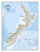
Mooie heldere wandkaart van Nieuw Zeeland met het Noordereiland en Zuidereiland op dezelfde kant afgebeeld. Veel plaatsnamen, goed kleurgebruik waardoor hoogteverschillen en bijvoorbeeld nationale parken goed zichtbaar zijn.   The reference map of New Zealand uses National Geographic's signature Classic style with blue ocean and stunning shaded relief. The map shows this island nation in great detail, from the subtropical North Island (Te Ika-a-Maui) to the glacial carved valleys of Fiordland on the South Island (Te Waipounamu). The North Island is best known for large volcanic lakes and the cities of Auckland and Wellington. The South Island is famous for the Southern Alps that run along the spine of the island. The highest point in the country is Aoraki (Mount Cook) and is found in the Southern Alps.   The first settlers of New Zealand were the Maori from Polynesia, the names on the map reflect this history with both English and Maori variants. The map also features a transportation…
31,95
Wandelgids Best Day Walks New Zealand - Nieuw Zeeland | Lonely Planet
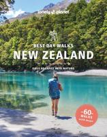
Lonely Planet heeft een nieuwe serie uitgebracht: Best Day Walks in verschillende landen. Het zijn de - door Lonely Planet uitgekozen - mooiste wandelingen verspreid over het land. Goed beschreven, met een schetsmatige kaart erbij ... het werkt heel stimulerend met mooie foto's! Lonely Planet's Best Day Walks New Zealand is your passport to 60 easy escapes into nature. Stretch your legs outside the city by picking a hike that works for you, from a few hours to a full day, from easy to hard. Climb ancient volcanoes, view amazing vistas, and scale tall mountains. Get to the heart of New Zealand and begin your journey now!       Inside Lonely Planet's Best Day Walks New Zealand Travel Guide:   Up-to-date information - all businesses were rechecked before publication to ensure they are still open after 2020’s COVID-19 outbreak   Colour maps and images throughout   Special features - on New Zealand's highlights for walkers, kid-friendly walks, accessible trails and what to take   Best for……
22,50
Wegenkaart - landkaart Planning Map New Zealand - Nieuw Zeeland | Lonely Planet
Lonely Planet New Zealand Planning Map Plan je droomreis naar Nieuw-Zeeland met de Lonely Planet New Zealand Planning Map – een onmisbare kaart om de mooiste bestemmingen van dit fascinerende land te ontdekken. Van de Marlborough Wine Region tot de fjorden van Fiordland, van Auckland tot Queenstown: deze waterdichte en duurzame kaart helpt je bij het uitstippelen van routes en het vinden van de belangrijkste highlights. Voordelen Waterdicht en duurzaam – in handig, opvouwbaar formaat met beschermhoes Volledige Nieuw-Zeeland kaart in kleur met duidelijk alfanumeriek grid Transportplanner met gemiddelde reistijden – ideaal voor routeplanning Top picks: beste natuurparken, stranden, wijnregio’s, Maori-cultuur en adventure-activiteiten Inclusief reistips, Maori-woorden en -zinnen, evenementeninfo en praktische highlights Met prachtige fotografie ter inspiratie Aandachtspunten Engelstalige uitgave – geen Nederlandse vertaling aanwezig Geen gedetailleerde wandel- of t…
10,95

Klanten-reviews van Wegenkaart - landkaart Nieuw Zeeland - New Zealand | Freytag & Berndt

Er zijn nog geen beoordelingen voor dit productBen jij de eerste die een review plaatst?

Meer over Wegenkaart - landkaart Nieuw Zeeland - New Zealand | Freytag & Berndt

Productomschrijving

Gedetailleerde, tweezijdige landkaart van Nieuw Zeeland, prima geschikt voor planning en rondtrekken. De berijdbare wegen zijn goed weergeven, zowel de hoofdwegen als provinciale en lokale wegen; wegnummers worden vermeld. Afstanden tussen plaatsen zijn in kilometers op de kaart ingetekend, daarnaast worden ook op belangrijke plekken benzinepompen gemarkeerd.

In het kaartbeeld wordt door middel van schaduw het reliëf weergegeven en soms enkele punten in het landschap met de daadwerkelijke hoogte. Provinciegrenzen zijn goed terug te vinden, nationale parken en reservaten ook. Met allerhande symbolen worden toeristische bezienswaardigheden weergegeven als monumenten, historisch belangrijke plekken, uitzichtpunten, hotels en campings. Ook luchthavens, treinverbindingen en havens vindt u er op!   Explore New Zealand with this Freytag & Berndt map. The best way to plan your trip, prepare your itinerary, and to travel independently in this country. As with all Freytag & Berndt maps the cartography is clear and detailed with the topography shown by relief shading with plenty of spot heights.   This map includes detailed land information on New Zealand and includes a few insets of surrounding islands, including Chatham Island and Auckland Island.    Freytag & Berndt maps make good use of an icon system. Icons show tourist information such as:   Diving sites and surf areas Ski resorts Museums and other places of interest Nature reserves and lakes and river systems Camping sites and hiking trails   Distances between points are shown as well as indications of steep gradients, all distances are in kilometres. The legend is in several languages including English.


Productinformatie

    Verken gerelateerde categorieën

    Webshop.nl maakt gebruik van cookies. Ga je verder op onze website, ga dan akkoord met het plaatsen van cookies en de verwerking van deze data door ons en vermelde partners.