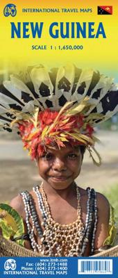
Wegenkaart - landkaart Nieuw-Guinea | ITMB

0

Verkopers met dit product

Verkoper
Bezorging
Prijs
DeZwerver.nl logo
DeZwerver.nl
2,95
13,95

Anderen bekeken ook

Wegenkaart - landkaart New Zealand - Nieuw Zeeland | ITMB
Een degelijke kaart met aanduidingen van o.a. nationale parken, vliegveld, benzinepomp, dirt-roads en kleine plattegrond van hoofdstad. Als overzichtskaart goed te gebruiken.   Legend Includes: Roads by classification, Points of Interest, Airports, Churches, Campsites, Caravan Sites, Caves, Lighthouses, Beaches, Fishing Spots, Surfing Spots, Ski Areas, Ho Springs, Museums, Golf Courses, Waterfalls, Mine, Harbours, Viewpoints, Sailing Spots, Scuba Diving Spots, Shipwrecks, National Parks, Lakes, Swamps, Glaciers, and much more.  
13,95
Wegenkaart - landkaart Auckland & North Island - Nieuw Zeeland | ITMB
Scale 1:12,500/1:950,000, This new ITMB map should really be called Auckland, Wellington, Christchurch and the North Island of New Zealand, but that’s too long a title. However, in addition to Auckland, the cities of Wellington and Christchurch are included on one side of the map (NZ urban areas don’t tend to be huge). The other side is a very detailed map of North Island, the main island of the country. This map will be perfect for both finding one’s way around Auckland’s waterfront and for exploring the highways and byways, communing with woolies; printed double-sided on paper
13,95
Wegenkaart - landkaart Papua New Guinea - Papua Nieuw Guinea - West Papua - Molukken | Reise Know-How Verlag
Tweetalige kaart (Engels en Duits). Door ingetekende lengte- en breedtegraden is het gebruik van GPS mogelijk. Met hoogtelijnen en uitgebreid wegennetwerk: daarnaast worden ook de afstanden tussen belangrijke plaatsen duidelijk leesbaar weergegeven. Het kleurgebruik is zodanig dat je een goede indruk krijgt van hoogteverschillen en soorten landschap. Natuurlijk staan de toeristische bezienswaardigheden duidelijk vermeld.    Gedrukt op water- en scheurvast papier! Polyart is een synthetisch product vrij van giftige stoffen dus duurzaam. Het papier gaat echt lang mee.   Topography is indicated by altitude colouring with numerous spot heights and names of mountain ranges and passes. Salt lakes, swamps, seasonal rivers and glacier are also shown. Detailed presentation of the road network includes minor roads and tracks and railways are also shown.   Internal administrative units are presented with their boundaries and names. National parks and other protected areas are highlighted. A wide…
11,50
Wegenkaart - landkaart Gibraltar | ITMB
We are always pleased to announce the release of a new title. The Straits of Gibraltar, as this map should be named is historically significant as the crossing point between Europe and North Africa and, more recently, as the guardian of the Mediterranean. It is now moving into a new era – tourism. The city/colony of Gibraltar itself is well worth a visit, and a detailed map is provided. The Spanish city/colony on the North African coast is equally interesting and is also shown, as is Tangier and a good stretch of the Moroccan north coast. This map is printed single-sided, on paper.
13,95
Wegenkaart - landkaart Peru | ITMB
Een degelijke kaart met aanduidingen van o.a. nationale parken, vliegveld, dirt-roads en kleine plattegrond van hoofdstad. Als overzichtskaart goed te gebruiken. Peru at 1:1,500,000 on a double-sided, waterproof and tear-resistant, indexed map from ITMB, with large, clear street plans of central Lima and Cusco, highlighting accommodation, places of interest and various facilities. The map divides the country north/south, approximately along the line between the Cordillera Blanca and Cordillera Huyahuash, with very little overlap between the two sides. Topography is very effectively presented by altitude colouring, with spot heights and additional graphics for swamps and marshland, glaciers and volcanos. The map shows the country’s road network distinguishing between all-weather and seasonable roads and indicates driving distances on main routes. Railway lines, including the popular routes linking Cusco with Puno and Arequipa, are very clearly shown. The map also shows local airports a…
13,95
Wegenkaart - landkaart India | ITMB
Een degelijke kaart met aanduidingen van o.a. nationale parken, vliegveld, benzinepomp, dirt-roads en kleine plattegrond van Delhi. Kleine overzichtskaarten van de regio's rondom Mumbai en Kolkata. Als overzichtskaart goed te gebruiken. Gedrukt op watervast papier wat de levensduur van deze kaart ten goede komt! In spite of the current turmoil, India is not just an important Asian country, it is a dynamic powerhouse of the continent, vying with China for dominance in the emerging world order. It is also an ancient society, home of Buddhism, Hinduism, and the Sikh faith. It is also a very complicated country to map and we have spent a lot of time and effort into adding new roads and extra towns. India evokes for me the days of the Rajasthan, the pink city of Jaipur, the deserted city of Fathepur Sikri, the Red Fort at Delhi, and the Residency at Lucknow. India is huge, it is beautiful, and it is – well, India. It is unique. Legend Includes: Main roads, Tourism information, historic pla…
13,95
Wegenkaart - landkaart Ghana | ITMB
Een degelijke kaart met aanduidingen van o.a. nationale parken, vliegveld, benzinepomp, dirt-roads en kleine plattegrond van hoofdstad. Als overzichtskaart goed te gebruiken. Folded road and travel map in color. Scale 1:500,000. Distinguishes roads ranging from motorways to other roads. Legend includes tracks, railroads, ferry routes, international airports, national airports, aerodromes/small aircrafts, gasoline/petrol stations, bus stations, hospitals/medical facilities, castles/forts, points of interest, ruins or archaeological sites, campsites and huts, museums, lodges, churches, mosques. Includes inset map of Cape Coast, Accra and Kumasi. Extensive index.
13,95

Klanten-reviews van Wegenkaart - landkaart Nieuw-Guinea | ITMB

Er zijn nog geen beoordelingen voor dit productBen jij de eerste die een review plaatst?

Meer over Wegenkaart - landkaart Nieuw-Guinea | ITMB

Productinformatie

    Verken gerelateerde categorieën

    Webshop.nl maakt gebruik van cookies. Ga je verder op onze website, ga dan akkoord met het plaatsen van cookies en de verwerking van deze data door ons en vermelde partners.