webshop.nl
Categorieën
  Sluiten

Meer ITMB
Meer ITMB in Literatuur boeken

Wegenkaart - landkaart New Zealand North Island | ITMB

0
ITMB is very pleased to be expanding our coverage of New Zealand with the release of this fourth title (the others being the country map, the South Island, and Auckland). At this expanded scale, it takes both sides of the sheet to show off the attractions of the northern half of NZ, but the shape of the island provides ample space for a large inset...

Webshops met dit product

Webshop
Bezorging
Prijs

Anderen bekeken ook

Wegenkaart - landkaart New Zealand North Island | ITMB
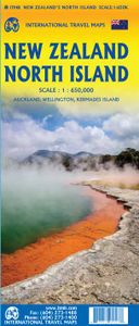
ITMB is very pleased to be expanding our coverage of New Zealand with the release of this fourth title (the others being the country map, the South Island, and Auckland). At this expanded scale, it takes both sides of the sheet to show off the attractions of the northern half of NZ, but the shape of the island provides ample space for a large inset of Auckland and more modest ones of the city region and of New Zealand’s public transport network on side one. Side two has an excellent inset map of Wellington and includes the northernmost portion of South Island, with the ferry connection linking the two islands. At this scale, the place names and road network are very readable, and there is lots of room to show attractions and touristic points of interest. The map also includes our Top Attractions list of must-sees, such as Napier Rotorua, and the Hobbitown Movie Set of Lord of the Rings fame.
13,95
Wegenkaart - landkaart New Zealand - South Island | ITMB
Een degelijke kaart met aanduidingen van o.a. nationale parken, vliegveld, benzinepomp, dirt-roads en kleine plattegrond van hoofdstad. Als overzichtskaart goed te gebruiken.   All of New Zealand is a travel paradise, but we particularly enjoy the larger and more wild South Island as a travel adventure. One side of the map covers the far south – Invercargill and Dunedin, Stewart Island, Milford Sound, north to Mount Cook in the Southern Alps. The other side continues north through Christchurch to Nelson on the north Coast and shows the ferry crossing to Wellington, on North Island. This side also includes a large and detailed inset map of Christchurch, which is still rebuilding after the horrific earthquake of a few years ago.   Legend Includes: Roads by classification, Railways, Airports, Lakes, Glaciers, Diving areas, Museums, Tourist information, Movie sets, zoos and much more.
13,95
Wegenkaart - landkaart New South Wales, Victoria, & Tasmania | ITMB
Een degelijke wegenkaart , schaal 1:1.900.000, met aanduidingen van o.a. nationale parken, vliegveld, benzinepomp, dirt-roads. Als overzichtskaart goed te gebruiken. We are pleased to announce the completion of our regional maps covering Australia with this map of the south-eastern segment of the country. This is the most densely-populated part of Australia, stretching from Lismore in the northeast to the Tasman Sea in the south. It includes all of New South Wales (NSW) and Victoria State, with South Australia as far west as Adelaide. It also shows Tasmania, Australia’s only island state, in good detail, as well as Flinders Island and King Island. The map includes two very large inset maps of Melbourne and of Sydney. This map covers the travel plans of 90% of the visitors travelling around Australia, a continental country that is very difficult to see all of in one trip. The expanded scale we’ve used allows adequate room to include wilderness campgrounds, recreational vehicle parks, ai…
13,95
Wegenkaart - landkaart Ierland | ITMB
As technology improves, we are able to produce more detailed maps than was previously possible. Such is the case with Ireland, a part of the world consisting of two countries divided by religion and history. Preparing a map of Ireland as a double-sided map means cutting the island into two geographic portions. Side 1 covers the northern half. This includes the portion known as Northern Ireland, or Ulster, and a fair portion of the Republic of Ireland, or Eire; essentially everything north of Dublin and west to Counties Mayo and Galway. Side 2 covers the southern half of the island from just north of Dublin to the outer tips of County Kerry. It also includes a nice inset map of central Dublin. Naturally, all motorways and roads are included, as are touristic attractions, camping/caravan sites, ferry terminals, and Top Attractions. This is a very detailed travel map of the island, printed on waterproof paper for durability. We had great fun driving around Ireland researching this map. It…
14,95
Wegenkaart - landkaart Egypt & Cairo | ITMB
Following the so-called Arab spring of a few years ago, northern Africa experienced much turbulence. Egypt experienced the overthrow of the government, the installation of a radical religious-oriented replacement, and the installation of military governance. Tourism plummeted. Most map publishers discontinued their maps of the country. Five years later, Egypt has stabilized and tourism is growing. We feel that the time is right to re-introduce our ITMB map of Egypt. This version focuses on the portions of the country that have been re-opened for tourism, which means from the Mediterranean coastline south to the Aswan Dam. The portion further south remains closed for the moment, as is the border crossing with Sudan. We have also been forced to leave off the Great Sand Sea and the Western Desert portions for the same reason of unrest, as the border areas with Libya remain very unstable. However, we have provided a large inset map of Egypt, covering everything, in the area of desert. We h…
13,95
Wegenkaart - landkaart Auckland & North Island - Nieuw Zeeland | ITMB
Scale 1:12,500/1:950,000, This new ITMB map should really be called Auckland, Wellington, Christchurch and the North Island of New Zealand, but that’s too long a title. However, in addition to Auckland, the cities of Wellington and Christchurch are included on one side of the map (NZ urban areas don’t tend to be huge). The other side is a very detailed map of North Island, the main island of the country. This map will be perfect for both finding one’s way around Auckland’s waterfront and for exploring the highways and byways, communing with woolies; printed double-sided on paper
13,95

Klanten-reviews van Wegenkaart - landkaart New Zealand North Island | ITMB

Er zijn nog geen beoordelingen voor dit productBen jij de eerste die een review plaatst?

Meer over Wegenkaart - landkaart New Zealand North Island | ITMB

Productomschrijving

ITMB is very pleased to be expanding our coverage of New Zealand with the release of this fourth title (the others being the country map, the South Island, and Auckland). At this expanded scale, it takes both sides of the sheet to show off the attractions of the northern half of NZ, but the shape of the island provides ample space for a large inset of Auckland and more modest ones of the city region and of New Zealand’s public transport network on side one. Side two has an excellent inset map of Wellington and includes the northernmost portion of South Island, with the ferry connection linking the two islands. At this scale, the place names and road network are very readable, and there is lots of room to show attractions and touristic points of interest. The map also includes our Top Attractions list of must-sees, such as Napier Rotorua, and the Hobbitown Movie Set of Lord of the Rings fame.

Productspecificaties

Artikelnummer(s)
Brand
ITMB

Verken gerelateerde categorieën

Webshop.nl maakt gebruik van cookies. Ga je verder op onze website, ga dan akkoord met het plaatsen van cookies en de verwerking van deze data door ons en vermelde partners.