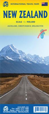
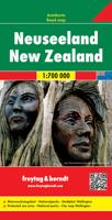
Wegenkaart - landkaart New Zealand - Nieuw Zeeland | ITMB

0
Een degelijke kaart met aanduidingen van o.a. nationale parken, vliegveld, benzinepomp, dirt-roads en kleine plattegrond van hoofdstad. Als overzichtskaart goed te gebruiken.   Legend Includes: Roads by classification, Points of Interest, Airports, Churches, Campsites, Caravan Sites, Caves, Lighthouses, Beaches, Fishing Spots, Surfing Spots, Ski A...

Verkopers met dit product

Webshop
Bezorging
Prijs
DeZwerver.nl logo
DeZwerver.nl
2,95
13,95

Anderen bekeken ook

Nieuw
Wegenkaart - landkaart Midden Amerika - Central America | ITMB
Een degelijke kaart met aanduidingen van o.a. nationale parken, vliegveld, benzinepomp, dirt-roads. Als overzichtskaart goed te gebruiken. Met Belize, Guatemala, Honduras, El Salvador, Nicaragua, Costa Rica en Panama. Folded color road and travel map. Scale 1:1,100,000. Distinguishes roads ranging from highways (paved/unpaved) to seasonal tracks. Legend includes swamps, glaciers, reefs, active volcanoes, railways, ferry routes, protected areas/national parks, international airports, domestic airports with scheduled services, landing grounds, points of interest, ruins, lighthouses, mines, beaches, gas stations, border crossing points. Includes inset map of Panama Canal Area, Isla del Coco. Extensive index, general information on the listed countries.  
13,95
Nieuw
Wegenkaart - landkaart Accra & Ghana zuid | ITMB
Ghana was the first African colony to become an independent nation, in 1957. It may not be the largest, most populous, or richest country on the continent, but it is one of the best-managed and prosperous democracies. One seldom hears about Ghana on the news as a result, because there is seldom bad news to report! Accra is one of the oldest cities in sub-Saharan Africa, and the coast of Ghana is littered by historical remnants of trading forts built by the Portuguese, the Dutch, and the British during the age of expansion. Accra itself is an interesting city and our motivation in publishing a map of it is simply the reality that no map existed prior to this effort. The regional map shows Ghana's coastline to advantage and the interior of the country as far north as Kumasi.   Legend Includes: Roads by classification, Airports, Aerodromes and small aircrafts, Ferries, Bus terminals, Railway stations, Gas stations, Border crossing and custom posts, Hospitals, Museums, Tourist information…
13,95
Nieuw
Wegenkaart - landkaart Philadelphia & Pennsylvania | ITMB
This map began as a result of a map conference held in Philadelphia a few years ago. Maps of the city at that time tended to concentrate on the entire spread-out urban area, resulting in the historic core, which was of interest mostly to visitors, crowded into a small portion of the map. Our map covers from the zoo and art gallery in the north to West Oregon St in South Phillie, so takes on much more than the historic area and the downtown, but does so at an excellent scale, so everything from the Liberty Bell to the University of Pennsylvania campus shows up clearly and easy to read. The other side of the map is also a brand new map for ITMB.     Legend Includes: Roads by classification, Airports, Aerodromes and small aircrafts, Ferrie routes, Bus terminals, Metro Stations, Railway stations, Gas stations, Car Parks, Border crossing, State parks with or without campsites, Hospitals, Shopping centres, Postoffices, Police stations, FireStations, Museums, Tourist information centers, Poi…
13,95
Wegenkaart - landkaart Afrika noordwest - Africa northwest | ITMB
Een degelijke kaart met aanduidingen van o.a. nationale parken, vliegveld, benzinepomp, dirt-roads en kleine plattegrond van hoofdstad. Als overzichtskaart goed te gebruiken. This is the detailed map of Africa emanating from our continental data base and, at an scale better than Michelin's famous regional map, we feel that this version is a winner. First, it is printed double-sided with the western coastal segment on one side and the eastern half on the other. Second, we have been able to improve the accuracy of the road information enormously at the better scale, and third we are making progress in developing a new series of travel maps for Africa by publishing the first of what we hope will become a new regional map covering Africa from top to bottom, or from Cape to Cairo, as Uncle Cecil used to say. The coverage of this map is from Morocco in the west to the Libyan/Egyptian border and from Senegal and Liberia in the southwest to the Chad/Sudan border in the southeast. This is also…
13,95
Wegenkaart - landkaart Philippines - Filipijnen | ITMB
Een degelijke kaart met aanduidingen van o.a. nationale parken, vliegveld, benzinepomp, dirt-roads en kleine plattegrond van hoofdstad. Als overzichtskaart goed te gebruiken. Inclusief plattegrond van Manilla 1:12000 This is an excellent map of the Philippines; newly updated. There are improvements on road classification a re-working of the Manila inset. double-sided. Legend Includes: Roads by classification, Point of Interest, National Park, Museum, Church, Cave, Beach, Dive Site, Golf Course, Airports and more.
13,95
Wegenkaart - landkaart Mexico Border States Northeast Coahuila, Nuevo Leon, Tamaulipas | ITMB
Een degelijke kaart met aanduidingen van o.a. nationale parken, vliegvelden en grote wegen. Als overzichtskaart goed te gebruiken. Tweezijdig. The Rio Grande dips south after curving around Big Bend, to flow into the Gulf of Mexico just east of Brownsville, Texas, and its sister city of Matamores, in Tamaulipas State of Mexico. This map covers Coahuila, Nuevo Leon, and Tamaulipas states, with a bit of Zacatecas thrown in for flavour. (This description will mean absolutely nothing to Europeans). The other side of the map contains detailed city maps of Monterrey (Mexico’s second largest city), Saltillo, and Victoria. Just think of this as being Mexico south of Texas, from Matamores west to Torreon and from Del Rio/Acuna all the way south to historic San Luis Potosi. This map will appeal to the American market primarily, but is a very detailed map of a part of Mexico that has largely been ignored until now. Legend Includes: International and provincial borders, roads by classification, r…
13,95
Nieuw
Wegenkaart - landkaart Guyana Suriname & French Guiana | ITMB
Een degelijke wegenkaart met aanduidingen van o.a. nationale parken, vliegveld, benzinepomp, dirt-roads en kleine plattegrond van hoofdstad. Als overzichtskaart goed te gebruiken.   The focus of this map is on Guyana, reflecting the changes coming about as a result of the growing assertiveness of Brasil, which has repaved the highway north from Manaus on the Amazon to the border with Guyana (at Bomfin). The Guyanese are improving the road to Georgetown, shortening travel times for goods in both directions by weeks. This new bridge also enables travelers to pass north and south much more easily. We have also re-done the inset map of Georgetown to bring it up to date. We have also changed the regional map on the reverse side, which used to cover all three Guianas countries, and replaced it by one concentrating on the other two countries. The most significant change we've made is to re-name Surinam to the country's preferred name of Suriname. As we made relatively few changes to the artw…
13,95
Nieuw
Spoorwegenkaart Sweden - Zweden | ITMB
Een degelijke wegenkaart met aanduidingen van o.a. nationale parken, vliegveld. Als overzichtskaart goed te gebruiken. This new version is printed on waterproof paper, more for durability than need, is double sided (south half/north half) in our traditional colours depicting elevations and showing roads, urban areas, attractions, airports, viewpoints, ferry routes, castles and everything else that visitors should want. The road information is very clearly shown, with motorways in blue, divided roads in green, major highways in orange, and secondary routes in red. The bridge from Copenhagen is shown as well as approach roads through Denmark, but only northern areas of Norway and a bit of Finland could be included in order to expand coverage to the max.
13,95
Nieuw
Wegenkaart - landkaart Brazilië | ITMB
Een degelijke kaart met aanduidingen van o.a. nationale parken, vliegveld, benzinepomp, dirt-roads en kleine plattegrond van hoofdstad. Als overzichtskaart goed te gebruiken. Brazil, or more properly, Brasil, is a difficult country to map as a country, in that most of the developed areas are in the relatively small extreme south of the country. The vast region of the Amazon Basin is lightly populated and is not easy to access. Our solution has been to portray the south portion on one side at a detailed scale, to enable such locations as Rio and Sao Paulo a better scale to help travellers, while mapping the north at a respectable but more limited scale on the That said, one still needs both sides of the map, as Brasilia, the capital, falls on the north side other side of the sheet. I should also note that roads north of Brasilia tend to be less well-paved than those in the south. The  shape of the country also presents mapping difficulties, in that little room is available for inset ma…
13,95
Wegenkaart - landkaart Planning Map New Zealand - Nieuw Zeeland | Lonely Planet
Durable and waterproof, with a handy slipcase and an easy-fold format, Lonely Planet New Zealand Planning Map is your conveniently-sized passport to traveling with ease. Get more from your map and your trip with images and information about top country attractions, itinerary suggestions, a transport guide, planning information, themed lists and practical travel tips. With this easy-to-use, full colour navigation tool in your back pocket, you can truly get to the heart of New Zealand, so begin your journey now! Durable and waterproof Easy-fold format and convenient size Handy slipcase Full colour and easy-to-use Before-you-go info Beautiful imagery Tailored itineraries Can't-miss regional highlights Detailed town index Transport planner Themed lists Covers Auckland, Bay of Islands, Hauraki Gulf, Waiheke Island, Rotorua, Bay of Plenty, Coromandel Peninsula, Wellington, Abel Tasman National Park, Marlborough Wine Region, Taupo, Tongariro Alpine Crossing, Matamata, Waitomo…
10,95

Klanten-reviews van Wegenkaart - landkaart New Zealand - Nieuw Zeeland | ITMB

Er zijn nog geen beoordelingen voor dit productBen jij de eerste die een review plaatst?

Meer over Wegenkaart - landkaart New Zealand - Nieuw Zeeland | ITMB

Productomschrijving

Een degelijke kaart met aanduidingen van o.a. nationale parken, vliegveld, benzinepomp, dirt-roads en kleine plattegrond van hoofdstad. Als overzichtskaart goed te gebruiken.   Legend Includes: Roads by classification, Points of Interest, Airports, Churches, Campsites, Caravan Sites, Caves, Lighthouses, Beaches, Fishing Spots, Surfing Spots, Ski Areas, Ho Springs, Museums, Golf Courses, Waterfalls, Mine, Harbours, Viewpoints, Sailing Spots, Scuba Diving Spots, Shipwrecks, National Parks, Lakes, Swamps, Glaciers, and much more.  

Verken gerelateerde categorieën

Webshop.nl maakt gebruik van cookies. Ga je verder op onze website, ga dan akkoord met het plaatsen van cookies en de verwerking van deze data door ons en vermelde partners.