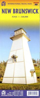
Wegenkaart - landkaart New Brunswick | ITMB

0

Verkopers met dit product

Verkoper
Bezorging
Prijs
DeZwerver.nl logo
DeZwerver.nl
2,95
13,95

Anderen bekeken ook

Wegenkaart - landkaart New Zealand - Nieuw Zeeland | ITMB
Een degelijke kaart met aanduidingen van o.a. nationale parken, vliegveld, benzinepomp, dirt-roads en kleine plattegrond van hoofdstad. Als overzichtskaart goed te gebruiken.   Legend Includes: Roads by classification, Points of Interest, Airports, Churches, Campsites, Caravan Sites, Caves, Lighthouses, Beaches, Fishing Spots, Surfing Spots, Ski Areas, Ho Springs, Museums, Golf Courses, Waterfalls, Mine, Harbours, Viewpoints, Sailing Spots, Scuba Diving Spots, Shipwrecks, National Parks, Lakes, Swamps, Glaciers, and much more.  
13,95
Wegenkaart - landkaart New Zealand North Island | ITMB
ITMB is very pleased to be expanding our coverage of New Zealand with the release of this fourth title (the others being the country map, the South Island, and Auckland). At this expanded scale, it takes both sides of the sheet to show off the attractions of the northern half of NZ, but the shape of the island provides ample space for a large inset of Auckland and more modest ones of the city region and of New Zealand’s public transport network on side one. Side two has an excellent inset map of Wellington and includes the northernmost portion of South Island, with the ferry connection linking the two islands. At this scale, the place names and road network are very readable, and there is lots of room to show attractions and touristic points of interest. The map also includes our Top Attractions list of must-sees, such as Napier Rotorua, and the Hobbitown Movie Set of Lord of the Rings fame.
13,95
Wegenkaart - landkaart New Caledonia & Oceania Cruising | ITMB
Aan de ene kant een degelijke kaart  van Nieuw Caledonië, schaal 1:530.000, met aanduidingen van o.a. nationale parken, vliegveld, benzinepomp, dirt-roads. As overzichtskaart goed te gebruiken. Aan de andere kant een overzicht van cruise routes in Oceanië, schaal 1:12.000.000 The South Pacific island complex known as New Caledonia, or Nouvelle Caledonie in French, consists of a main island and half a dozen smaller islands (collectively called the Loyalty Islands. It is an overseas possession of France and uses the Euro as its currency. It is located about halfway between Australia and Fiji and is south of Vanuatu. The main island is one of the larger land masses in the Pacific, with a reasonably well-developed road infrastructure linking the capital city of Naomea with other urban areas. There are resort hotels at various locations along the coastline, but this is a territory that one would have to regard as being adventuresome. Most of the attractions are concentrated in the vicinity…
13,95
Wegenkaart - landkaart New South Wales, Victoria, & Tasmania | ITMB
Een degelijke wegenkaart , schaal 1:1.900.000, met aanduidingen van o.a. nationale parken, vliegveld, benzinepomp, dirt-roads. Als overzichtskaart goed te gebruiken. We are pleased to announce the completion of our regional maps covering Australia with this map of the south-eastern segment of the country. This is the most densely-populated part of Australia, stretching from Lismore in the northeast to the Tasman Sea in the south. It includes all of New South Wales (NSW) and Victoria State, with South Australia as far west as Adelaide. It also shows Tasmania, Australia’s only island state, in good detail, as well as Flinders Island and King Island. The map includes two very large inset maps of Melbourne and of Sydney. This map covers the travel plans of 90% of the visitors travelling around Australia, a continental country that is very difficult to see all of in one trip. The expanded scale we’ve used allows adequate room to include wilderness campgrounds, recreational vehicle parks, a…
13,95
Wegenkaart - landkaart New Orleans - Mississippi River Basin | ITMB
New Orleans stadsplattegrond met schaal 1:15.000, bijzonder uitgebreid. ITMB is pleased to continue its detailed coverage of the USA with its first-ever map of the historic City of New Orleans. The urban area was settled by the French, and was the capital of the vast Louisiana Territory for many years. Napoleon, needing money to fight his many wars, sold the colony to the USA, in 1803, doubling the size of the new American nation overnight. The French Quarter, with buildings dating back 300 years, is the heart of the city and home to dozens of jazz emporiums. The British expulsion of the Acadians from what is now the Canadian provinces of Nova Scotia and New Brunswick, added a vibrant component to the city, creating the concept of the Cajuns. The oldest cathedral in the USA, St Louis, has dominated the city's skyline since 1794, opened just as the French Revolution was at its height. The city offers much more than just music, however, The Louisiana State Museum is where the agreement …
13,95
Wegenkaart - landkaart New England and New York State | ITMB
Goede dubbelzijdige wegenkaart waarbij met kleurgebruik de hoogte en natuurkundige aspecten wat duidelijker wordt weergegeven dan op andere kaarten. De wegen worden aangeduid met de bekende wegnummers en afstanden tussen steden staan weergegeven. Met symbolen worden toeristisch belangrijke aspecten getoond en ook bijvoorbeeld campings. Nationale parken zijn goed terug te vinden op deze kaart.  ITMB expands its coverage of the USA with a detailed map of New York State and New England on a double-sided map at a very detailed scale. The one side covers most of the state and the southern portion of the New England states, along with an inset map of the greater NYC area, the other side covers from Boston and Cape cod to the northern extremes of Maine and west into Vermont, with inset maps of Boston and Boston Region. The reality of mapping the USA is that it is too large a country and too populous to be mapped in detail except by regions. As a sophisticated economy, it has thousands of tow…
13,95

Klanten-reviews van Wegenkaart - landkaart New Brunswick | ITMB

Er zijn nog geen beoordelingen voor dit productBen jij de eerste die een review plaatst?

Meer over Wegenkaart - landkaart New Brunswick | ITMB

Productinformatie

    Verken gerelateerde categorieën

    Webshop.nl maakt gebruik van cookies. Ga je verder op onze website, ga dan akkoord met het plaatsen van cookies en de verwerking van deze data door ons en vermelde partners.