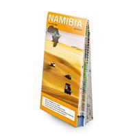
Wegenkaart - landkaart Namibia - Namibië | Tracks4Africa

0
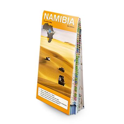
Uitstekende dubbelzijdige wegenkaart van Namibië, gemaakt door gerenommeerde kaartenmaker Track4Africa in Afrika. Met afstanden en reistijden tussen steden en op alle wegen vermeld. GPS via hun website te downloaden. De kaart wordt door vrijwel elke reisorganisatie geadviseerd als je met een eigen auto in Namibië rond gaat rijden. The Tracks4Afric...

Verkopers met dit product

Verkoper
Bezorging
Prijs
DeZwerver.nl logo
DeZwerver.nl
2,95
27,50

Anderen bekeken ook

Accommodatiegids Namibia Self-Drive Guide | Tracks4Africa
So, what is so special about the Tracks4Africa guide books? These are not guides written by armchair travellers or the personal experience of one person, but the combined experiences of a whole community of travellers. The T4A community travel far and wide – not by luxury bus or safari vehicle but on their own wheels. Sometimes they travel in groups and sometimes as lone rangers, but they always travel by motorbike, sedan or 4WD, therefore this guide is specifically aimed at self-drive travellers.   If you are a self-drive tourist, there are five things that you need to know when you are on the road: 1. Where to sleep. 2. Where to get fuel. 3. What to see and do. 4. Where to buy supplies. 5. Where to go in case of an emergency.   If you have the Tracks4Africa Self-Drive Guide as your travel companion, the answers to all these and many more questions will be at hand. If you are well prepared and well informed, you can really enjoy the unspoilt beauty of Africa! The Tracks4Afr…
52,50
Wegenkaart - landkaart Kaokoland and northern Damaraland - Namibië | Infomap
Goede betrouwbare kaart van het noordwesten van Namibië: Damaraland en Kaokoland. Met GPS coordinaten. Engels Colour folding Map, 52x73 cm, scale 1:620.000. The first scale road map of this area to be produced with GPS co-ordinates. 100 GPS Co-ordinates of major intersections, refuelling points and accommodation information. Map range 11°45’ to 15°00’ East and 17° to 20°00’ South. Detailed road map Kaokoland / Kaokoveld (Namibia) includes GPS co-ordinates of major intersections, refuelling points and accomodation information.   This map covers North-Western Namibia on the one side and BUSHMANLAND and CAPRIVI in North-Eastern Namibia on the reverse side. This map is very much recommended for travelers to these regions as an addition to our bigger scaled Namibia map. Here you get a nice amplified look at the regions with loads of GPS coordinates, accommodation and petrol points. Furthermore we included extensive route and travel ideas and general information on Kaokoland. Sold in a plas…
15,95
Wegenkaart - landkaart 3209 Adventure Map Namibia - Namibië | National Geographic
Mooie, heldere kaart van Namibië, gedrukt op scheurvast en watervast papier.   National Geographic's Namibia Adventure Map is designed to meet the unique needs of adventure travelers with its durability and accurate information. Each folded map provides global travelers with the perfect combination of detail and perspective, highlighting the area’s terrain and best locations for adventure activities. Adventure Maps include hundreds of points of interest that highlight diverse and unique destinations within the country.   The map includes the locations of thousands of cities and towns with a user-friendly index, plus a clearly marked road network complete with distances and designations for major highways, main roads, and tracks and trails for those seeking to explore more remote regions.   Key Features: Waterproof and tear-resistant Detailed interpretive information and local travel tips Detailed topography complete with activity symbols, ideal for exploring the country City overview …
17,50
Reisgids Botswana & Namibia - Namibië | Lonely Planet
De perfecte reisgids voor zowel de georganiseerde als de zelfstandige reiziger. Naast een algemene inleiding van het land / streek vol met praktische informatie over hoe je er het beste kunt reizen: slapen, eten, vervoer, excursies ... alles kun je er in vinden. Engelstalig. Lonely Planet Lonely Planet's Botswana and Namibia is our most comprehensive guide that extensively covers all the region has to offer, with recommendations for both popular and lesser-known experiences. Spot jackals in Etosha National Park, explore the German colonial town of Luederitz; or marvel at mighty Victoria Falls; all with your trusted travel companion. Inside Lonely Planet's Botswana and Namibia Travel Guide: Lonely Planet's Top Picks - a visually inspiring collection of the destination's best experiences and where to have themItineraries help you build the ultimate trip based on your personal needs and interestsLocal insights give you a richer, more rewarding travel experience - whether it's history, …
23,95
Wegenkaart - landkaart Kavango (Okavango) - Zambezi | Tracks4Africa
  Uitstekende wegenkaart van het gebied van de Okavango en Zambesi en ver daar buiten (zie uitsnede van kaart) , gemaakt door gerenommeerde kaartenmaker Track4Africa in Afrika. Met afstanden en reistijden tussen steden en op alle wegen vermeld. GPS via hun website te downloaden. De kaart wordt door vrijwel elke reisorganisatie geadviseerd als je met een eigen auto er rond gaat rijden.   Deze kaart is ontworpen op je te helpen het gebied van de Okavango en Zambesi  in volle vertrouwen te verkennen. Of je nu op asfalt-, of grindwegen, of een combinatie van de twee reist, deze kaart is zowel een navigatie-instrument, als een hulpmiddel om je trip te plannen.   Tracks4Africa, een bedrijf gevestigd in Zuid-Afrika is gekend voor zijn kaarten met GPS verwijzingen. Van Kaapstad tot Timboektoe worden deze kaarten gewaardeerd omwille van hun betrouwbaarheid. De gegevens op de kaart zijn opgetekend door een grote groep van reizigers over het land en hierdoor ontstaat er een continue update en ve…
27,50
Wegenkaart - landkaart Zimbabwe Traveller's map | Tracks4Africa
Uitstekende wegenkaart van Zimbabwe, gemaakt door gerenommeerde kaartenmaker Track4Africa in Afrika. Met afstanden en reistijden tussen steden en op alle wegen vermeld. GPS via hun website te downloaden. De kaart wordt door vrijwel elke reisorganisatie geadviseerd als je met een eigen auto in Zimbabwe rond gaat rijden.   Deze kaart is ontworpen op je te helpen Zimbabwe in volle vertrouwen te verkennen. Of je nu op asfalt-, of grindwegen, of een combinatie van de twee reist, de Zimbabwe kaart is zowel een navigatie-instrument, als een hulpmiddel om je trip te plannen.   Tracks4Africa, een bedrijf gevestigd in Zuid-Afrika is gekend voor zijn kaarten met GPS verwijzingen. Van Kaapstad tot Timboektoe worden deze kaarten gewaardeerd omwille van hun betrouwbaarheid. De gegevens op de kaart zijn opgetekend door een grote groep van reizigers over het land en hierdoor ontstaat er een continue update en verificatie. Tracks4Africa staat dan ook voor een kwaliteitsvolle cartografie. Deze kaarten …
27,50
Wegenkaart - landkaart Mexico Central & Mexico City | ITMB
Goede wegenkaart met duidelijk kleurgebruik. Het betreft een deel van Mexico met op de achterkant een stadsplattegrond van het centrale deel van Mexico City. MC is the largest city in the Western Hemisphere, with a population of 28,000,000 (or twice as big as New York City!). It would be impractical to portray the entire urban area on one map and have it make sense, so we show the portion of greatest interest to visitors, from the Chapultepec Zoological Park in the west to the incredibly busy Tapo Bus Terminal in the east, and from the railway station in the north to the southern east-west motorway just south of the main hospital complex. Much of MC’s touristic interest is concentrated in the Zona Rosa, Reforma, and Zocalo segments of the city centre, and these are shown in detail, noting hotels, major restaurants, shopping areas, and points of interest.   The map also includes inset maps of the San Angel area just north of the university, an inset map of the greater Mexico City Feder…
13,95
Wegenkaart - landkaart Nunavut - Northwest Territories | ITMB
The far north of Canada, north of 60 degrees, consists of three territories; the Yukon, the Northwest Territories, and Nunavut. Until now, there has never been a proper map of the territory that was carved off from the NWT a quarter century ago. With only 30,000 people and a scattering of settlements, Nunavut is larger than western Europe in area. This map took us years to prepare, using 1:250,000 government topo maps as a base and tracing thousands of little lakes. The traditional passageway of the fabled Northwest Passage is also shown. The most northerly civilian community in the world is on the map – Grise Bay, as well as Alert, the most remote place on earth. Originally, the NWT covered all of northwestern North America west of the Louisiana Purchase and the Loyalist colonies, and north of the Spanish provinces (essentially north of current day Sactamento). Political changes have reduced its size over the past century and a half to the region of Canada north of the 60th parallel …
13,95
Reisgids Namibia - Namibië | Rough Guides
Zeer goede reisgids voor zowel de georganiseerde maar vooral voor de zelfstandige reiziger. Boordevol informatie over reizen, slapen, eten, maar ook musea en cultuur. Voor  de meeste  landen meestal completer en beter dan de Lonely Planet ! This Namibia with Victoria Falls guidebook is perfect for independent travellers planning a longer trip. It features all of the must-see sights and a wide range of off-the-beaten-track places. It also provides detailed practical information on preparing for a trip and what to do on the ground. And this Namibia with Victoria Falls travel guidebook is printed on paper from responsible sources, and verified to meet the FSC's strict environmental and social standards.   This Namibia with Victoria Falls guidebook covers: Windhoek and around, The southwest, The southern Kalahari and the far south, Central-northern Namibia, Central coast, Etosha and the far north, The northeast, Victoria Falls.   Inside this Namibia with Victoria Falls travel book, you'll…
23,95
Wegenkaart - landkaart SC3-SC4 Swellendam to Mossel Bay | Tracks4Africa
The Cape to Addo map series covers the southern parts of the Western Cape of South Africa in a series of eight highly detailed maps, printed on four sheets of A1 durable paper.   We start in Cape Town in the west and move along the southern coast through the Overberg, Winelands, Garden Route, Klein Karoo R62, Baviaanskloof to eventually arrive in the Addo National Park up to Gqeberha (Port Elizabeth) in the east.   The maps are highly detailed and well researched. Our map scale is 1:200 000 which allows us to show a lot of detail including minor gravel roads, hiking trails, farm boundaries and points of interest which are relevant to self-drive tourists.   The size of the paper is kept small enough to allow this to be the perfect road tripping map. We use Duraflex paper and print two maps per sheet of A1 paper, making this a four-sheet series. Each map sheet is individually packed in a plastic protective sleeve.   The maps are perfect for day drives, overlanding or just doing road tri…
29,95

Klanten-reviews van Wegenkaart - landkaart Namibia - Namibië | Tracks4Africa

Er zijn nog geen beoordelingen voor dit productBen jij de eerste die een review plaatst?

Meer over Wegenkaart - landkaart Namibia - Namibië | Tracks4Africa

Productomschrijving

Uitstekende dubbelzijdige wegenkaart van Namibië, gemaakt door gerenommeerde kaartenmaker Track4Africa in Afrika. Met afstanden en reistijden tussen steden en op alle wegen vermeld. GPS via hun website te downloaden. De kaart wordt door vrijwel elke reisorganisatie geadviseerd als je met een eigen auto in Namibië rond gaat rijden.

The Tracks4Africa Namibia paper map is designed to be used in conjunction with the T4A GPS Map of Namibia. It is the largest available Namibia map at 1:1,000,000 scale, offering you the perfect trip planning tool for your next Namibian holiday. 

This T4A paper map series are probably the first comprehensive country maps in the world, offering travel time information for the entire road network, be it on tar, gravel or sand!    Key features:   
  • Large 1:1,000,000 scale 
  • Travel times and distances included on the map 
  • What you see on the paper map is exactly what you get on T4A GPS Maps 
  • Comprehensive set of roads and tracks in nature reserves 
  • Detailed information on camp sites and attractions 
  • Border crossings indicated with opening and closing times 
  • Visit www.tracks4africa.com for detail on places of interest 
  • Kaokoland in great detail with all off road tracks shown 
  • Detailed maps for Swakopmund and Windhoek 
  • Each town is shown with up to date tourist services information 
  • Shaded relief to accentuate mountains and other topographical features 
  The roads, tracks, places of interest as well as the distance data and travel time estimates on the map reflect the collective travel experience of the Tracks4Africa community of travellers over the past 10 years, with every single road being GPS recorded and verified by this community.    No need to transfer GPS coordinates from the map to your GPS as everything you see on the map is contained in our T4A GPS Maps. Our maps offer the most comprehensive coverage of tourist destinations in Namibia. Use T4A GPS Maps to navigate you to all the destinations you see on this country map.   Afmetingen uitgevouwen 126 x 100 cm

Verken gerelateerde categorieën

Webshop.nl maakt gebruik van cookies. Ga je verder op onze website, ga dan akkoord met het plaatsen van cookies en de verwerking van deze data door ons en vermelde partners.