webshop.nl
Categorieën
  Sluiten

Meer ITMB

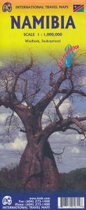
Wegenkaart - landkaart Namibia - Namibië | ITMB

Een degelijke kaart met aanduidingen van o.a. nationale parken, vliegveld, benzinepomp, dirt-roads en kleine plattegrond van hoofdstad. Als overzichtskaart goed te gebruiken. The former German colony and mandated territory of South-west Africa has emerged as a major touristic destination. Following our recent research trip to the country, we have m...
13,95

Webshops met dit product

Webshop
Bezorging
Prijs

Anderen bekeken ook

Wegenkaart - landkaart Namibia - Namibië | ITMB
Een degelijke kaart met aanduidingen van o.a. nationale parken, vliegveld, benzinepomp, dirt-roads en kleine plattegrond van hoofdstad. Als overzichtskaart goed te gebruiken. The former German colony and mandated territory of South-west Africa has emerged as a major touristic destination. Following our recent research trip to the country, we have made numerous changes to the map – upgrading roads that have been paved, changing our Caprivi Strip information, and re-doing our inset map of Windhoek. Printed on paper, single-sided; Folded road and travel map. Scale 1:1,600,000. Distinguishes roads ranging from highways to tracks (seasonal). Legend includes points of interest, internet cafes, restricted access roads, railroads, international/domestic airports, aerodromes, lodging, rest houses, guest farms, campsites, ruins historic/archaeological), museums, vistas, hot springs, caves, forts, shipwrecks, gas stations, medical facilities, missions, national parks/reserves, salt pans, restrict…
13,95
Wegenkaart - landkaart Maui, Kauai, & Molokai | ITMB
At long last, we have finally found time to complete our detailed mapping of the American state of Hawaii. The island of Maui may not be at well-known as Oahu, which is extremely popular with Japanese honeymooners, but it is as attractive touristically. Our coverage covers most of Side 1 and includes a detailed inset map of Wailuku, the principal urban area, as well as insets of Lahaina on the west coast and Wailea resort area. This side also includes a map of the island of Lanai, with its main urban area of Lanai City as an inset. Side 2 concentrates on the islands of Molokai, Kauai, and the lightly populated island of Ni’ihau, and includes detailed inset maps of Lihue, Kaunakakai, and Po’ipu, all of which are major resort destinations. The islands are loaded with beaches and places to stay, but also with attractions, which are shown on the map. This is a beautiful map, one of the best we have ever produced, and is a fitting companion to our maps of Big Island, and Oahu/Honolulu, as w…
13,95
Wegenkaart - landkaart Namibia - Namibië | Tracks4Africa
Uitstekende dubbelzijdige wegenkaart van Namibië, gemaakt door gerenommeerde kaartenmaker Track4Africa in Afrika. Met afstanden en reistijden tussen steden en op alle wegen vermeld. GPS via hun website te downloaden. De kaart wordt door vrijwel elke reisorganisatie geadviseerd als je met een eigen auto in Namibië rond gaat rijden. The Tracks4Africa Namibia paper map is designed to be used in conjunction with the T4A GPS Map of Namibia. It is the largest available Namibia map at 1:1,000,000 scale, offering you the perfect trip planning tool for your next Namibian holiday.  This T4A paper map series are probably the first comprehensive country maps in the world, offering travel time information for the entire road network, be it on tar, gravel or sand!    Key features:    Large 1:1,000,000 scale  Travel times and distances included on the map  What you see on the paper map is exactly what you get on T4A GPS Maps  Comprehensive set of roads and tracks in nature reserves  Detailed inf…
27,50
Wegenkaart - landkaart Egypt & Cairo | ITMB
Following the so-called Arab spring of a few years ago, northern Africa experienced much turbulence. Egypt experienced the overthrow of the government, the installation of a radical religious-oriented replacement, and the installation of military governance. Tourism plummeted. Most map publishers discontinued their maps of the country. Five years later, Egypt has stabilized and tourism is growing. We feel that the time is right to re-introduce our ITMB map of Egypt. This version focuses on the portions of the country that have been re-opened for tourism, which means from the Mediterranean coastline south to the Aswan Dam. The portion further south remains closed for the moment, as is the border crossing with Sudan. We have also been forced to leave off the Great Sand Sea and the Western Desert portions for the same reason of unrest, as the border areas with Libya remain very unstable. However, we have provided a large inset map of Egypt, covering everything, in the area of desert. We h…
13,95
Wegenkaart - landkaart Namibië | Infomap
Another InfoMap classic – now in its 13th edition and highly recommended!   Famous for its Namib desert, the oldest desert in the world, which straddle the western shore along the Atlantic, Namibia is country of intense beauty and seemingly unlimited space. It is a photographer’s paradise. Watch the afternoon shadows add drama to the dunes at Sossusvlei, walk through the ghost town of Kolmanskop, hike the Fish River Canyon, see the lunar landscape and Quiver trees near Keetmanshoop, experience a world transformed when the Etosha pan fills with water, or look out for the endangered cheetah of which Namibia has the highest population left in Africa.   The country is a hugely popular tourist destination that offers endless possibilities to travellers throughout all budgets and travel requirements. Tourism is one of the country’s main economic activities, with around one million tourists visiting Namibia each year. Given that the country’s population currently sits somewhere around 2 milli…
15,95
Wegenkaart - landkaart Afghanistan | ITMB
Een degelijke kaart met aanduidingen van o.a. nationale parken, vliegveld, benzinepomp, dirt-roads en kleine plattegrond van hoofdstad. Als overzichtskaart goed te gebruiken. Legend Includes: Roads by classification, silk road, airports, towns, villages, ruins, national parks, lakes, swamps, points of interest and other information It is a bit difficult to credit Afghanistan having touristic potential at the moment, but it is an extremely important country right now, and that justifies a very good map of the country. This is our third edition of this country and each one keeps getting better. We can’t justify sending a researcher into a combat zone to gather data, but we are thankful to those aid workers and soldiers who have added to our information base and helped make this map more useful. In this edition, we are showing some new roads, reflecting the reality that the country is succeeding in improving its infrastructure in spite of a very tense political situation. We have also pla…
13,95
Wegenkaart - landkaart Egypt & Cairo | ITMB
Following the so-called Arab spring of a few years ago, northern Africa experienced much turbulence. Egypt experienced the overthrow of the government, the installation of a radical religious-oriented replacement, and the installation of military governance. Tourism plummeted. Most map publishers discontinued their maps of the country. Five years later, Egypt has stabilized and tourism is growing. We feel that the time is right to re-introduce our ITMB map of Egypt. This version focuses on the portions of the country that have been re-opened for tourism, which means from the Mediterranean coastline south to the Aswan Dam. The portion further south remains closed for the moment, as is the border crossing with Sudan. We have also been forced to leave off the Great Sand Sea and the Western Desert portions for the same reason of unrest, as the border areas with Libya remain very unstable. However, we have provided a large inset map of Egypt, covering everything, in the area of desert. We h…
13,95

Klanten-reviews van Wegenkaart - landkaart Namibia - Namibië | ITMB

Er zijn nog geen beoordelingen voor dit productBen jij de eerste die een review plaatst?

Meer over Wegenkaart - landkaart Namibia - Namibië | ITMB

Productomschrijving

Een degelijke kaart met aanduidingen van o.a. nationale parken, vliegveld, benzinepomp, dirt-roads en kleine plattegrond van hoofdstad. Als overzichtskaart goed te gebruiken. The former German colony and mandated territory of South-west Africa has emerged as a major touristic destination. Following our recent research trip to the country, we have made numerous changes to the map – upgrading roads that have been paved, changing our Caprivi Strip information, and re-doing our inset map of Windhoek. Printed on paper, single-sided; Folded road and travel map. Scale 1:1,600,000. Distinguishes roads ranging from highways to tracks (seasonal). Legend includes points of interest, internet cafes, restricted access roads, railroads, international/domestic airports, aerodromes, lodging, rest houses, guest farms, campsites, ruins historic/archaeological), museums, vistas, hot springs, caves, forts, shipwrecks, gas stations, medical facilities, missions, national parks/reserves, salt pans, restricted areas, sand dunes, cliffs, passes. Includes inset map of Windhoek and Swakopmund. Indexed

Productspecificaties

Artikelnummer(s)
Brand
ITMB
Webshop.nl maakt gebruik van cookies. Ga je verder op onze website, ga dan akkoord met het plaatsen van cookies en de verwerking van deze data door ons en vermelde partners.