webshop.nl
Categorieën
  Sluiten

Meer ITMB
Meer ITMB in Literatuur boeken

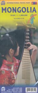
Wegenkaart - landkaart Mongolia - Mongolië | ITMB

0
Een degelijke kaart met aanduidingen van o.a. nationale parken, vliegveld, benzinepomp, dirt-roads en kleine plattegrond van hoofdstad. Als overzichtskaart goed te gebruiken. Thinking back, it seems hard to believe that we have sold through five editions of Mongolia maps. Of course, it is a popular travel destination, and reliable information is no...

Webshops met dit product

Webshop
Bezorging
Prijs

Anderen bekeken ook

Wegenkaart - landkaart Mongolia - Mongolië | ITMB
Een degelijke kaart met aanduidingen van o.a. nationale parken, vliegveld, benzinepomp, dirt-roads en kleine plattegrond van hoofdstad. Als overzichtskaart goed te gebruiken. Thinking back, it seems hard to believe that we have sold through five editions of Mongolia maps. Of course, it is a popular travel destination, and reliable information is now much more readily available than was the case when we first started mapping this vast and largely undeveloped desert country. I think it is fair to say that the main road network is pretty much fixed in position, but secondary roads tend to be tracks that follow diverse paths towards obscure destinations. Regardless, it is a lovely country to visit, with lots to see and friendly people. We've updated the Ulaanbaatar capital city inset map, noting the train ticketing office (which isn't in the train station), several museums and various temples.   Legend Includes: Roads by classification, Provincial Boundaries, Highways, Main Roads, Secondar…
13,95
Wegenkaart - landkaart USA Verenigde Staten | ITMB
Een degelijke kaart met aanduidingen van o.a. nationale parken, vliegveld, benzinepomp, dirt-roads en kleine plattegrond van hoofdstad. Als overzichtskaart goed te gebruiken. United States of America (USA) Travel Reference Map has been mapped before, but the USA is a huge country, extremely developed, and almost impossible to show on a map without over-simplification. Most commercial maps use small sheets of paper and print single-sided, making it impossible to show this vast country to advantage. Well, Lan’s been hard at work developing a ‘proper’ traveller’s aid to navigating around the USA, and here it is. We printed it on an exceptionally large sheet of paper, 39” tall by 54” wide (our normal printing size is 27”x39”). To do this, we merged our four existing databases into one, then split them so that the west side is on one side and the east side on the other. What results is a very large sheet, but a map at a VERY good scale. We were able to fit in 6,765 urban areas, all the Inte…
13,95
Wegenkaart - landkaart British Columbia | ITMB
Wegenkaart van alleen British Columbia. Calgary in het oosten staat er nog net op. Met campsites, register en nationale parken. This is our eight printing of our most popular provincial map for Canada. As with previous versions, we have updated road changes and new bridges. BC is not changing particularly quickly at the moment, due to the economic recession, but tens of thousands of people continue to migrate to the province each year, and its population is expected to double over the next twenty years. Thanks to its enormous size, huge tracts of land have been set aside for wilderness preservation, and yet the province boasts a road and rail network that would be the envy of smaller countries. The scenery tends to be described in superlative terms. Since I live her, I'll avoid the cliches, and content myself by saying that not only is this map superlative, we've reduced the retail price, so it is much more affordable both in America and overseas. Printed on paper, double-sided; inset …
13,95
Wegenkaart - landkaart Bahrain & Qatar | ITMB
Een degelijke kaart met aanduidingen van o.a. nationale parken, vliegveld, benzinepomp, dirt-roads en kleine plattegrond van hoofdstad. Als overzichtskaart goed te gebruiken.  Schaal: - Bahrein 1:115.000 - Qatar 1:300.000 The northern portion of the United Arab Emirates consists of a small peninsula (Qatar) and an island (Bahrain). Although these countries are not geographically significant in relation to their neighbours, they are enormously wealthy, thanks to oil, and have aspirations of grandeur. Qatar hosted the FIFA World Cup of soccer in November 2022. This is significant. Qatar, as a destination country, is now 'on the map'. Its capital, Doha, is quite well developed, with three Metro subway lines, motorways, and a sophisticated city centre dominated by superb high-rise architecture. Just to the west, the island of Bahrain is just as wealthy, and just as likely to have ornate architecture, luxurious shopping arcades, and an extravagant lifestyle. Its capital, Manama, is growing …
13,95
Wegenkaart - landkaart Japan North & Hokkaido | ITMB
Een degelijke kaart met aanduidingen van o.a. nationale parken, vliegveld, benzinepomp, dirt-roads en kleine plattegrond van hoofdstad. Als overzichtskaart goed te gebruiken. In one sense, this is a brand new map, in that the artwork is all brand new. In another sense, it is our map of Hokkaid re-worked into a more marketable format. In any case, it is a very much-needed sectional map of that portion of Japan from Tokyo northwards. Hokkaido is actually one of the most interesting parts of Japan to visit. The island was opened to settlement only after the Ameicans forced Japan to allow contacts with foreign countries in 1868, thanks to Admiral Peary and Gunboat Diplomacy. Hokkaido has been relatively untouched by Japan’s rush to economic dominance, so is the country’s skiing capital in winter and the part of Japan most similar to America. An inset map of Sapporo is included. The other side shows the main island of the country from Nagoya and Toyama (which are considerably west of Tokyo)…
13,95
Wegenkaart - landkaart Bahrain & Qatar | ITMB
Een degelijke kaart met aanduidingen van o.a. nationale parken, vliegveld, benzinepomp, dirt-roads en kleine plattegrond van hoofdstad. Als overzichtskaart goed te gebruiken.  Schaal: - Bahrein 1:115.000 - Qatar 1:300.000 The northern portion of the United Arab Emirates consists of a small peninsula (Qatar) and an island (Bahrain). Although these countries are not geographically significant in relation to their neighbours, they are enormously wealthy, thanks to oil, and have aspirations of grandeur. Qatar hosted the FIFA World Cup of soccer in November 2022. This is significant. Qatar, as a destination country, is now 'on the map'. Its capital, Doha, is quite well developed, with three Metro subway lines, motorways, and a sophisticated city centre dominated by superb high-rise architecture. Just to the west, the island of Bahrain is just as wealthy, and just as likely to have ornate architecture, luxurious shopping arcades, and an extravagant lifestyle. Its capital, Manama, is growing …
13,95
Wegenkaart - landkaart Western Australia | ITMB
The State of Western Australia occupies the western third of the continental country of Australia. The main city is Perth, in the southwest portion, and this is the part of the State with the best land and the most people. Much of the interior is arid desert-like grassland with shallow lakes that often dry out. The road network in the south is generally paved highways and secondary roads, with one road and one rail line heading east to SZ and the rest of the country. Roads in the north tend to be dirt, with the exception of the highway going towards Darwin in NT. There are no roads through the Great Sandy Desert, but the Canning Stock Route crosses the eastern fringe, going north-south. One needs an expensive permit to drive this hazardous track. Most of the attractions of the State are to be found fairly close to the coastline. Most of the larger urban areas tend to have been named after British places, such as Albany, Exmouth, and Port Hedland, but many names have been adopted from a…
13,95

Klanten-reviews van Wegenkaart - landkaart Mongolia - Mongolië | ITMB

Er zijn nog geen beoordelingen voor dit productBen jij de eerste die een review plaatst?

Meer over Wegenkaart - landkaart Mongolia - Mongolië | ITMB

Productomschrijving

Een degelijke kaart met aanduidingen van o.a. nationale parken, vliegveld, benzinepomp, dirt-roads en kleine plattegrond van hoofdstad. Als overzichtskaart goed te gebruiken. Thinking back, it seems hard to believe that we have sold through five editions of Mongolia maps. Of course, it is a popular travel destination, and reliable information is now much more readily available than was the case when we first started mapping this vast and largely undeveloped desert country. I think it is fair to say that the main road network is pretty much fixed in position, but secondary roads tend to be tracks that follow diverse paths towards obscure destinations. Regardless, it is a lovely country to visit, with lots to see and friendly people. We've updated the Ulaanbaatar capital city inset map, noting the train ticketing office (which isn't in the train station), several museums and various temples.   Legend Includes: Roads by classification, Provincial Boundaries, Highways, Main Roads, Secondary and other Roads, Capital, Cities, Nature sights, Airports, Point of Interests, Museums, Hot Springs, Glaciers, Gas Stations, Medical Facility, National Reserve, Hotels, Border Crossing, Mine, Mountain Peakas and much more

Productspecificaties

Artikelnummer(s)
Brand
ITMB

Verken gerelateerde categorieën

Webshop.nl maakt gebruik van cookies. Ga je verder op onze website, ga dan akkoord met het plaatsen van cookies en de verwerking van deze data door ons en vermelde partners.