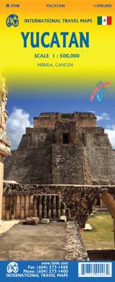
Wegenkaart - landkaart Mexico Yucatan Peninsula | ITMB

0
Een degelijke kaart met aanduidingen van o.a. nationale parken, vliegveld, benzinepomp, dirt-roads en kleine plattegrond van hoofdstad. Als overzichtskaart goed te gebruiken.   This is a modest upgrading, with little change over the previous edition; same cover, same ISBN, same price. We ran out of copies faster than expected and found few changes...

Verkopers met dit product

Verkoper
Bezorging
Prijs
DeZwerver.nl logo
DeZwerver.nl
2,95
13,95

Anderen bekeken ook

Wegenkaart - landkaart Mexico Yucatan Peninsula | ITMB
Een degelijke kaart met aanduidingen van o.a. nationale parken, vliegveld, benzinepomp, dirt-roads en kleine plattegrond van hoofdstad. Als overzichtskaart goed te gebruiken.   This is a modest upgrading, with little change over the previous edition; same cover, same ISBN, same price. We ran out of copies faster than expected and found few changes necessary to make to the artwork. Yucatan is one of those parts of Mexico seemingly unaffected by the Drug Wars, which appear to be tapering off in any case, and is as popular as ever.   Legend Includes: Roads by classification, International Airports, Domestic Airports, Lighthouses, Points of Interest, Archaeological Sites, Beaches, Caves, Gas Stations, Reefs, National Parks, Swamps, Mangroves, Temples, Camp Ground, Museums, Forts, Shipwrecks, Sinkholes, Border Crossings, Harbours, Churches, Monasteries, Mines, Other Archaeological Remains, Trailer Parks, Airstrip, Viewpoints, Cultural World Heritage, Fishing, Paragliding, Diving, Sailing, …
13,95
Wegenkaart - landkaart Mexico Oaxaca & Chiapas & Guerrero | ITMB
Folded road and travel map, in color. Scale 1:700,000. Distinguishes roads ranging from expressways (free/toll) to rural roads. Legend includes tracks, trails, international airports, domestic airports, airfields, gas stations, points of interest, archaeological sites, caves, beaches, lighthouses, mines, national parks, swamps, mangroves. Includes inset map of Oaxaca City Downtown Legend Includes: Airports, roads by classifications, distances between points, gas station, point of interests, archaeological sites, beaches, lighthouses, hypsography and other information.
13,95
Wegenkaart - landkaart 3105 Adventure Map Northern Yucatan Peninsula - Yucatan schiereiland noord | National Geographic
Wegenkaart van Yucatan schiereiland noord met vermelding van veel bezienswaardigheden, nationale parken en attrakties. Watervast en scheurvast. Juist door deze vermeldingen onderscheidt de kaart zich van andere wegenkaarten. The Northern Yucatan Peninsula and Maya Sites map includes: Detailed city inset maps of Cancún and Mérida with locations of attractions and key infrastructure Maya site locations with detailed Maya site inset maps and information for Chichén Itzá, Ek’ Balam, Tulum, El Rey, Uxmal, Cobá, and San Gervasio Detailed descriptions, photographs, and site maps of important Maya buildings and history Popular Yucatán resort towns Isla Mujeres, Cancun, Playa del Carmen, Akumal, Cozumel, Puerto Aventuras, and Tulum Popular adventure travel recreation points of interest Detailed road network UNESCO World Heritage sites
17,50
Wegenkaart - landkaart Mexico South | ITMB
Een degelijke wegenkaart met aanduidingen van o.a. nationale parken, vliegveld, benzinepomp, dirt-roads. Als overzichtskaart goed te gebruiken (De kaart beschrijft Mexico ten Zuiden van Tampico). Folded road and travel map in color. Scale 1:1,200,000. Distinguishes 5 types of roads, ranging from expressways to tracks. Legend shows international/provincial borders, international/domestic airports, airstrips, railways, trails, points of interest, archaeological sites, beaches, caves, gas stations, reefs, National Parks, swamps/mangroves. Map includes extensive index. Shown are also parts of Belize and Guatemala.  
13,95
Wegenkaart - landkaart Mexico | ITMB
Een degelijke wegenkaart met aanduidingen van o.a. nationale parken, vliegveld, benzinepomp, dirt-roads. Als overzichtskaart goed te gebruiken. Mexico remains a strong tourist destination for international visitors. This updated, double sided detailed travel map, scale 1:2,000,000, with comprehensive place name index. Distinguishes roads ranging from expressways (free/toll) to rural roads. Legend includes railways, tracks, trails, international airports, domestic airports, bridges, border crossing points, points of interest, archaeological sites, beaches, active volcanos, filling stations, national parks, deserts, places of touristic interest. Printed on durable, water-resistant plastic paper, suitable for travelling in areas with extreme humidity.
13,95
Wegenkaart - landkaart Kuala Lumpur & Malay Peninsula | ITMB
Goede stadsplattegrond van Kuala Lumpur. Met register en suburban treinsysteem. De echt verre buitenwijken van deze megastad staan er niet op. Aan de achterzijde een overzichtskaart van het vasteland van Maleisië met een schaal van 730.000 Street map of Kuala Lumpur at 1:10,000 covering the city from the Sentul Terminal and the Setapak Park in the north to the Chinese Cemetery in the south, and from the Parliament House (Bangunan Paliament) in the west to the Royal Selangor Golf Club in the east. TDetail includes markets, notable and public buildings, shopping malls, various religious buidings, accommodation, museums, theatres and cinemas, points of interest, post offices and police stations, bus terminals. Various railway systems and pedestrian roads are also indicated alongside land use, e.g. parks, markets, industrial areas, attractions, etc. Includes an extensive index of place names.  
13,95
Wegenkaart - landkaart Mexico Sonora & Chihuahua | ITMB
The border states between the USA and Mexico are of significant economic and travel importance, being some of the most traversed border crossings in the world. Touristically, northwestern Mexico appeals to desert lovers, with resort towns along the coast and arid ranch areas inland. The rail trip through the Copper Canyon is one of Mexico’s highlights and, yes, the hairless miniature shivering dog actually originates from Chihuahua. Printed double-sided on paper. Legend Includes: International and provincial borders, airports, roads by classifications, distances between points, gas stations, point of interests, archaeological sites, beaches, lighthouses, hotels, parks, museums, caves and other information.
13,95
Wegenkaart - landkaart Kamchatka Peninsula & Russia Far east | ITMB
Een degelijke kaart met aanduidingen van o.a. nationale parken, vliegveld, benzinepomp, dirt-roads en kleine plattegrond van hoofdstad. Als overzichtskaart goed te gebruiken. Schaal: Kamchatka 1 : 1,700.000 & Eastern Siberia 1 : 3.600.000 This is the most recently released title in our Russia series. In this revised edition, we have expanded the area of coverage to include the portion of Russia known as the Far East Republic and the eastern portions of Siberia (in January, we released Siberia itself). Lets start with the Kamchatka peninsula itself. This is a very interesting adventure travel destination, famous for its geothermal geysers and its isolation from the rest of Russia. There is only one city of any size, Petropavlovsk Kamchatsky (which I genuinely hope is colloquially known as PK), the capital and location of the peninsula only significant airport. We have included an inset map of the city. We also include a map of the famous Valley of Geysers (south of Klyuchi). Interestin…
13,95
Stadsplattegrond - Wegenkaart - landkaart Quebec City & Gaspe Peninsula | ITMB
Een degelijke kaart aan twee kanten bedrukt. Aan de ene zijde een plattegrond van Quebec stad, schaal 1:10.000. En aan de andere zijde een wegenkaart, schaal 1:750.000, van Gaspe schiereiland met aanduidingen van o.a. nationale parken, vliegveld, benzinepomp, dirt-roads. ITMB is pleased to be introducing yet another brand new title to our line. Quebec City is one of the oldest urban areas in North America, having been continuously occupied since 1608 (unfortunately, the first attempt at settlement, in 1606, failed through poor planning, and all the settlers perished). QC is also the only completely walled city in North America and the city streets within the walls have barely changed in 400 years. The city is also linguistically unique in being almost completely French Canadian in language (Montreal is much more Anglophiled). The city was the capital of French Canada until General Wolfe and the British army arrived in 1759. The British were able to climb the cliffs protecting the city…
13,95
Wegenkaart - landkaart Mexico North East | ITMB
Mexico is one of our favourite places to visit, and is also very popular with American travelers. The five states that border Texas – Coahuila, Nuevo Leon, Tamaulipas, Zacatecas, and San Luis Potosi may not be well-known internationally, but Monterrey (the third largest city in Mexico), Nuevo Laredo, Matamoros, Torreon, Tampico, Aguascalientes, and Ciudad Victoria evoke images of the Mexico of ranches and vast distances. This is actually a fertile and economically developing part of the country, bordered by the Gulf of Mexico on the east, Texas on the north, and ITMB’s maps of Central Mexico on the south and our new map of Sonora and Chihuahua States on the west. This is an excellent map for cross-border expeditions; printed single-sided, on paper, showing main and secondary road connections, rail lines, gas stations in smaller towns, and whatever tourist attractions we were able to locate. Legend Includes: Airports, roads by classifications, distances between points, gas station, poi…
13,95

Klanten-reviews van Wegenkaart - landkaart Mexico Yucatan Peninsula | ITMB

Er zijn nog geen beoordelingen voor dit productBen jij de eerste die een review plaatst?

Meer over Wegenkaart - landkaart Mexico Yucatan Peninsula | ITMB

Productomschrijving

Een degelijke kaart met aanduidingen van o.a. nationale parken, vliegveld, benzinepomp, dirt-roads en kleine plattegrond van hoofdstad. Als overzichtskaart goed te gebruiken.

  This is a modest upgrading, with little change over the previous edition; same cover, same ISBN, same price. We ran out of copies faster than expected and found few changes necessary to make to the artwork. Yucatan is one of those parts of Mexico seemingly unaffected by the Drug Wars, which appear to be tapering off in any case, and is as popular as ever.   Legend Includes: Roads by classification, International Airports, Domestic Airports, Lighthouses, Points of Interest, Archaeological Sites, Beaches, Caves, Gas Stations, Reefs, National Parks, Swamps, Mangroves, Temples, Camp Ground, Museums, Forts, Shipwrecks, Sinkholes, Border Crossings, Harbours, Churches, Monasteries, Mines, Other Archaeological Remains, Trailer Parks, Airstrip, Viewpoints, Cultural World Heritage, Fishing, Paragliding, Diving, Sailing, Surfing, Hospitals, Accommodations, Universities, and much more.

Productinformatie

    Verken gerelateerde categorieën

    Webshop.nl maakt gebruik van cookies. Ga je verder op onze website, ga dan akkoord met het plaatsen van cookies en de verwerking van deze data door ons en vermelde partners.