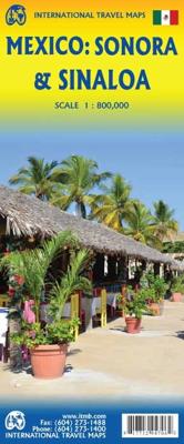
Wegenkaart - landkaart Mexico Sonora & Chihuahua | ITMB

0
The border states between the USA and Mexico are of significant economic and travel importance, being some of the most traversed border crossings in the world. Touristically, northwestern Mexico appeals to desert lovers, with resort towns along the coast and arid ranch areas inland. The rail trip through the Copper Canyon is one of Mexico’s highli...

Verkopers met dit product

Verkoper
Bezorging
Prijs
DeZwerver.nl logo
DeZwerver.nl
2,95
13,95

Anderen bekeken ook

Wegenkaart - landkaart Mexico North East | ITMB
Mexico is one of our favourite places to visit, and is also very popular with American travelers. The five states that border Texas – Coahuila, Nuevo Leon, Tamaulipas, Zacatecas, and San Luis Potosi may not be well-known internationally, but Monterrey (the third largest city in Mexico), Nuevo Laredo, Matamoros, Torreon, Tampico, Aguascalientes, and Ciudad Victoria evoke images of the Mexico of ranches and vast distances. This is actually a fertile and economically developing part of the country, bordered by the Gulf of Mexico on the east, Texas on the north, and ITMB’s maps of Central Mexico on the south and our new map of Sonora and Chihuahua States on the west. This is an excellent map for cross-border expeditions; printed single-sided, on paper, showing main and secondary road connections, rail lines, gas stations in smaller towns, and whatever tourist attractions we were able to locate. Legend Includes: Airports, roads by classifications, distances between points, gas station, poi…
13,95
Wegenkaart - landkaart Mexico - Chihuahua & Coahuila | ITMB
Een degelijke kaart met aanduidingen van o.a. nationale parken, vliegveld, benzinepomp, dirt-roads. Als overzichtskaart goed te gebruiken. Northern Mexico is a vast desert-like plateau deeply steeped in Spanish colonial heritage. The very first settlement inside what is now the USA was the town of Presidio (long before the English thought of settling Jamestown) and is still one of the few crossings of the Rio Grande into Texas (itself a former Mexican province). There are two major cities in the region, Chihuahua, 300 kms south of El Paso, and Monterrey, the largest city in northern Mexico. There are major touristic attractions at Monclova, Saltillo, Parras, Torreon, and Cuauhtemoc, the end of the famous Copper Canyon rail line. The map extends a bit into Sinaloa, to include Los Mochis on the Pacific coastline. The entire rail line is also shown. This is an important part of North American history. It may not be as well-known to Europeans who favour the beaches of the Yucatan, but it …
13,95
Wegenkaart - landkaart Palestine & Jerusalem - Palestina | ITMB
This is a new title for ITMB and the first time a separate map for that portion of the area known as Palestine and controlled by Palestinians has been published. This is essentially an attempt to show a political reality that exists, in that no one denies that both the West Bank and the Gaza Strip exist, albeit as a tightly-controlled entity that is not a country in the traditional sense of the word but is, nonetheless the homeland of millions of people and a self-governing entity. Jerusalem has been shown as an entity, without a border, in order to emphasize its importance as a unifying point of three great religions. Barricades do exist within the city, but these exist mostly to prevent clashes and reduce frictions, and we prefer to concentrate our hopes for Jerusalem as a future symbol of unity. Geographically, to fit both the southerly Gaza Strip area and the northerly West Bank portion together, it has been necessary to include large portions of Israel proper. The border has been…
13,95
Wegenkaart - landkaart The Andes | ITMB
Een degelijke wegenkaart van de hele Andes met aanduidingen van o.a. nationale parken, vliegveld, Als overzichtskaart goed te gebruiken. We are pleased to be able to re-introduce this important title into our publishing range after a lapse caused by Covid. The Andes mountain chain is the southern extension of the Sierra Nevada chain through Mexico and Central America, which is, in turn the southern extension of the Rocky Mountain chain from Alaska to the Mexican border. The Andes is a magnificent series of high mountains that enters Colombia and spreads southwards through Ecuador and Peru all the way to southern Patagonia. The map is double-sided, with the Northern Andes on one side and the other side divided into two side-by-side maps portraying the Central Andes and the Southern Andes. Thus, the map coverage focuses on the Andes themselves, rather than on all of South America. All of Colombia and Peru are shown, most of Bolivia, all of Chile, and the Patagonian portion of Argentina …
13,95
Wegenkaart - landkaart Mexico Gulf Coast | ITMB
Een degelijke kaart met aanduidingen van o.a. nationale parken, vliegveld, benzinepomp, dirt-roads. Als overzichtskaart goed te gebruiken. Mexico is an ever-popular travel destination. The country is so large that we started mapping it as a series of regional maps years ago. The Gulf Cost extends from Brownsville, Texas through Vera Cruz to the Yucatan Peninsula. Due to the shape of the region, all of Belize and about half of Guatemala is included, but the focus is on the many attractions of the eastern Gulf coast of Mexico. Side 1 cover the northern coastal regions, going inland as far as Monterrey, Zacatecas, Morelia, and Mexico City. Side 2 shows the Gulf Coast from Tampico to Carmen, then on to Merida, Cancun, and the southern tip of Belize. By the shape of this part of Mexico, the Pacific Coast, from the Guatemalan border westwards past Acapulco is also shown. All major roads are shown, but as passenger rail service was discontinued several years ago, we have opted to not show mo…
13,95
Wegenkaart - landkaart Baja California - Mexico | ITMB
Een degelijke kaart met aanduidingen van o.a. nationale parken, vliegveld, benzinepomp, dirt-roads. Als overzichtskaart goed te gebruiken. The long peninsula on the north-western edge of Mexico (the ‘lost’ province of Alta California being the temporary possession of that country to the north) is a favourite travel destination for visitors from all over the world, whether they be day-trippers crossing into Tijuana, RVers headed for the Gulf, 4x4ers wanting to explore the dreaded Viscaino Desert, or intrepid explorers wanting to experience a part of Mexico that has always prided itself as being a little ‘different’. I remember the first time Kevin Healey and I visited the peninsula in 1988. He couldn’t handle the spicy food, and we had to beat a retreat to the north after three days, but he produced the definitive Baja map two months later. This digitized, double-sided map is based on his efforts, but has been updated several times since his death, and Lan and I love going to Baja to r…
13,95
Wegenkaart - landkaart Mexico Central & Mexico City | ITMB
Goede wegenkaart met duidelijk kleurgebruik. Het betreft een deel van Mexico met op de achterkant een stadsplattegrond van het centrale deel van Mexico City. MC is the largest city in the Western Hemisphere, with a population of 28,000,000 (or twice as big as New York City!). It would be impractical to portray the entire urban area on one map and have it make sense, so we show the portion of greatest interest to visitors, from the Chapultepec Zoological Park in the west to the incredibly busy Tapo Bus Terminal in the east, and from the railway station in the north to the southern east-west motorway just south of the main hospital complex. Much of MC’s touristic interest is concentrated in the Zona Rosa, Reforma, and Zocalo segments of the city centre, and these are shown in detail, noting hotels, major restaurants, shopping areas, and points of interest.   The map also includes inset maps of the San Angel area just north of the university, an inset map of the greater Mexico City Feder…
13,95
Wegenkaart - landkaart - Stadsplattegrond Toronto & Southern Ontario - Ontario zuid | ITMB
Overzichtskaart van het zuiden van Ontario - schaal 1:600.000 - met op de andere kant een grote plattegrond van Toronto op schaal 1:12.000 Legend Includes: Roads by classification, Accomodations, Museum, Churches, Buildings, Points of tourist, Public Interests, Post Offices, Police Stations, Schools, Live Theatres, Cinemas, Ruins, Bus Terminals, Ferry Terminals, Service Areas, Hospitals, Ports, Mines, RCMP, Major Airports, Secondary Airports, Camp Grounds, National Park and Equivalent Reserves, Ski, Picnic Sites, and much more.   Toronto is the largest city in Canada by far. Touristically, its attraction rests with its central core, from High Park in the west to the Don River in the east, and from the park-like islands in Lake Ontario to Bloor Street in the north. In this area, one finds remnants of the oldest portion of ‘muddy York’, the original fort built to deter American raiders (close to the exhibition grounds), Campbell House (at Queen & University), and the first public schoo…
13,95
Wegenkaart - landkaart Borneo - Kalimantan | ITMB
The Island of Borneo is shared by three countries: Malaysia and Brunei have the northern portion, with the balance forming Kalimantan Province of Indonesia. This double-sided map shows both northern and southern portions to good advantage; printed on paper. Legend Includes: International and state boundaries, roads by classifications, distances between points, rivers, lakes, national parks, beaches, hotels, lighthouses, airports, place of interests and other information
13,95
Wegenkaart - landkaart - Wegenatlas Pan-Americana North | ITMB
Wegenatlas - A5 formaat - verschillende schalen - voor de het Noord-Amerikaanse gedeelte van de Pan-Americana ( Pan-American Highway ) van Alaska langs the Pacific kust van British Colombia in Canada, de staten Washington, Oregon en Californie, Mexico, Guatemala tot Panama.   The Pan-American Highway was created by the USA to improve road communications within the Western Hemisphere post-WW2. The highway started at the Mexican border and eventually reached somewhere south of Santiago in Chile. It was a vote-buying gimmick by the Americans to fund allies, but it also created an essential 'spine' road through Central America to the Darien Gap and along the west coast of South America to the then-limits of Chile. Driving the Pan-Am has become a travel experience. More recently, the improvement in more northerly highways, such as the Dalton Highway from Fairbanks to Prudhoe Bay in Alaska, the paving of most of the Stewart Highway through British Columbia, and the tremendous improvement in…
16,50

Klanten-reviews van Wegenkaart - landkaart Mexico Sonora & Chihuahua | ITMB

Er zijn nog geen beoordelingen voor dit productBen jij de eerste die een review plaatst?

Meer over Wegenkaart - landkaart Mexico Sonora & Chihuahua | ITMB

Productomschrijving

The border states between the USA and Mexico are of significant economic and travel importance, being some of the most traversed border crossings in the world. Touristically, northwestern Mexico appeals to desert lovers, with resort towns along the coast and arid ranch areas inland. The rail trip through the Copper Canyon is one of Mexico’s highlights and, yes, the hairless miniature shivering dog actually originates from Chihuahua. Printed double-sided on paper.

Legend Includes:
International and provincial borders, airports, roads by classifications, distances between points, gas stations, point of interests, archaeological sites, beaches, lighthouses, hotels, parks, museums, caves and other information.

Verken gerelateerde categorieën

Webshop.nl maakt gebruik van cookies. Ga je verder op onze website, ga dan akkoord met het plaatsen van cookies en de verwerking van deze data door ons en vermelde partners.