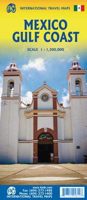
Wegenkaart - landkaart Mexico Gulf Coast | ITMB

0
Een degelijke kaart met aanduidingen van o.a. nationale parken, vliegveld, benzinepomp, dirt-roads. Als overzichtskaart goed te gebruiken. Mexico is an ever-popular travel destination. The country is so large that we started mapping it as a series of regional maps years ago. The Gulf Cost extends from Brownsville, Texas through Vera Cruz to the Yu...

Verkopers met dit product

Verkoper
Bezorging
Prijs
DeZwerver.nl logo
DeZwerver.nl
2,95
13,95

Anderen bekeken ook

Wegenkaart - landkaart Baja California - Mexico | ITMB
Een degelijke kaart met aanduidingen van o.a. nationale parken, vliegveld, benzinepomp, dirt-roads. Als overzichtskaart goed te gebruiken. The long peninsula on the north-western edge of Mexico (the ‘lost’ province of Alta California being the temporary possession of that country to the north) is a favourite travel destination for visitors from all over the world, whether they be day-trippers crossing into Tijuana, RVers headed for the Gulf, 4x4ers wanting to explore the dreaded Viscaino Desert, or intrepid explorers wanting to experience a part of Mexico that has always prided itself as being a little ‘different’. I remember the first time Kevin Healey and I visited the peninsula in 1988. He couldn’t handle the spicy food, and we had to beat a retreat to the north after three days, but he produced the definitive Baja map two months later. This digitized, double-sided map is based on his efforts, but has been updated several times since his death, and Lan and I love going to Baja to r…
13,95
Wegenkaart - landkaart - Wegenatlas Pan-Americana North | ITMB
Wegenatlas - A5 formaat - verschillende schalen - voor de het Noord-Amerikaanse gedeelte van de Pan-Americana ( Pan-American Highway ) van Alaska langs the Pacific kust van British Colombia in Canada, de staten Washington, Oregon en Californie, Mexico, Guatemala tot Panama.   The Pan-American Highway was created by the USA to improve road communications within the Western Hemisphere post-WW2. The highway started at the Mexican border and eventually reached somewhere south of Santiago in Chile. It was a vote-buying gimmick by the Americans to fund allies, but it also created an essential 'spine' road through Central America to the Darien Gap and along the west coast of South America to the then-limits of Chile. Driving the Pan-Am has become a travel experience. More recently, the improvement in more northerly highways, such as the Dalton Highway from Fairbanks to Prudhoe Bay in Alaska, the paving of most of the Stewart Highway through British Columbia, and the tremendous improvement in…
16,50
Wegenkaart - landkaart Mexico Pacific Coast en Guadalajara | ITMB
Een degelijke kaart met aanduidingen van o.a. nationale parken, vliegveld, benzinepomp, dirt-roads. Als overzichtskaart goed te gebruiken. The area of coverage has been extended to cover everything on Mexico’s western coast, from Mazatlan to Acapulco, and shows all of the roads and sights inland as far as Zacatecas, San Luis Potosi, and Queretaro. As a bonus, we have included a detailed map of Mexico’s third largest city, Guadalajara, on the reverse side, for the convenience of visitors to this fascinating section of the country; printed on paper, double-sided.
13,95
Wegenkaart - landkaart New Orleans - Mississippi River Basin | ITMB
New Orleans stadsplattegrond met schaal 1:15.000, bijzonder uitgebreid. ITMB is pleased to continue its detailed coverage of the USA with its first-ever map of the historic City of New Orleans. The urban area was settled by the French, and was the capital of the vast Louisiana Territory for many years. Napoleon, needing money to fight his many wars, sold the colony to the USA, in 1803, doubling the size of the new American nation overnight. The French Quarter, with buildings dating back 300 years, is the heart of the city and home to dozens of jazz emporiums. The British expulsion of the Acadians from what is now the Canadian provinces of Nova Scotia and New Brunswick, added a vibrant component to the city, creating the concept of the Cajuns. The oldest cathedral in the USA, St Louis, has dominated the city's skyline since 1794, opened just as the French Revolution was at its height. The city offers much more than just music, however, The Louisiana State Museum is where the agreement …
13,95
Wegenkaart - landkaart Slovenie - Slovenia & Croatian coast | ITMB
ITMB have visited Slovenia several times and find it to be an interesting and scenic part of Europe with modern and well-maintained hotels, restaurants and roads, with prices being much more affordable than in neighbouring countries to the west. As the country is not particularly large, we have limited our country coverage to one side of the sheet, with a detailed inset map of Ljubljana. The other side is a lovely map of the Dalmatian Coast. Now that Croatia is part of the EU, border limitations with the rest of western Europe have been removed and driving from Italy or Slovenia southward towards Dubrovnik is easy. The map shows the Pula Peninsula, the coastal islands of Cres, Brac, and Havar, and resort communities such as Zadar, Split, and medieval Dubrovnik. The new coastal motorway is mostly complete, but political difficulties are forcing an expensive tunneling project to by-pass part of Bosnia. Once completed, the highway will stretch to the Montenegrin border and become a major…
13,95
Wegenkaart - landkaart Mexico Central & Mexico City | ITMB
Goede wegenkaart met duidelijk kleurgebruik. Het betreft een deel van Mexico met op de achterkant een stadsplattegrond van het centrale deel van Mexico City. MC is the largest city in the Western Hemisphere, with a population of 28,000,000 (or twice as big as New York City!). It would be impractical to portray the entire urban area on one map and have it make sense, so we show the portion of greatest interest to visitors, from the Chapultepec Zoological Park in the west to the incredibly busy Tapo Bus Terminal in the east, and from the railway station in the north to the southern east-west motorway just south of the main hospital complex. Much of MC’s touristic interest is concentrated in the Zona Rosa, Reforma, and Zocalo segments of the city centre, and these are shown in detail, noting hotels, major restaurants, shopping areas, and points of interest.   The map also includes inset maps of the San Angel area just north of the university, an inset map of the greater Mexico City Feder…
13,95
Wegenkaart - landkaart Cuba West | ITMB
Een degelijke wegenkaart met aanduidingen van o.a. nationale parken, vliegveld. Als overzichtskaart goed te gebruiken. his is a brand new title for ITMB and reflects the growing interest in travel to Cuba resulting from improved relations with the USA. Licenses to fly into the country from a dozen cities have already been approved; 60 more are awaiting approval. All are for flights into Havana and Varadero airports – in other words, the western half of the country. ITMB already has an exceptionally good map of the entire country. We also have a separate map of Havana. This map expands the scale and opens the information for the western half of the island nation as a double-sided map, with the portion west of Havana (La Habana) to Pinar del Rio province in the far west and south to the Isla de la Juventud (better known, but mis-named, as the Bay of Pigs Invasion Site). This side also has an excellent map of the Varadero beach resort area as an inset, and a map of greater Havana. The ot…
13,95
Wegenkaart - landkaart Spain Mediterranean Coast | ITMB
Een degelijke overzichtskaart van het oosten en zuiden van Spanje. Spain is one of the most popular travel destinations in Europe. The country is extremely diverse, reflecting its history. The coastal areas of the Mediterranean were probably first settled by Phoenicians, then Greeks, then Romans, and then Arabs before being brought into a united Spain at the time Columbus was seeking a sponsor to fund his proposed journey to discover new lands to the west. This map focuses on the coast from the French border south through Catalunya all the way to the Straits of Gibraltar and Cadiz. The offshore islands of Mallorca, Ibiza, and Menorca are included, as is the North African Spanish enclave of Ceuta and the British enclave of Gibraltar. All road and rail lines are shown, including the new Cadiz to Madrid fast train. By the nature of mapping, a considerable amount of the interior is on the map as well, so this map is much more than just a coastal journey through Valencia and Murcia to reac…
13,95
Wegenkaart - landkaart Western Canada | ITMB
Een degelijke kaart met aanduidingen van o.a. nationale parken, vliegveld, benzinepomp, dirt-roads. Als overzichtskaart goed te gebruiken. This is actually our second attempt at mapping the western portion of Canada; the first covered everything from northwestern Ontario to the Pacific Ocean and, while it was an excellent map, the scale that such a huge area covered necessitated severe problems. In this version, all of British Columbia, Alberta, and the Yukon have been mapped from fresh digital data and presented at 1:1.4T scale. This would have been impossible when we prepared the first map. The Northwest Territories portion had to be compressed in two ways; first, the scale is 1:2M; second, only the portion with roads is shown. This is still an extremely large area. One has to consider the actual size of Canada when designing a map. Most countries in Europe would fit into this area, which only covers 20% of Canada. The Fort McMurray forest fire of a year ago covered an area larger t…
13,95
Wegenkaart - landkaart Canada | ITMB
Een degelijke kaart met aanduidingen van o.a. nationale parken, vliegveld, benzinepomp, dirt-roads en kleine plattegrond van hoofdstad. Well, it’s about time, eh?!? ITMB, after only thirty years on the go, finally gets around to publishing a map of Canada. When we first started mapping, there was a pressing need for good maps of Central and South America, then of Africa, then etc etc and we never found time to concentrate on our own country until fairly recently. This map was prepared by Natural Resources Canada and is, as a result, as accurate a map as one could hope to have. We are very proud of it, and very pleased to be able to use such top-rate cartography. The map covers all of the land mass of Canada, from its southernmost point to the top of Ellesmere Island and from the Atlantic coast to the Pacific. It’s an excellent map, but I’m going to give one proviso. Canada is the second-largest country on the face of the planet and there is no way that a single-sided sheet can portray…
13,95

Klanten-reviews van Wegenkaart - landkaart Mexico Gulf Coast | ITMB

Er zijn nog geen beoordelingen voor dit productBen jij de eerste die een review plaatst?

Meer over Wegenkaart - landkaart Mexico Gulf Coast | ITMB

Productomschrijving

Een degelijke kaart met aanduidingen van o.a. nationale parken, vliegveld, benzinepomp, dirt-roads. Als overzichtskaart goed te gebruiken.

Mexico is an ever-popular travel destination. The country is so large that we started mapping it as a series of regional maps years ago. The Gulf Cost extends from Brownsville, Texas through Vera Cruz to the Yucatan Peninsula. Due to the shape of the region, all of Belize and about half of Guatemala is included, but the focus is on the many attractions of the eastern Gulf coast of Mexico. Side 1 cover the northern coastal regions, going inland as far as Monterrey, Zacatecas, Morelia, and Mexico City. Side 2 shows the Gulf Coast from Tampico to Carmen, then on to Merida, Cancun, and the southern tip of Belize. By the shape of this part of Mexico, the Pacific Coast, from the Guatemalan border westwards past Acapulco is also shown. All major roads are shown, but as passenger rail service was discontinued several years ago, we have opted to not show most rail lines. This is a map for explorers and adventurers to discover by driving. It covers all of historic Mexico and complements other ITMB maps detailing regions of a fascinating country, where the first word you learn is 'Hola!'   Legend Includes: Roads by classification, Rivers and Lakes, National Park, Airports, Points of Interests, Highways, Main Roads, Zoos, Fishing, and much more...

Verken gerelateerde categorieën

Webshop.nl maakt gebruik van cookies. Ga je verder op onze website, ga dan akkoord met het plaatsen van cookies en de verwerking van deze data door ons en vermelde partners.