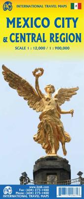
Wegenkaart - landkaart Mexico Central & Mexico City | ITMB

0
Goede wegenkaart met duidelijk kleurgebruik. Het betreft een deel van Mexico met op de achterkant een stadsplattegrond van het centrale deel van Mexico City. MC is the largest city in the Western Hemisphere, with a population of 28,000,000 (or twice as big as New York City!). It would be impractical to portray the entire urban area on one map and ...

Verkopers met dit product

Verkoper
Bezorging
Prijs
DeZwerver.nl logo
DeZwerver.nl
2,95
13,95

Anderen bekeken ook

Wegenkaart - landkaart Mexico North East | ITMB
Mexico is one of our favourite places to visit, and is also very popular with American travelers. The five states that border Texas – Coahuila, Nuevo Leon, Tamaulipas, Zacatecas, and San Luis Potosi may not be well-known internationally, but Monterrey (the third largest city in Mexico), Nuevo Laredo, Matamoros, Torreon, Tampico, Aguascalientes, and Ciudad Victoria evoke images of the Mexico of ranches and vast distances. This is actually a fertile and economically developing part of the country, bordered by the Gulf of Mexico on the east, Texas on the north, and ITMB’s maps of Central Mexico on the south and our new map of Sonora and Chihuahua States on the west. This is an excellent map for cross-border expeditions; printed single-sided, on paper, showing main and secondary road connections, rail lines, gas stations in smaller towns, and whatever tourist attractions we were able to locate. Legend Includes: Airports, roads by classifications, distances between points, gas station, poi…
13,95
Stadsplattegrond - Wegenkaart - landkaart Quito & Ecuador Central | ITMB
Een degelijke wegenkaart van Ecuador met aanduidingen van o.a. nationale parken, vliegveld, benzinepomp, dirt-roads en kleine plattegrond van hoofdstad. Als overzichtskaart goed te gebruiken. Finally, ITMB releases its long-awaited re-worked map of the wonderful South America city of Quito. The city is squeezed in between mountain ranges and, the entire city stretches from north (on the right-hand side of the map) to the south. The "bottom" of the map is, actually the eastern portion. A regional inset map clarifies the situation. The street network is clearly shown, along with the rapid line bus way and the city's Metro. The Old Town is perhaps the most interesting portion of the city for visitors and is on the left-hand portion of the map. The newer downtown is centered on La Carolina Park on the right-hand side of the map. This is where most of the shopping malls and hotels are located. The old airport is shown in part on the far right, but the new international airport is located f…
13,95
Wegenkaart - landkaart Litouwen & Letland | ITMB
ITMB is very pleased to release its first-ever map of the Baltic country of Lithuania, which occupies Side 1 of this double-sided map. It is bordered by Latvia on its north, the Russian enclave of Kalingrad on its southeast, and Poland and Belarus on its south and east. It is now on the front lines of tension between Russia and its neighbours, as are all the Baltic states. It is also a valued member of both NATO and the EU, and as such is easy to access from either Poland or Latvia. Lithuania fronts on to the Baltic Sea with a major port at Klaipeda (formerly Memel), with its capital being Vilnius. Historically, the country has suffered German and Russian invasions during the 20th century, the last of which resulted in the country losing its independence completely by being absorbed into the Russian Empire in the latter stages of WW2. It regained its independence in 1991, with the collapse of the USSR and shortly thereafter applied to join both the European Union and NATO. Touristical…
14,95
Wegenkaart - landkaart Mexico - Chihuahua & Coahuila | ITMB
Een degelijke kaart met aanduidingen van o.a. nationale parken, vliegveld, benzinepomp, dirt-roads. Als overzichtskaart goed te gebruiken. Northern Mexico is a vast desert-like plateau deeply steeped in Spanish colonial heritage. The very first settlement inside what is now the USA was the town of Presidio (long before the English thought of settling Jamestown) and is still one of the few crossings of the Rio Grande into Texas (itself a former Mexican province). There are two major cities in the region, Chihuahua, 300 kms south of El Paso, and Monterrey, the largest city in northern Mexico. There are major touristic attractions at Monclova, Saltillo, Parras, Torreon, and Cuauhtemoc, the end of the famous Copper Canyon rail line. The map extends a bit into Sinaloa, to include Los Mochis on the Pacific coastline. The entire rail line is also shown. This is an important part of North American history. It may not be as well-known to Europeans who favour the beaches of the Yucatan, but it …
13,95
Wegenkaart - landkaart Mauritania & Mali | ITMB
Een degelijke kaart met aanduidingen van o.a. nationale parken, vliegveld, benzinepomp, dirt-roads en kleine plattegrond van hoofdstad. Als overzichtskaart goed te gebruiken. Mali 1:1.900.000 Mauretanië 1:2.200.000 In this edition, we have combined Mauritania with Mali. Although both are interesting countries, the two fit naturally together as a unit, albeit at slightly differing scales. Technically, this should be a 1st edition map, as it is the first time we have combined these two desert countries on to one sheet, but I ll let Robert at the Library of Congress worry about the niceties of bibliographic accuracy as soon as Trump allows him to do the work he loves for a salary. Mauritania was one of the most unusual countries I visited as a young traveller. Of course, I had an advantage, in that I was too young to know that what I was doing was supposed to be impossible. I entered from what was then the Spanish Sahara via a piste (a sandy track with multiple pathways, only some of whi…
13,95
Wegenkaart - landkaart Mexico Gulf Coast | ITMB
Een degelijke kaart met aanduidingen van o.a. nationale parken, vliegveld, benzinepomp, dirt-roads. Als overzichtskaart goed te gebruiken. Mexico is an ever-popular travel destination. The country is so large that we started mapping it as a series of regional maps years ago. The Gulf Cost extends from Brownsville, Texas through Vera Cruz to the Yucatan Peninsula. Due to the shape of the region, all of Belize and about half of Guatemala is included, but the focus is on the many attractions of the eastern Gulf coast of Mexico. Side 1 cover the northern coastal regions, going inland as far as Monterrey, Zacatecas, Morelia, and Mexico City. Side 2 shows the Gulf Coast from Tampico to Carmen, then on to Merida, Cancun, and the southern tip of Belize. By the shape of this part of Mexico, the Pacific Coast, from the Guatemalan border westwards past Acapulco is also shown. All major roads are shown, but as passenger rail service was discontinued several years ago, we have opted to not show mo…
13,95
Wegenkaart - landkaart Mexico Border States Northeast Coahuila, Nuevo Leon, Tamaulipas | ITMB
Een degelijke kaart met aanduidingen van o.a. nationale parken, vliegvelden en grote wegen. Als overzichtskaart goed te gebruiken. Tweezijdig. The Rio Grande dips south after curving around Big Bend, to flow into the Gulf of Mexico just east of Brownsville, Texas, and its sister city of Matamores, in Tamaulipas State of Mexico. This map covers Coahuila, Nuevo Leon, and Tamaulipas states, with a bit of Zacatecas thrown in for flavour. (This description will mean absolutely nothing to Europeans). The other side of the map contains detailed city maps of Monterrey (Mexico’s second largest city), Saltillo, and Victoria. Just think of this as being Mexico south of Texas, from Matamores west to Torreon and from Del Rio/Acuna all the way south to historic San Luis Potosi. This map will appeal to the American market primarily, but is a very detailed map of a part of Mexico that has largely been ignored until now. Legend Includes: International and provincial borders, roads by classification, r…
13,95
Wegenkaart - landkaart Utah & Colorado | ITMB
Een degelijke wegenkaart met aanduidingen van o.a. nationale parken, vliegveld, benzinepomp, dirt-roads. Als overzichtskaart goed te gebruiken. ITMB is gradually mapping the entire USA in appropriate scales. Most States fit fairly well into the 1:500 to 1:750T scale, and Utah is perfect for mapping. It is also a perfectly nice place to visit, so we are pleased to add it to our program. This map shares a sheet with Colorado, so please note that the ordering information is the same. Utah is Mormon country and the temple in Salt Lake City is a sight to see. The Great Salt Lake to its west is interesting to view, but more popular is the Bonneville Salt Flats at its western edge, where so many speed records have been won. Utah also has two of Americas most scenic national parks: Zion in the southwest and Canyonlands in the southeast. Combined with Colorado to its east and to Idaho in the north (ITMBs Pacific Northwest regional map) and ITMBs companion maps of Arizona and New Mexico, this m…
13,95
Wegenkaart - landkaart USA Southwest - zuidwest | ITMB
Een degelijke kaart met aanduidingen van o.a. nationale parken, vliegveld, benzinepomp, dirt-roads. Als overzichtskaart goed te gebruiken   We're introducing a map of the US Southwest States, notably most of California and Nevada, Arizona, most of Utah, and the western third of New Mexico and Colorado. Our regional series is at 1:1M scale. This results in instances where the name of the map may differ from the common perception. In US parlance, the 'Southwest' is often thought to be Arizona and New Mexico, whereas in reality it is southern California, Nevada, and Arizona. If one includes New Mexico, the square sheet of paper has to go so far north that one ends up including Denver. This is our compromise and we'll figure out how to deal with Texas, New Mexico, Louisiana, and Oklahoma a bit further down the line. This double-sided map covers from Reno and Sacramento in the north to Tijuana and Deming NM in the south, and from the Pacific coastline in the west to Gallop NM and Grand Jun…
13,95
Wegenkaart - landkaart Portland & Oregon | ITMB
This is a brand new title from ITMB. Portland is the largest city in the American state of Oregon. It is not the capital; that distinction belongs to Salem, about 50 miles to the south, but Portland is an actual sea-going port, although it is a hundred miles away from the ocean. It is situated on the majestic Columbia River, which at one time formed the border between British-controlled Canada and the emerging United States. That changed after 1842, with the Oregon Treaty, under which both governments agreed to "share" the territory. At that time, the British capital was Astoria, a lovely town at the mouth of the Columbia, but the Governor, realizing that sharing with the Americans meant capitulation to the Americans, moved the capital north to Victoria, on what was then designated a separate colony. Regardless, today both Portland and the State of Oregon present some of the nicest scenery in America. Our portrayal of the city goes from the Northwest Freemont Bridge in the north (the …
13,95

Klanten-reviews van Wegenkaart - landkaart Mexico Central & Mexico City | ITMB

Er zijn nog geen beoordelingen voor dit productBen jij de eerste die een review plaatst?

Meer over Wegenkaart - landkaart Mexico Central & Mexico City | ITMB

Productomschrijving

Goede wegenkaart met duidelijk kleurgebruik. Het betreft een deel van Mexico met op de achterkant een stadsplattegrond van het centrale deel van Mexico City.

MC is the largest city in the Western Hemisphere, with a population of 28,000,000 (or twice as big as New York City!). It would be impractical to portray the entire urban area on one map and have it make sense, so we show the portion of greatest interest to visitors, from the Chapultepec Zoological Park in the west to the incredibly busy Tapo Bus Terminal in the east, and from the railway station in the north to the southern east-west motorway just south of the main hospital complex. Much of MC’s touristic interest is concentrated in the Zona Rosa, Reforma, and Zocalo segments of the city centre, and these are shown in detail, noting hotels, major restaurants, shopping areas, and points of interest.   The map also includes inset maps of the San Angel area just north of the university, an inset map of the greater Mexico City Federal District (with invaluable information about motorways), and a transit map of greater MC. The transit map is also reproduced on the back cover for ease of use. The reverse side of the map focusses on the central portion of Mexico, from San Luis Potosi in the north to Acapulco in the south and from Puerto Vallarta in the west to east of Pueblo in the east. It includes several well-known tourist resort areas, but also several important historic centres of Mexico, such as Guadalajara, Taxco, Cuernavaca, Leon, and San Miguel de Allende. It would be worthwhile for anyone travelling to Mexico to have this map alone; combining it with MC merely makes it into a ‘must have’ for anyone flying into MC and hoping to explore beyond the city.   We love technology and enjoy the convenience of GPS, but you can’t plan a trip on a phone screen and navigation doesn’t work where there’s no cell signal. Start your next trip on the right foot with a high-quality folding travel map. Make the most of your next adventure, even if you lose GPS or cell signals. You’ll always be on the correct route with our folding travel maps. Your adventure starts here!

Verken gerelateerde categorieën

Webshop.nl maakt gebruik van cookies. Ga je verder op onze website, ga dan akkoord met het plaatsen van cookies en de verwerking van deze data door ons en vermelde partners.