webshop.nl
Categorieën
  Sluiten

Meer Hema Maps

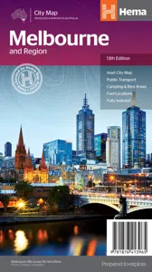
Wegenkaart - landkaart Melbourne and Region Map | Hema Maps

0
Handige kaart van zowel de stad Melbourne als het omliggende gebied. Description Melbourne & Region The Melbourne and Region map features a primary map of Greater Melbourne (1:115,000) that includes highways, major roads and local streets, as well as 24-hour fuel, parks and caravan parks. On the reverse is a Melbourne CBD map with accommodation, sh...

Webshops met dit product

Webshop
Bezorging
Prijs

Anderen bekeken ook

Wegenkaart - landkaart Tasmanië - Tasmania | Hema Maps
Op deze kaart staat Tasmanië in zijn geheel op 1 deel van de kaart. Goede, overzichtelijke, leesbare kaart van het hele eiland. Nationale Parken zijn er goed op te vinden en de afstanden worden weergegeven. Op de achterkant nog deelkaartjes van enkele steden en NP s. The fourth edition of Hema’s Tasmania State Map features Hema’s distinctive and informative maps fully, all of which have been field checked by Hema’s Map Patrol to ensure the best possible accuracy with the latest mapping data.    A fully indexed state map of Tasmania (TAS) at a scale of 1:500,000. Marked on the mapping are national parks, fuel locations as well as camping and rest areas.    The reverse side consists of:   a summary of the key things to see and do broken up into the North West, Launceston, Tamar and the North a table listing of National Parks and Reserves with key features and facilities (such as Camping and Caravan sites, BBQ, toilets and showers) Visitor centre listing Map of the area around Zeehan …
15,95
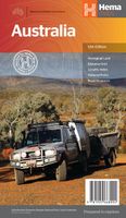
Wegenkaart - landkaart Australia - Australië | Hema Maps
Mooie, grote, duidelijke kaart van Australië met veel informatie. Oa bezinestations (ook in de outback) en een goed overzicht van de doorgaande (grote) wegen waardoor de kaart erg handig is van het plannen van uw route. Ook staan er afstanden op vermeld.   Verder staan er stadkaartjes op van het (centrum) van de belangrijkste Australische steden:   Adelaide, Brisbane, Canberra, Darwin, Hobart, Melbourne, Perth en Sydney   Hema’s iconic large map of Australia is ideal as a trip planning tool and travel companion. Marked on the map are localities, the major road network, distances and major national parks. The map also shows localities, the major road network, distances and major national parks. The visual appeal makes it perfect as a decorative map or an educational tool. On the reverse side is an overview of Australia's iconic touring regions featuring history, geology and landforms, nature, bucket-list attractions and iconic 4WD tracks.   Key Features Hema's iconic map of Austral…
15,95
Wegenkaart - landkaart - Stadsplattegrond Estonia, Estland en Tallinn
Goede wegenkaart van Estland met bezienswaardigheden, kilometers etc. daarop aangegeven. The map displays Estonia on one side and Tallin on the other, each showing a separate index. Road networks distinguish motorways, major and minor roads with intermediate distances on connecting roads. Railways and ferry routes are also shown, while symbols clearly indicate parking and international and domestic airports.   Topography is represented by altitude colouring and graphics locate rivers, lakes, national parks and reserves, Unesco World Heritage sites, scenic spots, hotsprings etc. Symbols mark locations of various places of interest including hotels, campsites, historic ruins, castles, beaches, ports etc. International and administrative boundaries are marked. Latitude and longitude lines are drawn at intervals of 20’.   The street plan of Tallin is a clearly laid out and extends from the Gulf of Tallin to Tallin international airport and the intercity bus station in the south, the Centra…
13,95
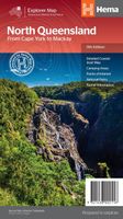
Wegenkaart - landkaart Explorer Map North Queensland | Hema Maps
Detailkaart van een deel van Australië. Zeer goed leesbaar, met naast de topografische details veel symbolen waarmee allerhande toeristische zaken worden aangeduid als campsites, nationale parken, attracties, wandelmogelijkheden etc. Covering Australia's beautiful North Queensland. There is alot of town map insets, tourist information, and photographs on the reverse side Touring map of the northern half of Queensland, with enlargements of popular areas, street plans, lists of facilities, etc. The main map extends south to well beyond the Flinders Highway between Townsville and Mount Isa, including Mackay on the coast. The map shows the road network, including minor roads and unsurfaced tracks, plus railways and local airfields/aerodromes. Designated Tourist Routes are highlighted and symbols mark places of interest (many annotated with brief description), historical sites, tourist resorts, youth hostels, etc. Topography is indicated by names of mountain ranges and peaks, as well as by …
13,95
Wegenkaart - landkaart Gold Coast and region | Hema Maps
Goede, overzichtelijke, leesbare kaart van de hele provincie. Nationale Parken zijn er goed op te vinden en de afstanden worden weergegeven. Op de achterkant nog deelkaartjes van enkele steden en NP s.   Map of Gold Coast: CBD, City, Suburbs & Hinterland This map of the Gold Coast includes detailed mapping of the city (1:15,000) and suburbs (1:50,000), as well as a comprehensive overview of the surrounding Gold Coast Hinterland (1:100,000).   There’s plenty of useful visitor information marked on the mapping for staying in and getting around the Gold Coast, including fully updated roads, facilities and accommodation, as well as 2018 Commonwealth Games venues and temporary Park ‘n’ Ride locations.   Map Features: Perfect for Visitors Surfers Paradise, Coolangatta & Tweed Heads Gold Coast Hinterland Commonwealth Games Venues Commonwealth Games Park n Ride locations Public Transport Route Map 24-hour fuel Accommodation & POI Marked Fully Indexed Suburbs Index Street Index Tourist Attracti…
11,50
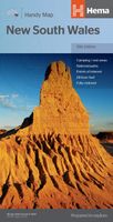
Wegenkaart - landkaart New South Wales handy map | Hema Maps
Goede, tweezijdige overzichtelijke, leesbare kaart van de hele provincie. Nationale Parken zijn er goed op te vinden en de afstanden worden weergegeven.  New South Wales Map in a series of indexed touring road maps of Australia’s states from Hema, with each state available either on a single-sided map with additional information on the reverse, or as double-sided map in a more convenient smaller format. The map presents the road network from main highways, shown with their names, to minor roads and 4WD tracks, indicating unsealed routes and rough tracks. Driving distances are marked on many smaller local roads. Railway lines and local airports or airstrips are included. Symbols highlight roadside rest areas, 24h fuels supplies, as well as campsites and caravan parks, places of interest, etc. Colouring indicates national parks and other protected areas including marine parks, Aboriginal lands and restricted entry zones. The maps have a latitude/longitude grid at intervals varying from 3…
11,50

Klanten-reviews van Wegenkaart - landkaart Melbourne and Region Map | Hema Maps

Er zijn nog geen beoordelingen voor dit productBen jij de eerste die een review plaatst?

Meer over Wegenkaart - landkaart Melbourne and Region Map | Hema Maps

Productomschrijving

Handige kaart van zowel de stad Melbourne als het omliggende gebied. Description Melbourne & Region The Melbourne and Region map features a primary map of Greater Melbourne (1:115,000) that includes highways, major roads and local streets, as well as 24-hour fuel, parks and caravan parks. On the reverse is a Melbourne CBD map with accommodation, shopping and other places of interest pinpointed, along with train and tram network maps and a Melbourne Region map. Key Features Highways, major roads and local streets Points of interest Accommodation Travel Information Parks Caravan Parks 24 Hour Fuel Tram lines Railway stations Suburbs Suburbs Index Shopping centres Theatres/Cinemas Sporting venues Tram and Train network maps The cosmopolitan capital of Victoria, Melbourne is a city of distinct districts: each with its own particular appeal. For a different view of the city head to the observation deck at the Eureka Skydeck for 360° views. A cruise along the Yarra River provides yet another perspective. Set around Port Phillip Bay, the city can easily be explored on the many tram routes. Amid the hustle and bustle of the CBD are numerous cafes, restaurants, boutique fashion shops, theatres and galleries where visitors can easily while away the hours. Browse through the exhibitions at the National Gallery of Victoria. Other highlights include the Melbourne Zoo and the Sea Life Melbourne Aquarium. Down at the St Kilda foreshore, talk a wander along the beach or sample some of the fish and chips. If you are into sport, then you are in luck because major national and international sporting events are frequently held at venues including the Melbourne Cricket Ground, Etihad Stadium, Rod Laver Arena, Hisense Arena, Flemington Race Course and Visy Park. It’s also possible to tour the MCG or visit the National Sports Museum. Horse racing is another popular sport, and not just for the ‘big one’ – Melbourne Cup. The Australian Racing Museum and Hall of Fame have all you’d ever want to know about the history of racing. Take a step back in time at the Melbourne Museum, Polly Woodside and Gold Treasury Museum. The Scienceworks Museum and Planetarium is a must-visit too. Other fascinating insights into the city’s past can be gained at the Old Melbourne Gaol and Cook’s Cottage

Productspecificaties

Artikelnummer(s)
Brand
Hema Maps
Webshop.nl maakt gebruik van cookies. Ga je verder op onze website, ga dan akkoord met het plaatsen van cookies en de verwerking van deze data door ons en vermelde partners.